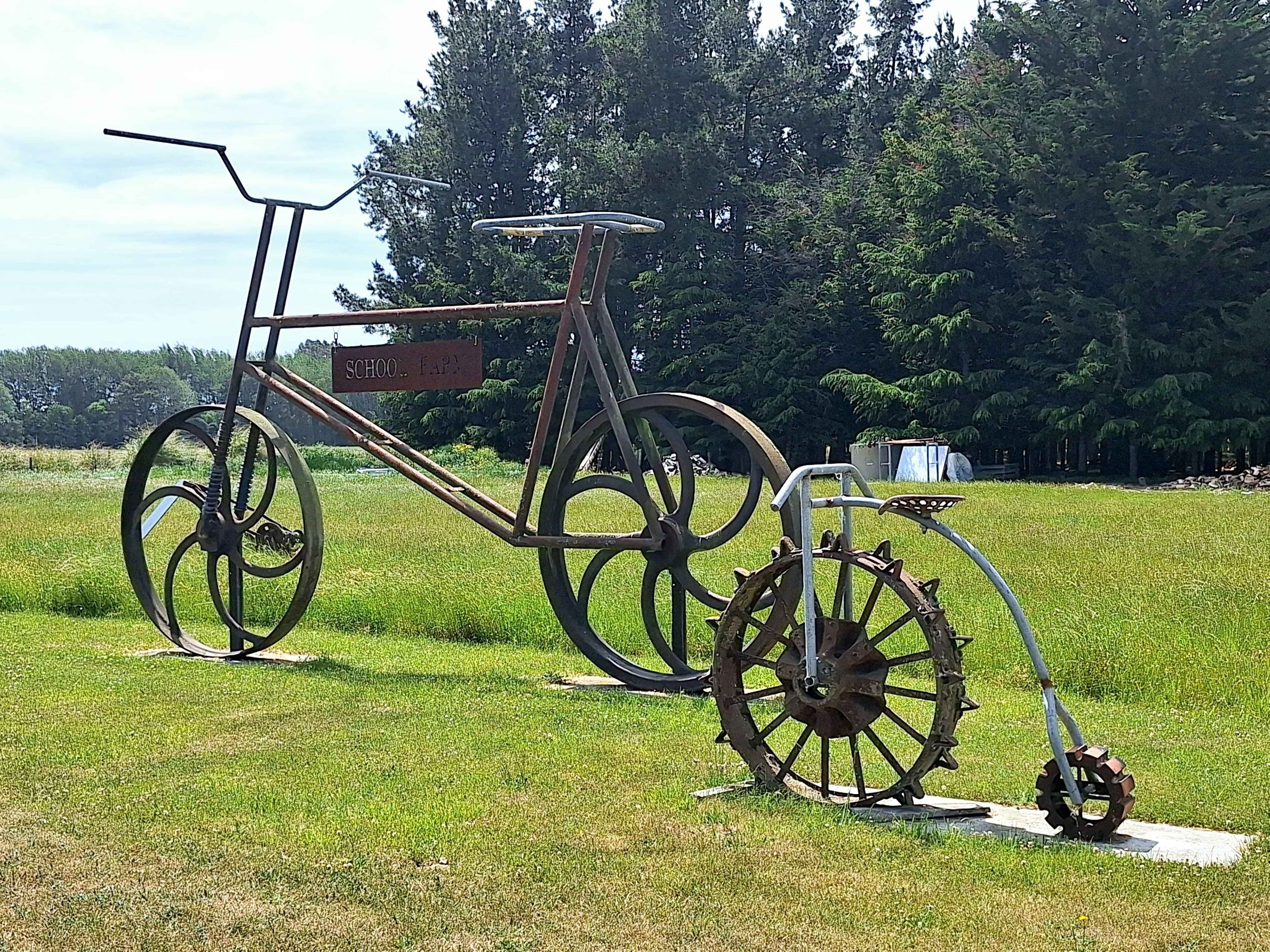
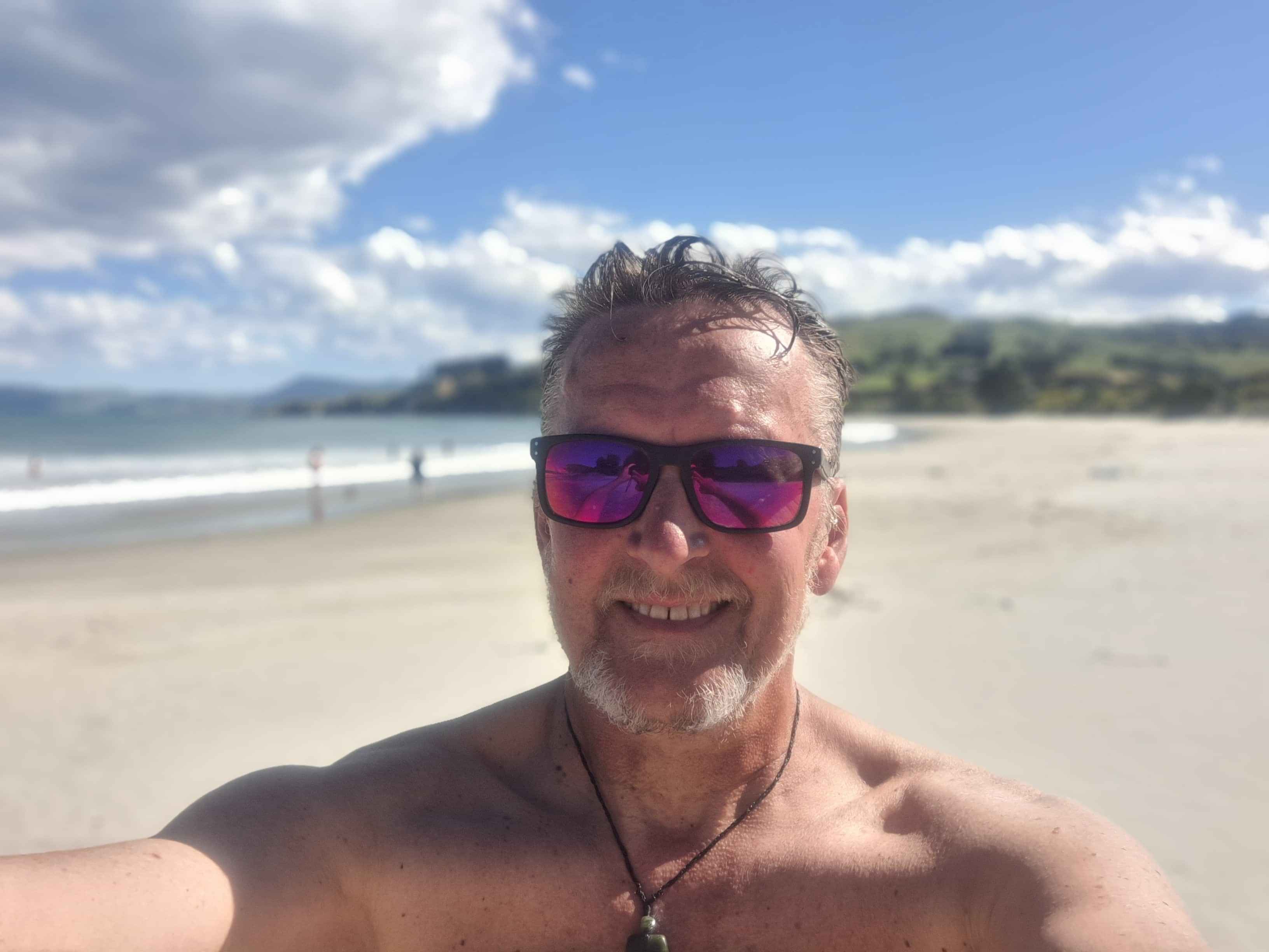
South Island
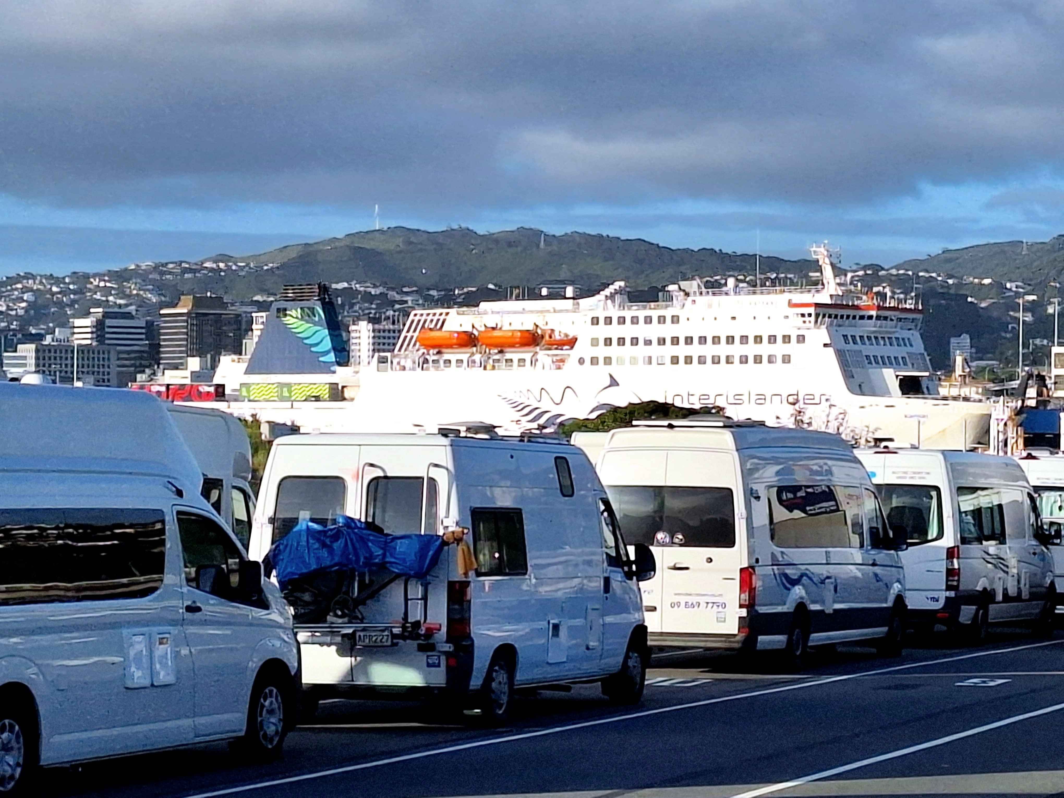
Interislander, Wellington
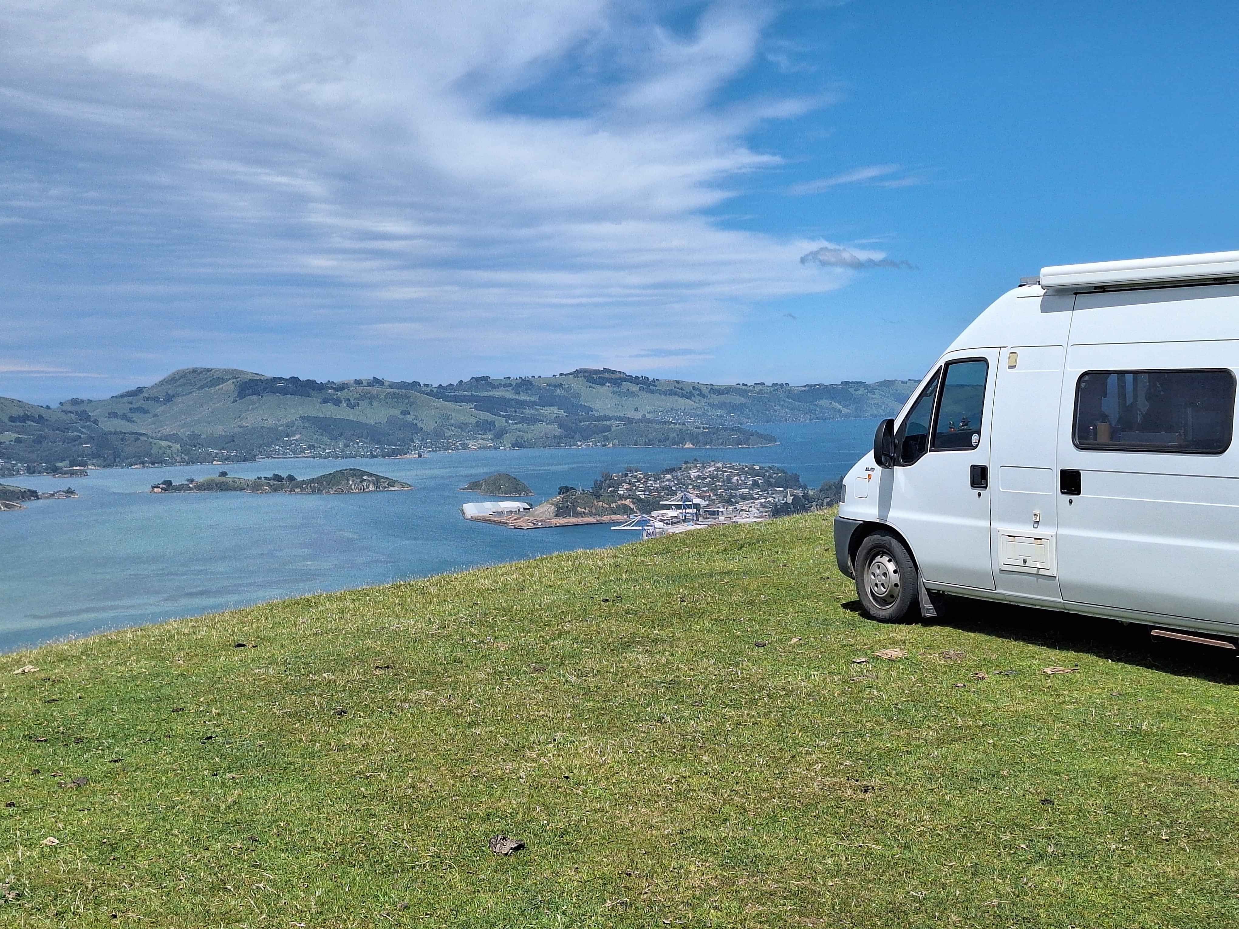
The perfect start to my South Island adventure. Soft Easterly breeze of 8kmh, a mostly sunny sky, with an unusually flat sea. In past week, winds over 60kmh. I arrived at the crack of dawn, an hour before last boarding call. Somehow I found myself last van in a massive queue of haulers, campers and the national favourite, Ford Rangers.
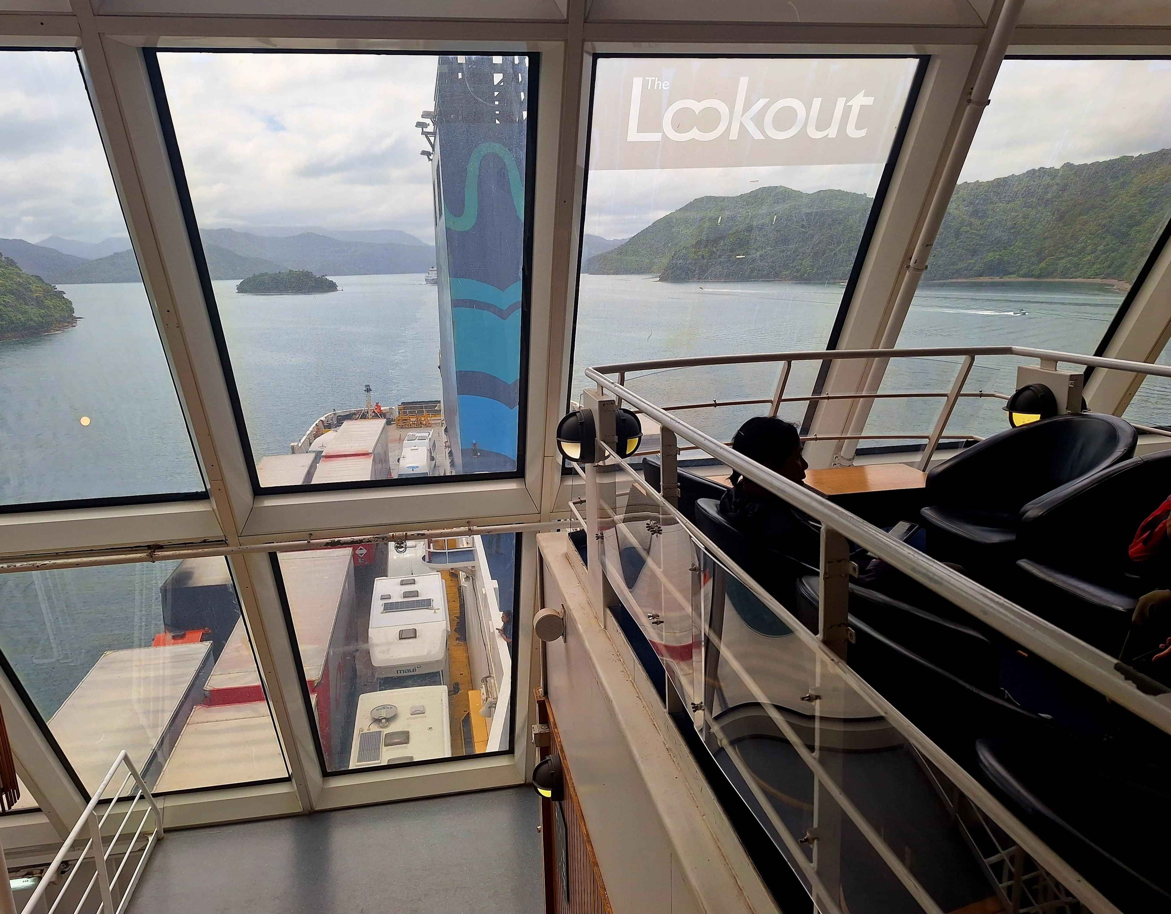
The sounds, Marlborough
One of New Zealand's top trips, neatly tacked onto the ferry crossing on the Cook Strait from Wellington to Picton, being the cruise through the sunken valleys of the Marlborough Sounds. 1.5 hours exiting Wellington harbour, 1 hour or more in the Strait and 1 hour or more slowly cruising underneath towering hills which line both sides of the Sounds. Top Tip...Best view, and there's many is the Top Deck or Rooftop to embrace this stunning magic.
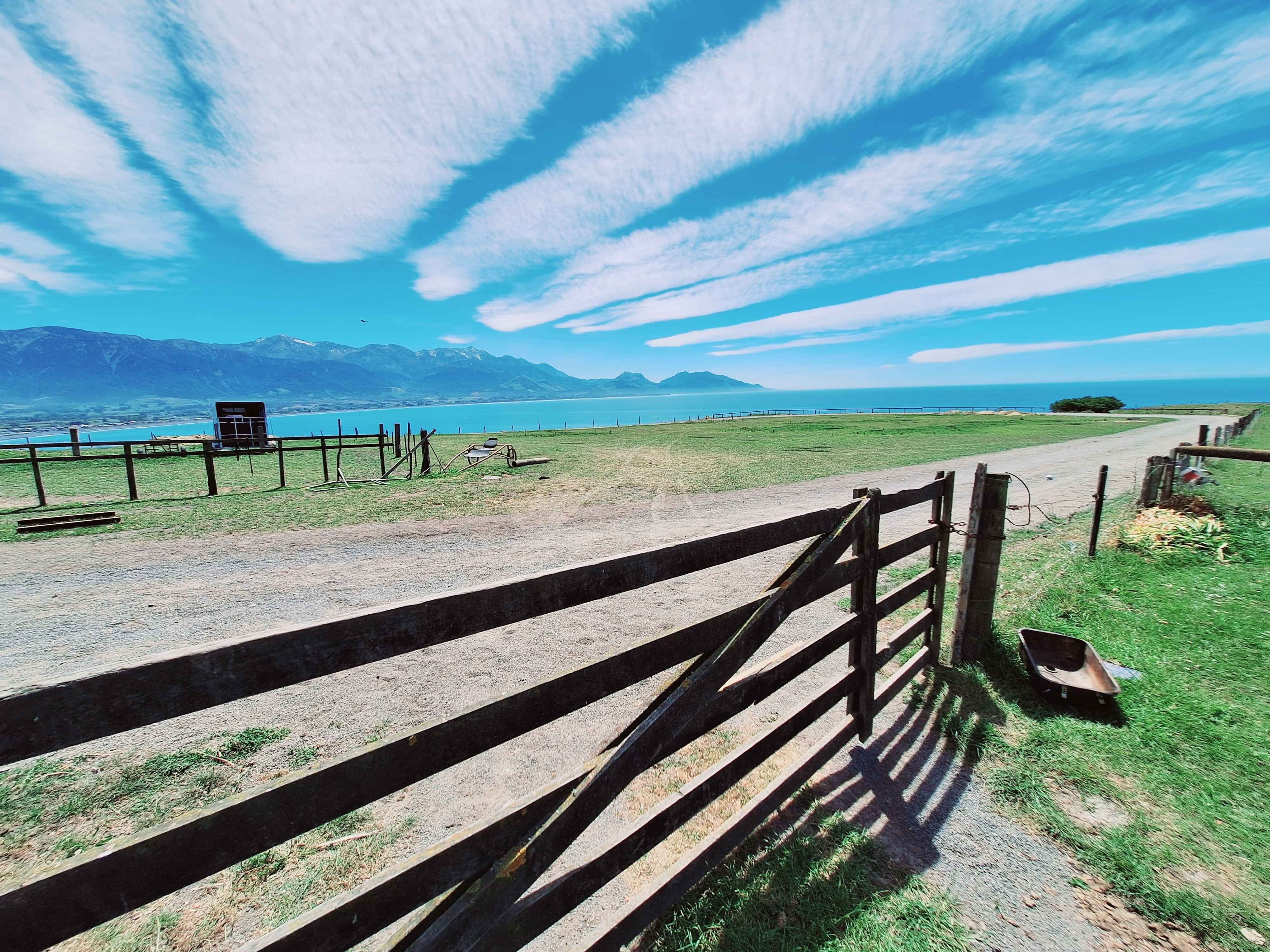
Picton
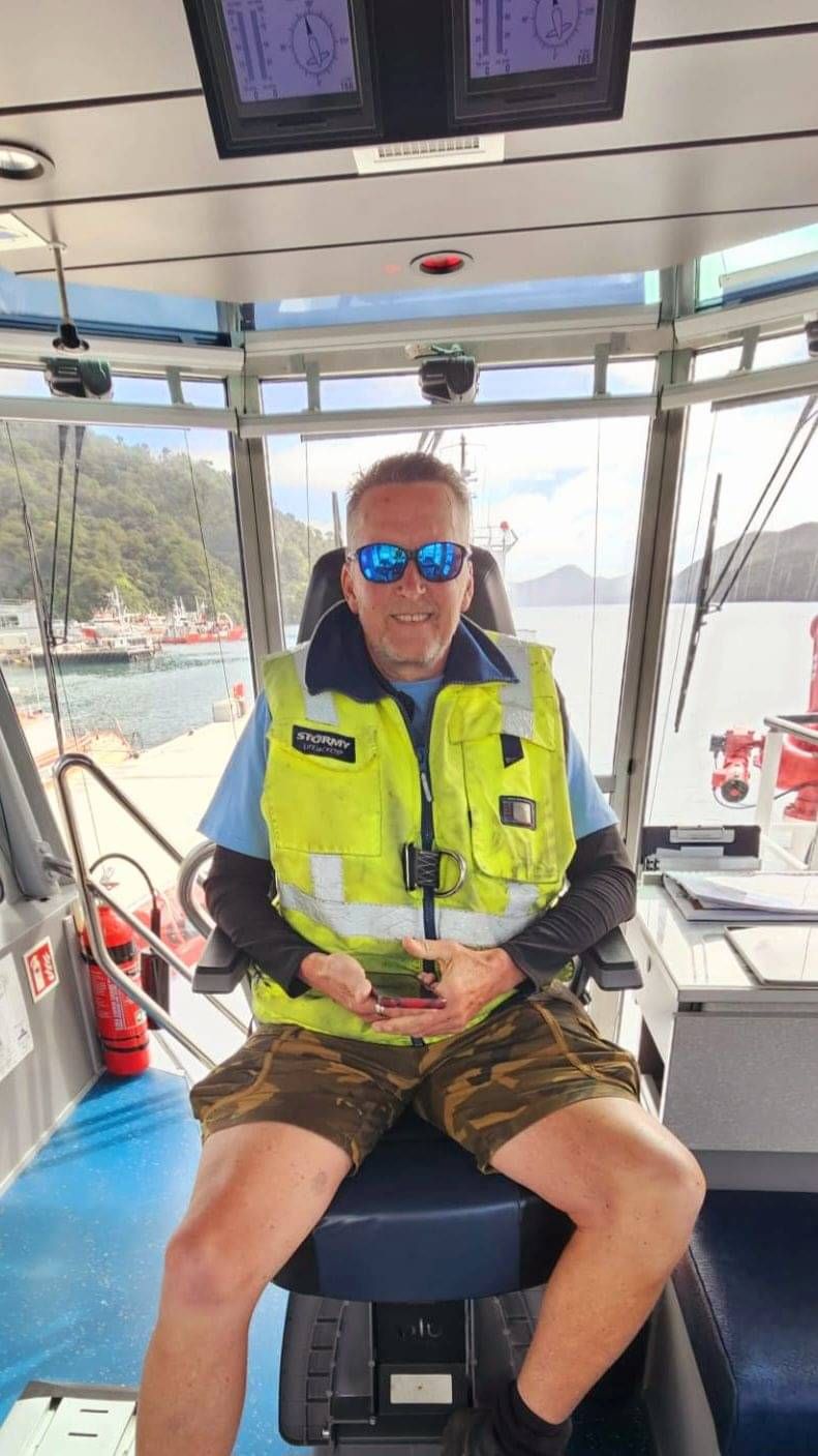
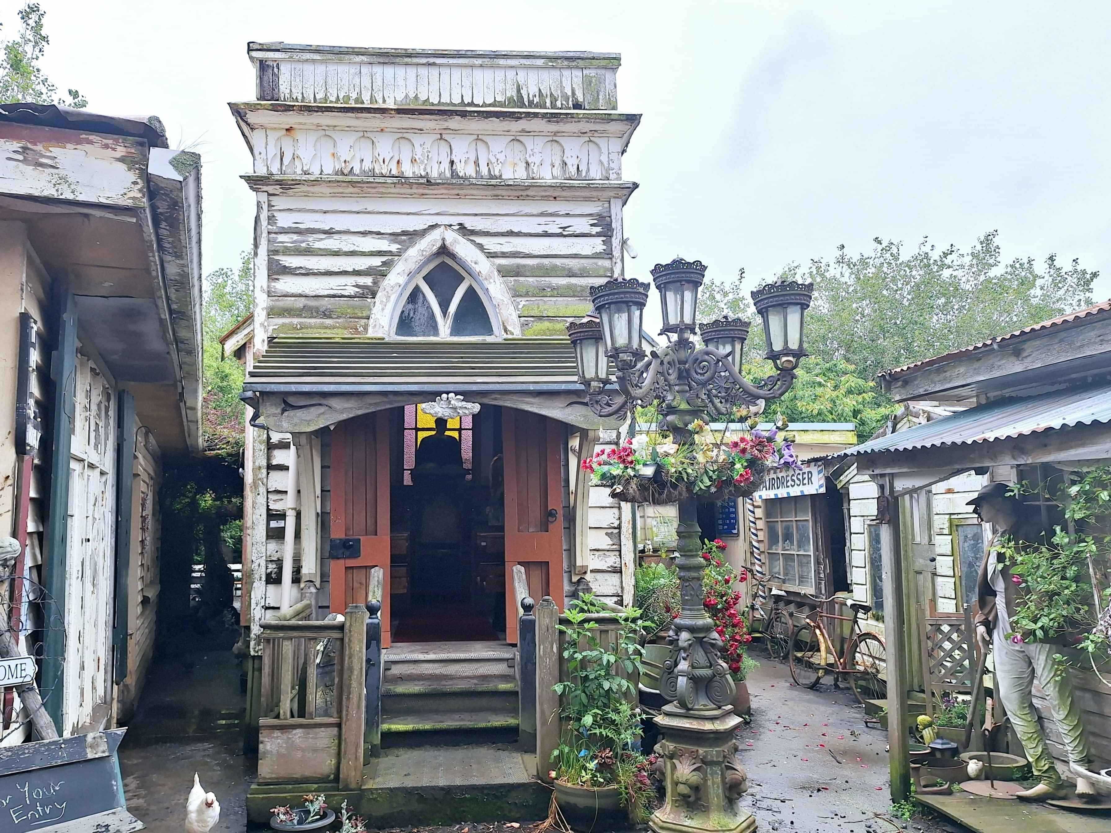
Picture Postcard Picton....The first port of call, at the head of the Sounds. Love this place. So much so, I spent 3 active days here with Pictons Top Hosts, Bex and Gaz. They offered Indoor Golf at their Picton Ranch, a secret mission into Spy Valley, and truly there is a Spy communication site here, a variety of poshy vineyard settings, a cafe with a full-blown plane in the front yard and every boys dream, Captain Tugboat on a fire engine red Ports of Marlborough Tug. Photos never lie.
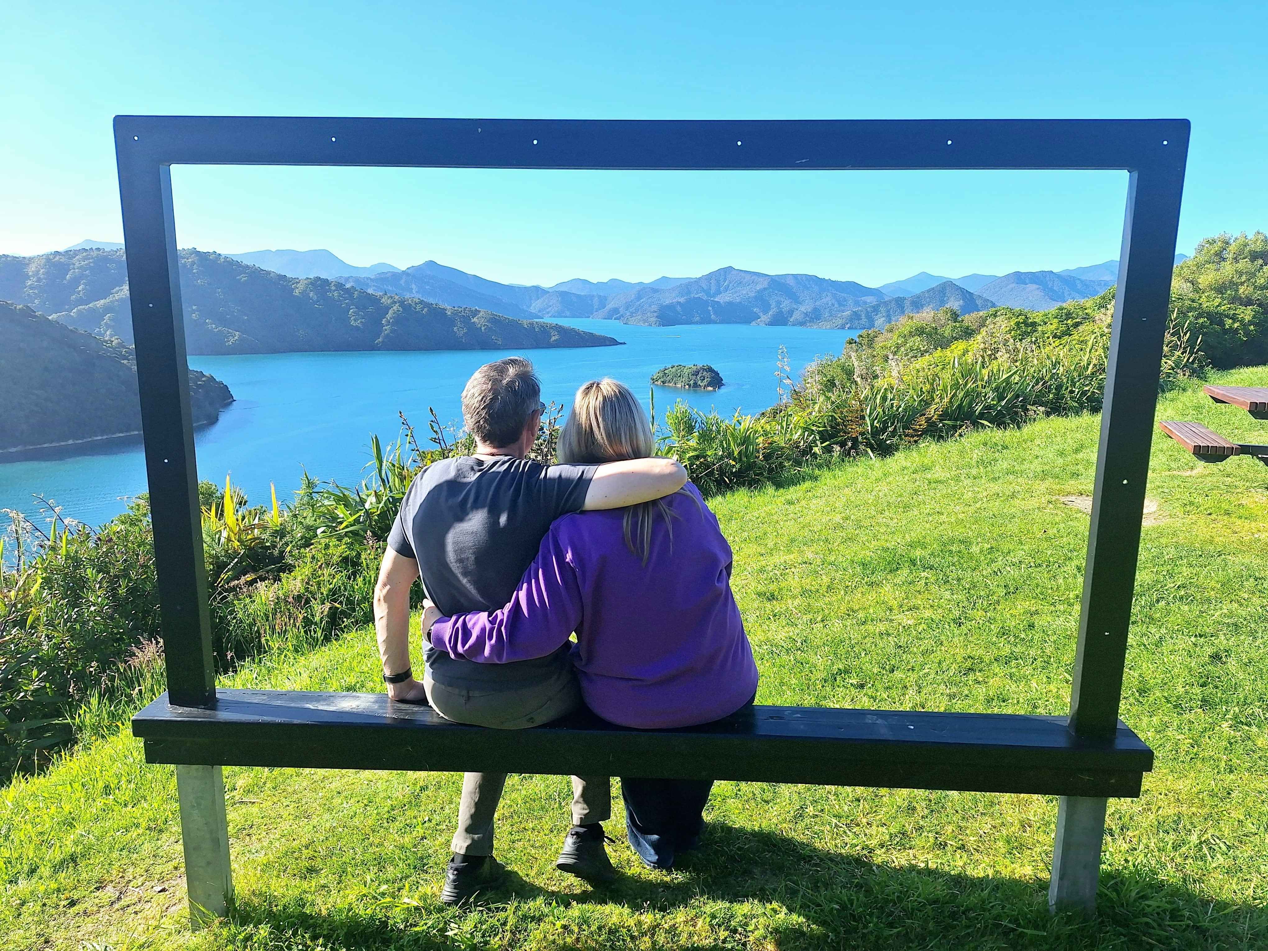
Queen Charlotte
There's a fairly hefty but doable trek along the length of the Queen Charlotte Sounds whereby watertaxis take both Walkers and mountainbikers to the head of the Peninsula. Then you're on your own. Bring tents, food and water. See you back in Picton after 3 or more days. 2 to 3 for bikes. More for Walkers. You can simply do daytrips too.
Blenheim
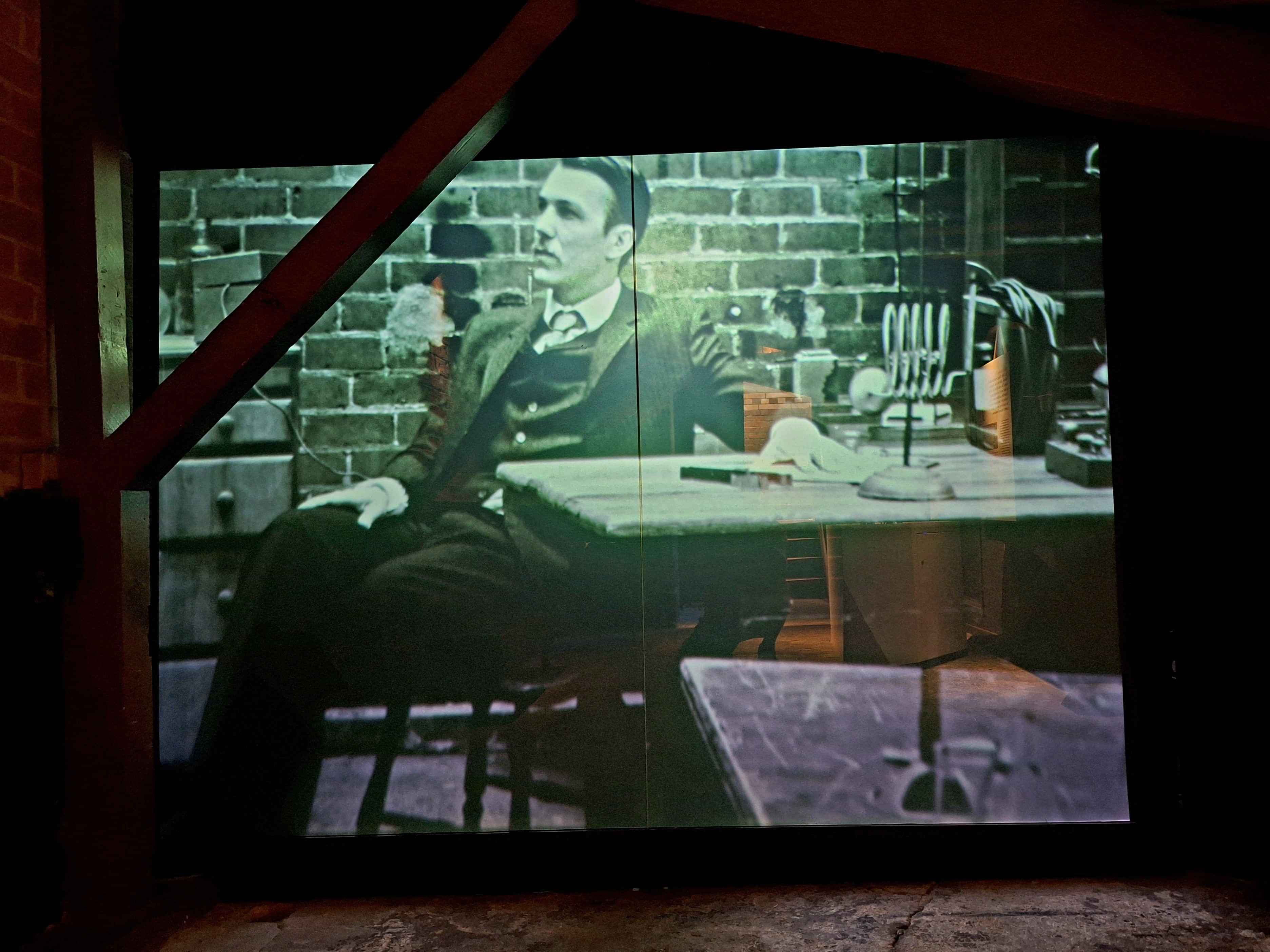
Home to the countries Spy Agency, gizzillions ofbarrels of fine Marlborough Plonk, alongside some very fine Quaffing establishments. Farrington even had a music studio in the bowels of the building to hammer out your next musical classic. You'll see a few folk zig zagging the roads on hired bikes as they wobble from vineyard to vineyard. Plus don't ignore the fabulous Peter Jackson offering showcasing his famous collection of WW1 Biplanes and other Weta Workshop models and mannequins. Top Tip...SLip, SLop, Slap as this is arguably NZs highest sunshine belt.
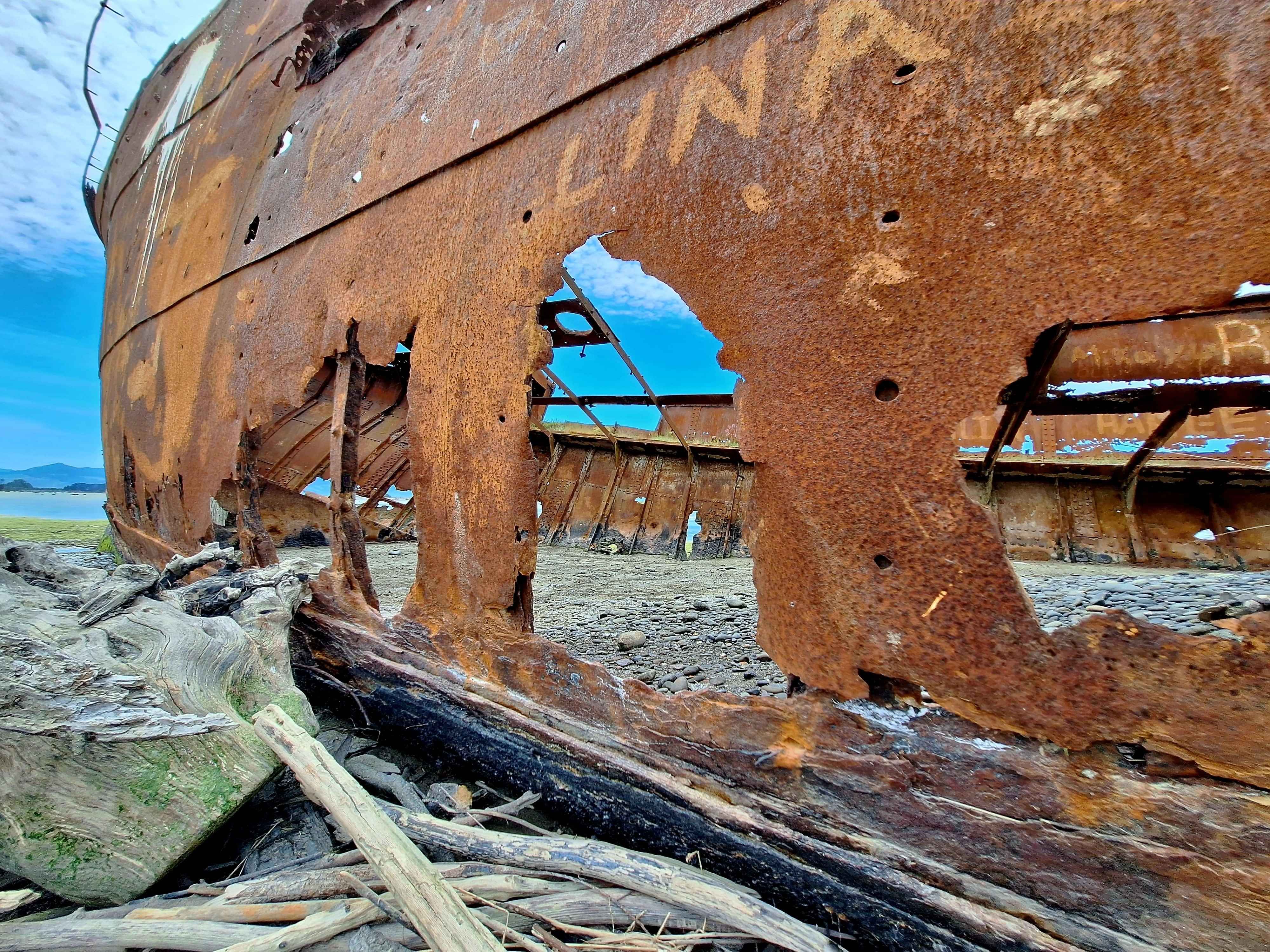
Wairau Lagoons and Bar
Artifacts have been carbon dated to year 1300. This is genuinely agreed as the landing spot where the Maori ancestors first arrived in NZ. It's significant, but in typical Kiwi manner, not alot of song and dance is made about this. The acknowledgements at Wairau Bar are more "Softly Softly". Top Tip...great 1 hour walk each way out to see the 1928 hulk of the SS Waverley lying broadside in the mud at Wairau Lagoons. The 1864 hulk, the SS Kennedy, deliberately sunk, sits awkwardly at the Wairau Bar.
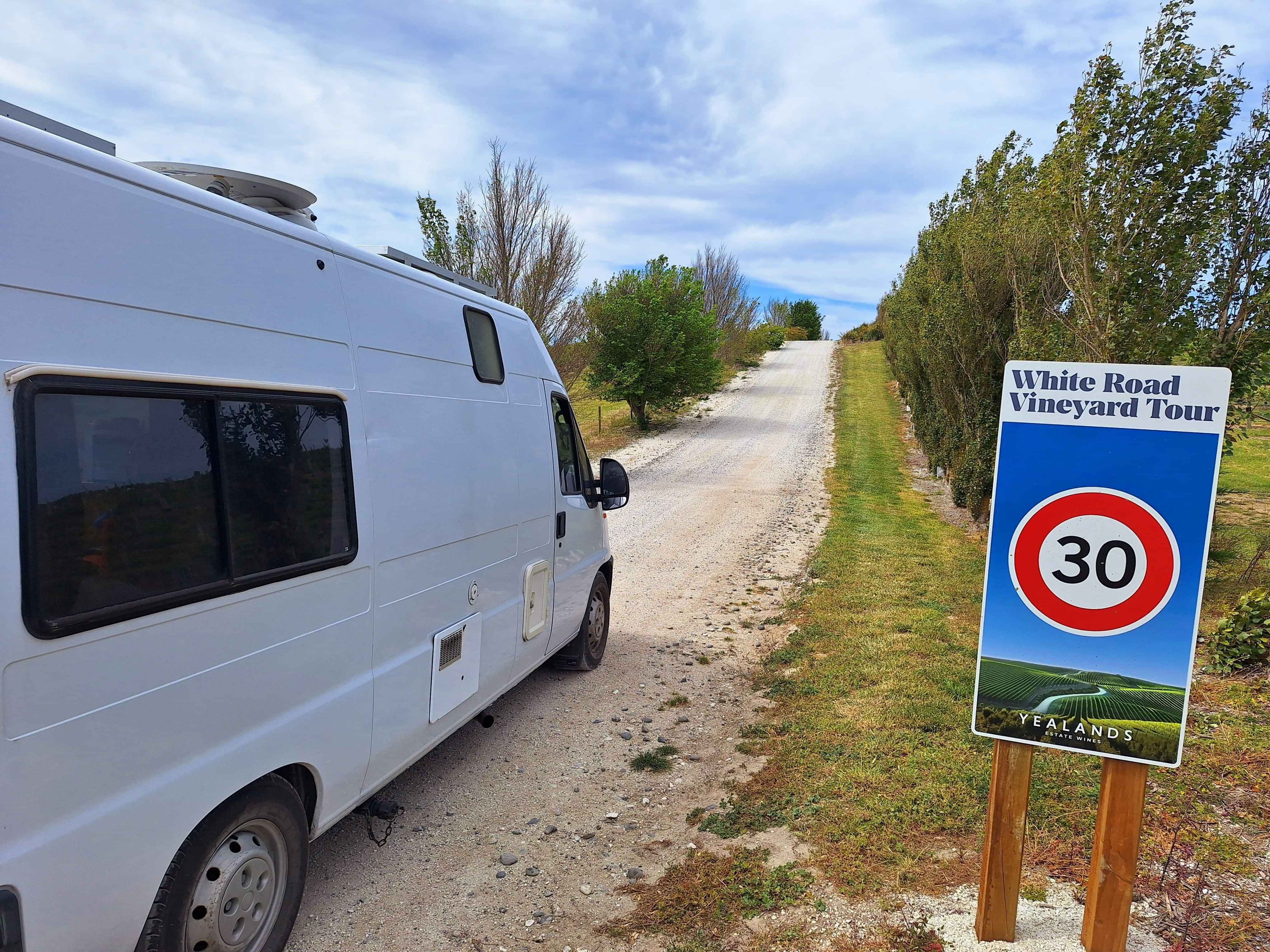
Seddon, Whites Road Tour
Seddon is infamous for enduring the punishing earthquake of 6.5 Richter scale in 2013. This tiny town was hit from the very centre of the Cook Strait, 20kms away.
Famous for the Whites Road Tour through the folded landscape of Yellands Estate Vineyard. An 8km jolly old trek up and down undulating lime coloured roadway, passing hundreds of acres of grapes, some with sheep grazing under the vines. A first. Top Tip, drive in behind the Seddon town and drive 8km alongside the Awatere River to a most impressive vineyard, open to the public. Don't steal the grapes, however.
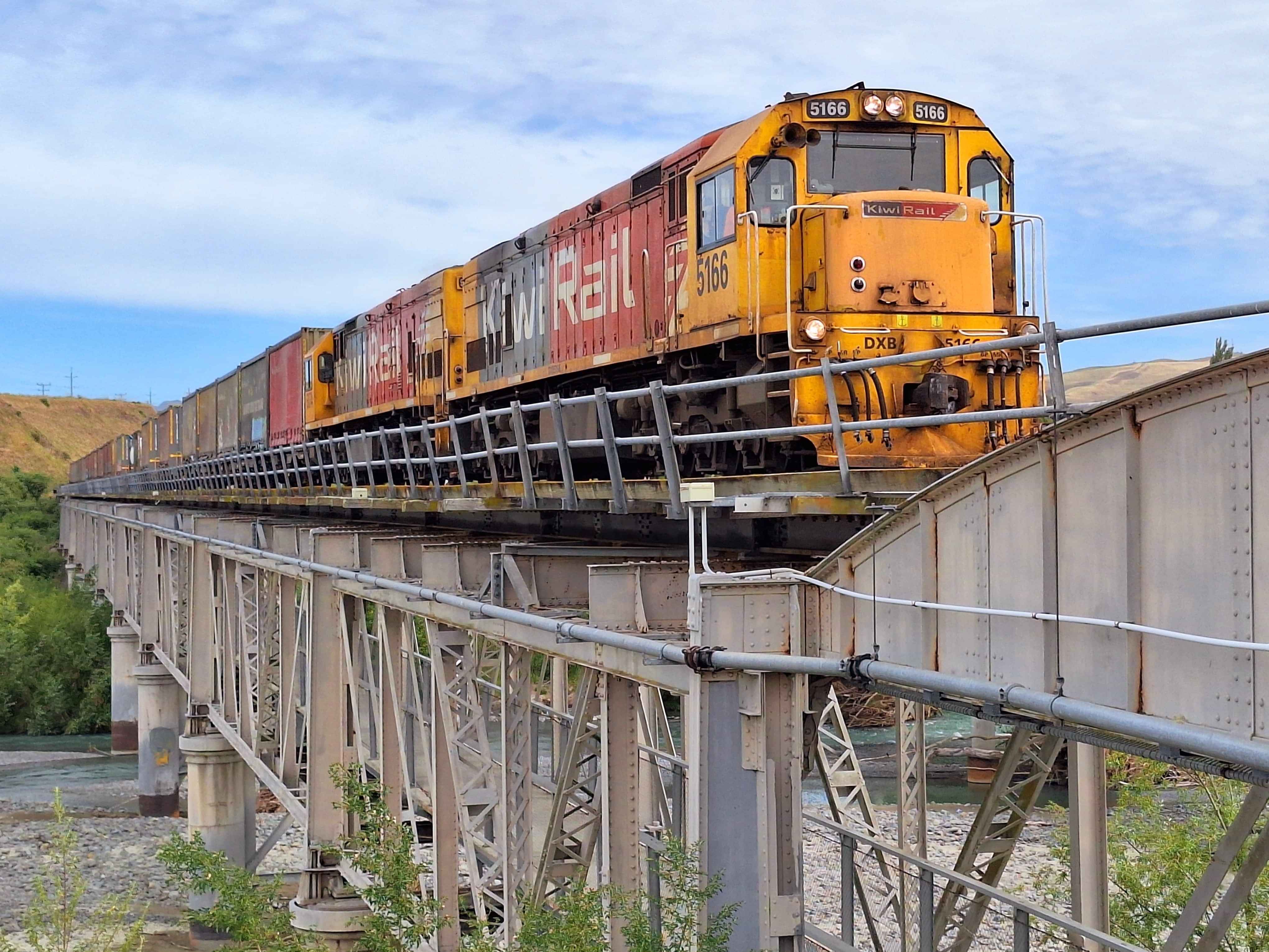
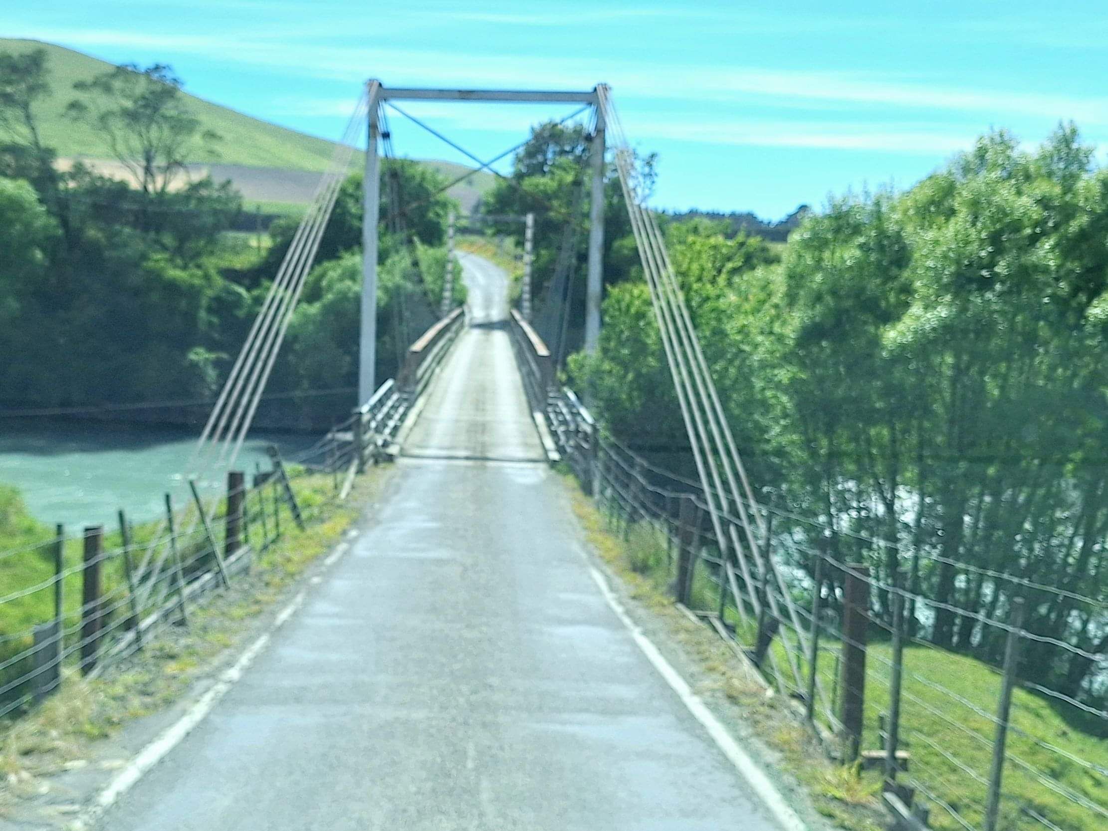
Awatere River road-rail
A unique engineering idea whereby trains travel directly above the underslung State Highway road bridge. A double bridge infact. It was this way for years, before SH1 was widened for faster traffic next door. However the bridge is now used as a cycling and for foot traffic with the rail line still operating above. Managed to view a passing lengthy train. Missed the opportunity to view from underneath as it "clikety clicked" above. Next time.
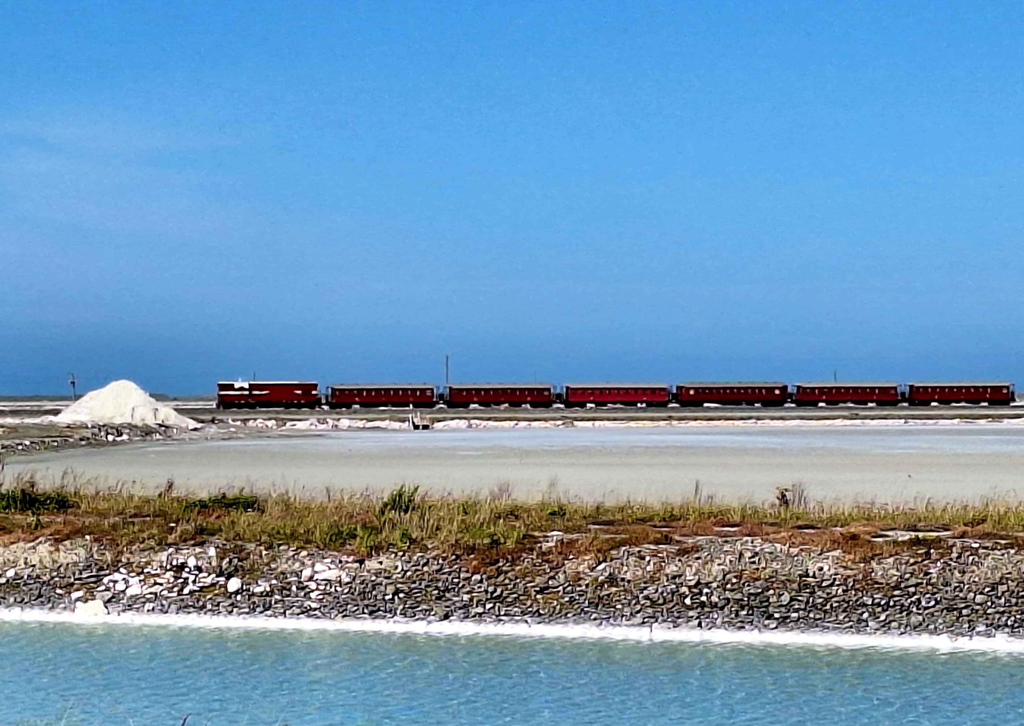
Lake Grassmere
Using a low sea level lake system, sea salt is harvested and Solar-Dried from vast lake beds. Essentially removed from the Pink Purple baths, piled high, then sorted and bagged for release into various markets. The Dominion Brand is an old Kiwi icon, now Asian owned. A firm favourite with Friday Fush n Chups. Known for the Pink and purple hues in the lake beds. Sadly, not today. Although a passing yesteryear tourist train passing one salt pile made up for the lack of salt bath colour. Salt had evaporated in these lakes since 1940.
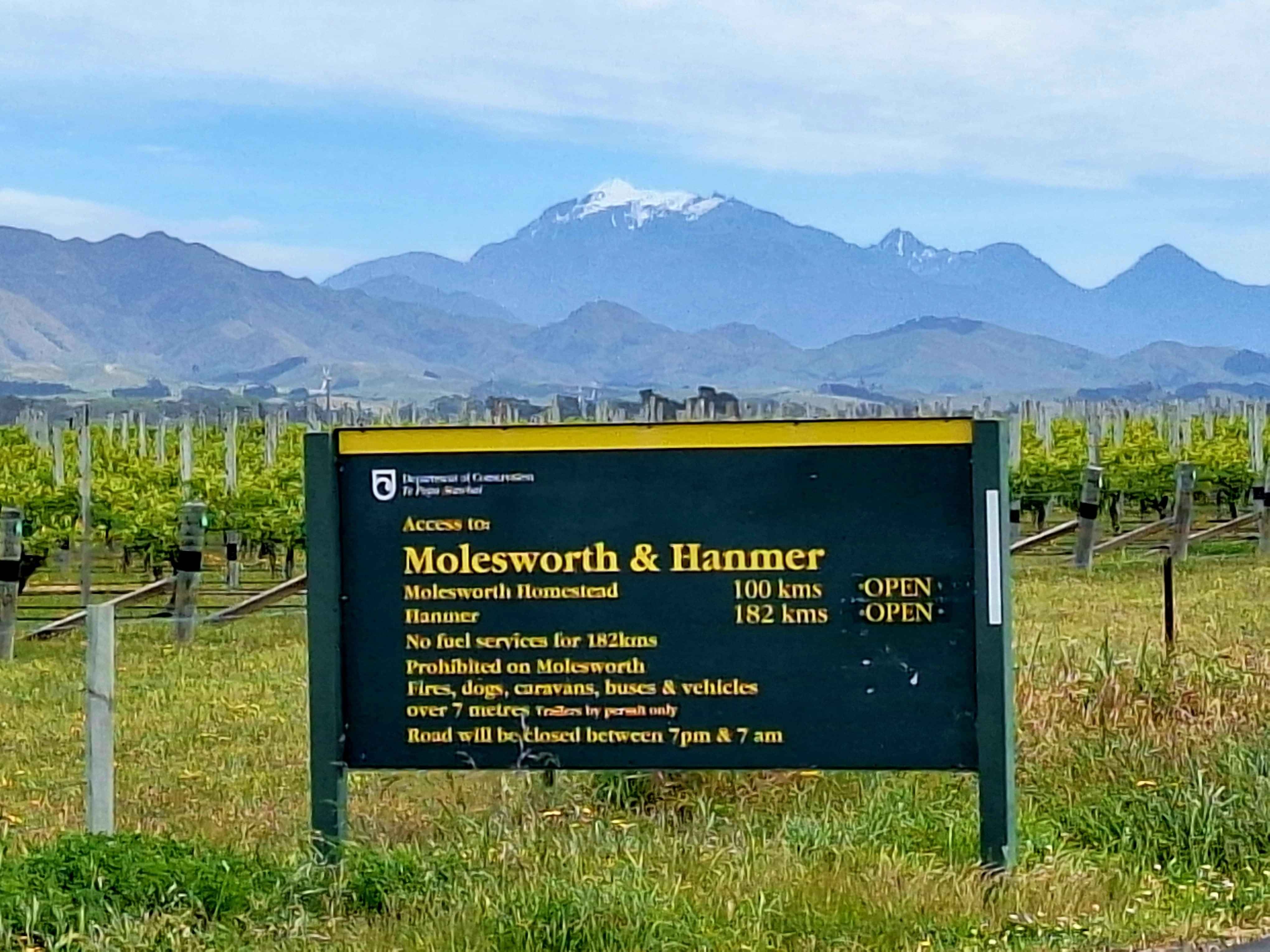
Molesworth Station Gravel epic
On future list, the epic gravel trek from outside Seddon across NZs largest farmyard of 1800 square kilometers to the hotpools at Hanmer. 200 kilometres of dusty road through am ice aged carved valley with Hikers, mountain bikers and 4WD vehicles. Even mums cars are viewed here. 3 to 5 days of adventure. The road in on Awatere Valley Road starts on tarmac, but eventually gives way to gravel. Then a bumpy 160kms of bone jarring fun. Anyone fancy a tandem mountain bike. I'm in. Top Tip...camp along the way. No hurry. Bikers have achieved this in 24 hours and less. I'm a 5 dayer I reckon.
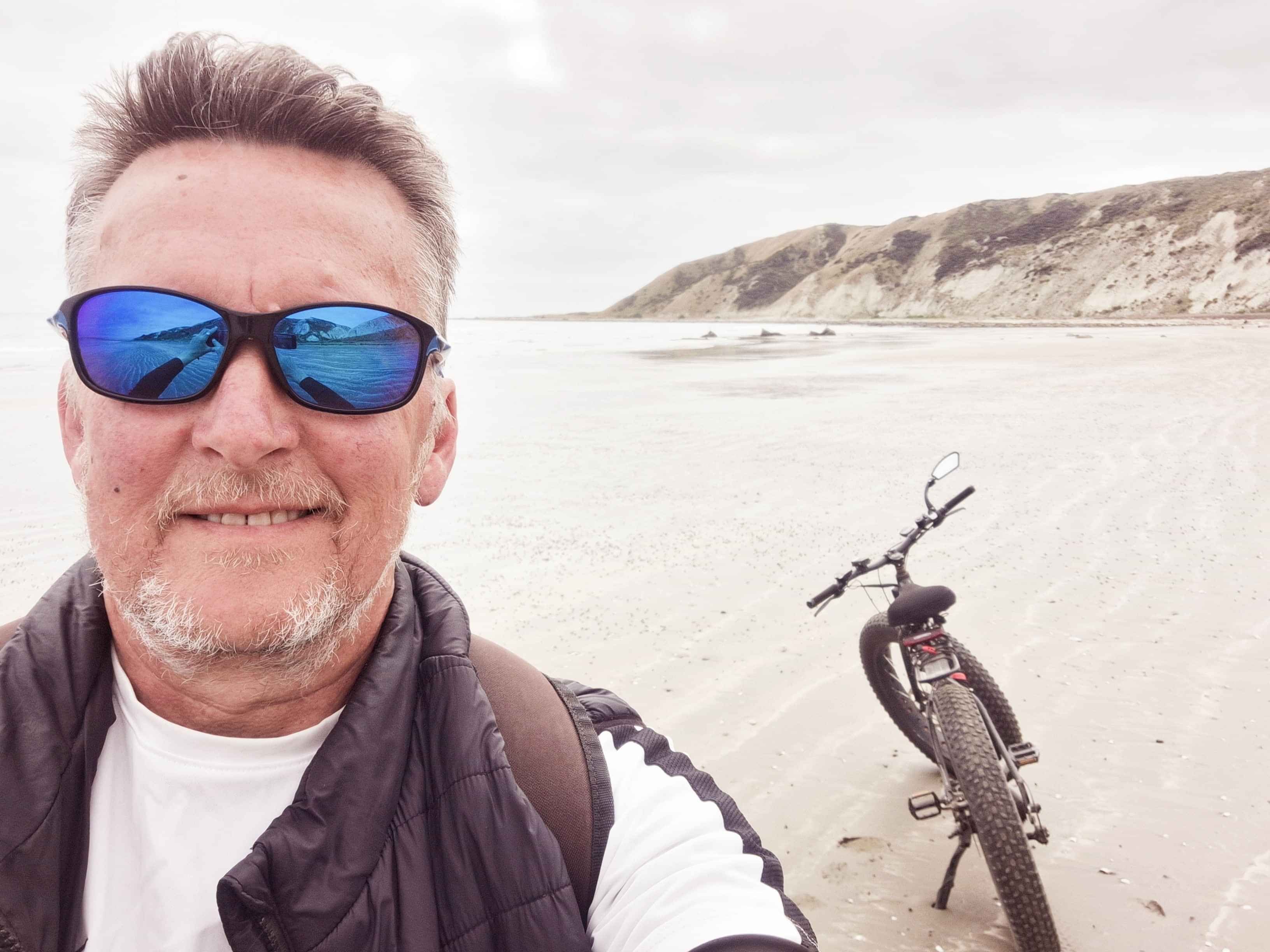
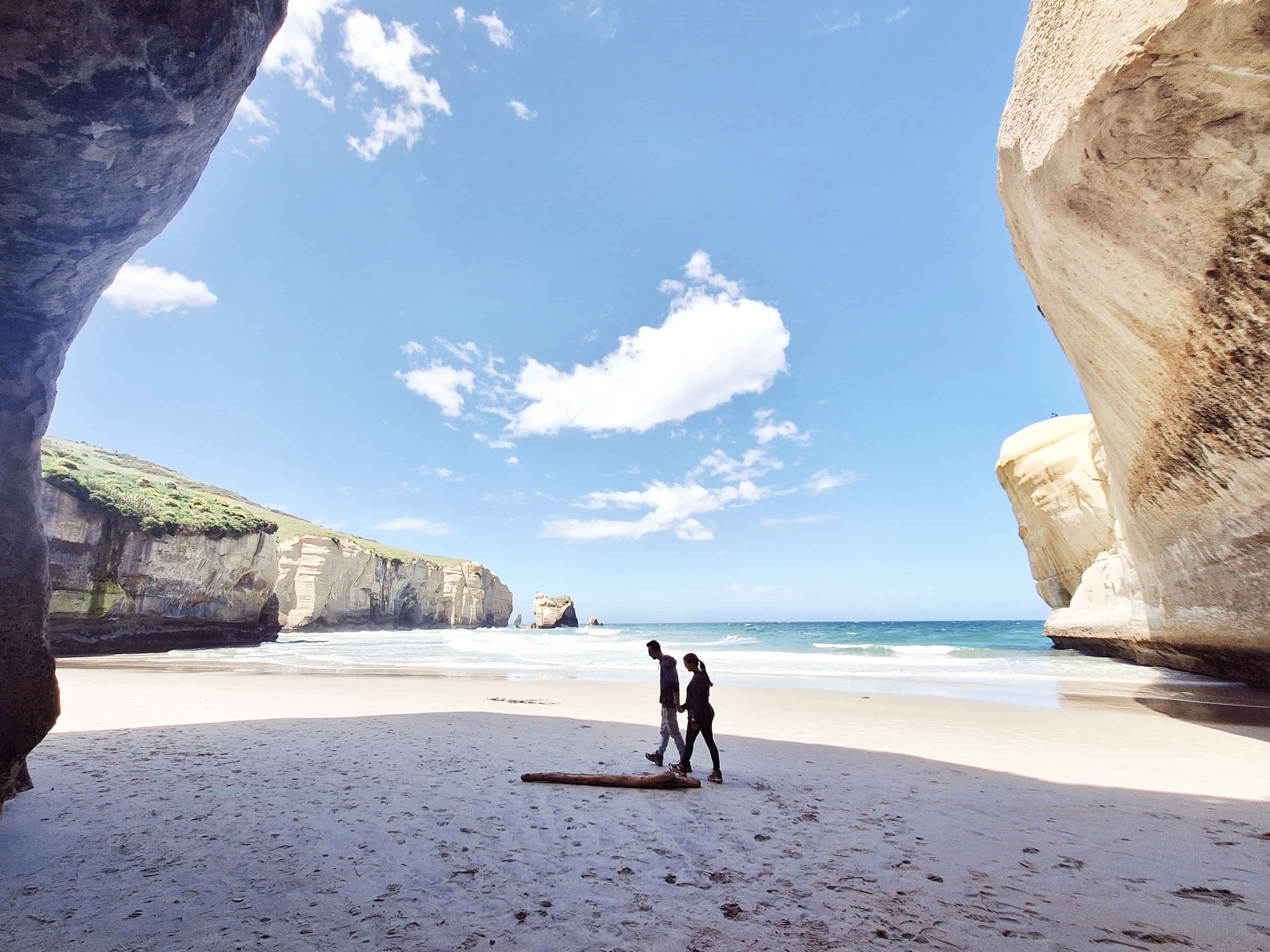
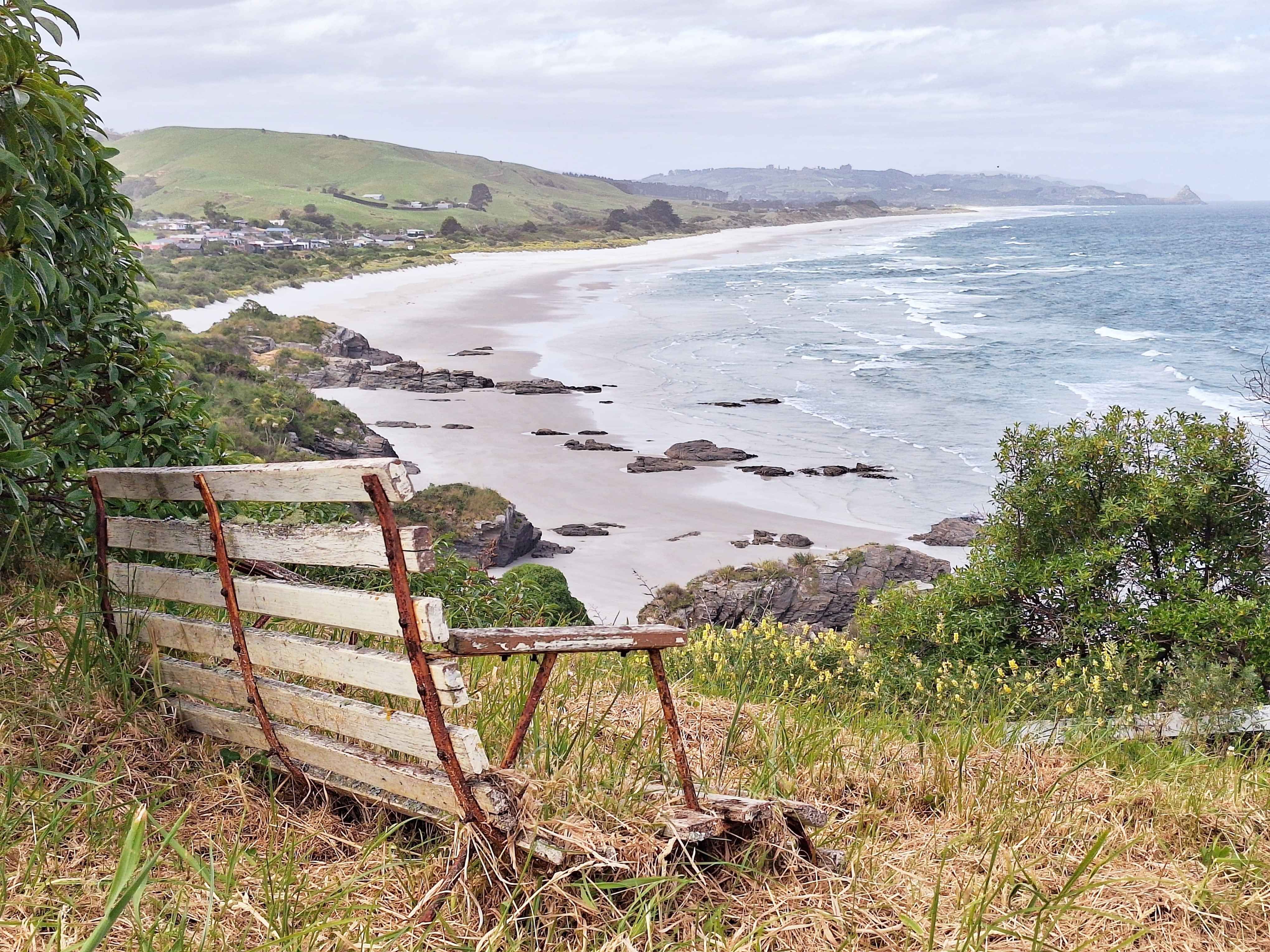
Marfells Beach
Directly behind and south of Lake Grassmere, the Salt Lake, and a couple of Bays around from the lighthouse of Cape Campbell sits a delightful easy facing camp and beach. Popular with cray potters and beach mountain bikers. If you get past the lighthouse, the next bay is Ward Beach where wind and ocean sculptures boulders reside.
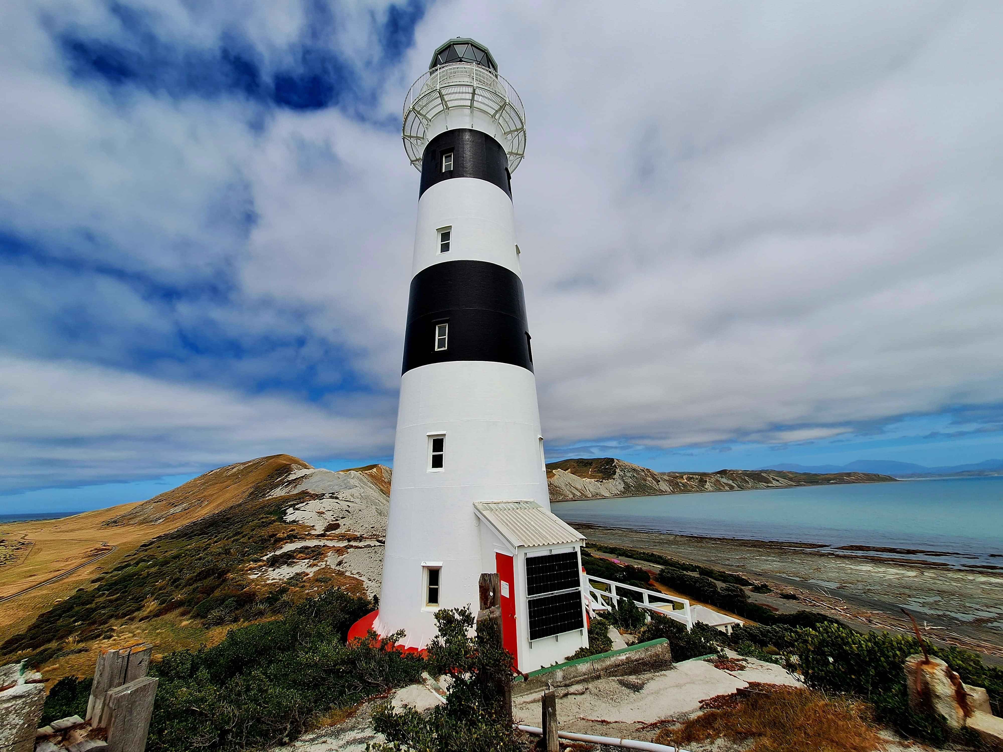
Cape Campbell lighthouse
Arguably the most easterly point on the South Island sits a lighthouse dressed in the colour's of a zebra crossing. You'll find alot of sleeping seals, so be aware whilst walking or biking. They don't attack unless you block access too the sea. Otherwise, no drama. Try biking from Marfells as the hike is sizeable for the non hikers or strollers. You will need to push thro7gh 100 metres of pea stone at the halfway mark. You've been warned.
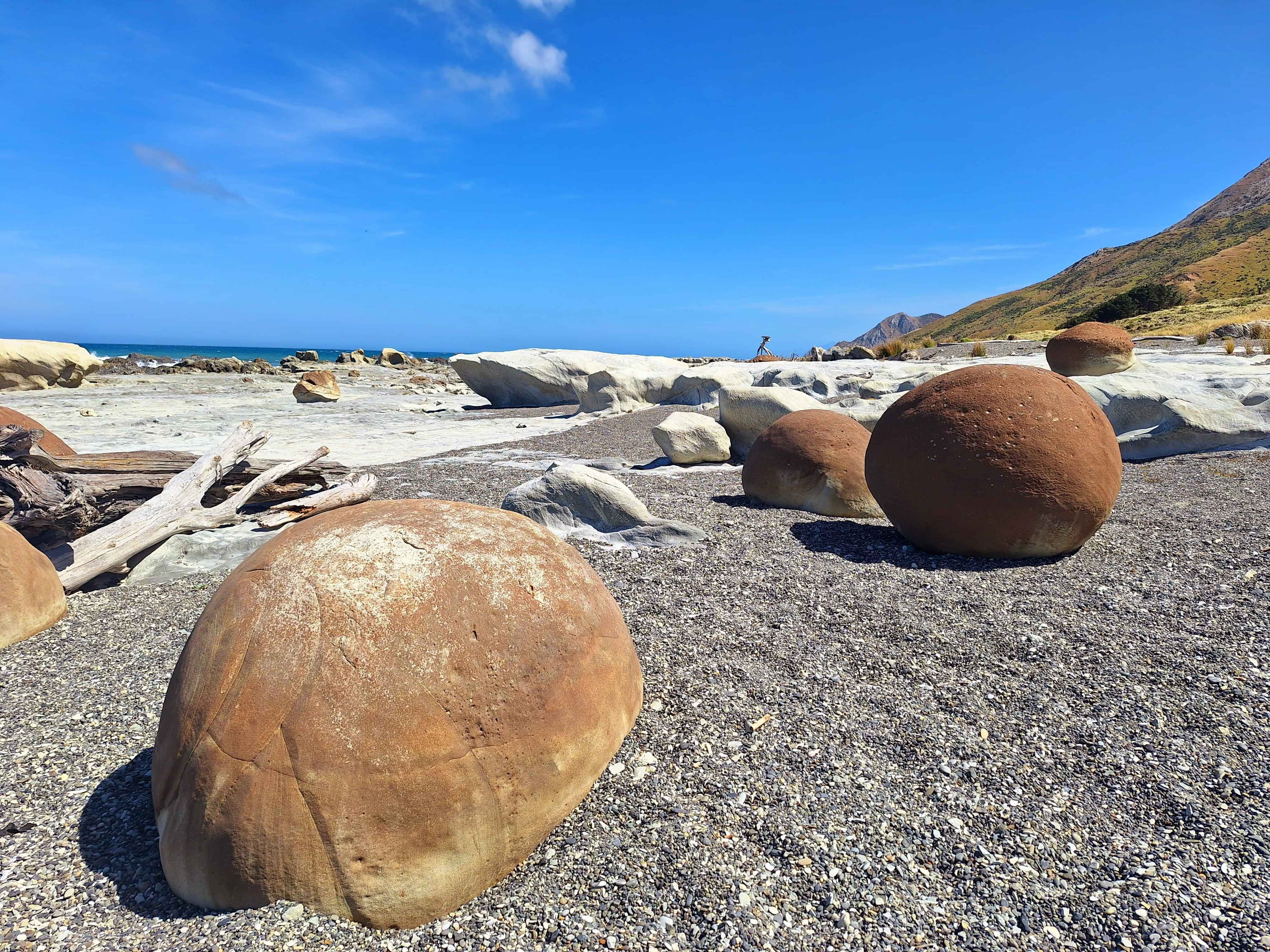
Ward beach
Similar to the Moeraki Boulders south of Oamaru, these somewhat smaller Bend it Like Beckham stone footballs were formed 65 million years ago, in the same way of the Oamaru cousins, in mudstone. Sadly since I was last here, the numerous round footballs are degrading and many have broken apart with the relentless battering of the Pacific Ocean. Ward Beach is also a fine example of the uplift of the Kaikoura Quake of 2016. Look out for the acres of white rock which scissored upwards along the waterline. Most dramatic examples here.
TheStore@Kekerengu
My halfway teahouse cafe between Kaikoura and Blenheim. If the suns out, a perfect beachside coffee stop in The Stores, garden setting.
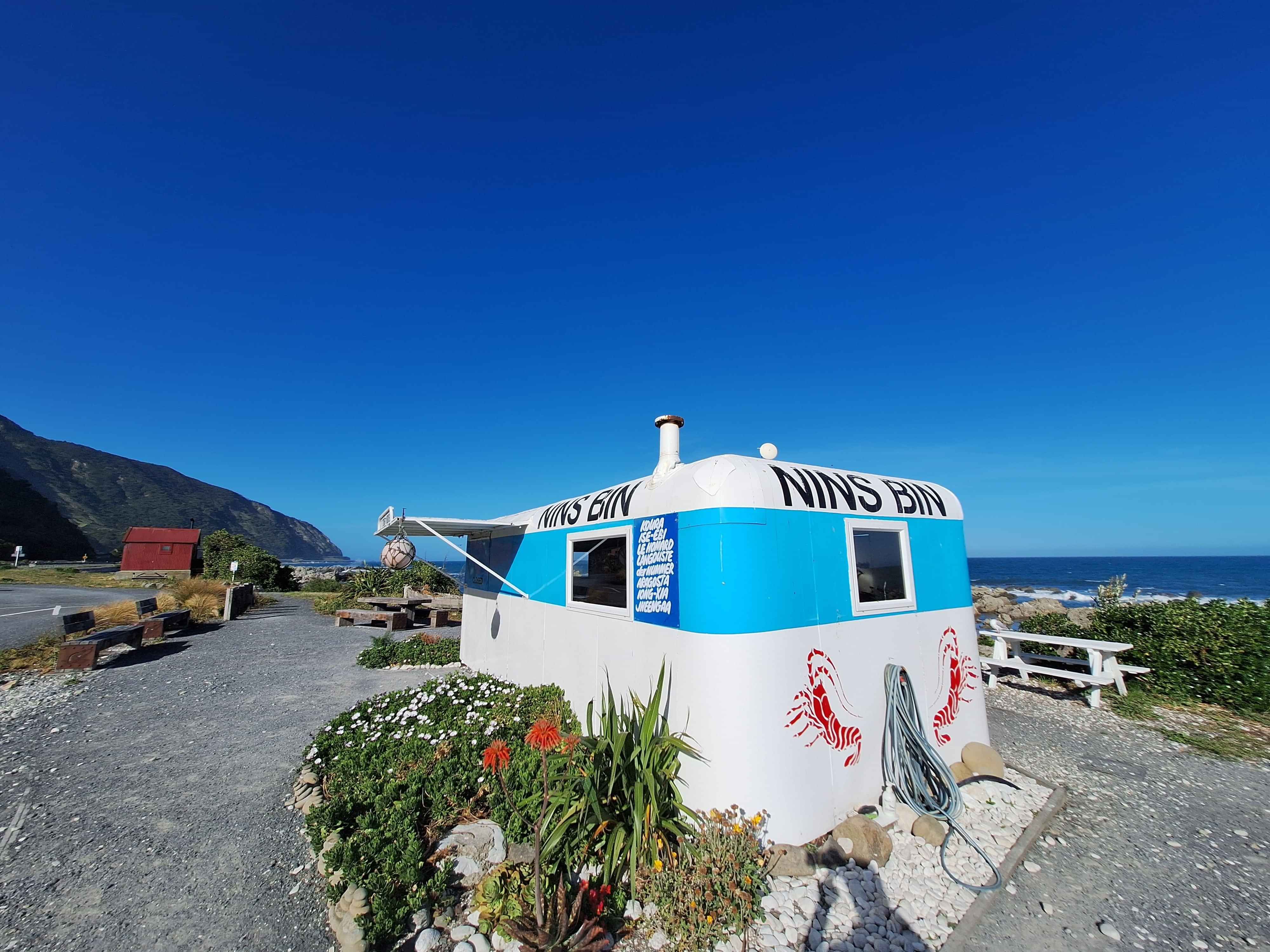
Nins Bin
Left my run late to stop for an early dinner, as the Nins Bin crew had fled by the time I pulled in. An iconic Kai stop and busy as in summer. Just after viewing the seal rookery at Ohau Point, it's a nice treat before heading to Kaikoura...when it's open ofcourse.
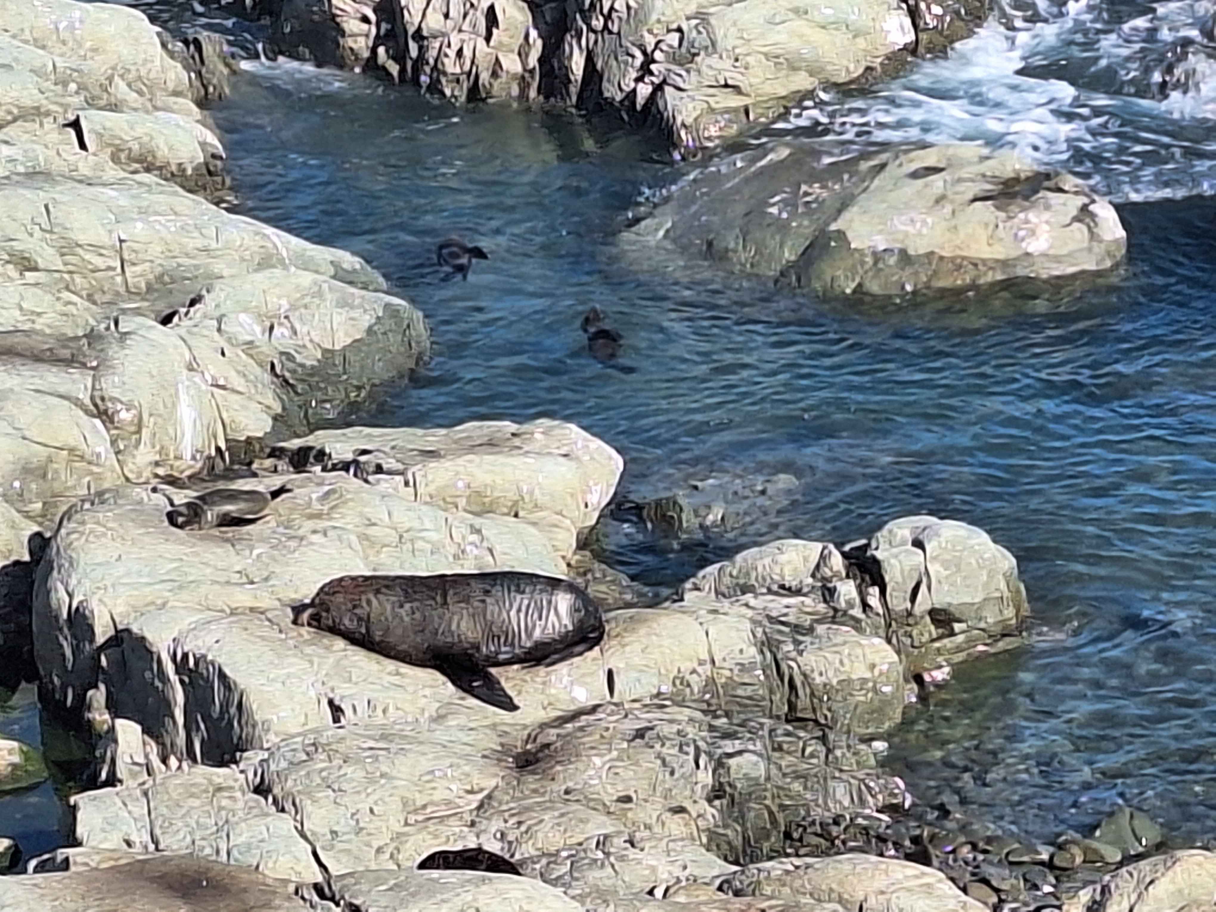
Ohau Point, Kaikoura
A fully protected area. Even the seals know they're safe here from human harm. An immensely popular stop for drivers heading into Kaikoura. You'll discover the rookery of mum and baby seals in large numbers. Above the pools are up to 100 travellers peering down to see what the fuss is about. This area was devastated in the 2016 earthquakes, but extensive work by the Government repaired the truly massive road and rookery damage. Inturn the seals have returned in ever greater numbers. Top Tip...if you're heading to Kaikoura to see the wildlife, this stop is sometimes better than the foreshore of Kaikoura.
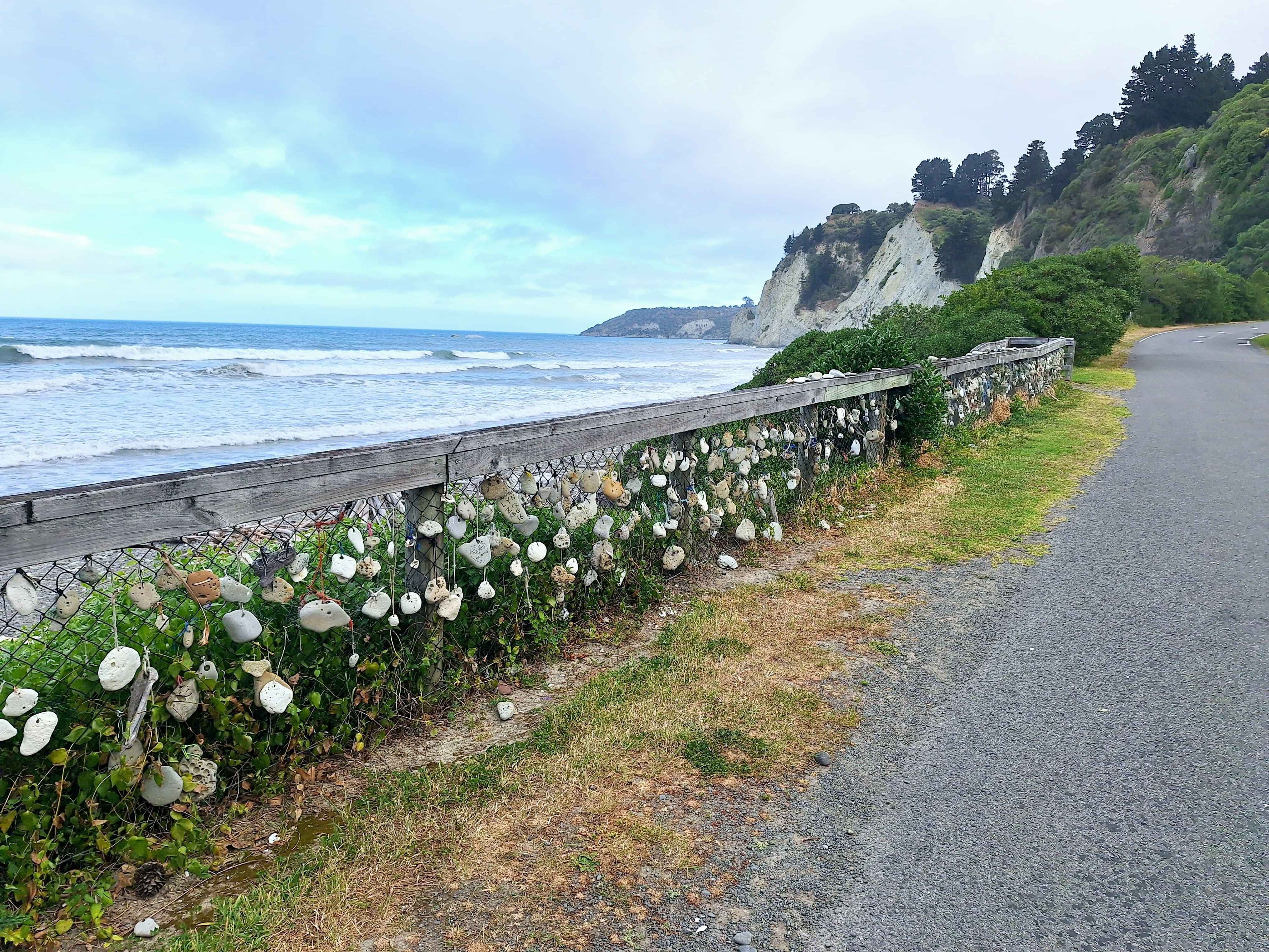
Kaikoura
Irish migrants arrived circa 1865 including the O'Donnell, Gallagher, Keenan, Smith .Kerr and more to settle in Kaikoura. The O'Donnell House, an Irish pub in the rural area, celebrates these early pioneers. You can too. Guinness anyone. Whales are the big ticket item in Kaikoura. Daily boat rides to the edge of the channel guarantee generally that you'll catch a glimpse of a tail at least. We tried the external prop engine with Kaikoura Air to sight disappearing whales from up high. The newest buzz in town is Star Gazing ad this town is fully recognized as a Dark Sky area. Apparently hard to gain this accreditation. If you want a good spot, head at dusk to the Kaikoura Lookout on the hill or down at coastal level in the grounds of Fyffe House. Top Tip....the selected photo is a private trotters race track circuit with uninterrupted views over the town and across to the Kaikoura Mountains. Love that.
Gore bay
A recognized Mainland surfers hideaway 8kms coastal side of Cheviot township, and the halfway point to Amberley in northern Christchurch. The surf barrels constantly roll in night and day. Top Tip...A decent backroad to Port Robinson and Hurunui Mouth, both worthy of exploring.
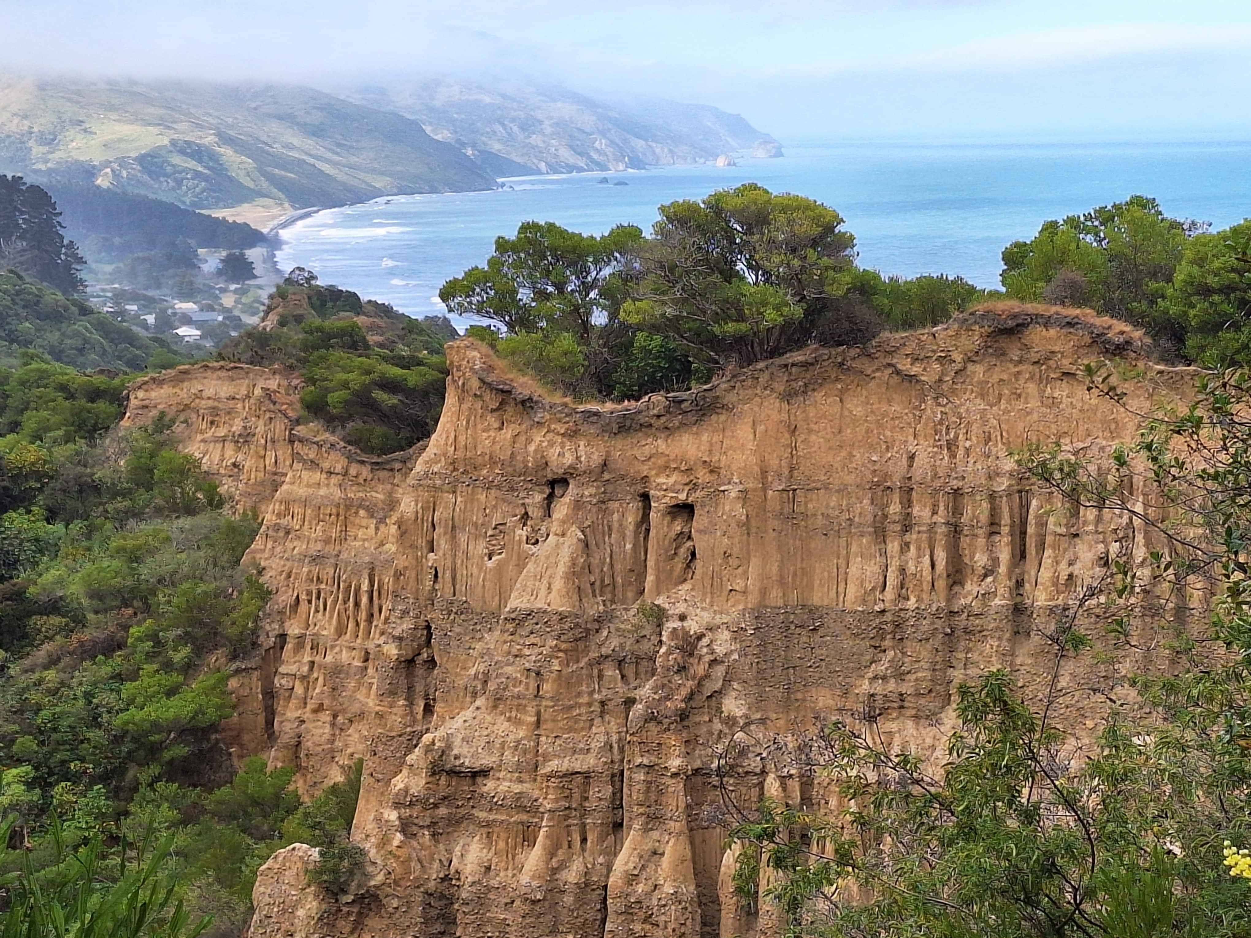
Cathedral gully, Domett
I decided to walk the kilometre hill to reach the impressive Cathedral Pipes. Suggest taking the camper. Steep. These pipes are a series of rock pillars, eroded by rainwater over the soft rock to form a cathedral look. The view from up high over the pillars and down to the bay is equally appealing. One critical dubbed these as World Famous in NZ.
Port Gibson? Port Robinson?
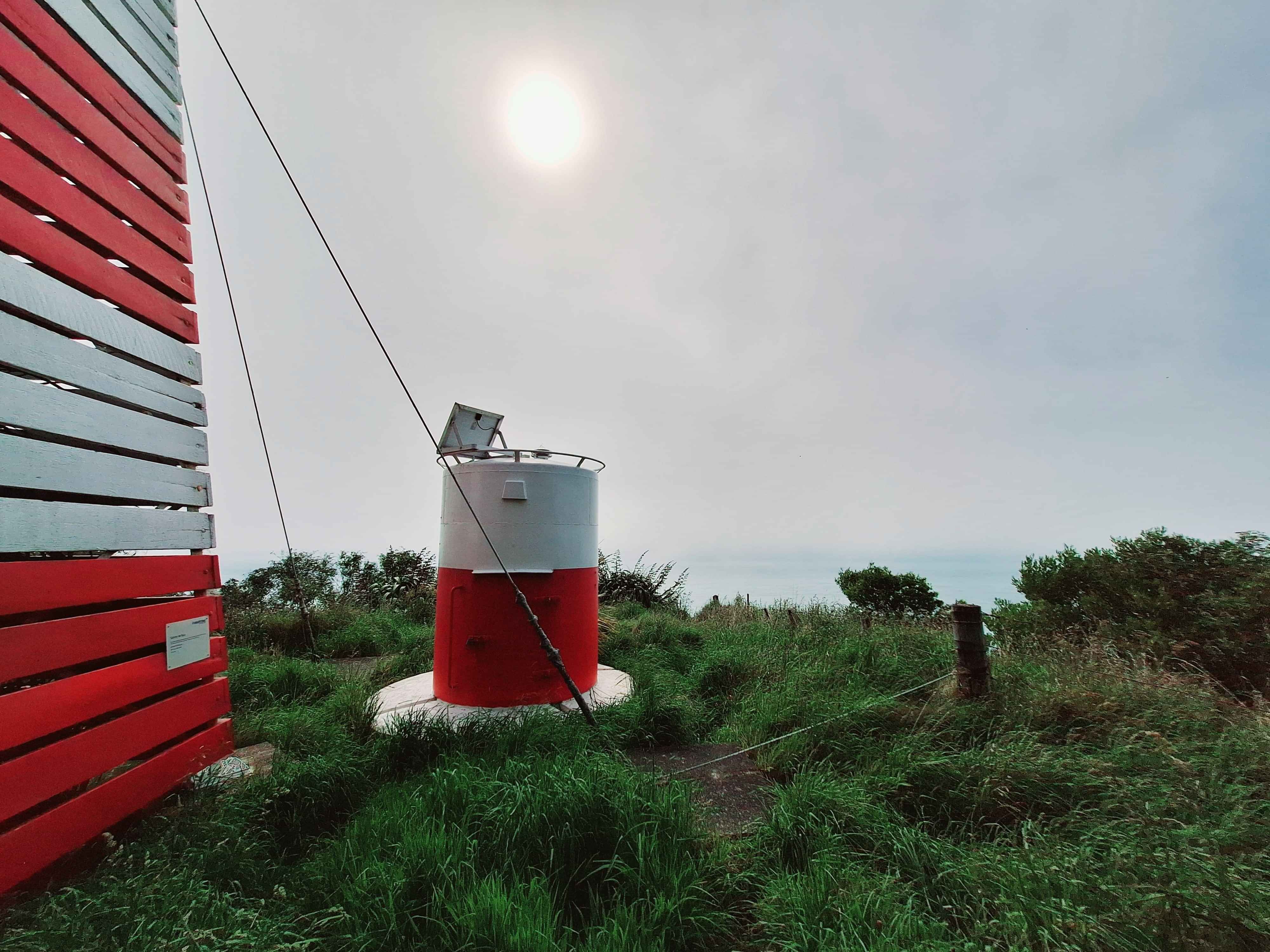
Although I discovered the actual lighthouse, maybe more Beacon, it's location name confused me. This small lighthouse has shone here since 1948. Could this be NZs dinkiest warning light for boaties, or more precisely, dinkiest lighthouse. Map shows Port Robinson. Another showed this as Port Gibson where the light sits. Top Tip...You'll need to scurry through a farmers paddock to discover it. Let's trust he's not farming Bulls.
Hurunui Mouth
I've concluded I've got a fixation for swing bridges. Recently cycled 5kms to see one on a river cycled trail. Allover NZ I stop to view and photograph. It's rather odd behavior. This one wonderfully creaked and bounced as tires hit the timber floor. Naturally I turned around for another round. Oh, it's a nice fishing enclave too at the end of the Hurunui River Mouth.
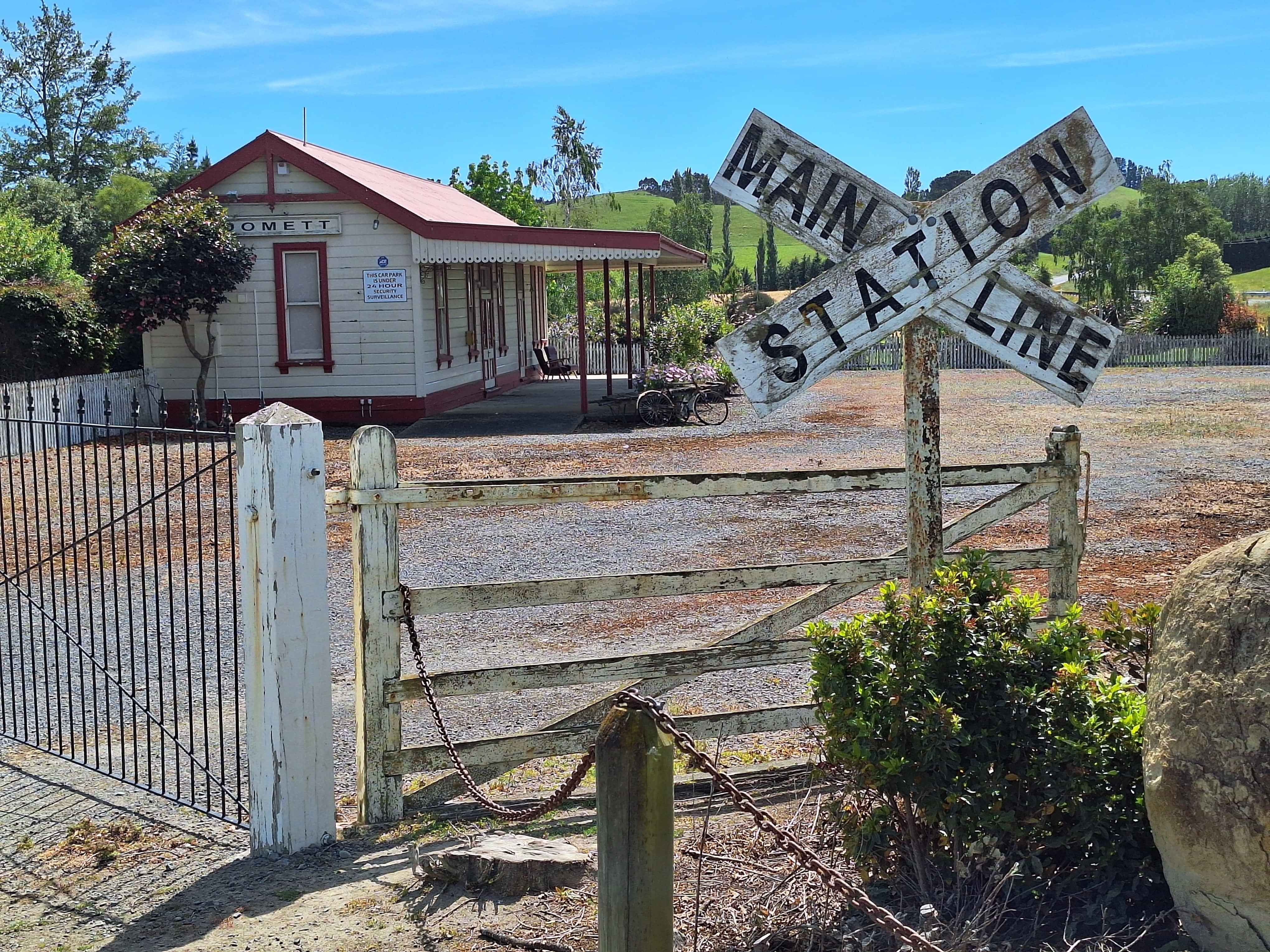
Domestic Rail station
I've always loved the Domett Rail station, currently a private residence on SH1, just south of Cheviot. Today I noticed the forsale sign. Not truly feasible, but dreamy all the same. Reminded me of the time I was keen to buy a church in Westmere, Auckland, or a slice of heaven overlooking a golf course on Karikari Peninsula. Pure fantasy, really.
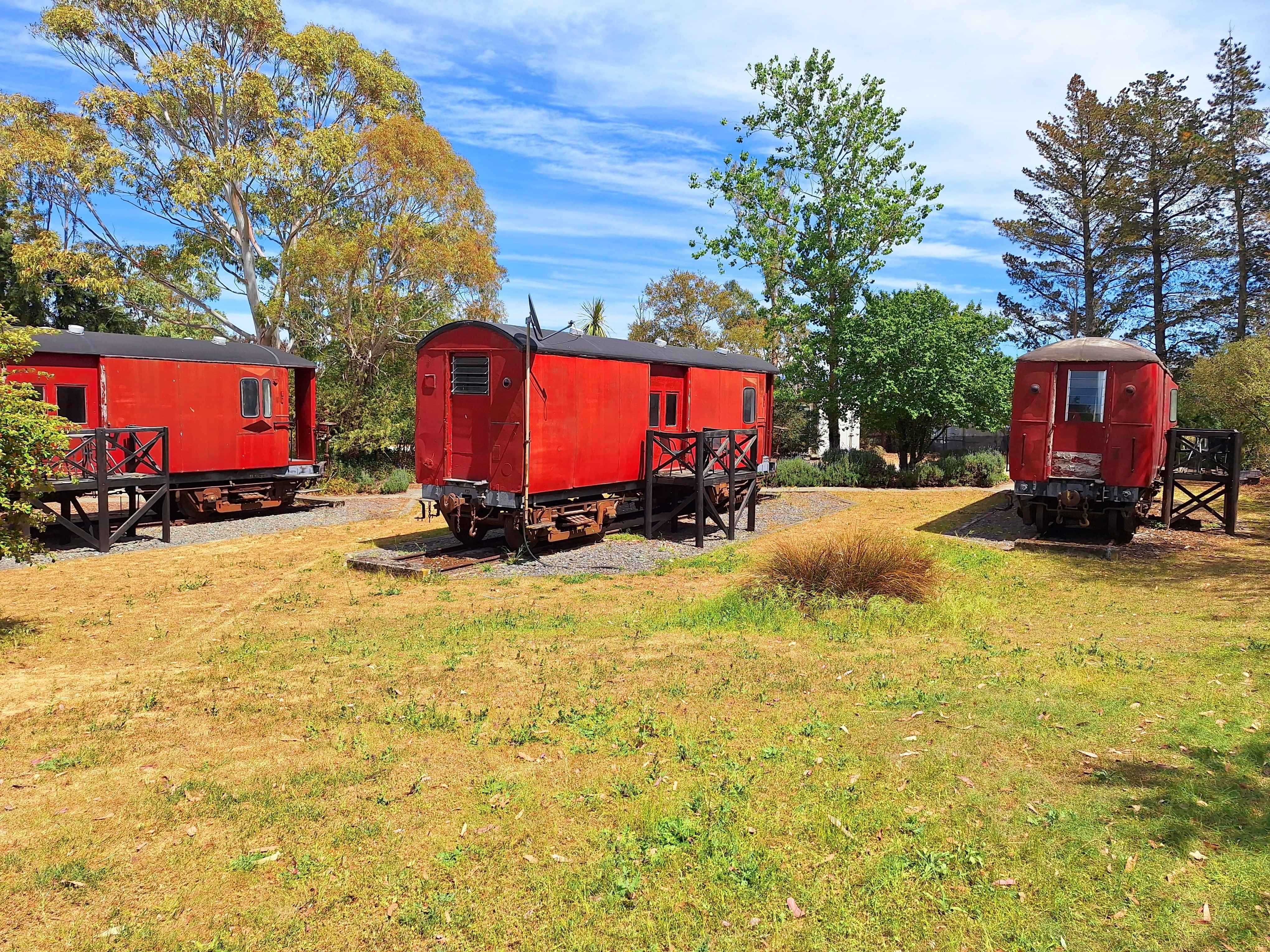
Waipara
The Sleepers is a very unique property. Some would suggest, Quirky. A series of old school railway carriages dressed up as couples accommodation. It's also a campers rest spot. Reminded me of very similar propositions in Okaihau Northland and on the hill in Raglan, Waikato New owners at the Sleepers, Waipara. Campervans welcomed. I'll be back.
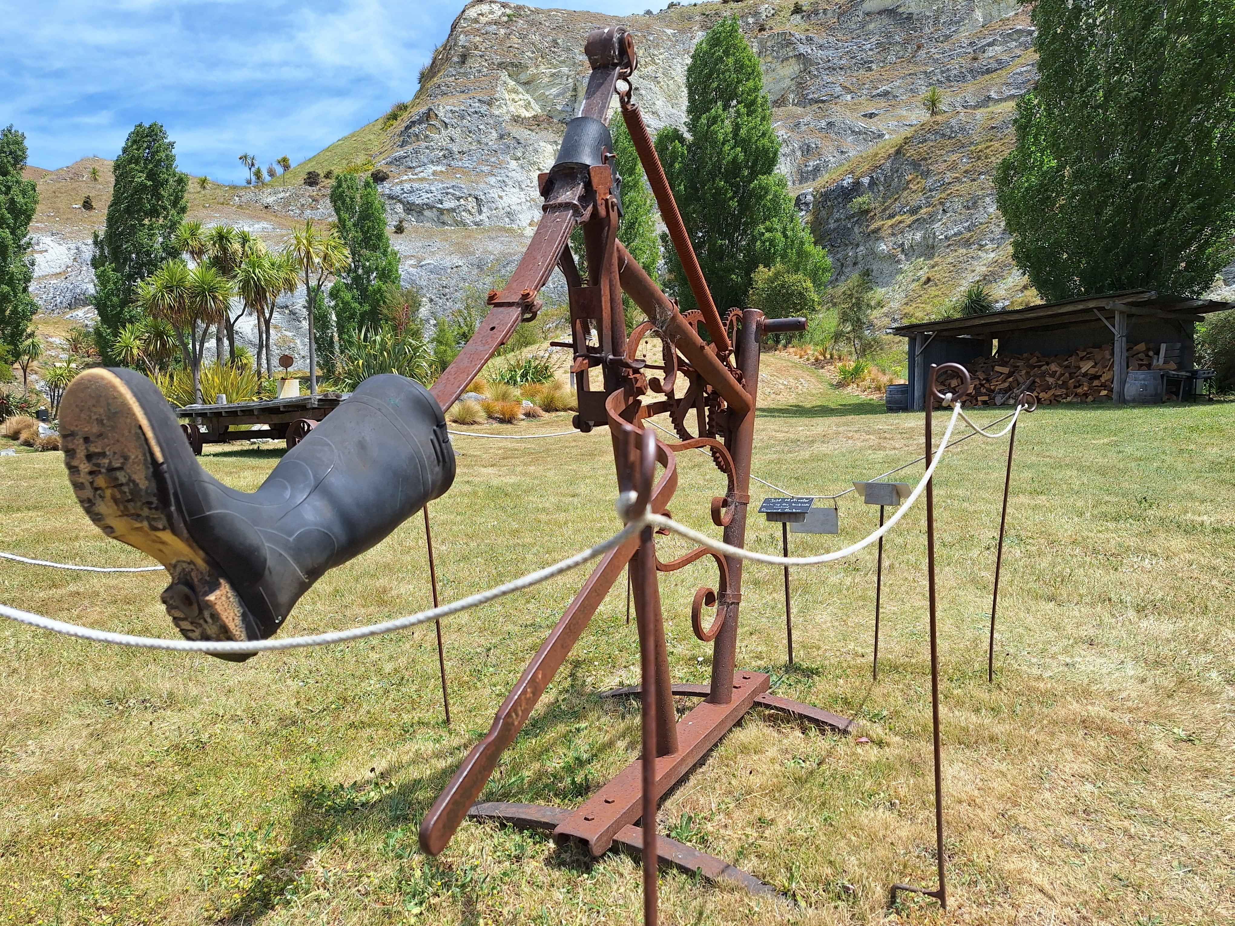
Iron ridge quarry, limestone hills, waipara river
A couple have radically transformed a massively sheer walled quarry pit into a piece of paradise complete with sculptures. Your entrance fee helps with the ongoing restoration whereby truck after truck imported soil to repair the starkness of an old rundown quarry pit. Take the very nice 10km drive past vineyards like The Bone Line and do bring a picnic. Free coffee on entrance too. Intime I do hope they add to the classic Kiwiana No.8 fencing wire attitude of the Kicking Gumboot. Very Fred Dagg perhaps.
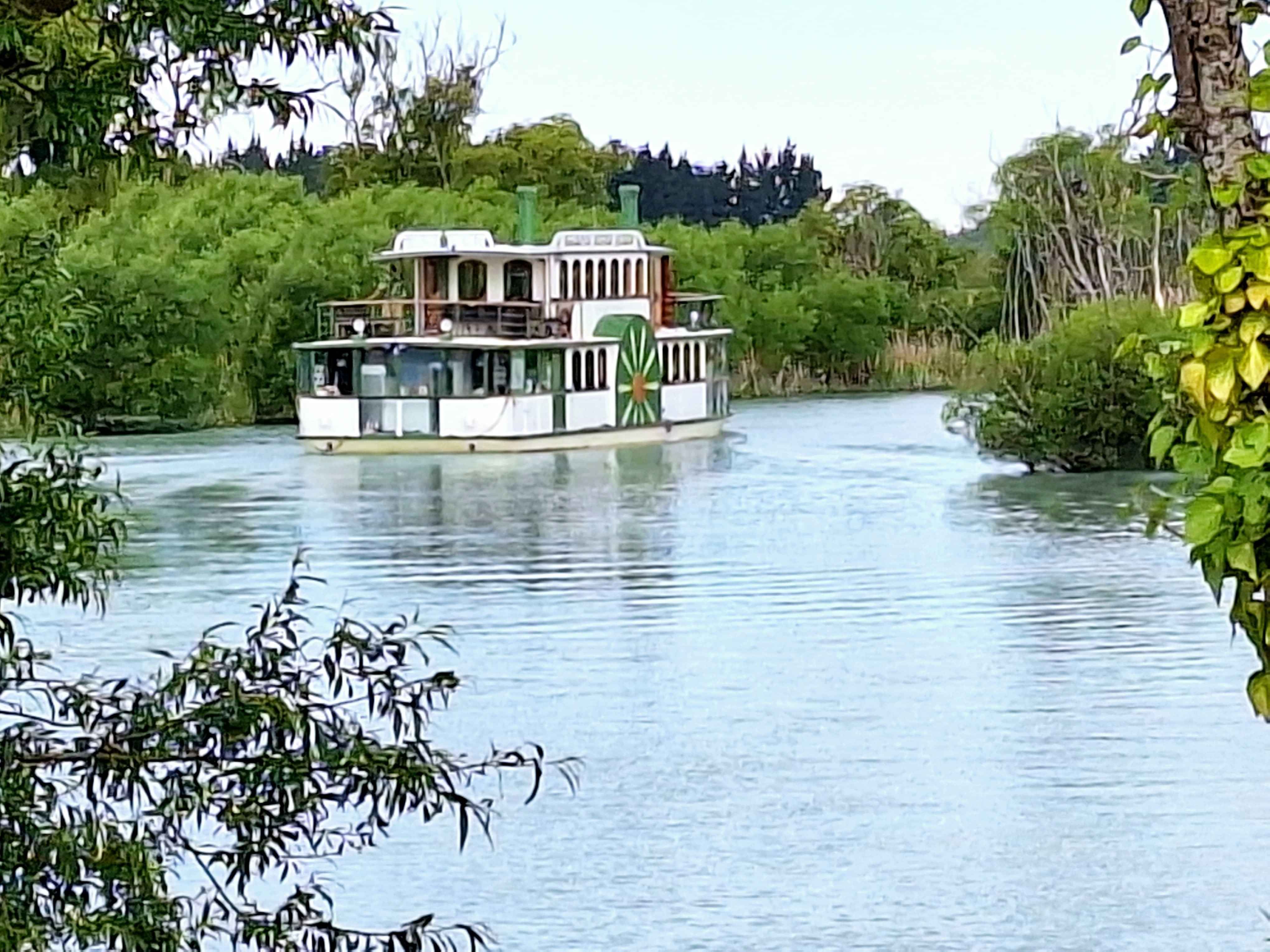
Kaiapoi, North Christchurch
I was on a Mississippi Paddleboat, true story, feeling the breeze and stillness on this unique river cruise, then right next door the Speedway roared into life. Oddly opposite in atmosphere. The paddleboat chugs the turquoise Kaiapoi River most days. Lunch-Dinners available too, although I stuck with the cruise only. Short arms, long pockets perhaps. A different way to take in the most northern "red-zoned" suburb of Christchurch.
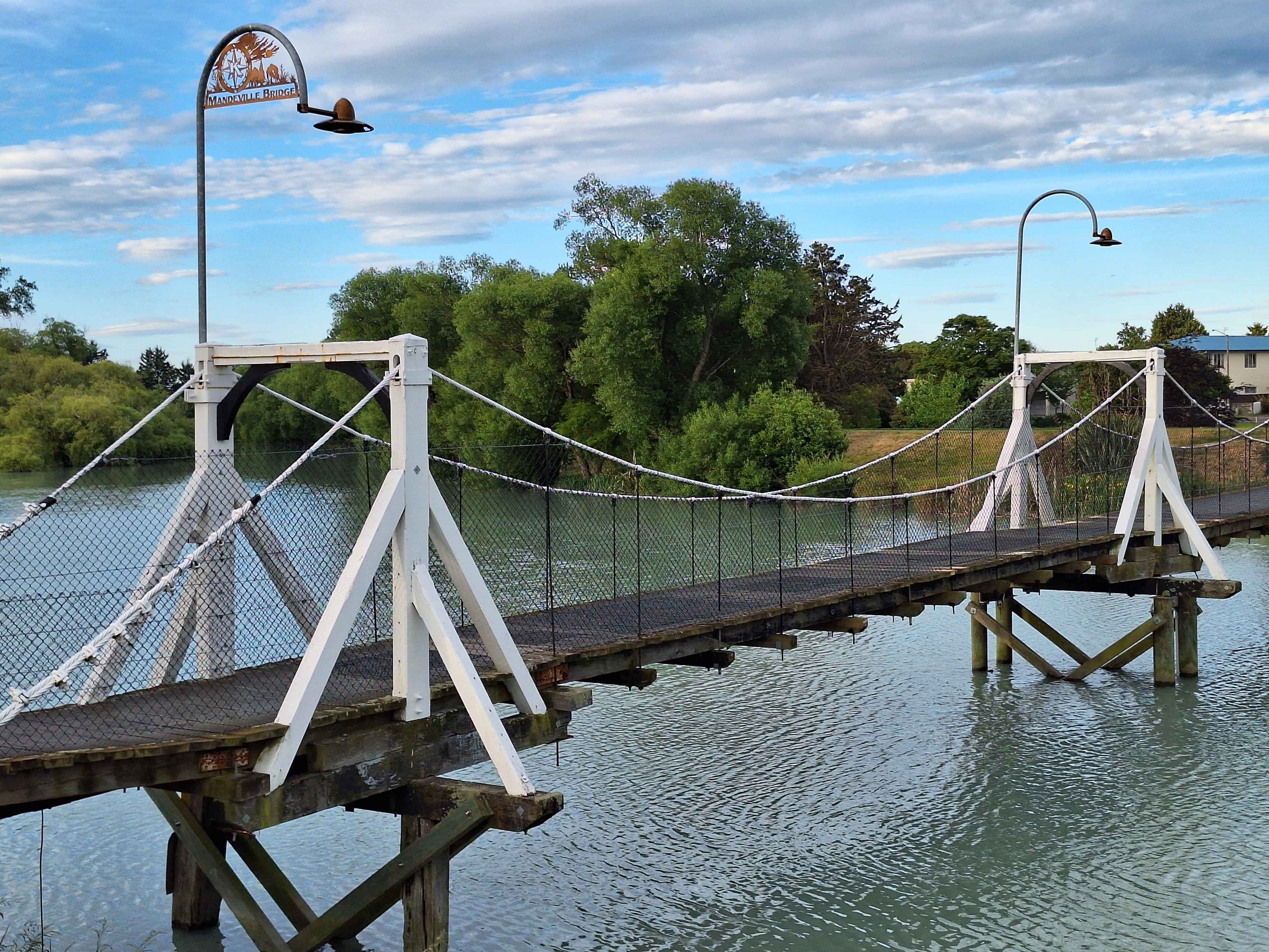
Mandeville Footbridge,
raven quay, Christchurch
Ballast blocks from a ship from Sydney makes up the actual oldest bridge in NZ in Kohukohu Northland from 1843. However it's simply a block bridge, not a hanging bridge. Over the Kaiapoi River sits a true hanging bridge from 1873 (admittedly 30 years on), but one of the very few original bridges from this period. Historic older bridges of the 1800s era have mainly been altered, reconstructed, even removed. This footbridge is the original. Ok, they had to shore up from underneath a dippy section due to the 2011 Christchurch earthquakes. But never altered the mainframe of the bridge, making this example one of NZs oldest in original form.
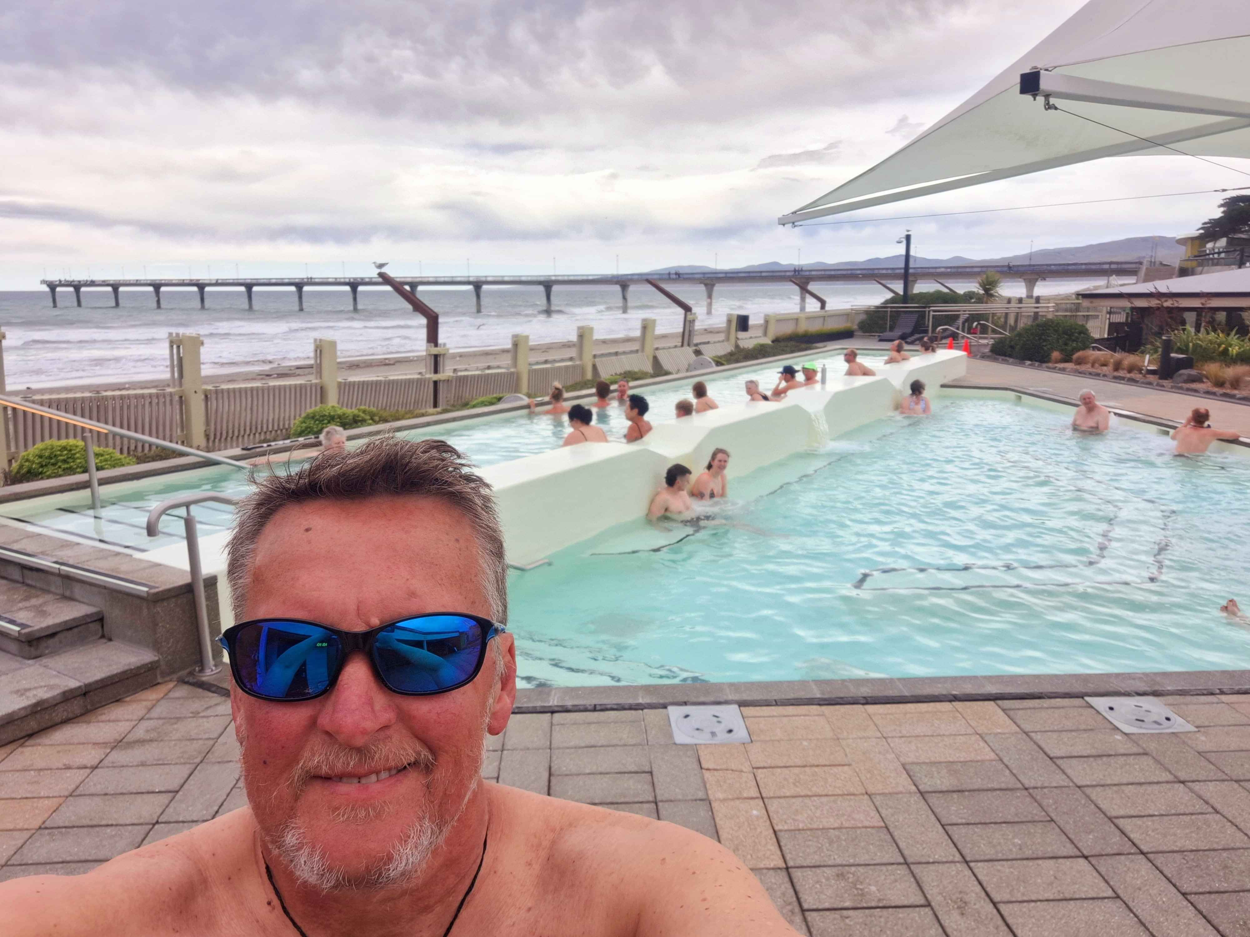
New Brighton hotpools and Pier
Two for the price of one. Soaking in the prized beachside hotpools whilst soaking in the view of the Brighton Pier
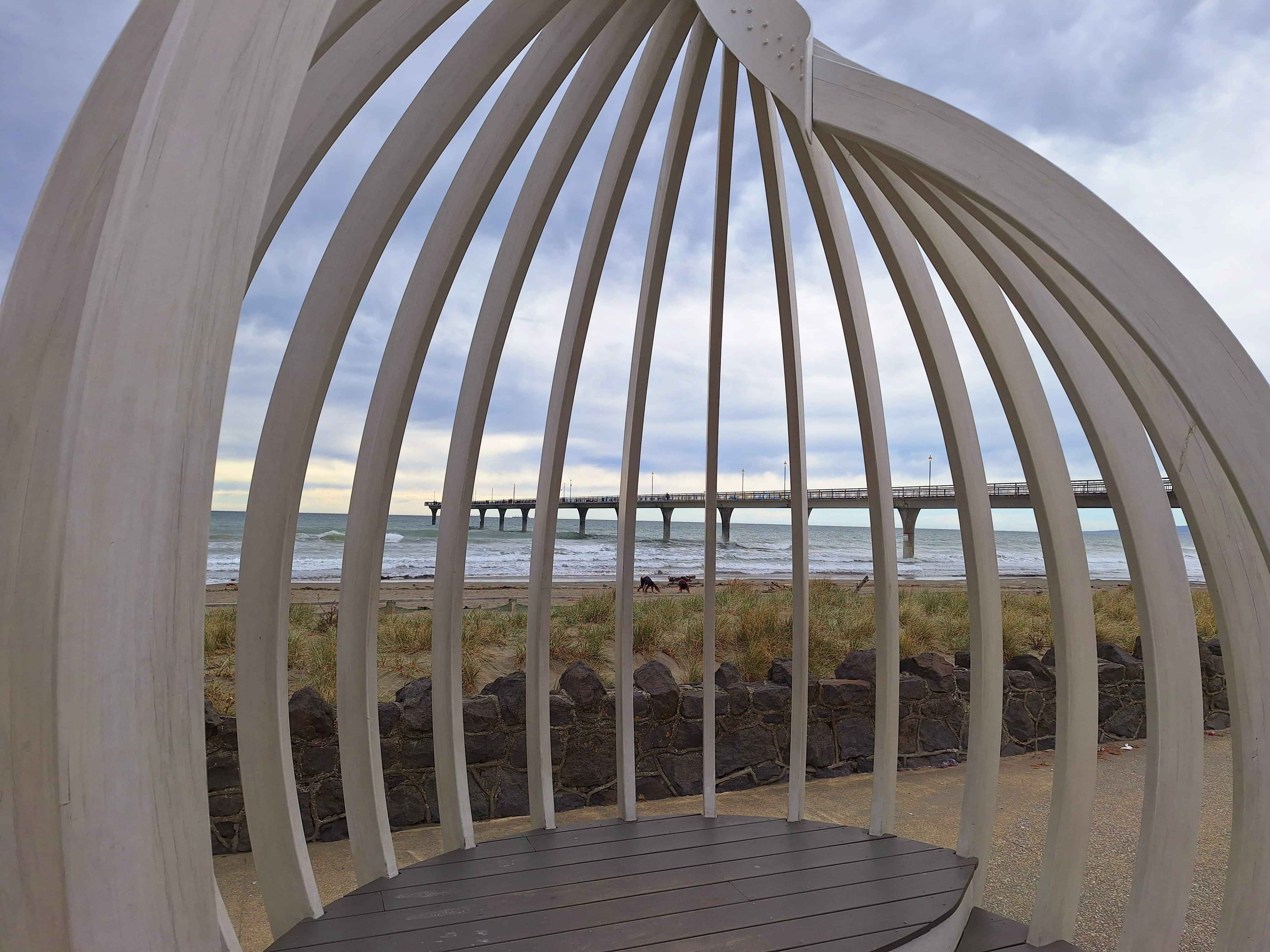
Marine Parade, Christchurch
They demolished the UK version of Brighton Pier, but even the 2011 Christchurch earthquake couldn't shift this Brighton icon. Although the town didn't fair we'll. There is a massive Redzone between Marine Parade and the CBD of Christchurch. Many Suburbs are now simply vacant land. No one can build here, fullstop. Marine Parade is trying to change that with new housing and redevelopment of the community, where the quake didn't hit. The divide between the red zoned areas has created a rundown vibe for this once vibrant beach township.
Godley Head, Lyttleton
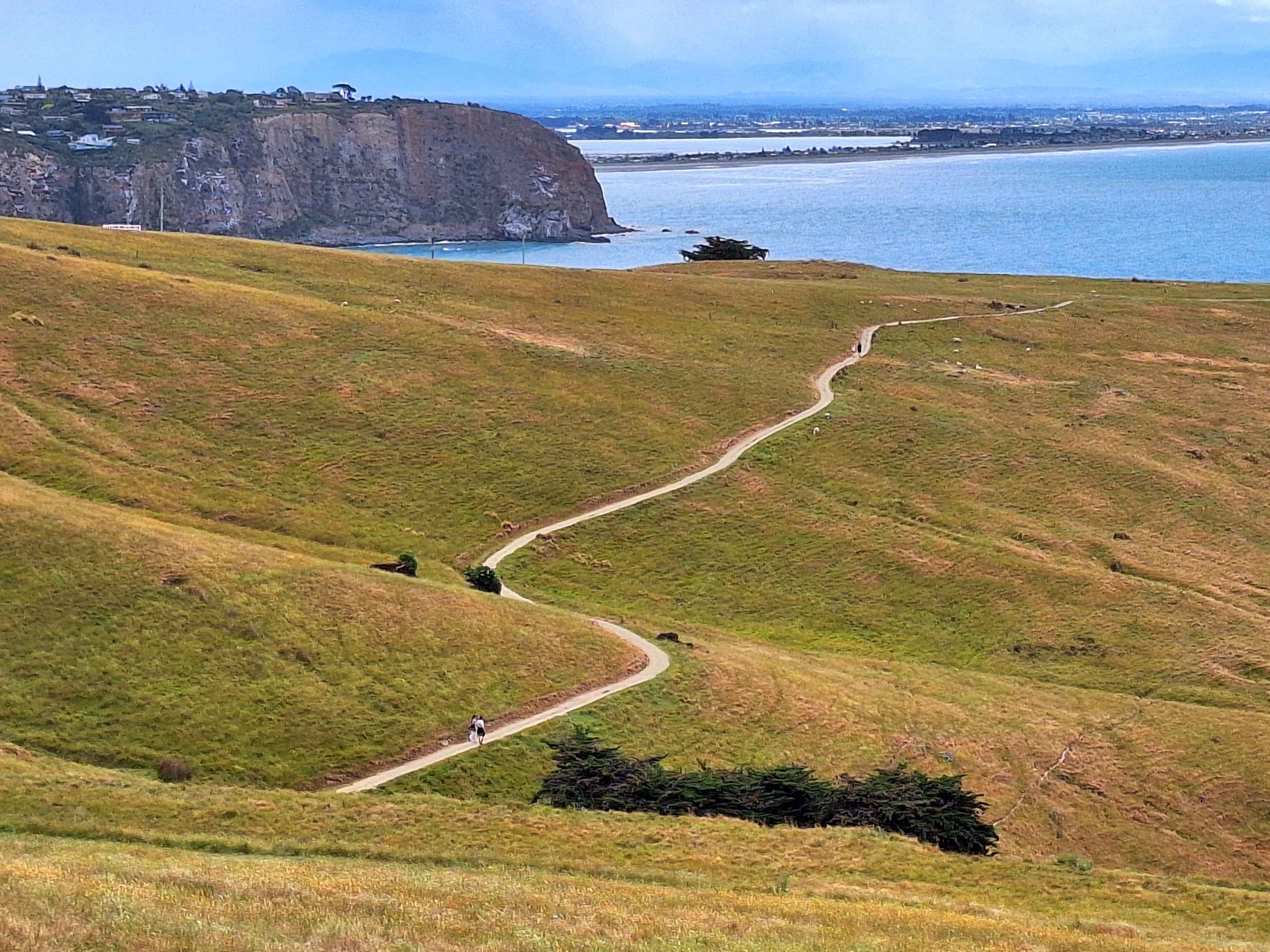
One of Christchurchs great coastal adventures, including a meandering pathway, at times 500 metres above crashing surf. Expect to be on your feet for 1.5 hours each way, However the rewards are the never ending vista of beach Suburbs from Sumner to New Brighton. Plus the goal to reach the WW2 gun emplacements of Godley Head. It's exhilarating and quite dynamic as the pathway meander around numerous small bays. It's flat for 70%, with zig zag turns to soften the climb. Start the cliffside amble from Taylor's Mistake, over an enjoyable windy road from Sumner.
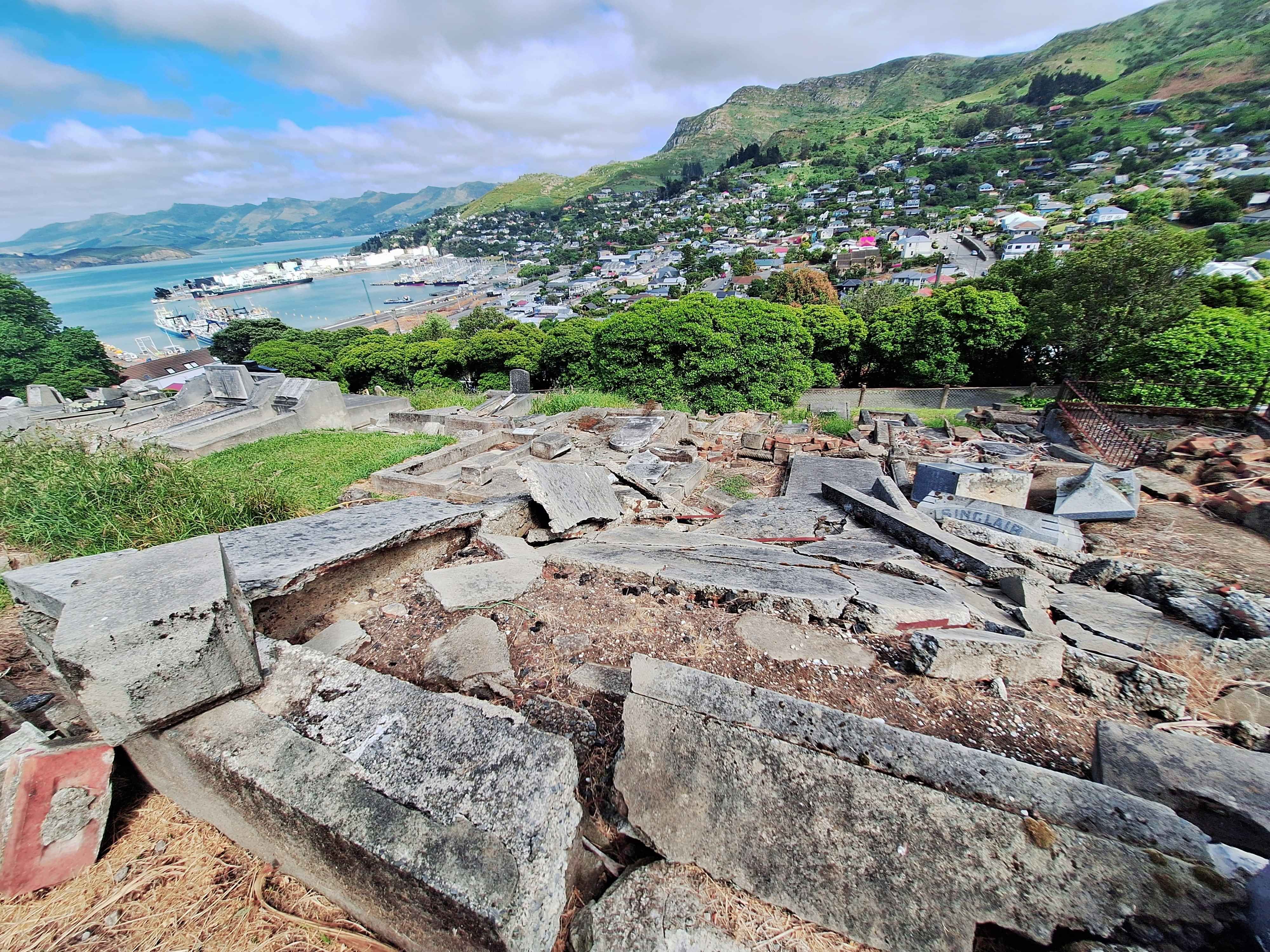
Stevenson steep, The Hills
I've heard of Rd., St., Ave., even Cres., but never a Steep until I walked up it. Yep, definitely 'Steep', which leads you up onto Lyttletons Catholic Cemetary equally on a Steep incline. Here are graves for WW1 soldiers, including Rifleman Hansen from 1919 and early Lyttleton ancestors of the 1800s. The views atop this Cemetary are rated, Spectacular. Sadly due to the 2011 massive earthquake of Christchurch and beyond, this cemetary was devastated. Many sites simply piles of broken brick and grave stones.
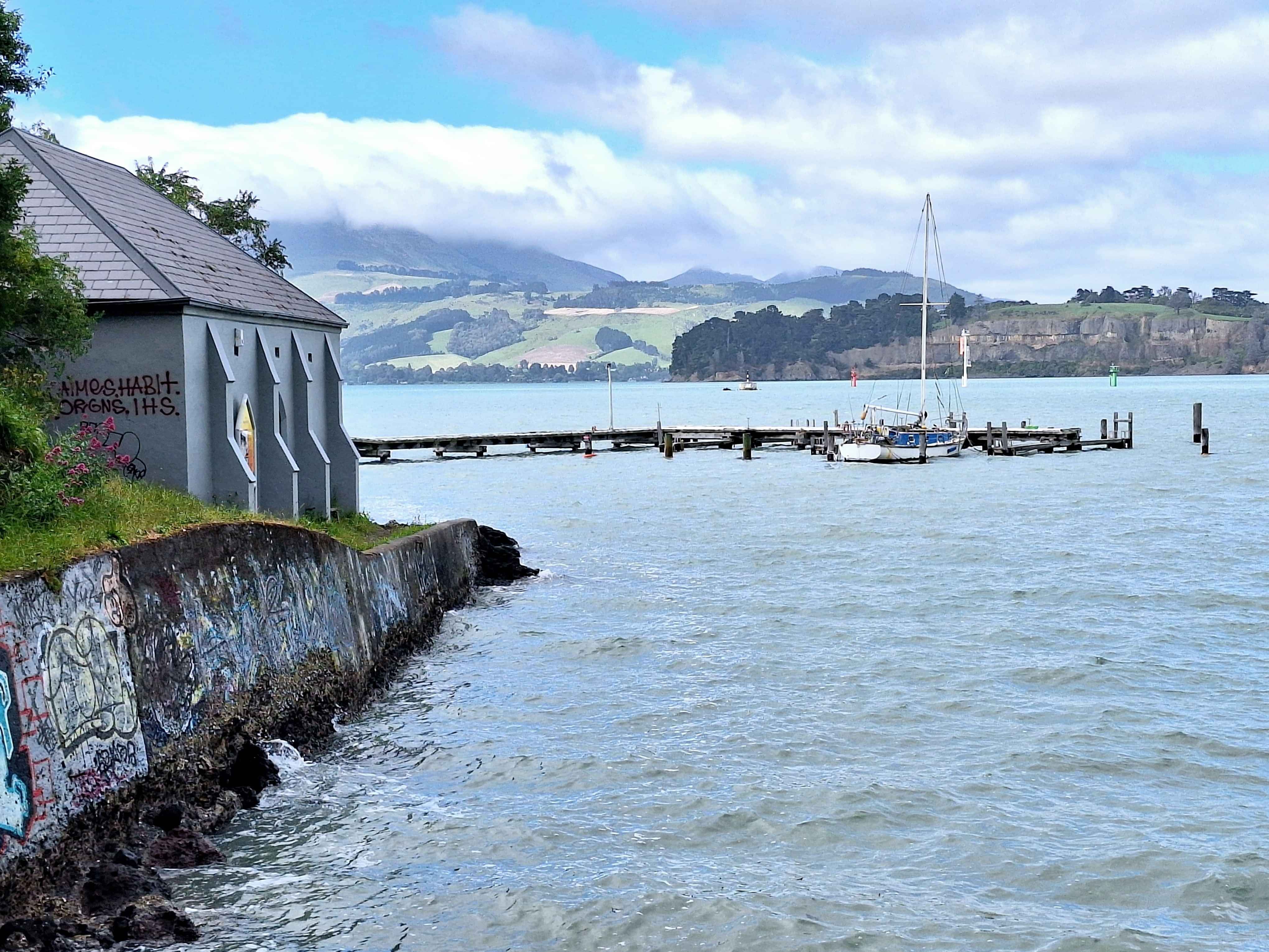
Corsair Bay, Lyttleton Harbour
You truly would be unlikely to casually discover NZs most hidden museum. Locals know, but few else I'm sensing. This site for near to 100 years was out of bounds to the Kiwi public, as it housed bang, bang, boom material from 1874 to 1960s. Then once shells were removed, in went the only surviving torpedo boat worldwide from the early 1900s, maybe late 1800s. This museum tucked behind a sizeable boating club, has a semi constructed Torpedo Boat, the HMS Defender. They open Sundays, apparently. Top Tip...always investigate behind sheds on waterfront as who knows what lurks down there. Fascinating.
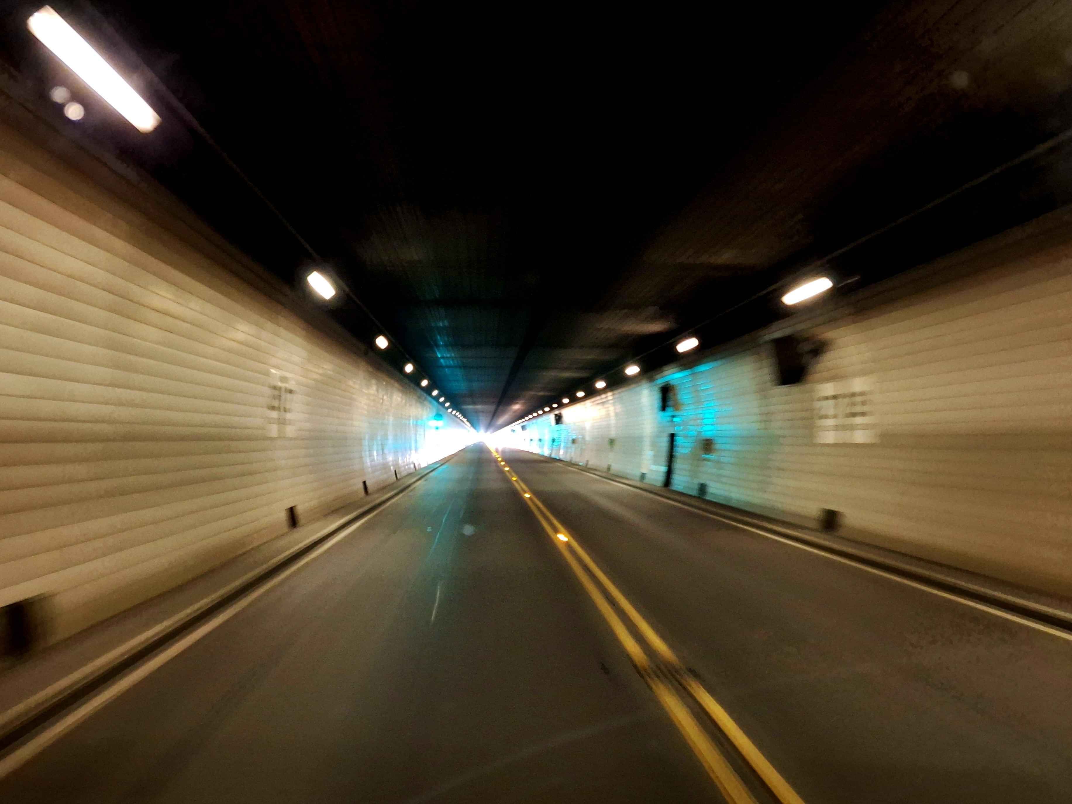
Christchurch Lyttleton Tunnel
This was until Auckland did the Showoff tunnel under Waterview, the longest NZ tunnel. Nothing lasts forever. Still they are the Mainlands longest tunnel at 1.9kms. Showoff Auckland at 2.4km. The Toot Tunnel under Mt Victoria Wellington is at 600 metres. The unlined rock tunnel of Homer, Milford Sound sits at a steep incline of 1 kilometre. The most beautiful walking tunnel with an elevator shift is the Durie Hill tunnel in Wanganui at 1/4 kilometre in length. The very cold feeling Karangahake Cycle Tunnel on the Hauraki Rail Trail sits at 1.1km in length.
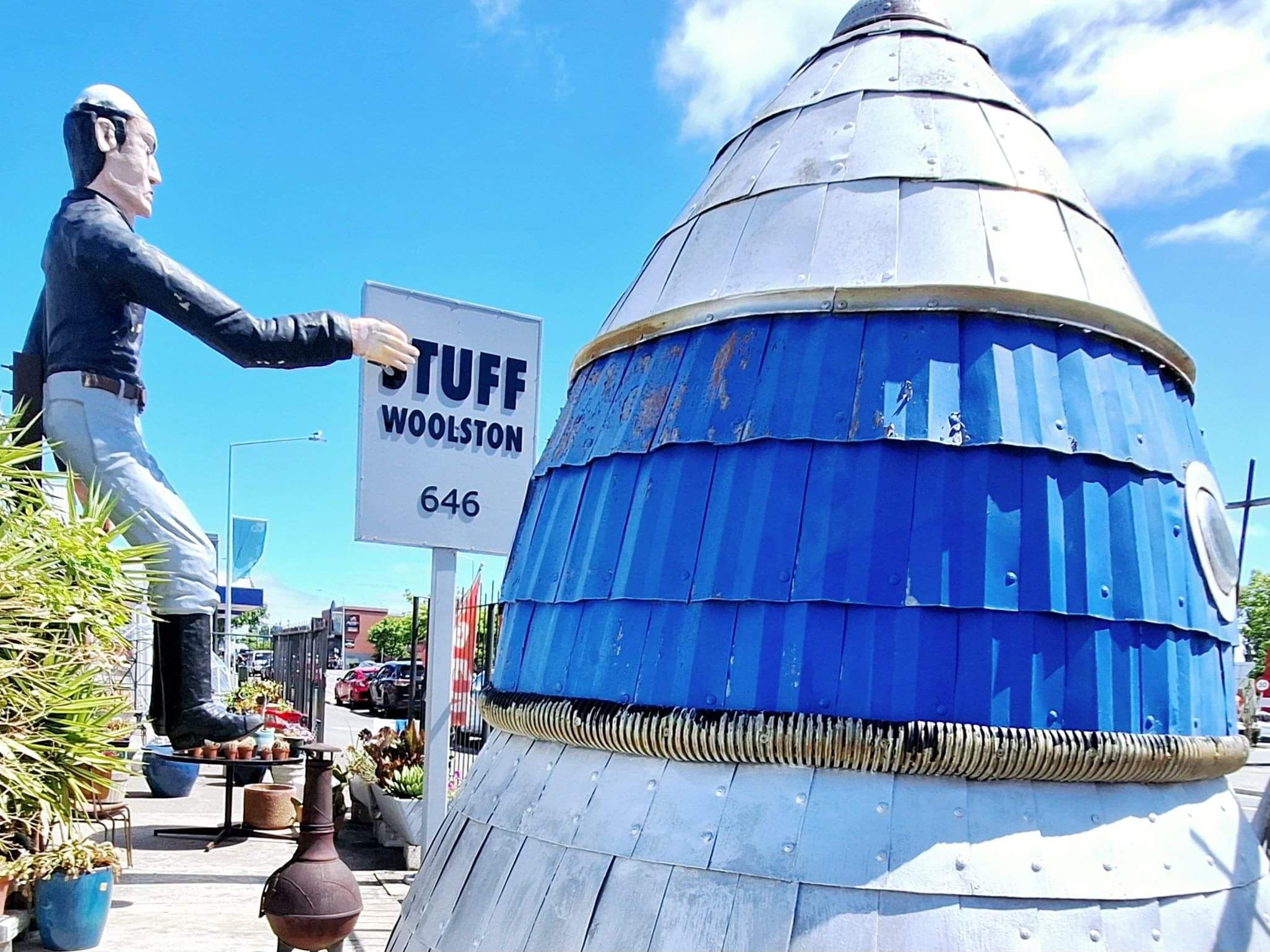
Woolston 'Stuff'
No not the remnants of the once media giant, Stuff, buy the quirkiest, likeable, even desirable home of truly good stuff.
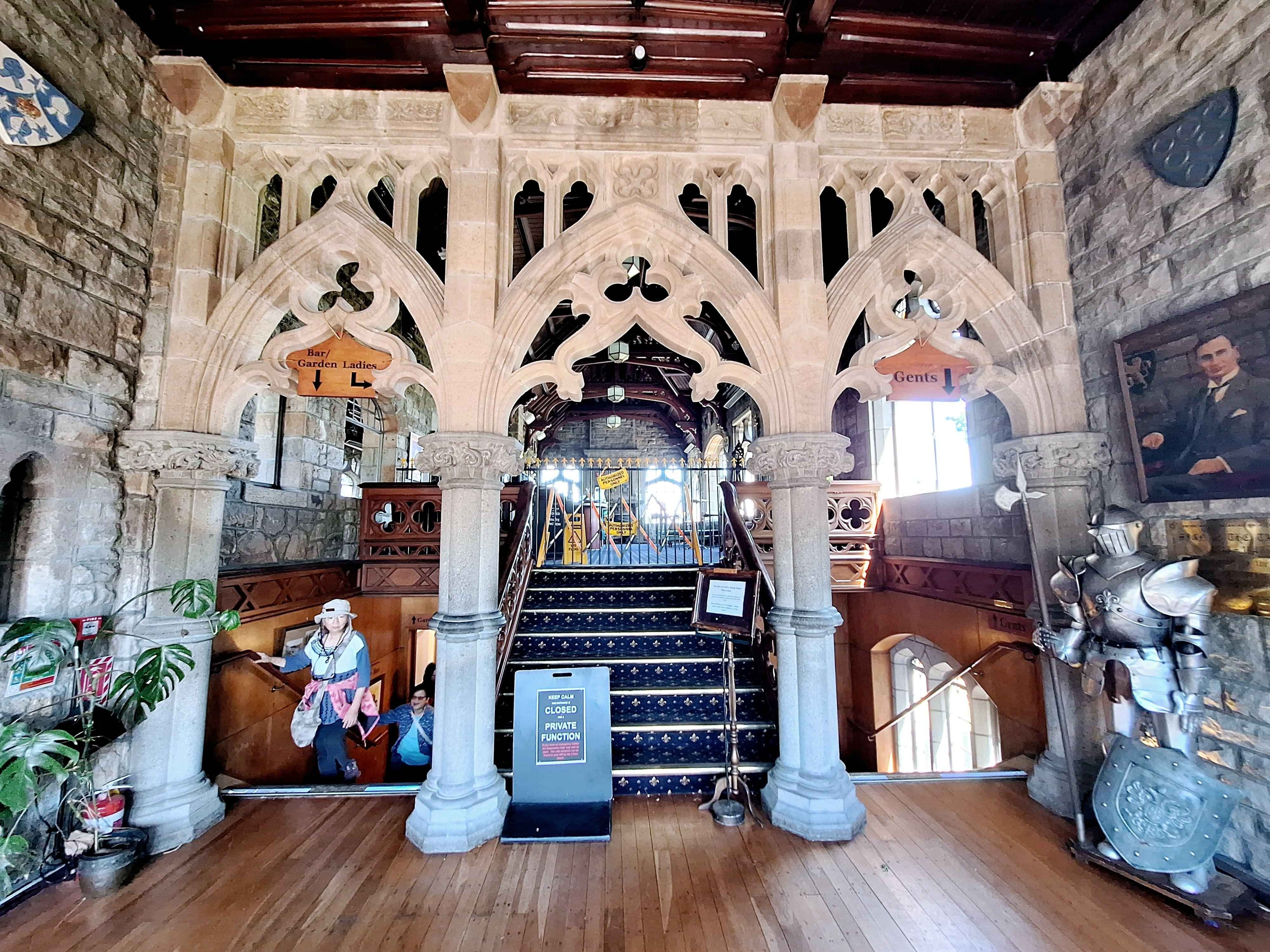
Cashmere Castle
A cafe in a castle. Doesn't get much better than that @ the gorgeously named, Sign of the Takahe, whereby they publicly state where drinking to be merry is encouraged. Locals, no doubt. Top Tip...walk through the delightful garden to a neighbouring viewing platform with views out over the Adventure Park and 180 degrees to New Brighton Beach. Top views without a gondola. If gondolas are your thing, the Christchurch Gondola and Christchurch Adventure Park Gondola at 1.8km in length are both close by. The Adventure park is cheaper and longer. The recognized Gondola is pretty exciting with views behind over to Lyttleton. Hey, try walking back down the Bridal Trail. I did. Crikey, that's steep, but incredibly folk run up it.
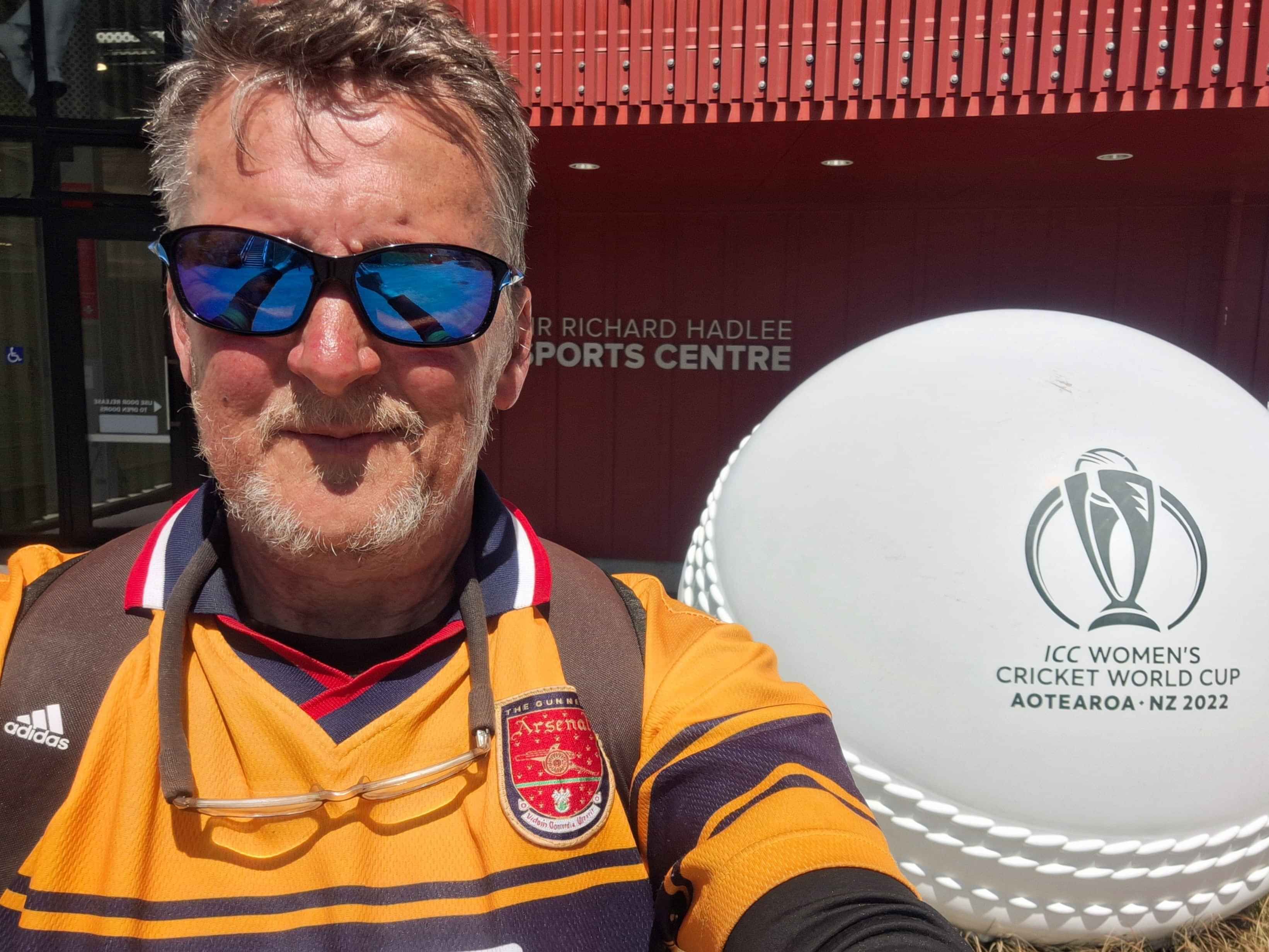
Sporting Icons
I stumbled across an Icon of NZ Sport I still rate as NZs greatest Sport star, being Sir Richard Hadlee, at the home of NZ cricket, Hagley Park, maybe perhaps, Hadlee Park. Mt. Maunganui and Taranakis hillside terraces are smaller equals. On the sporting note, Sir Richard was a big as the Allblacks during the 80s, 90s. He roused a nation with his long run up and constant dismay by any worthwhile batsman. There were others ofcourse, Chatters, Crowe, Smith and Cairns and later gun stalwarts as in Vittori, McCullum,Bond etc. But can you go past The Man. No way.
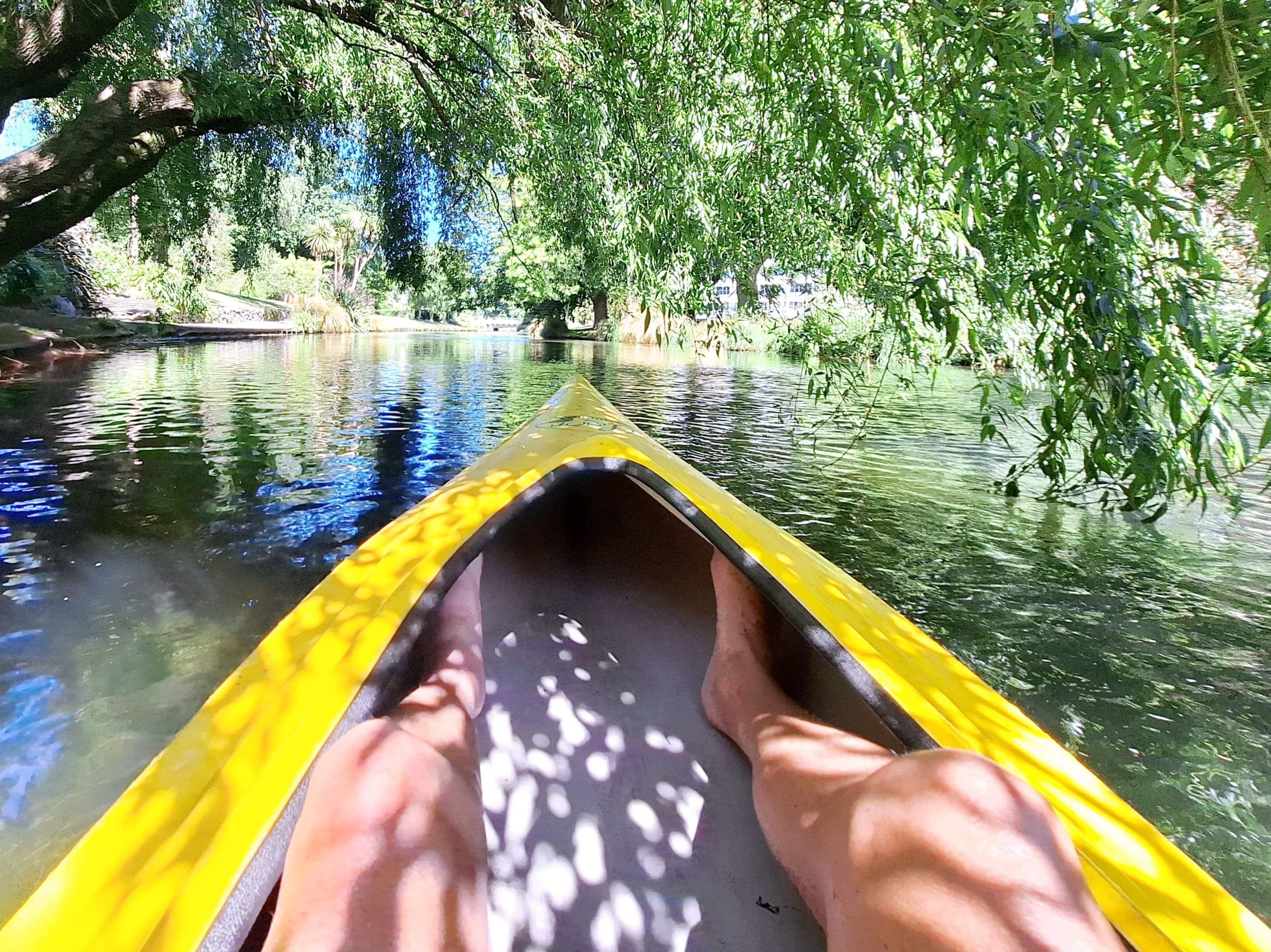
Avon River, Riccarton
This 11km scenic meandering river is arguably both the principle highlight visually of central Christchurch and ironic lowlight, due to the rupturing that, occurred during the 2010 and 2011 earthquakes, along the length of this famed riverway. The irony being the meandering river was part of the creation of the Redzoned areas that necessitated the destruction and removal of thousands of homes along this concourse. Today, little can be built here, hence suburb after suburb of desolation. The beauty however still exists after remediation of banksides with continuation of the Punt service and river canoes. I'm an old kayaker, so the decision to enter the Avon by kayak was a given. Just knobbly knees showing on my riverway jaunt alongside a few Punts.
Rutherford den
Sir Ernest Rutherford, noted Pysicist of Nelson and Christchurch and honoured on the NZ $100 bank note, was famous for...Radioactive dating, Acoustic methods for detecting submarines and possibly one of the world's biggest, even greatest event, the Splitting of the Atom. Essentially this Kiwi, was the start of nuclear fision and inturn nuclear armaments. The Arts Centre in central CBD has the Rutherford Den, where a young Ernest studied his craft. Top Tip...free to view.
Nz longest road bridge
Hard to imagine this lengthy bridge outmuscles the famous Auckland Coathanger Bridge from the North Shore to the city centre of Auckland. But at 1.7km long it overshadows it's Auckland competition. Sadly you can't walk around the bridge, just simply as you travel 100kmh against oncoming traffic equally travelling towards you at 100kmh, for 1.7km, with just a fine line of white paint and no offshoot if you err. What could go wrong.
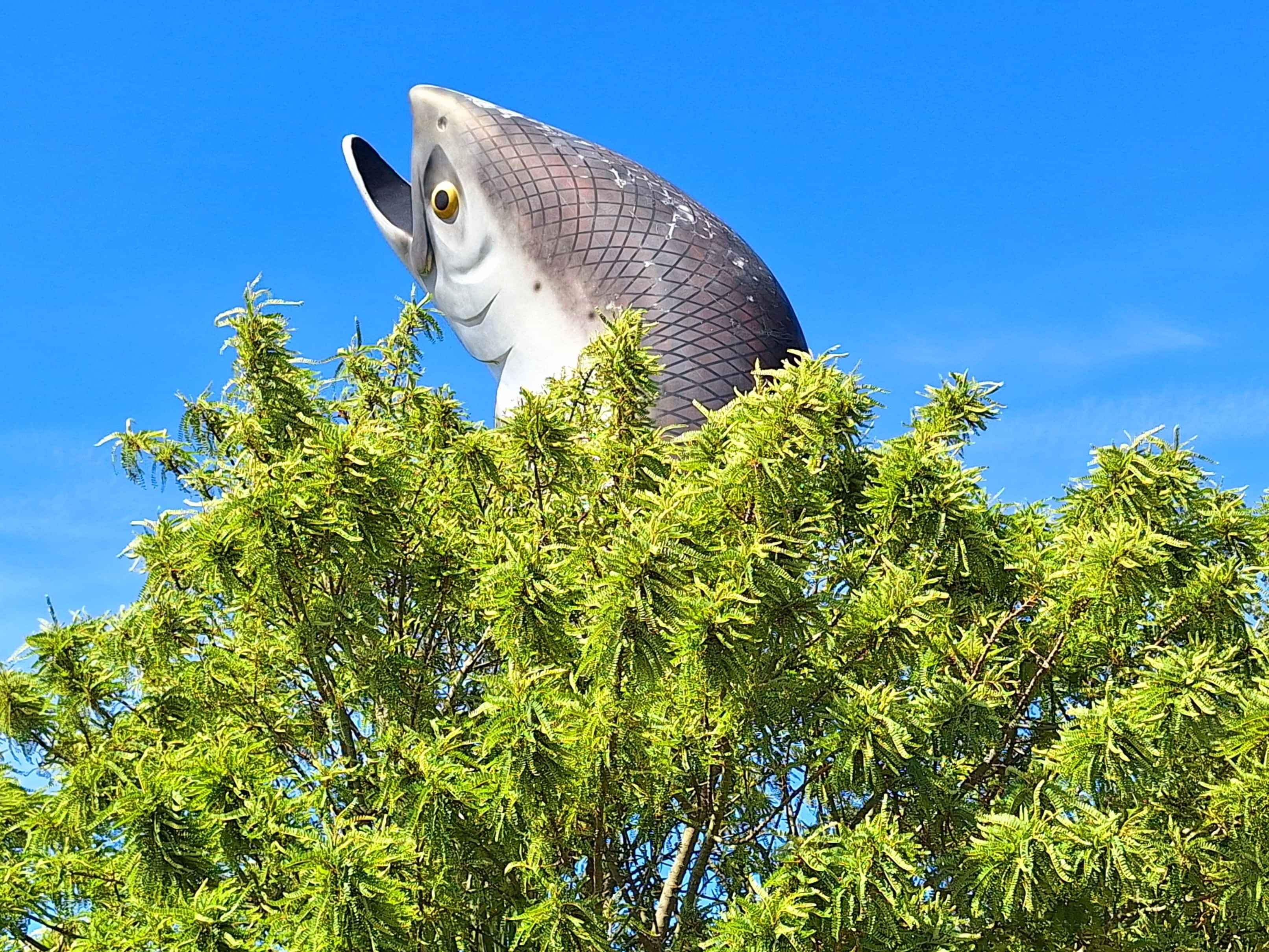
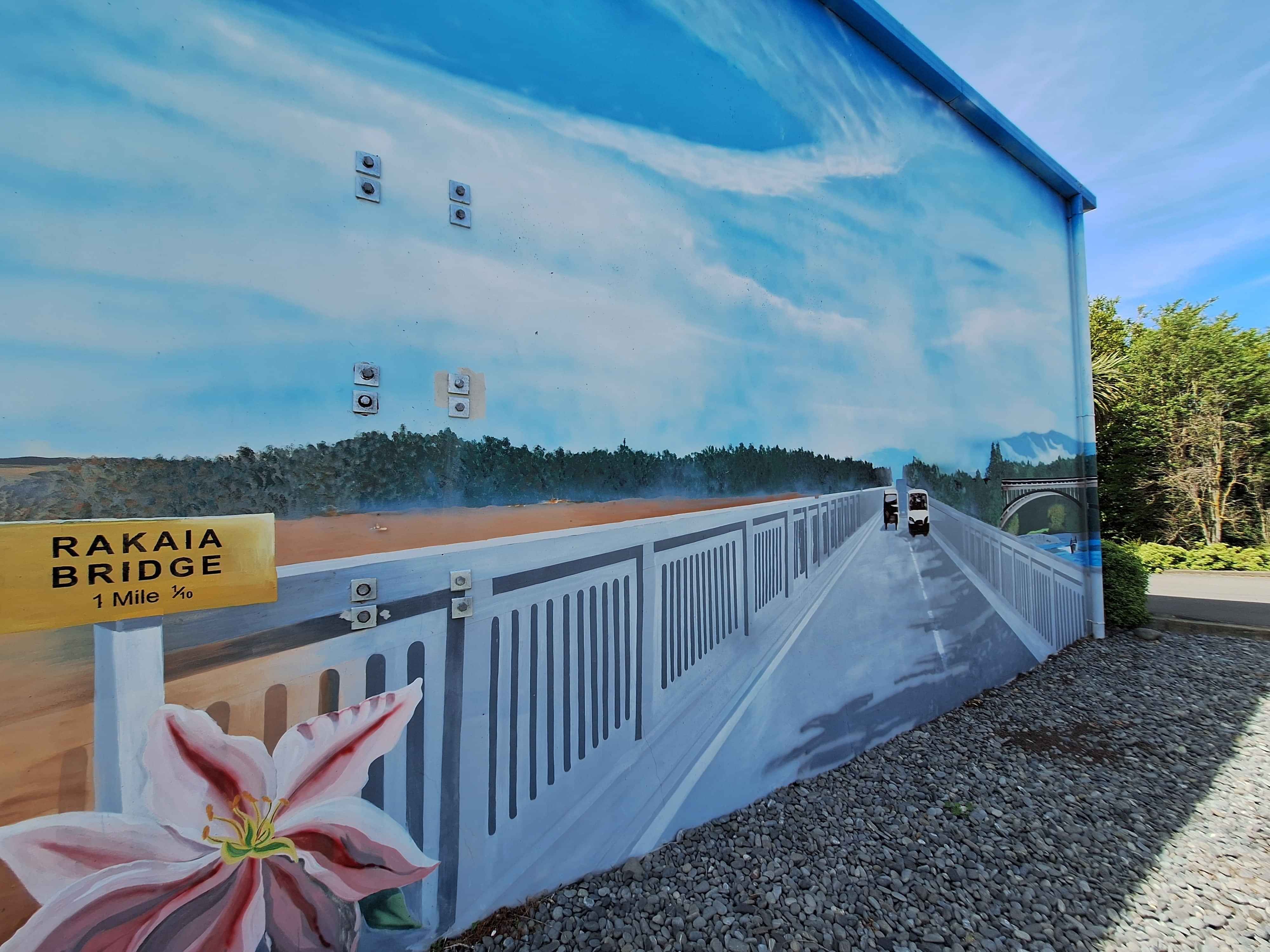
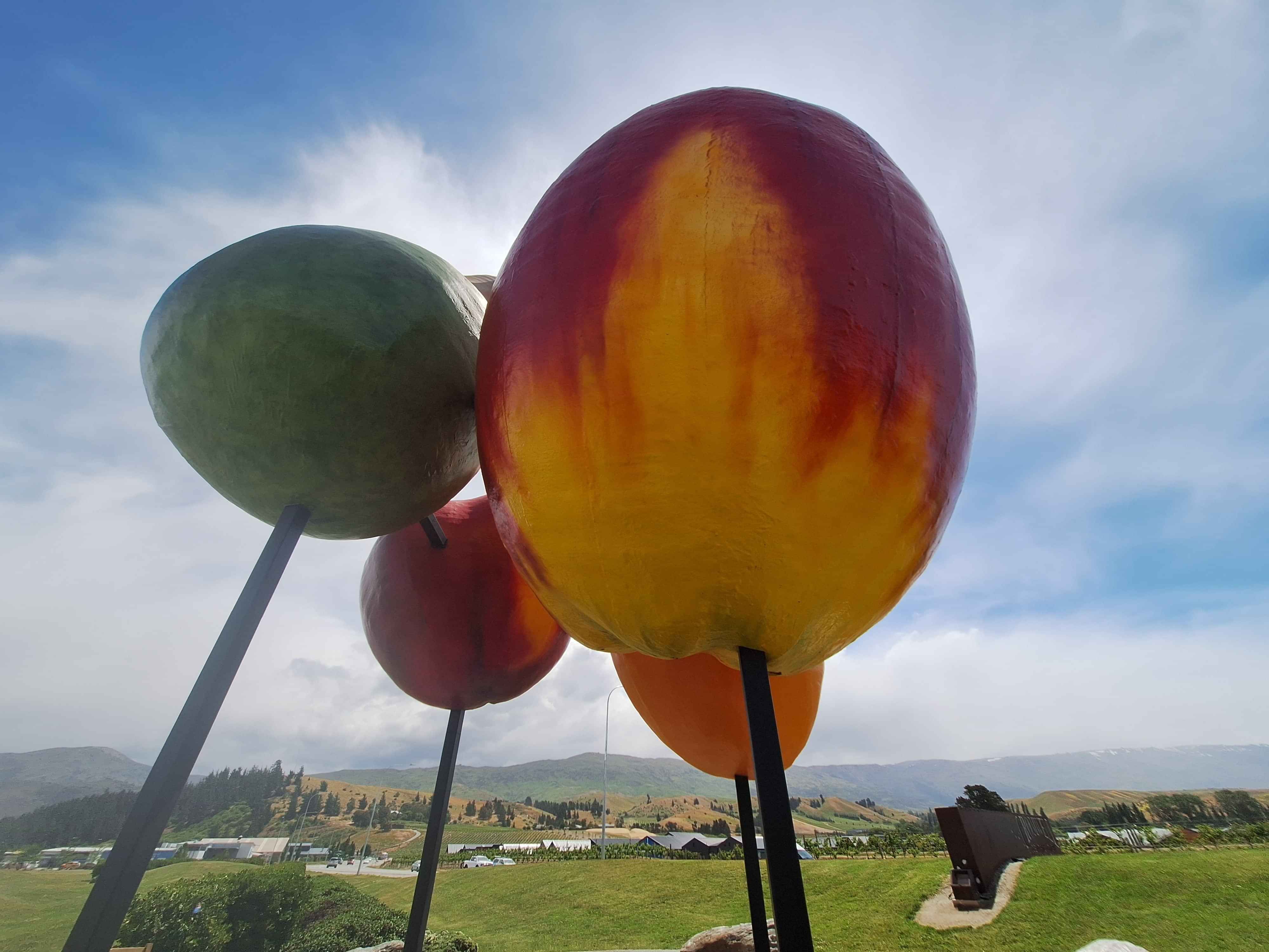
Nz sea Salmon, Rakaia
I felt Gore in Southland would have been a match with Rakaia interms of their towns icons. But with Rakaia hoisting a 12 metre sea run Salmon as the towns Icon, smashes the Gore competitor with a 9 metre Brown Trout. Apparently Rakaia Salmon is inline for a full replenishment from end of this year, into 2026.
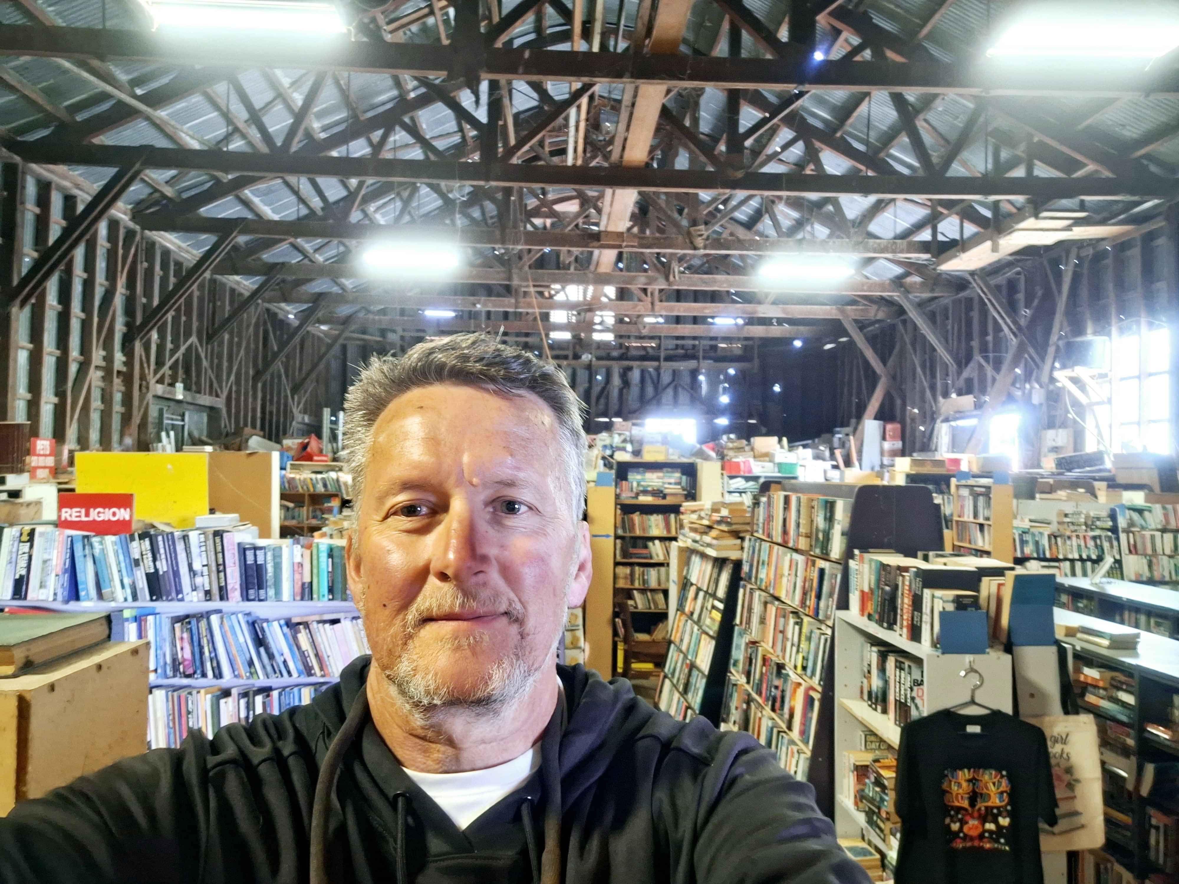
Cherysey barn
Love these Old School style discoveries, whereby tens of thousands of books are housed in an old corrugated iron barn. I wondered where all the old throw outs went. Many here, I sense. It's messily tidy (isn't that an oxymoron, pretending he's well read). It hasn't changed alot over the years, and long may it never alter as it's a wonderful engaging environment to idle away some time. The crowds do stop off SH1 just before rural sector of Ashburton. This town only has a big book barn and a big book cafe. Nah, that'll never work.
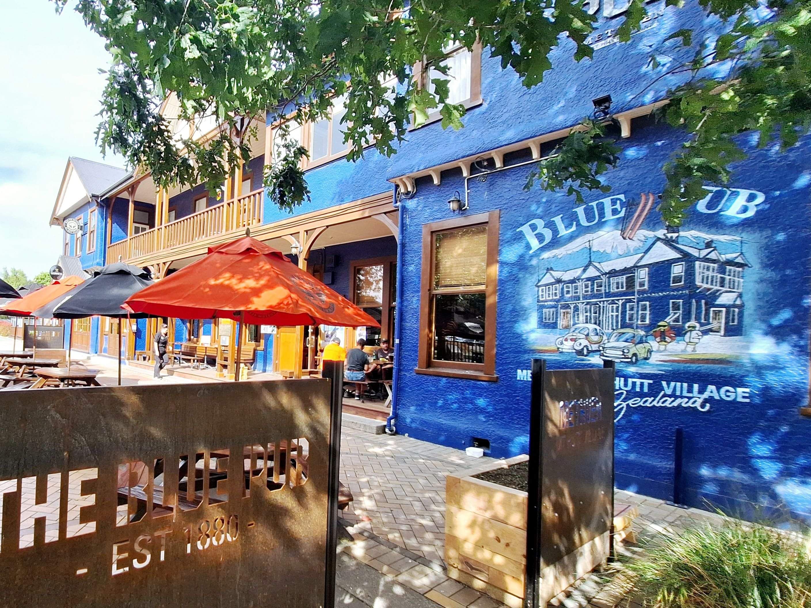
Blue pub Brown pub, methven
Famous on a number of levels with the competing directly opposite Blue and Brown Pubs. Famous in NZ for celebrating the Topp Twins as residents of Methven, including their famed corner cafe at no.45. Sadly the singing country stars and entertainment icons have left town. However the cafe remains. I actually saw the Topps on a previous trip here, simply walking the town. Being of bashful Kiwi ways, I saw, raised my eyebrow, smiled, said nothing daft, till I turned the corner and jumped on the spot exclaiming the only Kiwi way, Yeah Nah OMG. Kiwis never create a fuss. Yeah, Gidday. Methven also the ski capital for Cantabrians during the winter months.
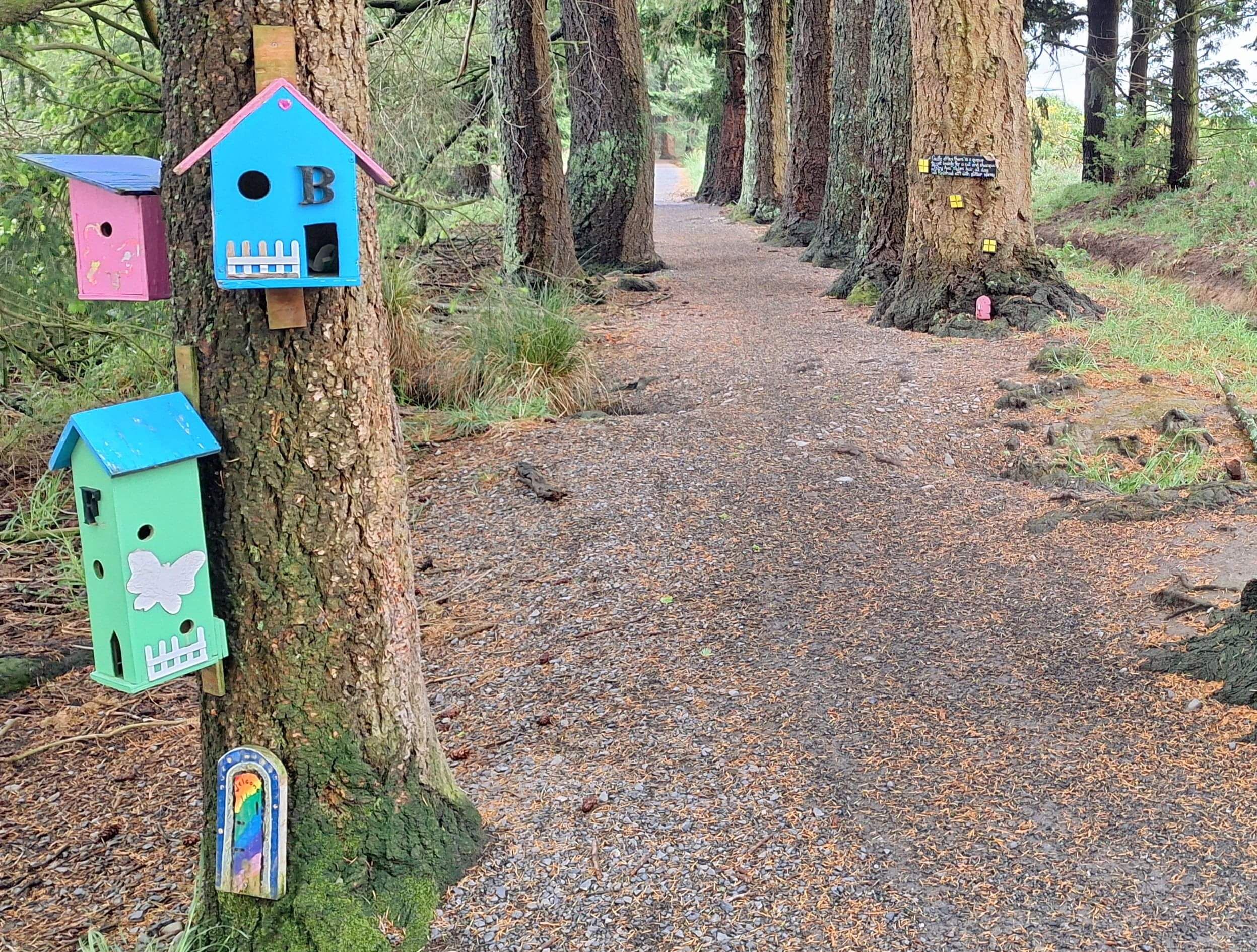
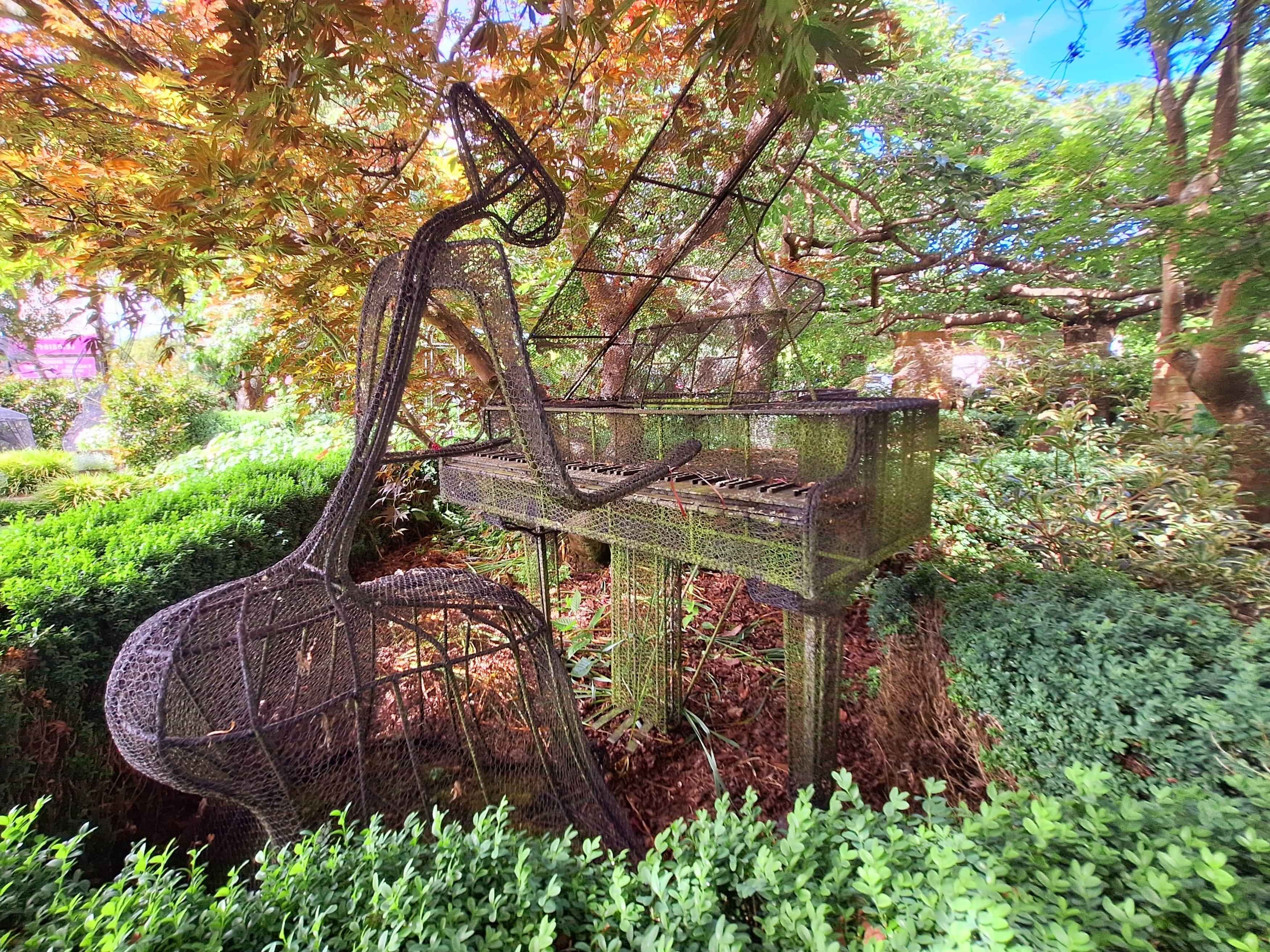
The Enchanted forest
If you are under 10, a manchild, even an adult kiddo (hey, stop pointing), then this forest, even art instalation, with its neatly trimmed paved pathway, between rows of tall timber, will excite. Its highly professional and definitely fun with thankfully undamaged fairy doorways and 'Pixie Poetry' across hundreds of trees. Lowdown for the Smaller ones, too. Walk, or cycle and cintinue on the canal style waterways as far as the Ashburton River if you choose.
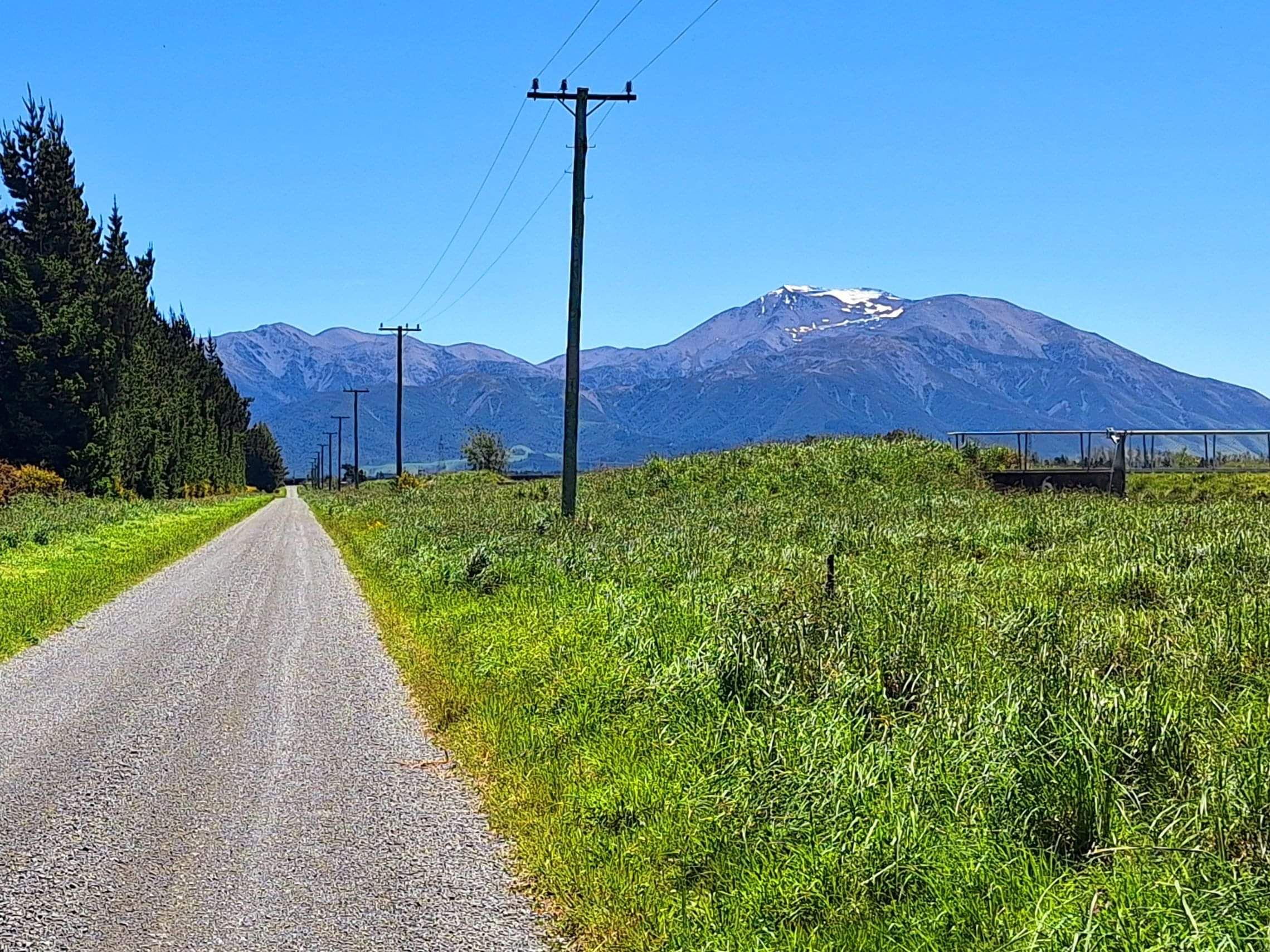
Mt hutt
I was quietly relieved when I ventured to below Mt Hutt, the Cantabrians Skifield, that it was actually closed on the access road. A few tried and were forced back. Not alot of turning room once on the road up. The last time I attempted a big skifield trek in my old but steady campervan, it whizzed and showed signs of distress. A light dusting of snow sits atop Mt Hutt, but only on the crest. However, very cold at under 10 degrees celsius, even though the sun appeared.
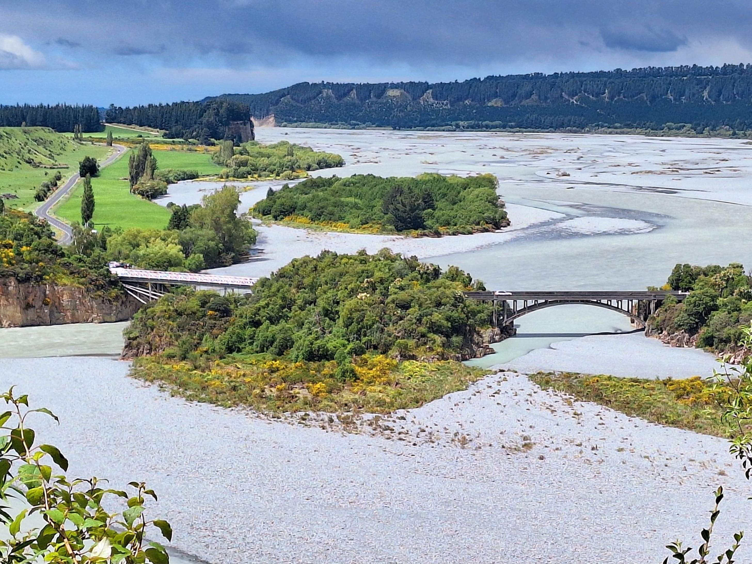
Rakaia Gorge Walkway
A series of mountain river systems from Mt Hutt, Mt Williams, Mt Oakden, the Rolleston Range and more feed collectively into the braided river of the Rakaia. At the Gorge where it all happens, makes for a stunning vista if you drive in from the Methven Mt Hutt end. At the Gorge the torrent is released and broadens out to ten times it's inititial river width and forms an alluvial braided pathway for the river to rush through to the township of Rakaia. Here they have constructed NZs longest bridge to actually cross this ever widening river system. Top Tip...walk the Gorge pathway into the hills for a stunning look back over the gorges 2 bridges and fanlike delta. Interestingly if you could cross over these colosial mountain ranges, you would actually be directly on the West Coast at the equally stunning Hokitika Gorge.
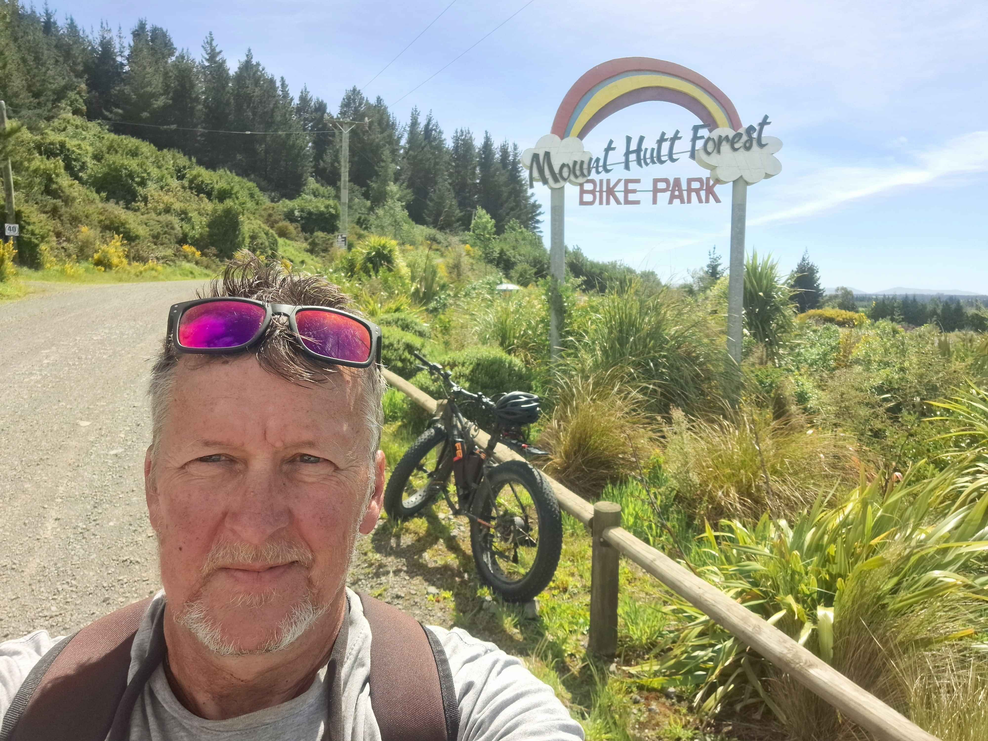
Mt Hutt Forest
At the entrance and base of Mt Hutt, sits an array of easy to challenging bike trails. At the extreme end, sits the warming sounding Pinky's Trail. Essentially a poor turn or failed brakes and you're essentially, to quote a Kiwi term, Munted. Id suggest start with the introductionary level, the Swamp Donkey, then change up a gear and head for the Front Door, then homeward via the Back Door. (OK, I see you snickering away). You will need your own mountain or gravel bike.
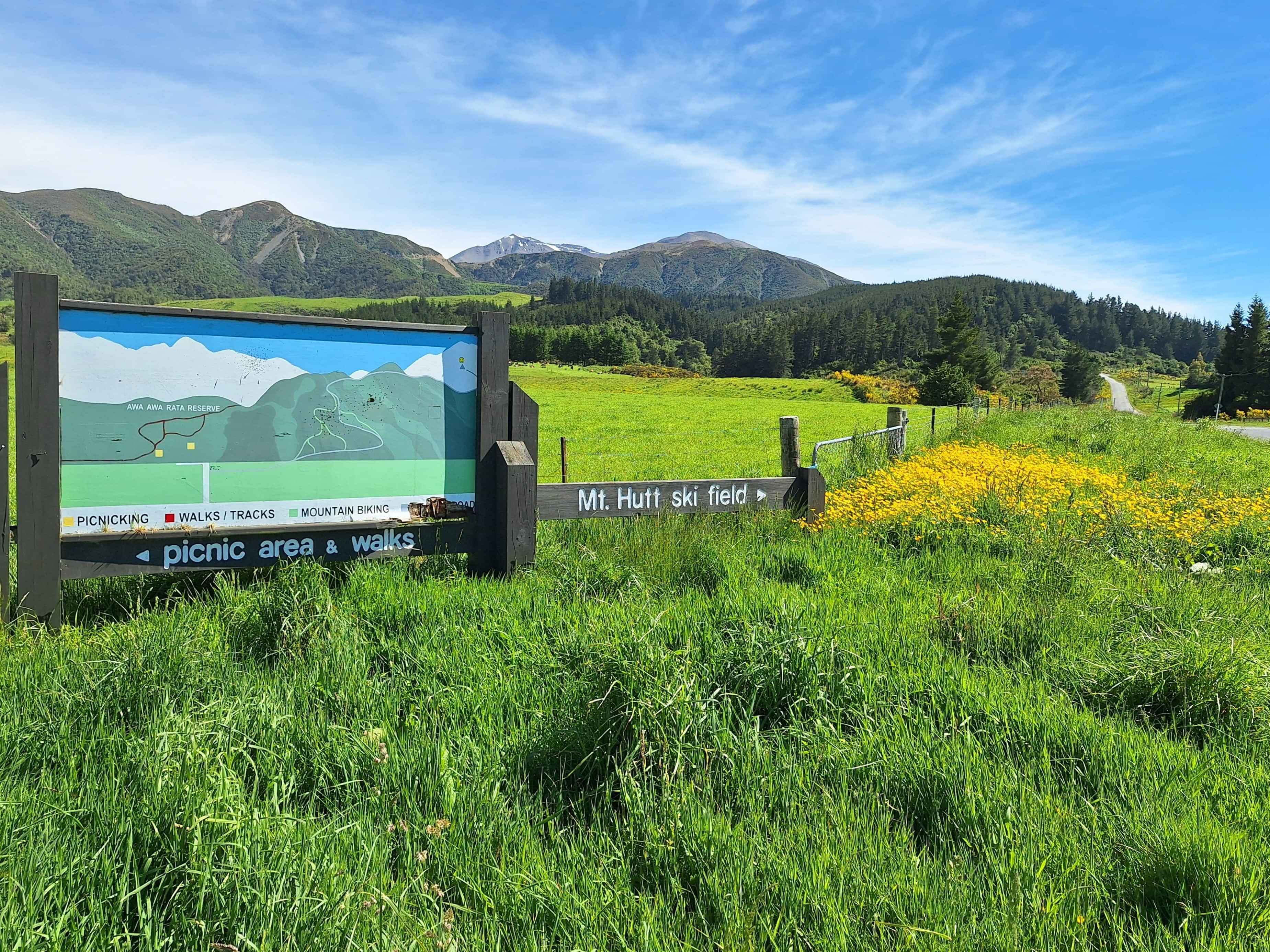
Pudding hill
Possibly NZs most endearing name. So I just had to visit. Luckily, right next door too the bike park forest. Too the right you head skywards to the peak of Mt Hutt. To the left is the home of Pudding Hill. I discovered a number of forest walks, including a lengthy trek across to the mid range of Mt Hutt. Views back across the plains. Pudding Hill has two specific picnic spots, including the colorful flower inspired Awa Awa Rata Mclennans Bush
Allentown Pub
Home to the region Dinkiest Pub, the Brantworth Arms. Room for one standing 3 seater table, or added standing room for 6, discovered in the rural belt of Ashvegas. Ashburton regularly get the 'Michael' taken out of it, due to the perceived lack of nightlife. But don't be fooled, this town hums, including the recent hosting of the Chilli Championship, giving proof, there's life in thos old dog yet.
Ashvegas
Host to one of the finest English Gardens throughout NZ. Infact recognized worldwide as a garden of International Significance. The garden, Trott Garden is immaculate in its presentation and visually rewarding. Across town on the coastal side of SH1, is the most absorbing Aviation Museum, including ownership of the once famed Harrier Jumpjet. Plus intriguingly proprietor of space junk in the form of a Spaceball, courtesy of a Soviet Satellite Cosmos 482 which broke up over the South Island in 1972. For those who travel with a mountain bike, I'd fully recommend the 11km loop trail through the Ashburton forest adjacent to the Ashburton River. It's fully contoured and 'banked' over its entire length in noth directions. It's quite the trail. Grade 2 to 3. Top Tip...at the conclusion of the loop, you'll discover a trail of 4kms and 2.5kms through the bush. After completing this sector on my mountain bike, I discover, infact this was a motorcycle track. I thought it was strangely wide with deep wheel groves, but carried on regardless. Whoops, perhaps my Homer Simpson moment. Doh !.
Ealing
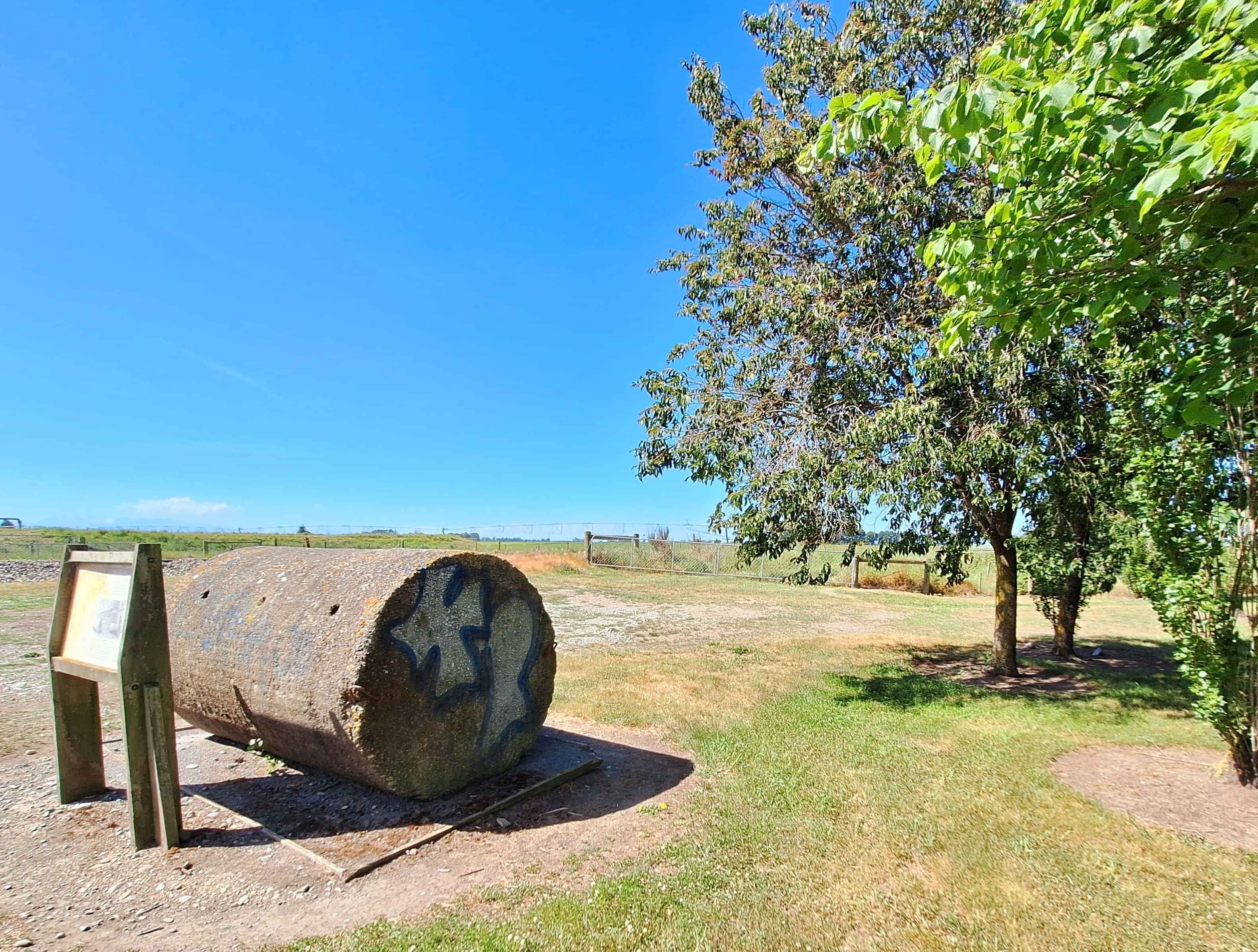
I have an affinity to the Ealing name, after my OE in my 20s whereby this towns name brought back fond memories. The NZ version is vastly different to that of Ealing UK. Locally its completely rural on the edge of Geraldine and Temuka. In 1942 it found itself as a defensive fort with Japanese submarines directly off the coast. A hastily engineered Roadblock was designed using a local pipe company to roll out, massive cylindrical concrete roadblocks to halt any attempt to land and fight in this rural community. These roadblocks were positioned on beaches and entrance to the Rangitata River which connected to the Pacific Ocean. Alongside these Roadblocks, which were rolled onto highways and rail connections, machine gun pillboxes were manned alongside these concrete items. This example in Ealing maybe the countries last visible roadblock which stayed here till the 1960s before being rolled into a river. Now excavated, it sits at an Ealing rest stop, enjoyed generally by graffiti taggers . Interesting history, however.
winchester
This SH1 Tiny Town punches above its weight for Arty endeavors. A must stop is the Mia Flora Cafe housed in the most beautiful private garden, alongside one of the most engaging small sized garden centre with great vibes. Comes complete with a gift gallery. In the garden stunning sculptures galore.
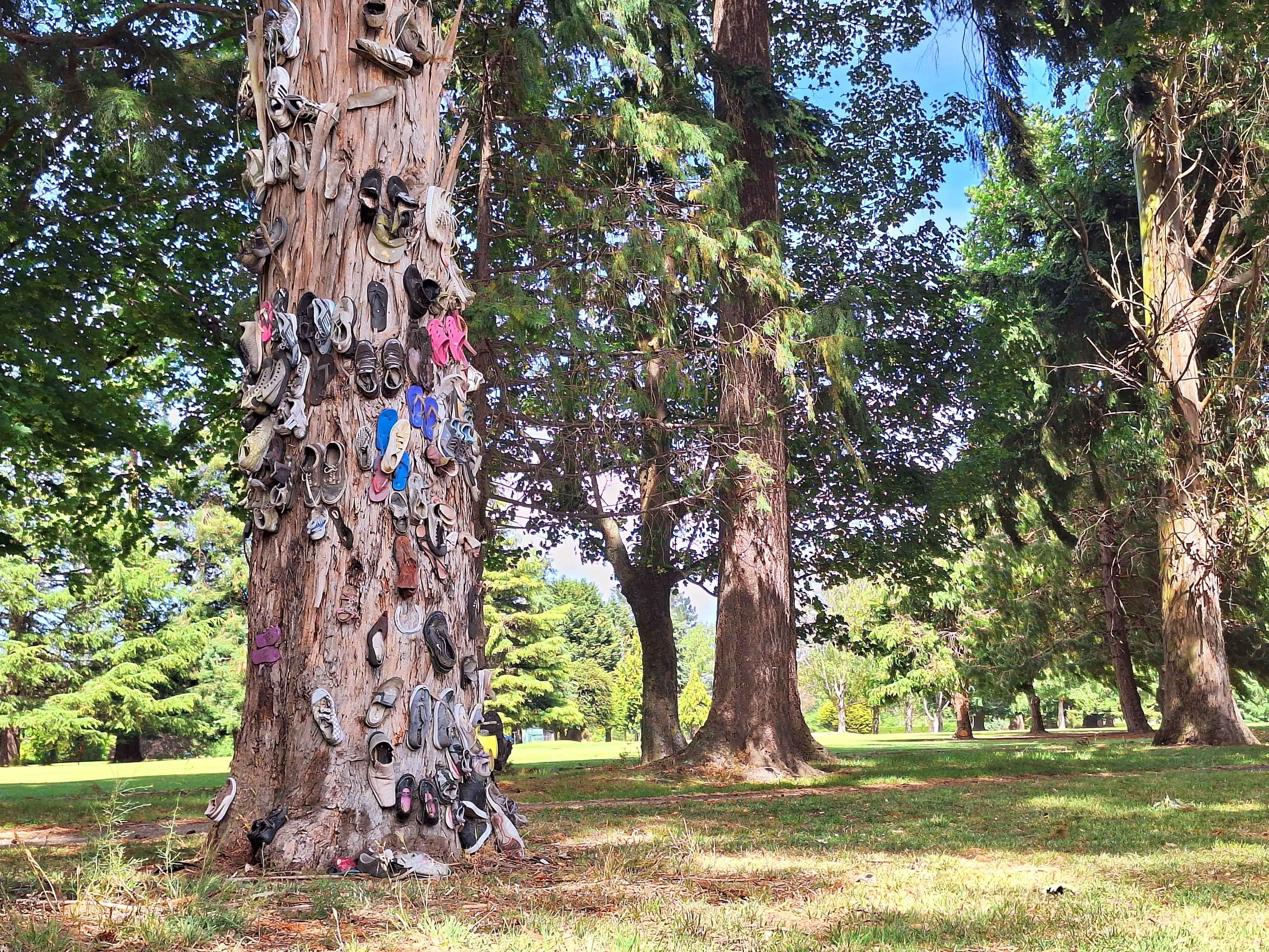
Temuka-town
Not so sure I've previously discovered a Shoe Tree. There's the Waikatos Tooth Fence with a Prime Ministers brush, the Wanaka Bra Fence which just keeps expanding. The Awakiri Springs Gumboot Fence, the bike Fence at Oparau Kawhia. Plus the various Jandal fences, with Maketu taking Gold. But never have I discovered a Shoe Tree. There are Lost Soles on a beach on the Dargaville coast, however. Brothers, perhaps.
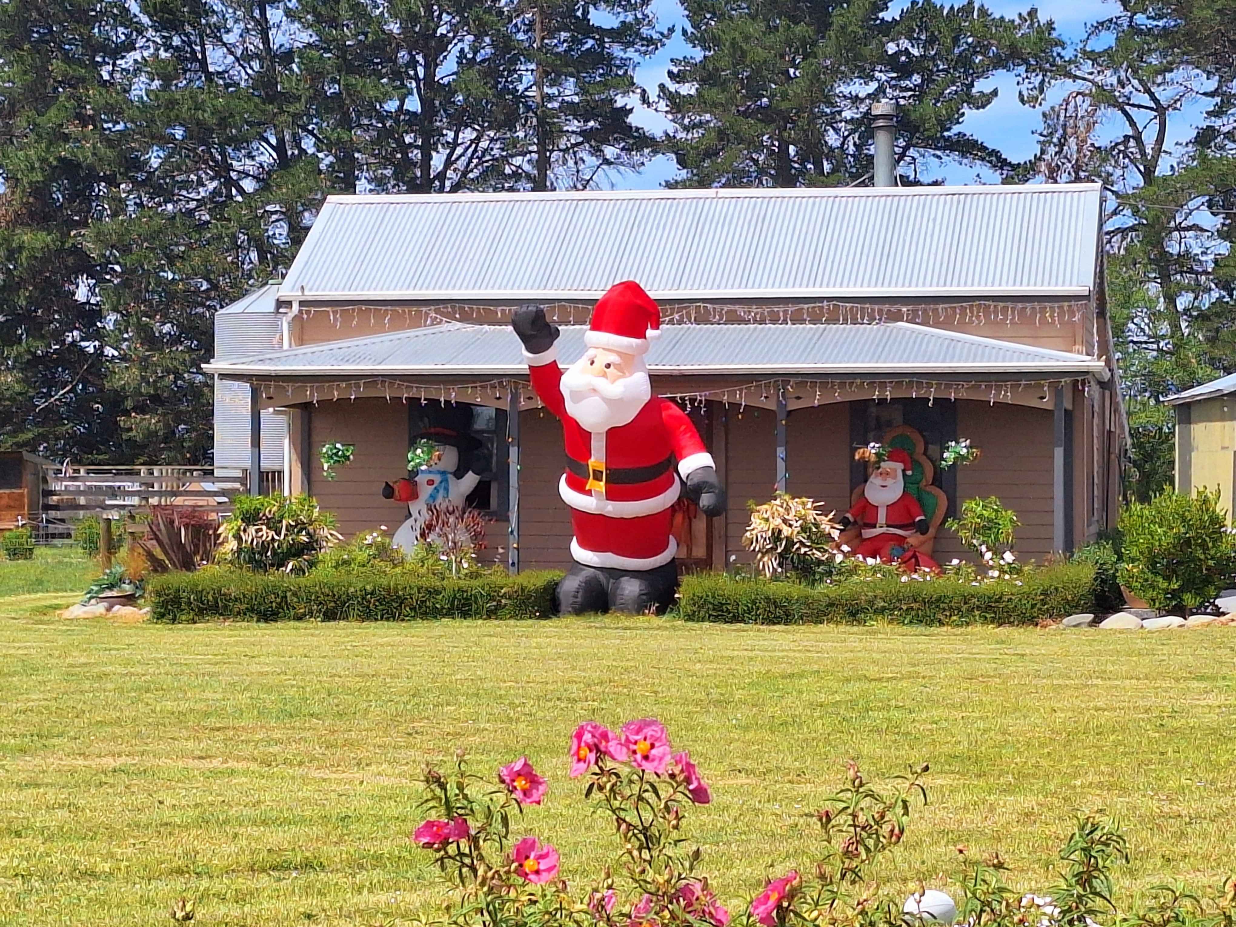
Temuka-rural
One of the better Christmas Festive Gardens I've seen on this trip in saying that, it's actually still November, but whose being picky. Done with warmth and a dash of Rural style and charm. Watch out, Ponsonby, Auckland.
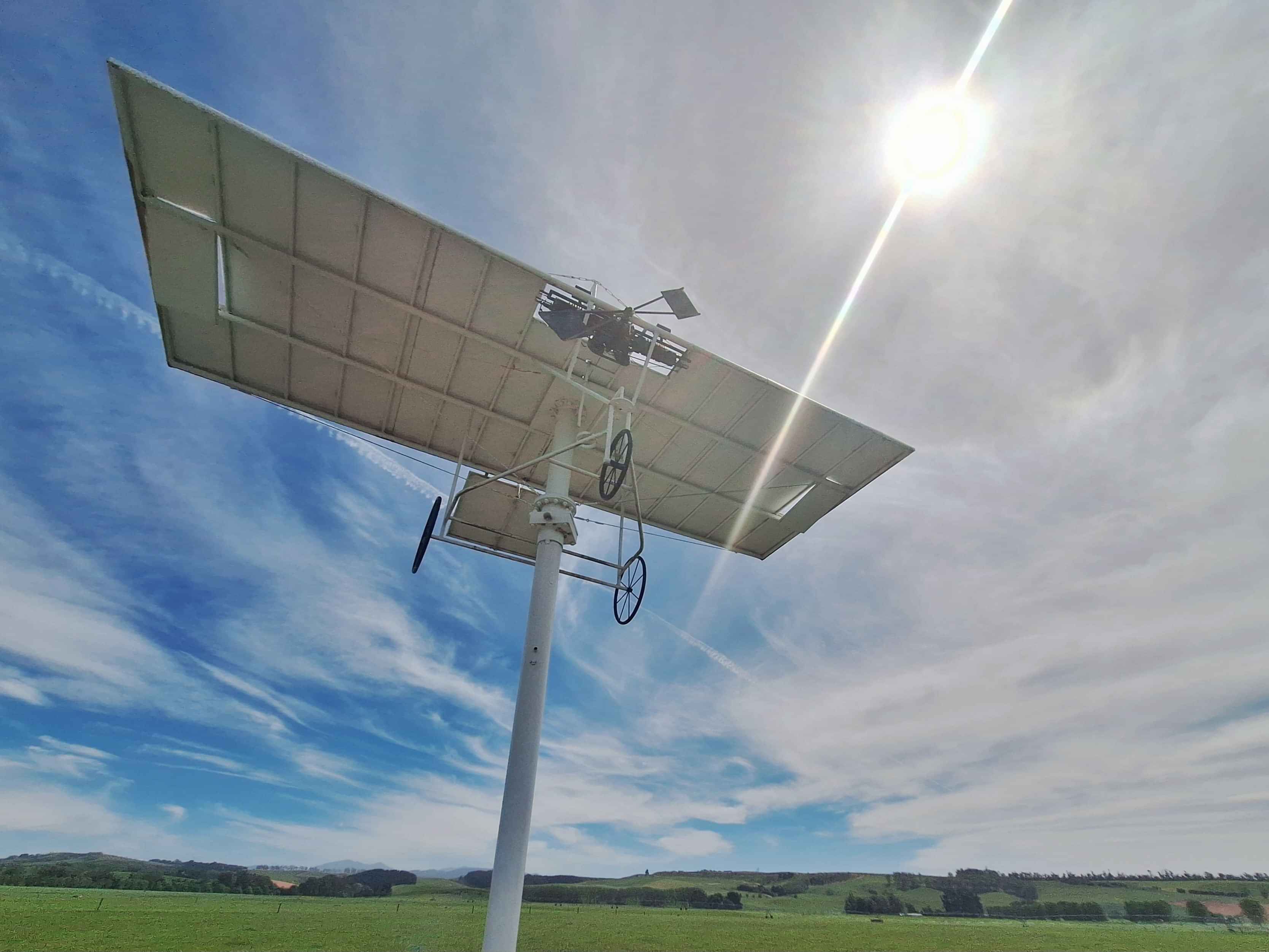
Waiotahi
We don't always adequately celebrate "Great Kiwis", ...Sir Ed, being an exception...However here on a South Canterbury Rural Farm, Robert Pearse, a farmer, self taught inventor and eccentric visionary, built using thrown out junk metal from the local tip, the world's first ever flying contraption that lifted by mechanicals means, the ability to fly. He flew 100 metres along his farm, with witnesses to comically land in a hedge. However it was flight and it was by air. He has been credited with the very first use of ailerons on the wing edges to create lift. Sadly he let the patent slip, and the USA Wright Brothers, illegally stole this science and received acknowledgement and recognition as first people to ever fly, 8 months after Pearses farm flight at Waiotahi. There was confirmation by photograph of Pearses first flight. However all photos were lost in photographers house fire. Pearse flight was March 1903. Wright's flight 8 months later. A monument sits at the exact point where Pearse flew 100 metres. Un 1951 Pearse died in Sunnyside Hospital , a psychiatric hospital for the mentally disturbed.
Pleasant Point
Another interesting small town where a funky cafe exists inside a true mechanics business. Next door sits a taxidermy business flourishing with keepsakes for local and visiting hunters. Around the corner sits an engineering farmyard, once the prime business need offered by this community. Today a handful of extra huge engineering sculptures sit quietly here. People stop due to the absurdity of the items. There's also a newish bike trail from Lake Tekapo, through Pleasant Valley and onto the coast at Washdyke, Timaru. (The Central South Trail). There is also a 2km long rail attraction preserving railway history. Top Tip...Check out the only Model T Ford Railcar. It's quite the looker
Caroline Bay
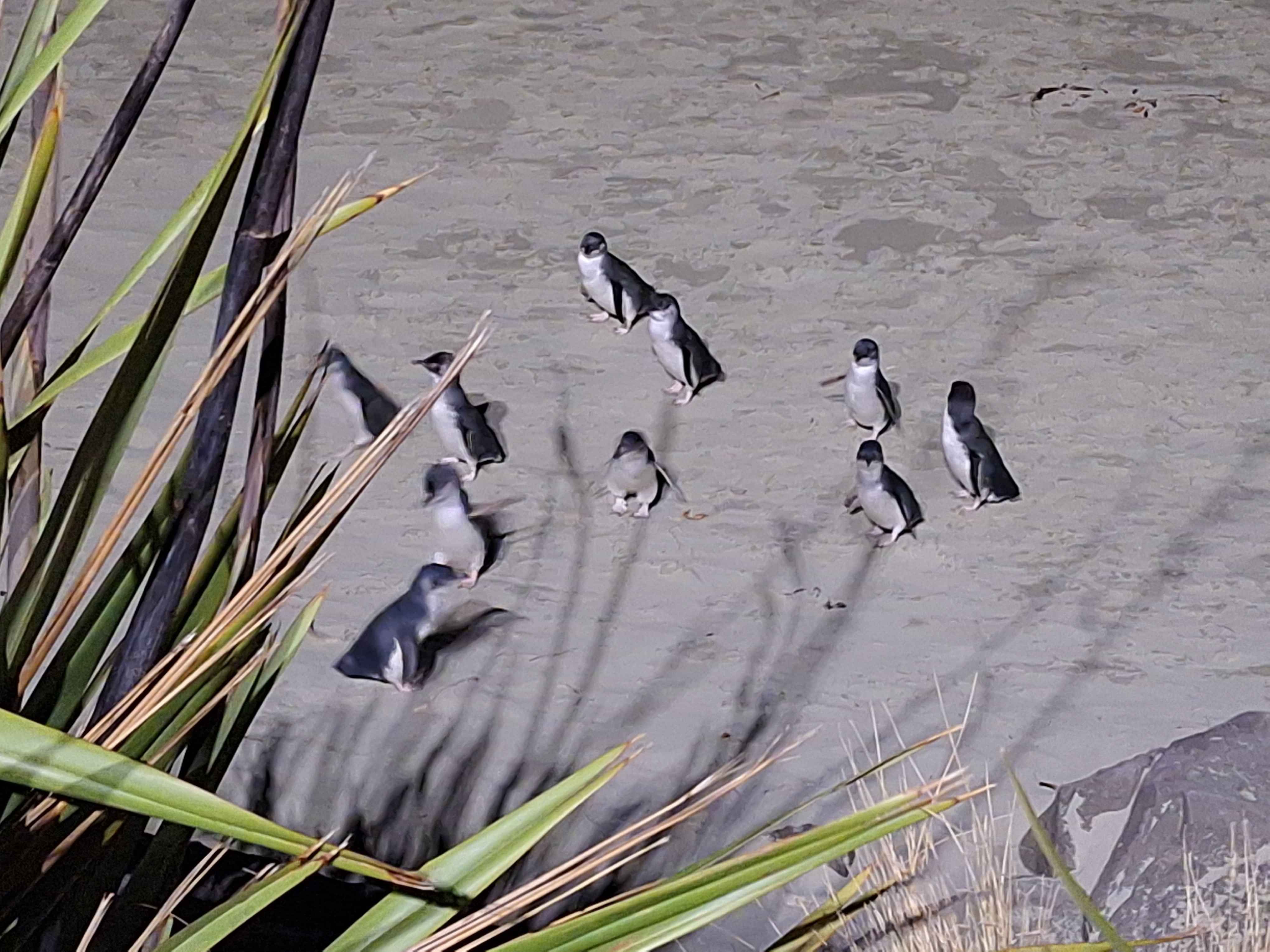
Every night, 365 days a year, crowds fill the roadway above Caroline Bay to witness the evening arrival of Blue Penguins who have been out in the ocean for over 8 hours. Around 9.30pm, in summer, as many as 200 to 400 visitors line the Bays, container terminal roadway to witness the return of the Penguins. They actually arrive in 1,2s,3s and more, then waddle along from the sea to find their nesting spots with nesting partners. Like any human grouping, these Penguins generally stop in groups to 'natter'.
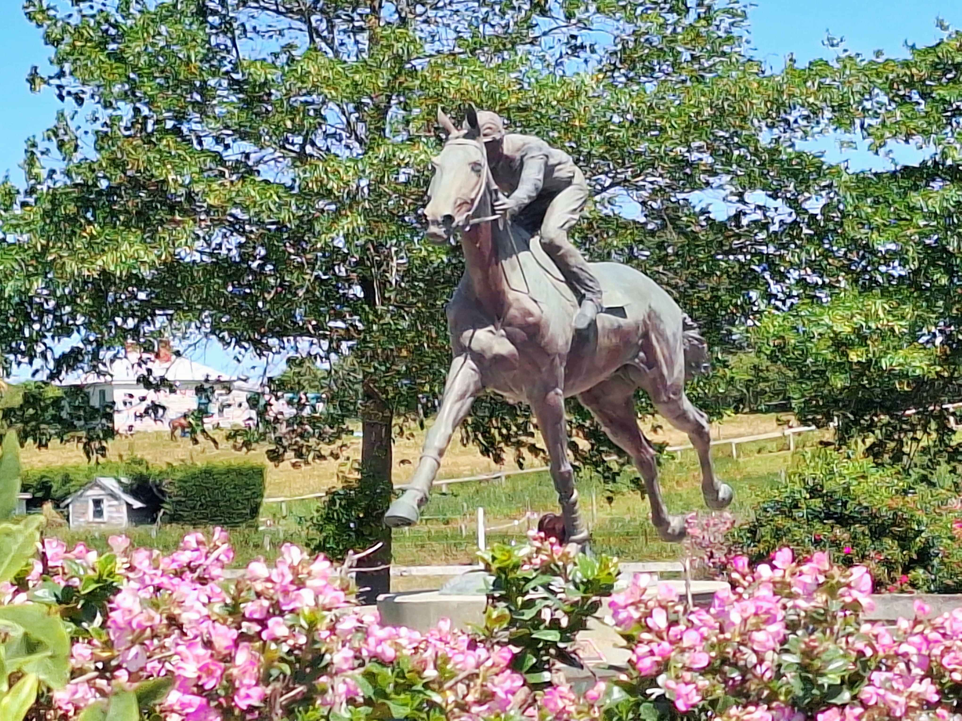
Washdyke, timaru
A local boy made good. A legend in these parts, gifted with an unusually hefty sized heart. Phar Lap has been avidly written about, and starred in an international movie. Born nearby at Sea down, he initially didn't rate with his very first race coming last. However hos record stands with 37 winners medals on 51 starts. Took the Melbourne Cup in 1930, then raced the high flyers in USA. He was sadly targeted in Melbourne by a betting syndicate, then died in USA of arsenic poisoning. Dodgey finale at best. He has been honoured in death by the naming of Phar Lap of the Timaru Racetrack. In Melbourne honoured in the cities museum. Equally so at Te Papa in Wellington. Simply, Legend.
Seadown
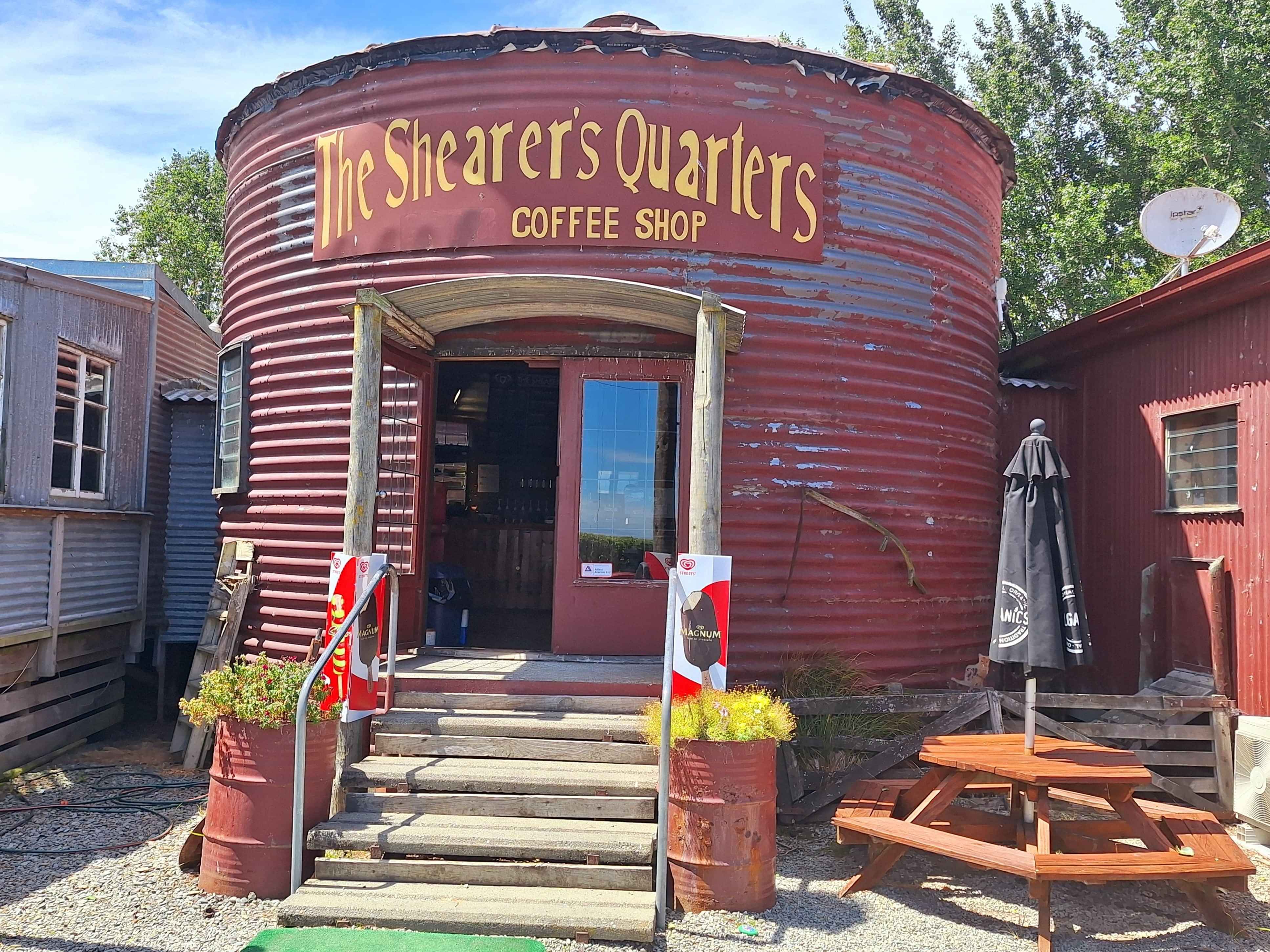
A retro rustic cafe operating inside an oversized 'tin can', being an original Shearers Shed in rural sector of Timaru.
St. ANDREWS
A popular iconic pub on the state highway, built in the classic Art Deco way, with leadlights and geometric shaping. Distinctive. Built in 1937, but initially started in 1876 before fire destroyed that version in 1936. It's been an identity here for 135 years. Top Tip.. the Horeke Hotel on the Hokianga Harbour, Northland is NZs oldest surviving hotel. Followed closely by the Duke of Marlborough in Russell 1840, the Moutere Inn 1850 and the delightful Cardrona Hotel of 1863.
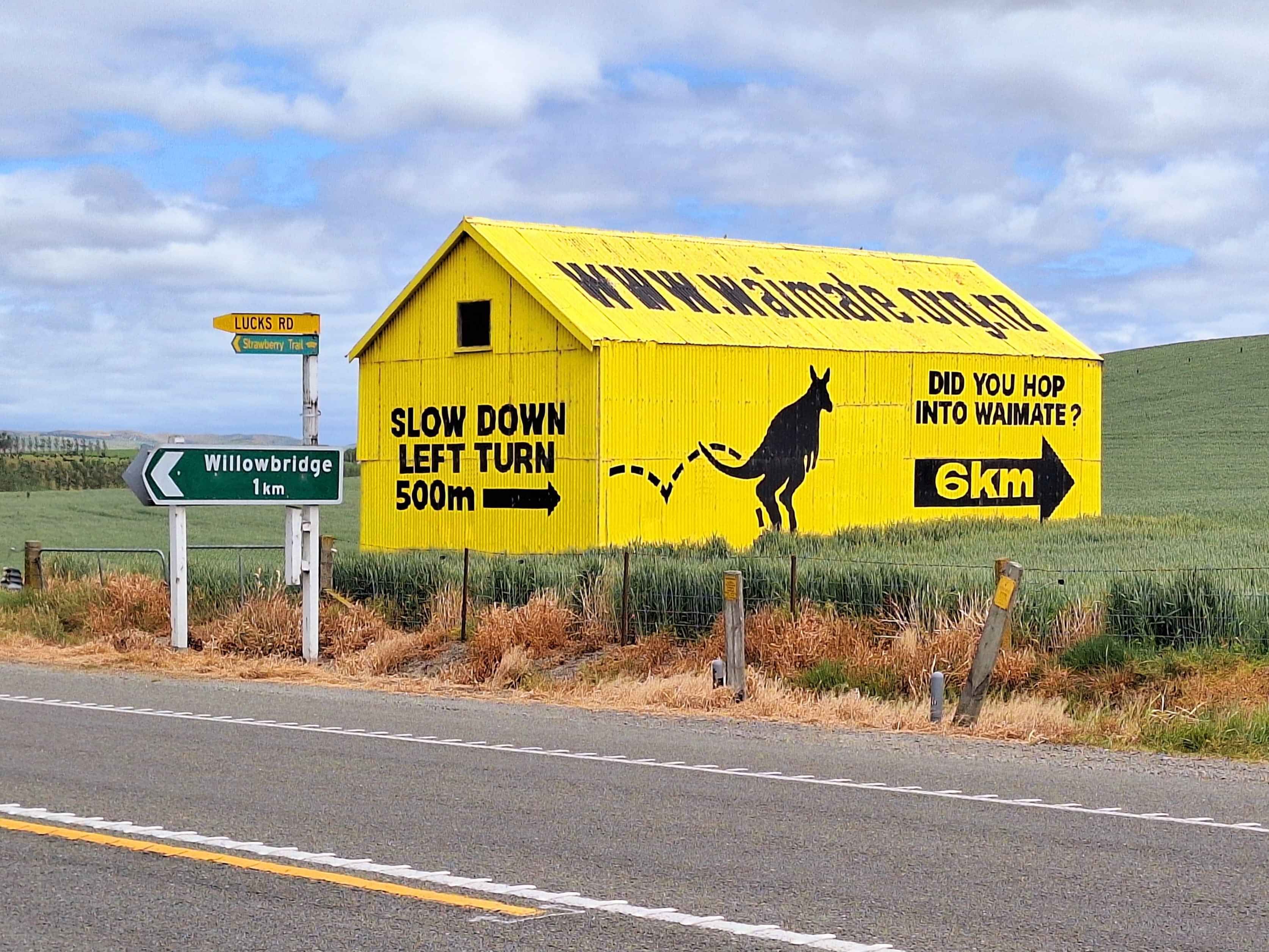
Willowbridge
Opposite Lucks Road, 6km outside Waimate sits NZs most distinguishing Road Sign for any NZ town. Here in NZ signpost colour's is an enormous yellow corrugated iron shed , including a graphic of a hopping Wallaby (Waimates town icon) advising drivers passing in both directions to either Hop in for a visit, or questioning, Did you infact Hop in. Clever marketing. So much so key rings of the yellow building have sold out to enthused travellers.
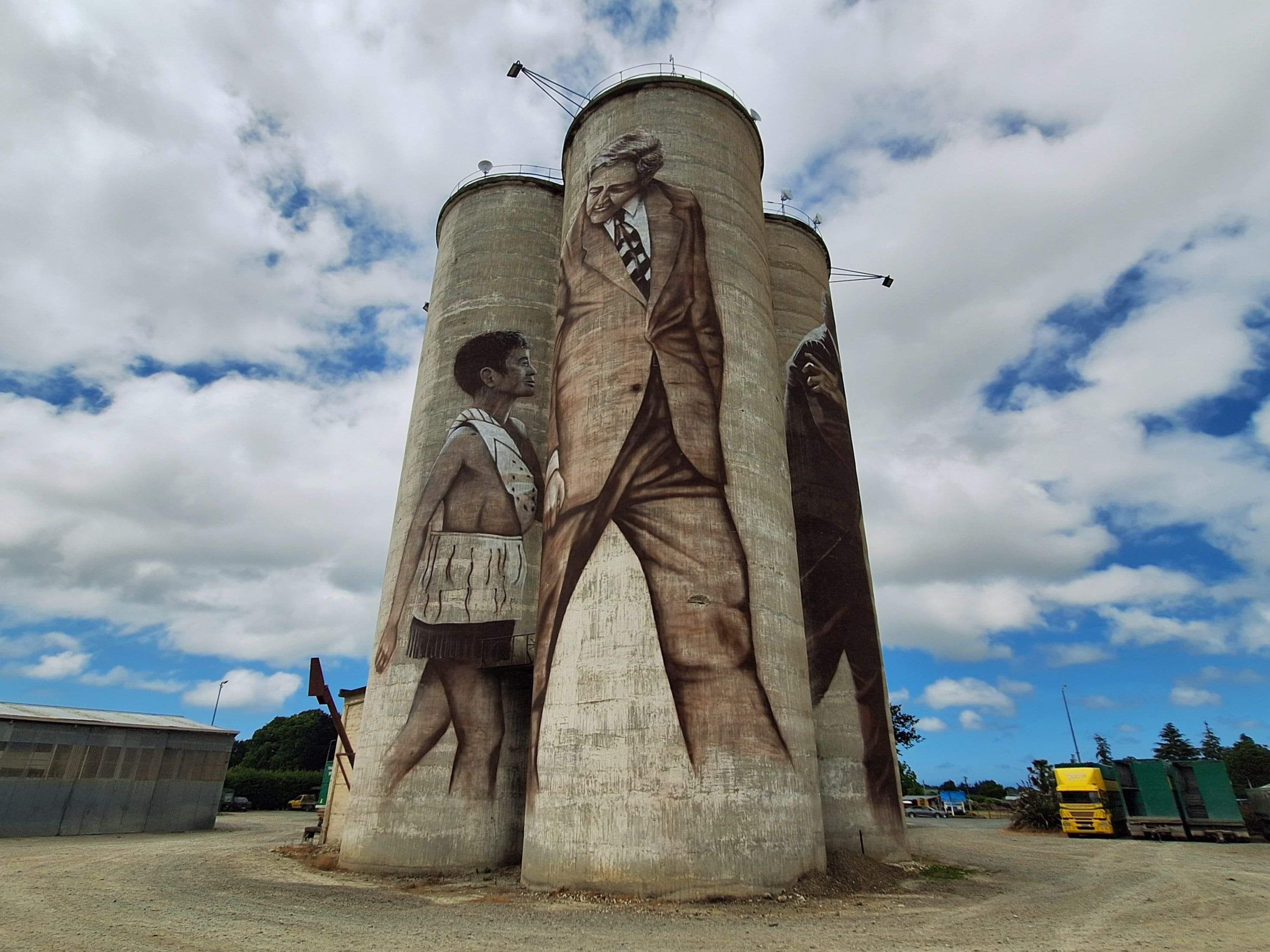
Waimate
This, off the main highway, town, enjoys 3 distinctive town icons that most travellers agree on. The first being the Yellow Corrugated Iron Shed, the White Horse on the Hill and the incredibly dynamic Silos smack bang in the centre of town. From a variety of angles, the art subject matter changes, depending on where you are. These multi Silo Art subjects sit directly inside the towns biggest hauling company property and can literally be spied allover town. You can't miss them.
The White horse monument
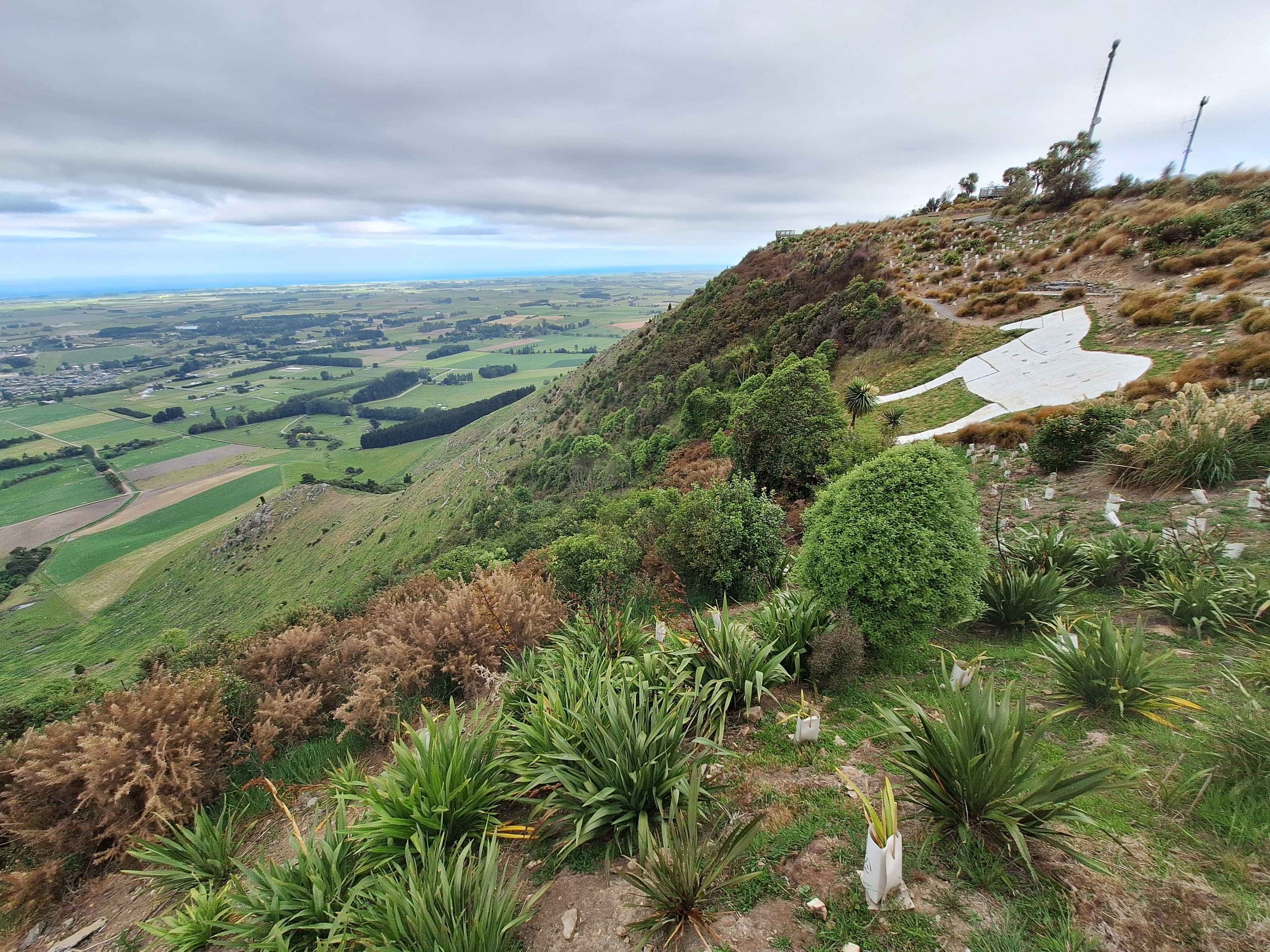
High up on the hillside dominating Waimate sits a white horse on the hill. At town level the horse is visible, but rather small on the actual size of the hill it sits on. Many drive the stoney roadway, up the hill to view both the horse and the vista. Frankly it's truly stunning as you gaze down over Waimate and out for many miles to the ocean. Top Tip.. the better option to get to the top of the hill, is by mountain bike. A brilliant easy grade trail has been crafted over 5kms in length . They've essentially made every zig zag turn, by grading a pathway with a very gradual climb per zig or per zag. It starts at the gate of the Open Sanctuary where bikes are encouraged, then after 5kms of east travel you'll pop up at the White Horse Monument. The trip home is simply free wheeling. Fully recommend it if bikes are of interest.
KAPUA- 'A MOA haul'
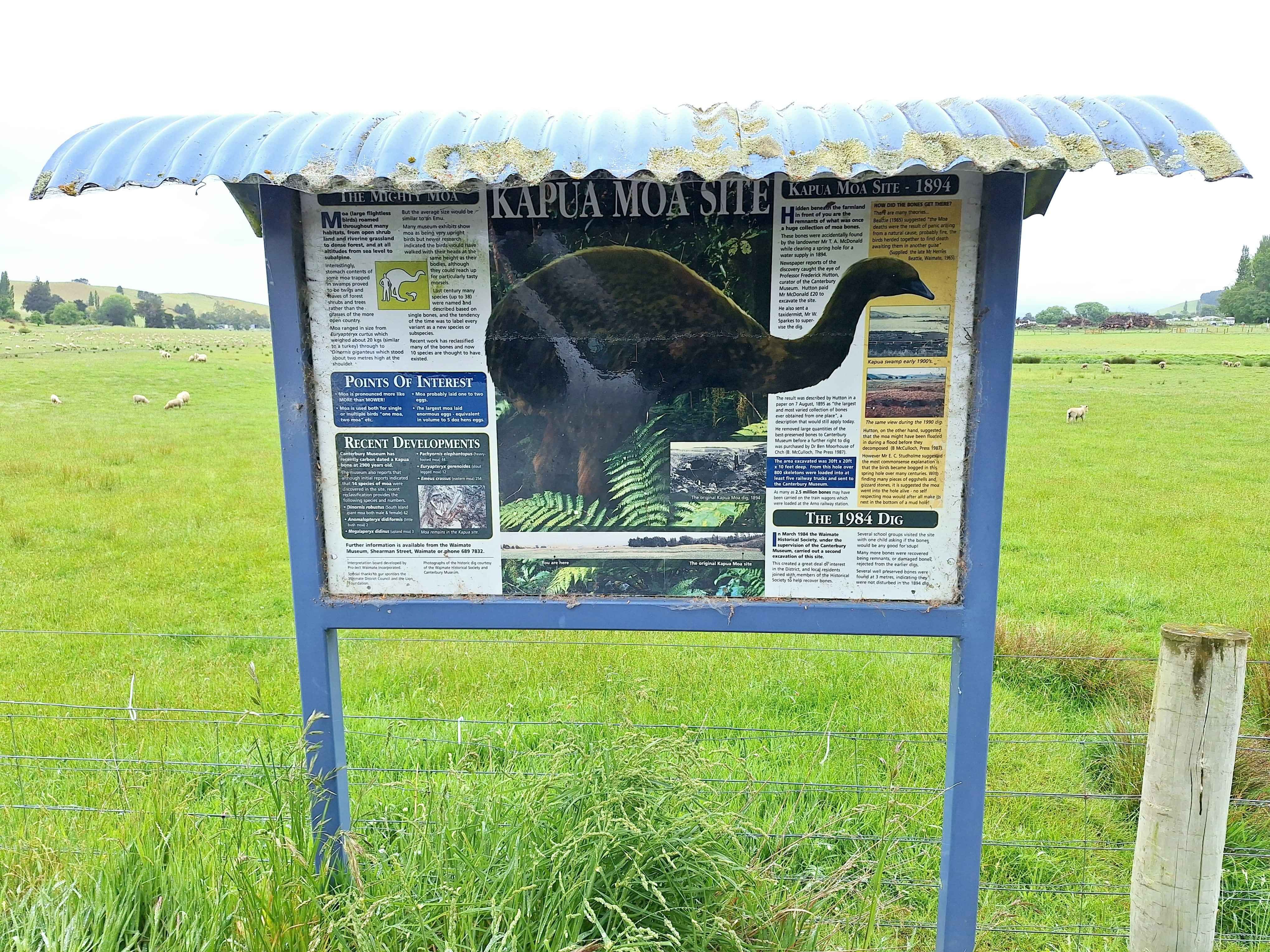
This spot in rural Waimate Valley has recorded the biggest ever haul of Moa Bones , discovered on just one farm in a Gorge south west of Waimate. An astonishing 7 railway carriages will filled to breaking of Moa bones . They unearthed 2.5 million individual bones from 6 species of Moa. The site is only 3 miles by 1 Mike and was once a lakebed. These bones have been dated from 1014 to 714 BC. Staggering.
Wahio Downs-"Ted's bottle"
This is a tale that should be a blockbuster Kiwi movie. Ted, local farmer and Army Reservist was a likeable larikan of the district. The story goes, Ted was enjoying last drinks at the Wahio Tavern , heard the trains whistle, and had just received an unopened bottle which he said to the Barnan, keep it here for me, and I'll share a drink with you when I return from the war. The year was 1939. The barman agreed to hold the unopened beer behind the bar. To this very day, the bottle remains as he was killed in action and this bottle represents loss for a tiny community and a solid gentleman's agreement. Visitors turn up in vast numbers to share a drink (but not Ted's bottle) to salute him. I did just that. It's a touching story and fiercely protected by the taverns community. Currently the bar is being sold, however the sale agreement endures new leasees fully honoured Ted's wishes.
Ikawai
Have you ever tried to find an important roadsign, only to discover that the naked pole in the ground, is the actual spot your are wanting to locate. I wanted to get to a town, called unbelievably "Earthquake ". Only after a couple of uturns did I realize the pole marked the spot, but without the Earthquake name. Ofcourse, what young guy wouldn't want this name for his flats walls.
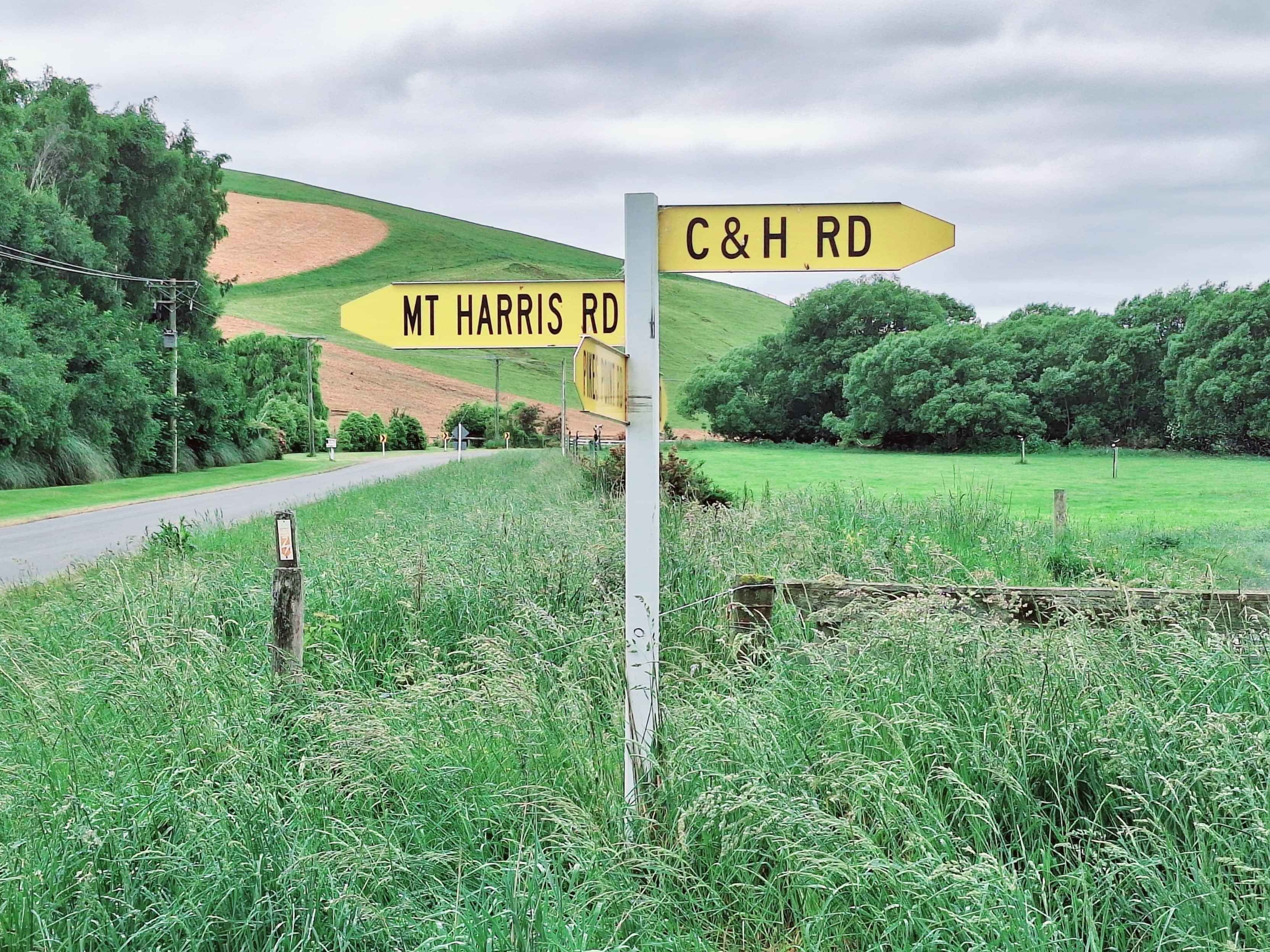
As I drove further on, I noted a most unusual street sign by the name of C&H Road. I googled it, to find the actual name is Cock and Hen, but no doubt the local community got tired of relentlessly replacing this obvious "flat target', so offered now only C&H Road. Intriguing.
Earthquakes is a place
This area is a fascinating open air scientific study zone whereby earthquakes millions of years ago, 23+ million raptured this land and rockface. Essentially big land drops and rises. It's factual that this entire area used to be under the ocean judging by the many sea mammal fossils that are regularly discovered . Case pinpoint, a 8 metre whale skeleton was discovered right here. Throughout the Waitaki Valley various whale and marine life fossils are discovered. So much so UNESCO has shown an interest in this entire region.
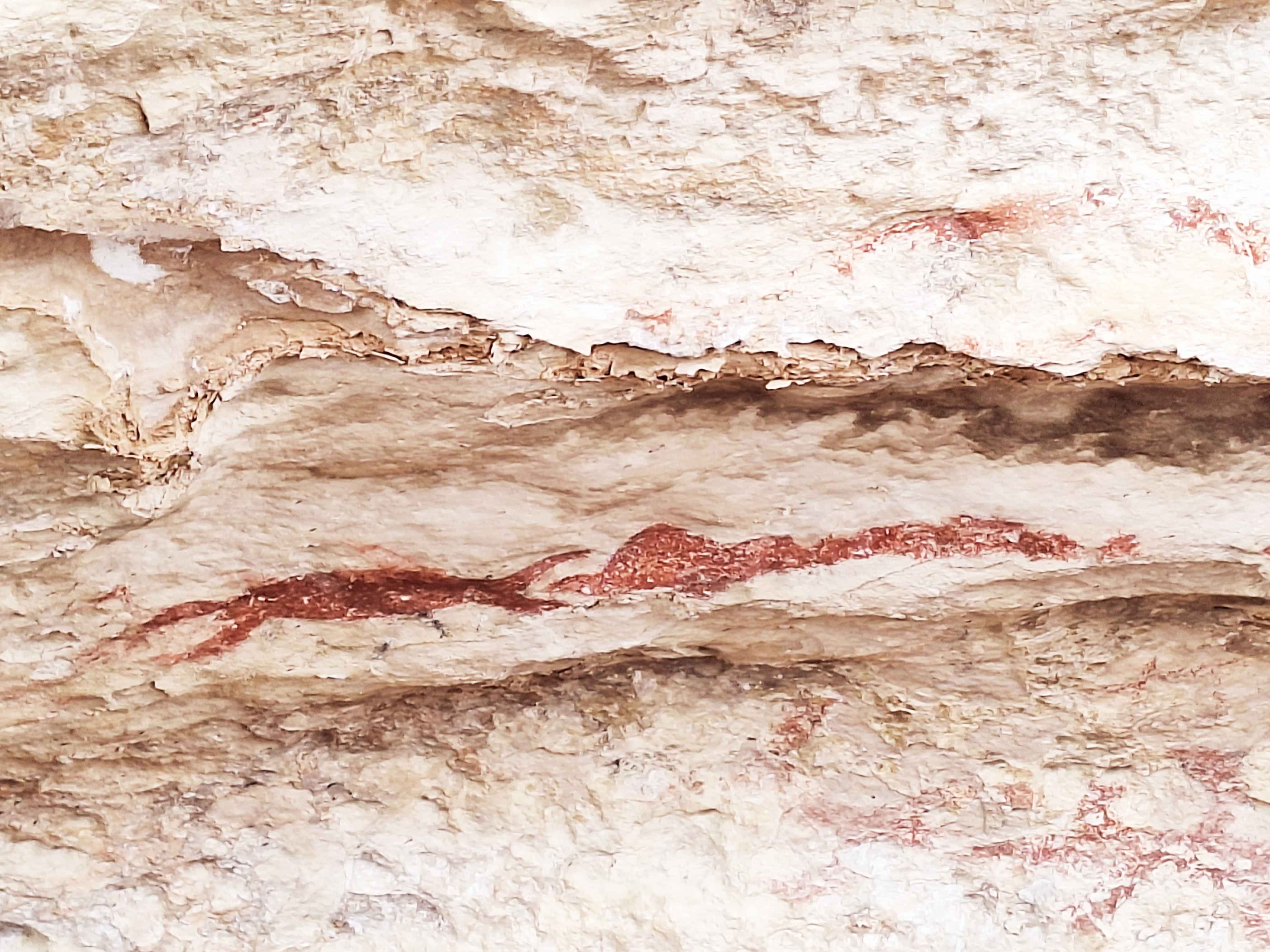
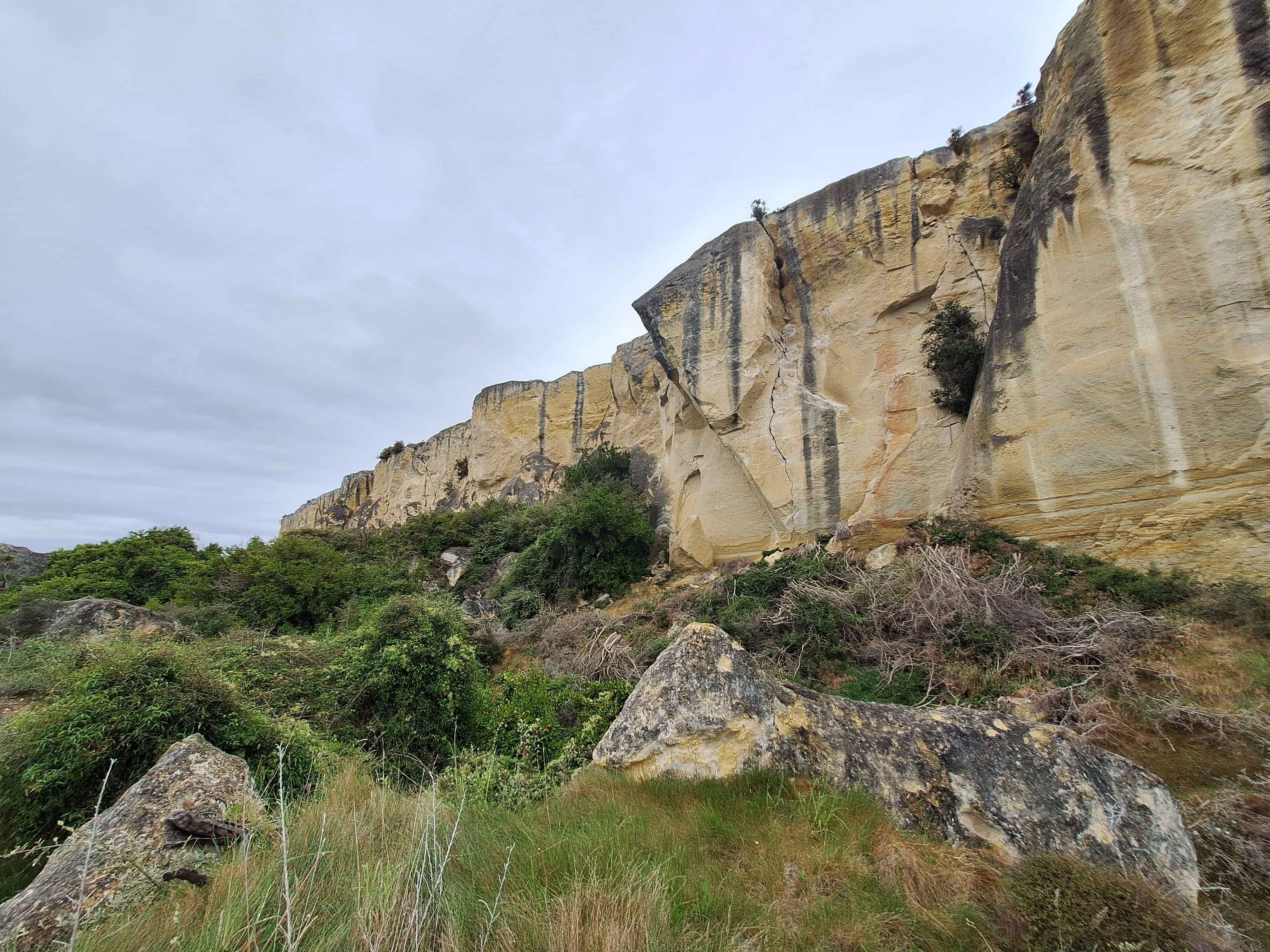
Waikaura Rock Art
Along the underside crevices of this massive overhanging rockface, numerous early Maori rock art was discovered around the Duntroon Valley. At this very site, some examples remain, however disturbingly many art pieces were removed for qualified analysis, only to discover they infact destroyed the precious artwork in transit. Many blocks were chiseled out by Scientists of the times, but few survived. Staggering.
Duntroon
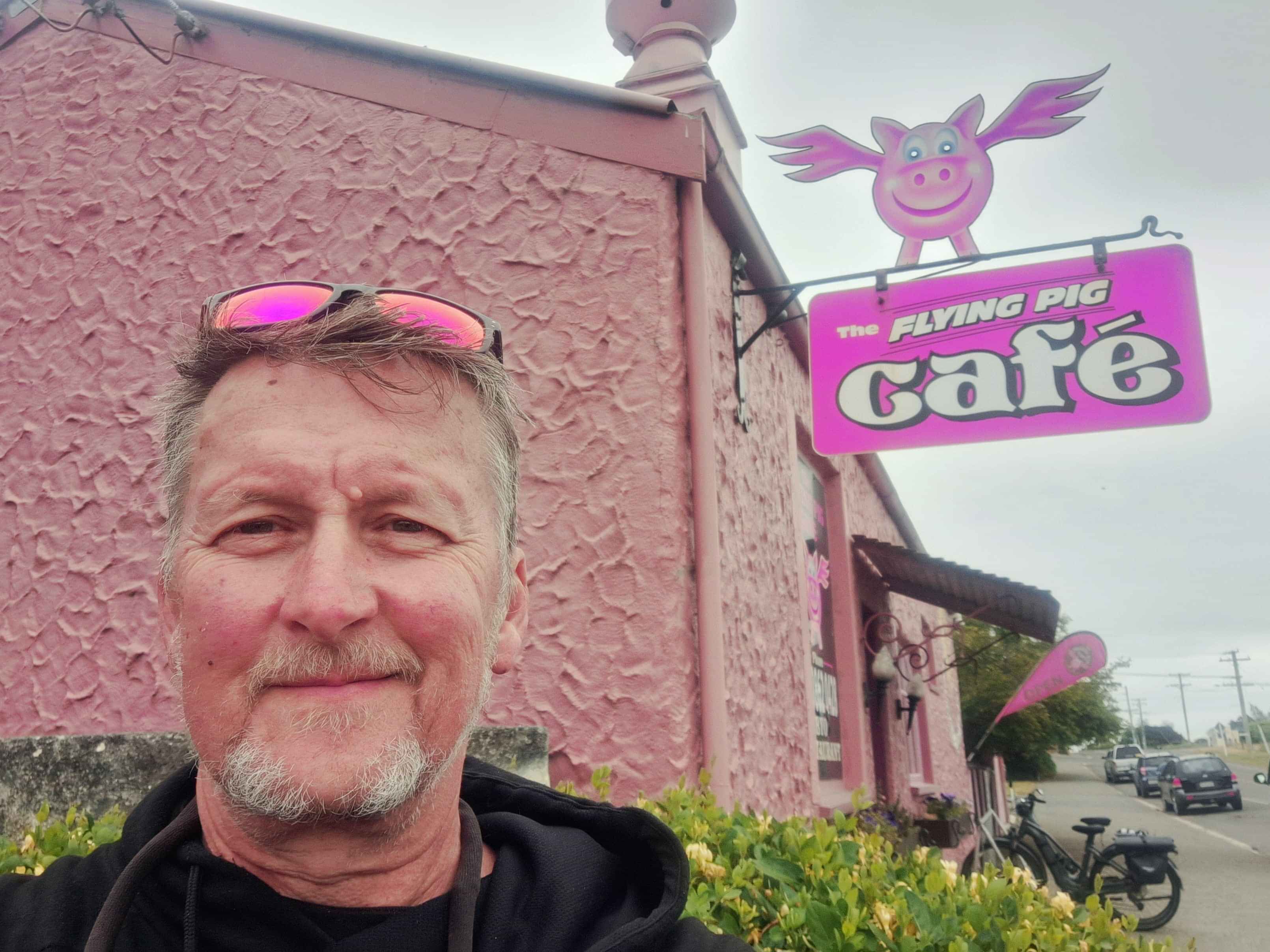
This small rural township on the Waitaki River hosts visitors interested in The Elephant Rocks, The Maori Rock Art and The Vanishing World Heritage Centre which documents the continuous fossil discoveries from all over the Waitaki area. Duntroon also hosts the growing band of multi day cyclists on the Alps to Ocean 3-6 day biking oodyssey from Mt Cook to Oamaru covering 200kms of mainly trails. Duntroon is seen as the last stop before the last leg. The Flying Pig with its fun outside decor brings in the crowds too.
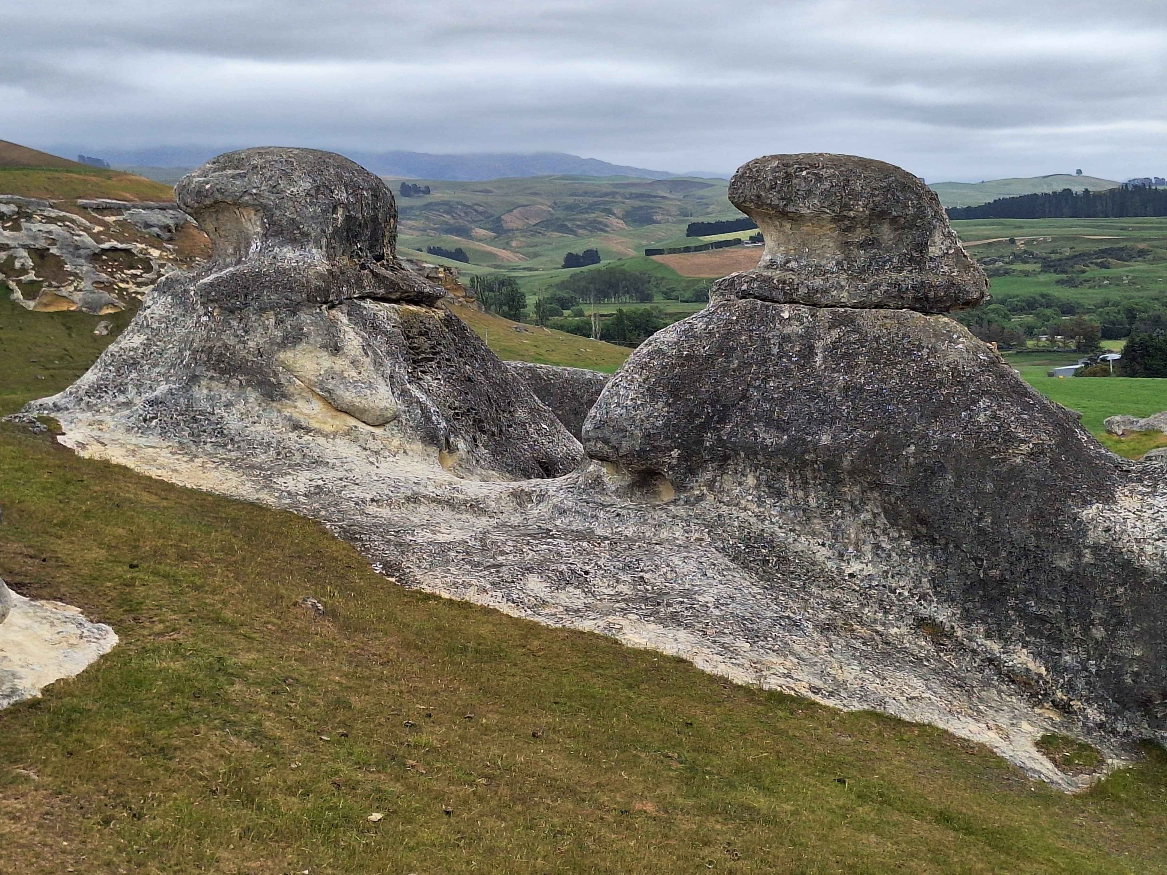
Elephant Rocks
The massive Waitaki Whitestone Geopark keenly followed by UNESCO, stretches from Duntroon in the North, to Palmerston in the South and to Lake Ohau in the West, just under the Alps, UNESCO of Paris has a definite interest in the ongoing historical discoveries of fossils. There are 15 locations of interest from Elephant Rocks to Moeraki Boulders through too Maori Rock Art, Earthquakes discoveries to a variety of intriguing local finds. Whales, Dolphins and Penguins have been fosillised alongside the Moa The Vanishing World Centre was established on the back of these discoveries
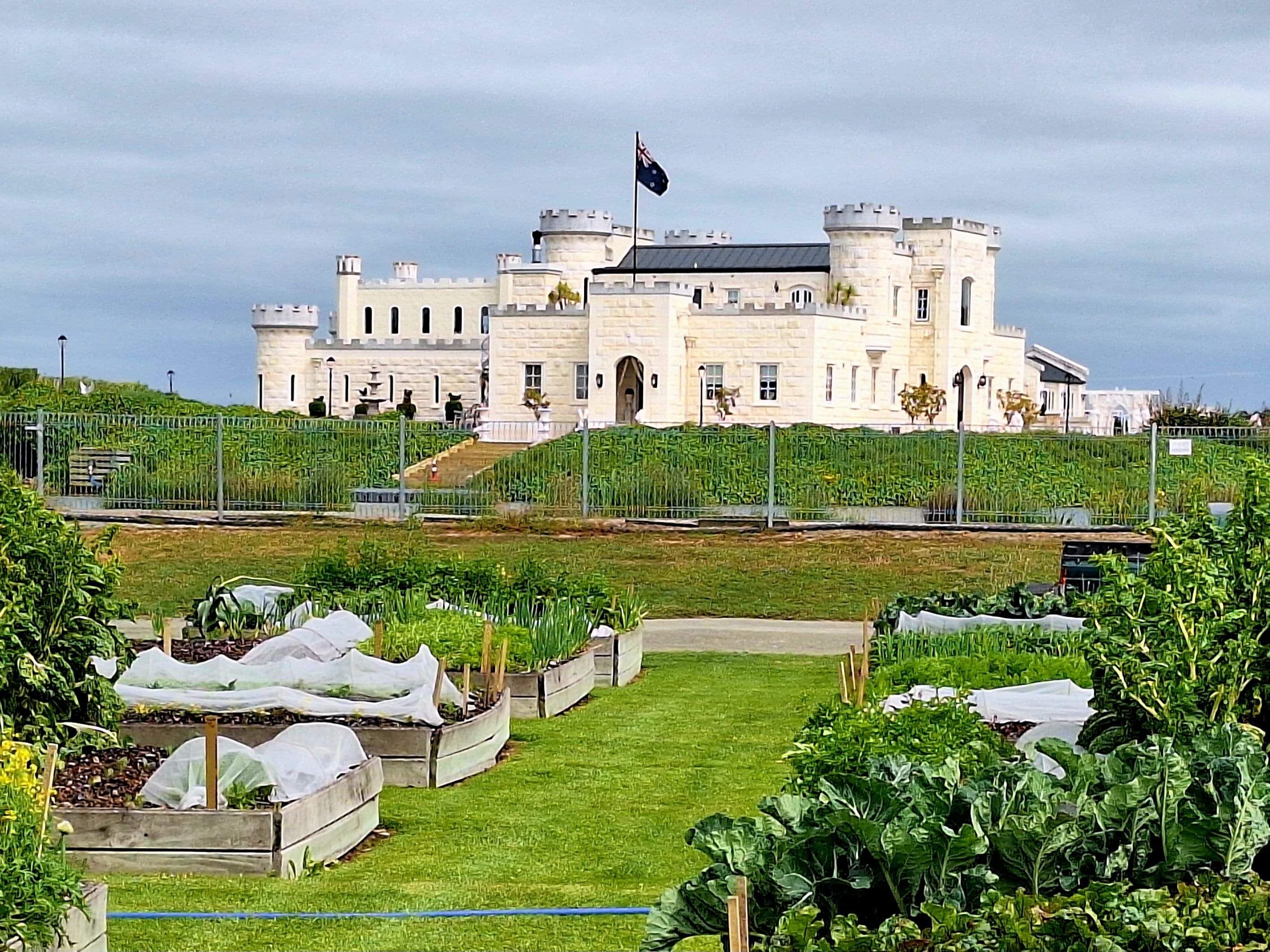
Dots Riverstone Castle
How many wives have said to their other half, Doll if you want to make me happy, build me a castle. So he did. This has got to be the most romantic gesture, fullstop. There's more to the tale, naturally, but one young woman's dream came especially true. Dots a powerhouse herself and has built a fantastic retail emporium on her land adjoining the Castle on the Lake with working drawbridges. Daily tours too.
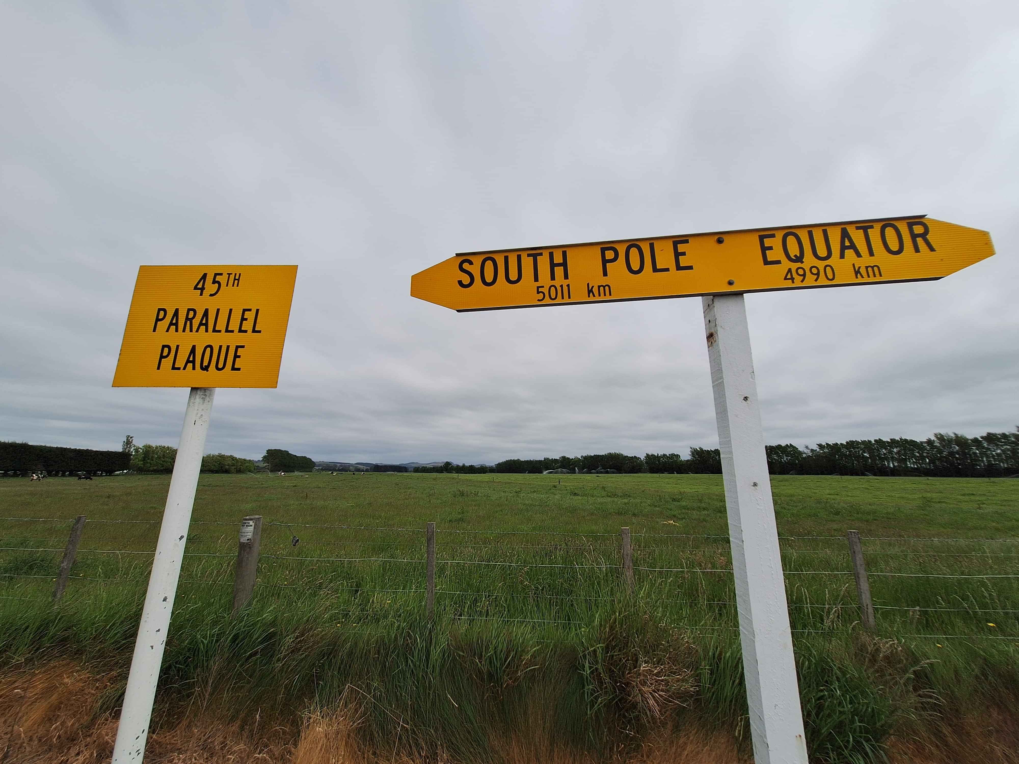
45th Parallel
There are various markers in NZ from Cape Reinga at the Top, to Bluff or Slope Point in the South, to the Nelson Hill for the dead centre of NZ. Here outside of Oamaru, namely Hilderthorpe is an unsung hero of the middle point between the Equator and the Antarctica. I felt I just had to stop. Rumors abound that due to the bulge affect at the Equator and how it flattens at the South Pole, thar dead central is infact around where the Yellow Eyed Penguins reside a little south of Oamaru Central. Probably just being picky
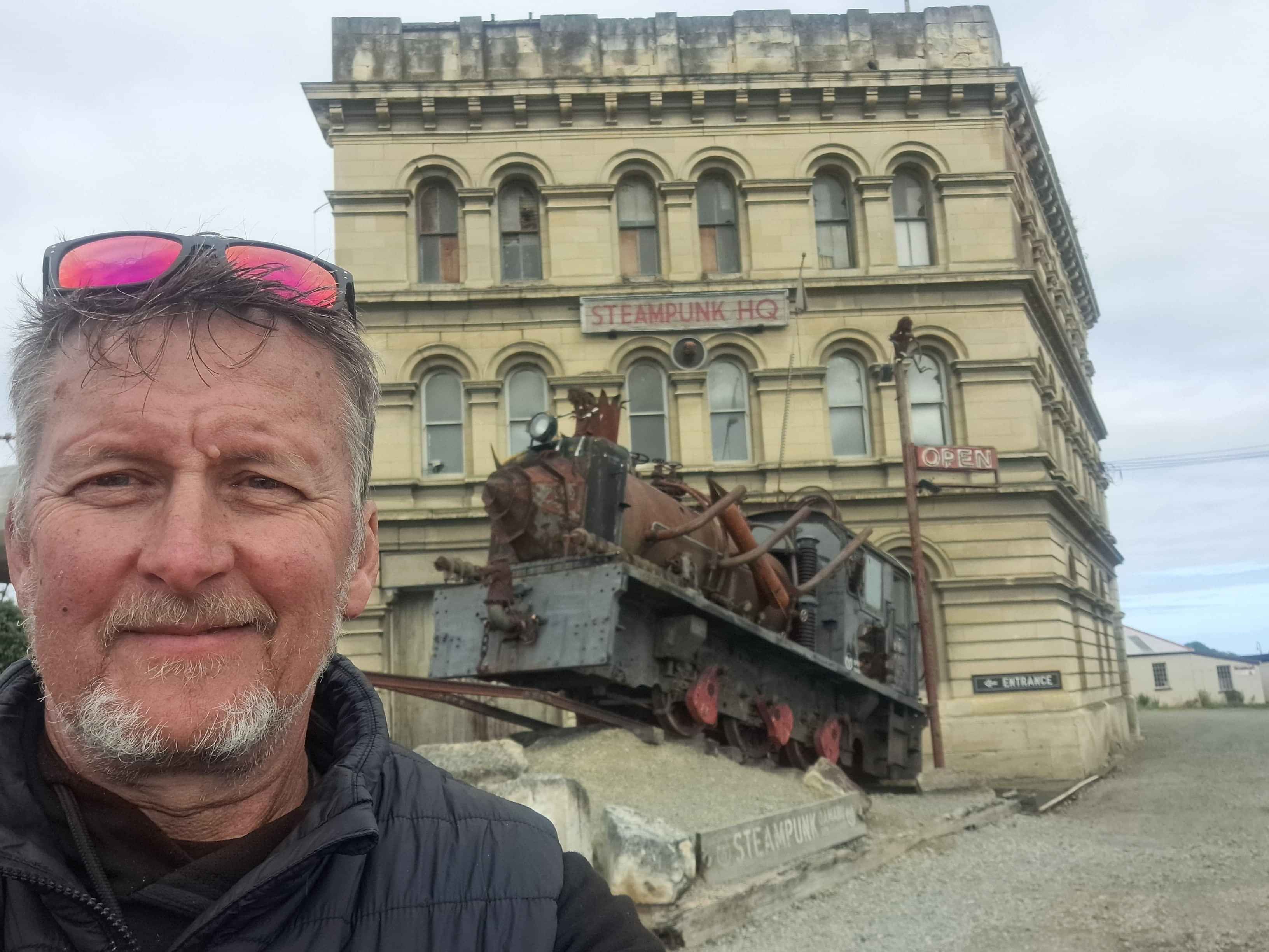
Oamaru white rock city
Is there a more attractive Streetscape in all of NZ, than the delightful historic strip besides the immensely photographed Steampunk Gallery. I suggest, not.
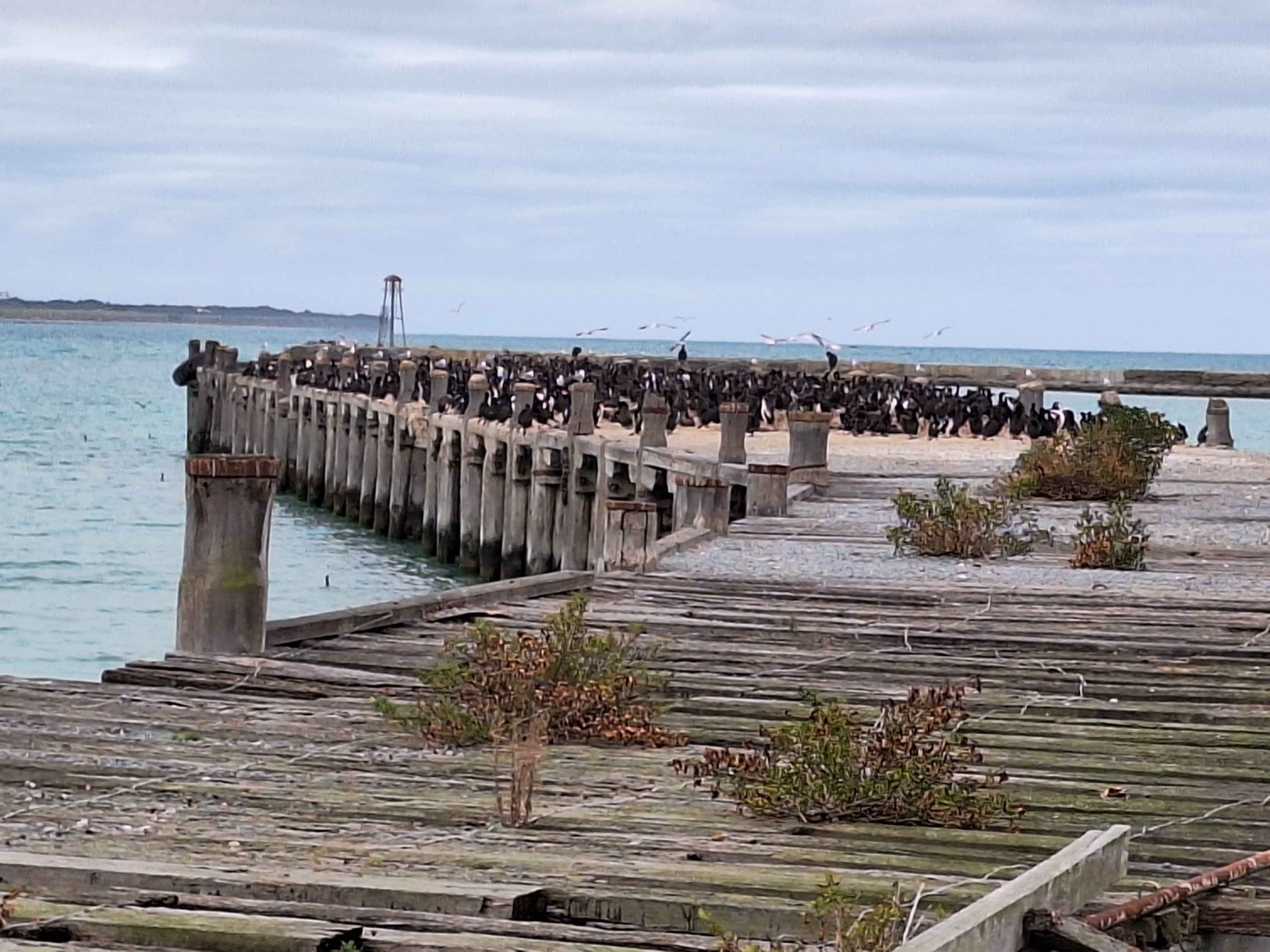
Shags of oamaru
The main draw card is the nightly parade of penguins that scurry up the boat ramp to there numerous boxes after 8 hours of fishing. It's a fantastic show, but you'll need patience as it's the Penguin timetable only. Bring a pre prepared hotwater bottle as you'll be sitting around for long periods with no Penguin in sight. Next door to the fancier parade, sits a misused old wharf taken over by Diving Shags. Great view at the Oamaru Lookout above the city. The Yellow Eyed penguins can be found at Bushy Beach. However your 'hide' is positioned hundreds of feet away hovering over their beach. Personally I'd recommend Lighthouse Road at Moeraki Village. Closer to view and more potential.
Waianakarua
If you've ever wondered about the 'birds and the bees' when it comes to the birth of the Macrocarpa in NZ, here's the evidence.
Kakanui
Is this NZs best General Store attire? Makes you want to stop for a coffee. We'll it did for me.
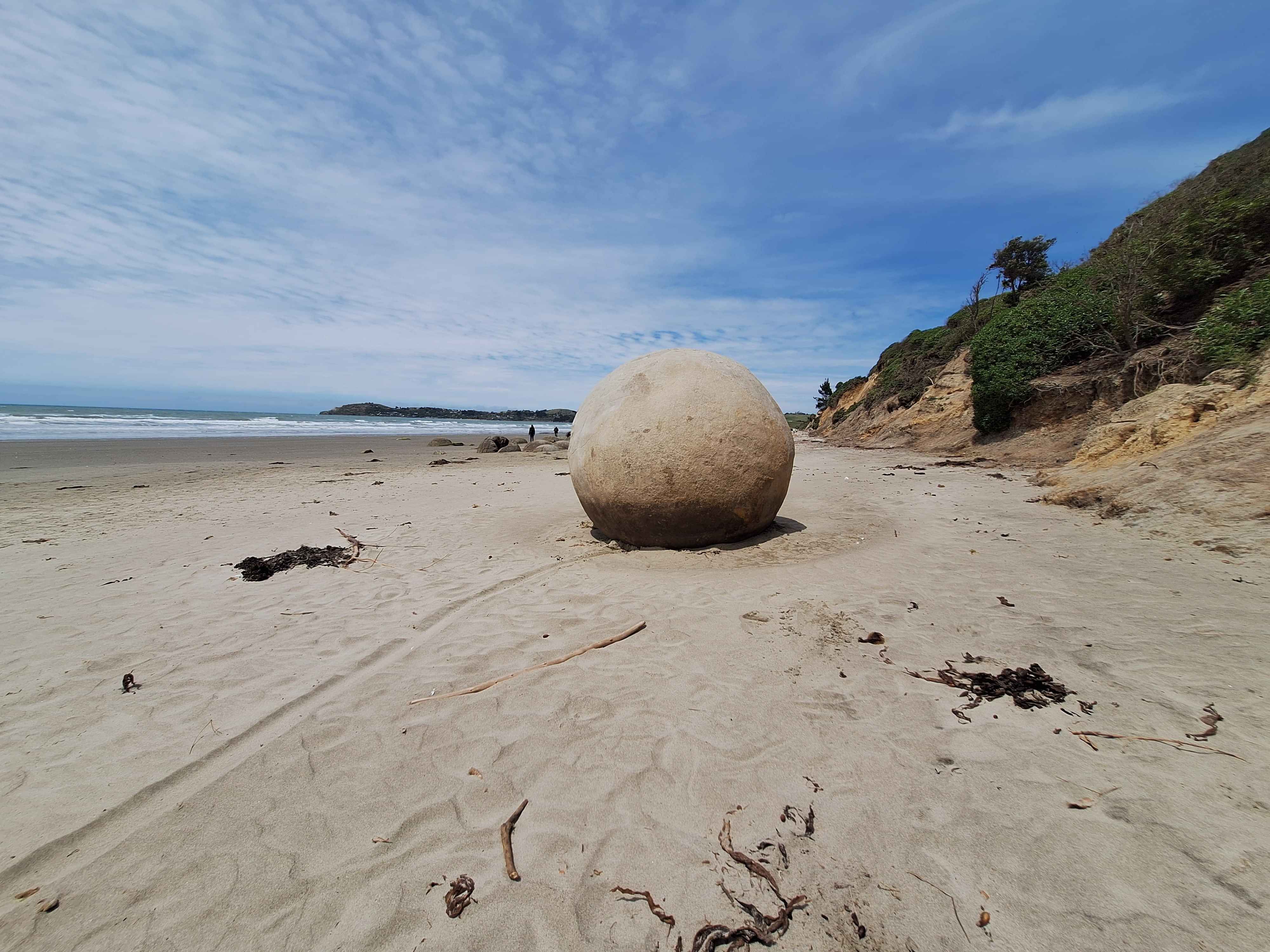
Moeraki Boulders
Today, only ONE complete Boulder was visible on Moeraki Beach. The remaining Globes, are sunken beneath the sand, with either tops or top half showing. The rest are either broken and in some cases completely smashed. A far cry from even 4 years prior. Apparently they do disappear beneath the moving sand, and reappear later. But on viewing, I'm dubious of this effect. Essentially most are showing big fissures, cracked or completely shattered. The Pacific Oceans anger is creating havoc for this very soft rocks with hollow inners. Add more cyclones, and I'm guessing Moeraki Boulders will be gone in 5 years time. Top Tip...Ward Beach after Seddon has smaller versions of these rocks. Sadly they are being wrecked equally.
Moeraki village, Fleurs
This wee gem of a restaurant is worthy of attention. Hidden somewhat from mainstream environments, it still brings in the diners from both overseas and directly out of corporate Dunedin. It's not pretentious. It feels spot on either inside where you can sign the rafters or outside watching the fishing boats dock. It wasn't open on the day I visited, but did note inside was still an ongoing restaurant. It's a 5 out of 5 experience from my visits previously. I'll be back.
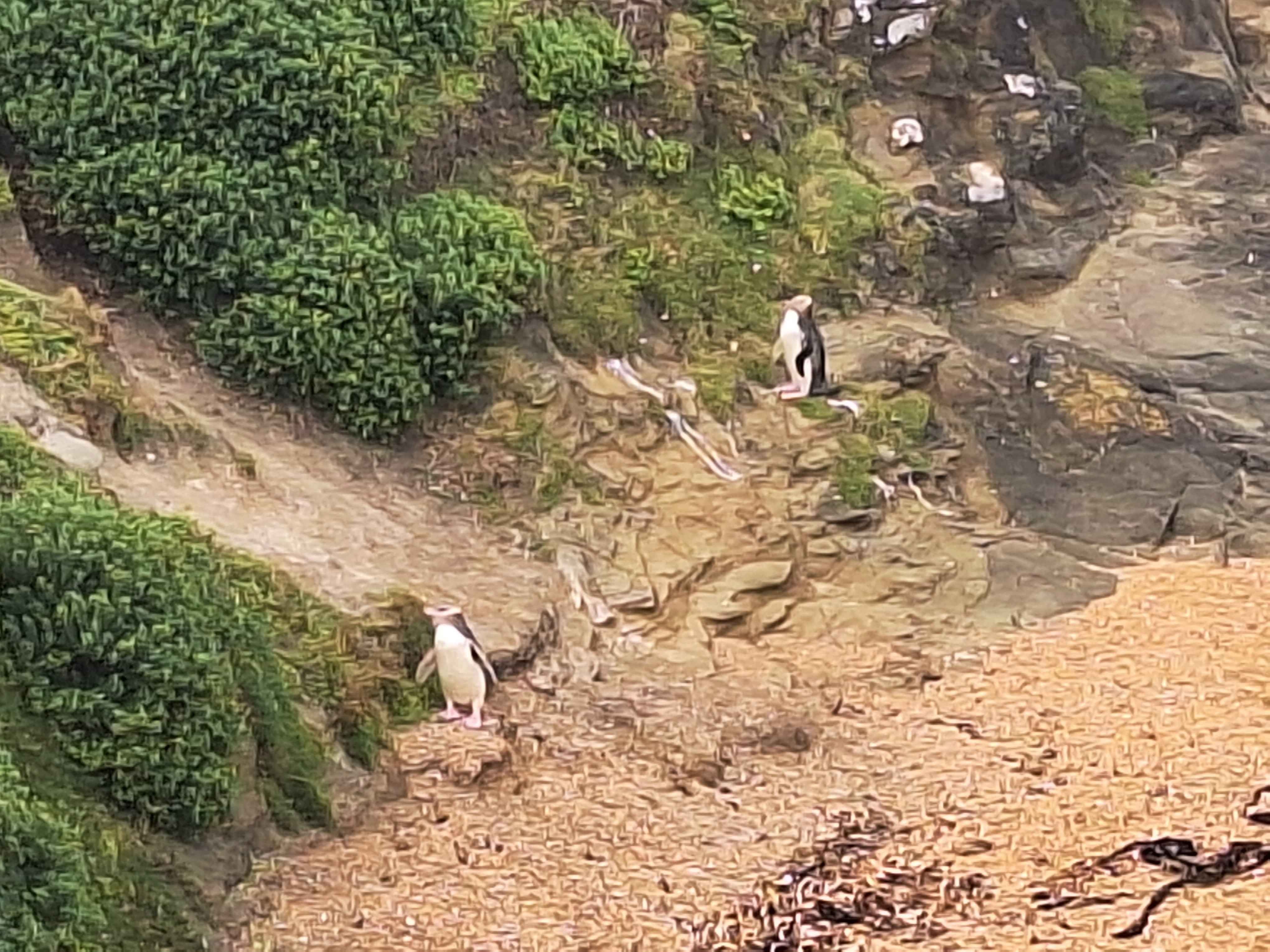
Katiki Point Hoiho penguin
Finally saw the very evasive Yellow Eyed Penguins, doing the courtship phase on the beach below the lighthouse. These endangered and threatened birds, and worlds rarest were on full display at the Katiki Lighthouse Peninsula. Penguins normally hide, but today they openly paraded about. Young love, perhaps. Further down the peninsula a teenage seal posed up a storm, so ofcourse...click, click, click.
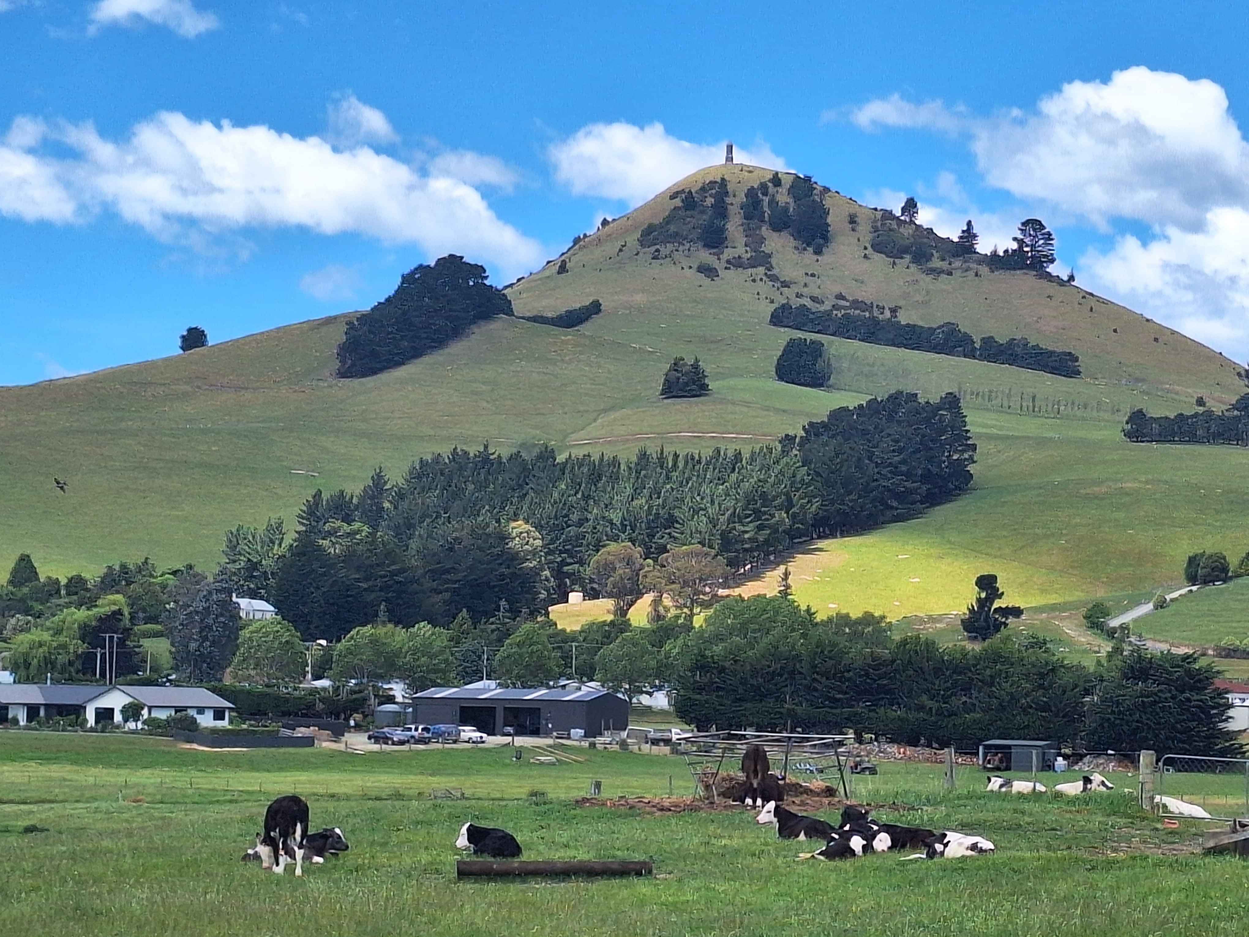
Palmerston
Very different in size to the North Island Palmerston, but both rural. This town is known as the starting point of the Pig Route for those heading into the vast interior of Central Otago and Rail Trail, namely Middlemarch to Alexandra. The big ticket item here is too conquer the towns hill. Be warned it's uphill sharply all the way. No roads here, just grass tracks on a steep incline. At the top, a monument you can climb from the inside is recognition to a pioneer of these lands, a Sir John Mckenzie. Not of the Mckenzie Country variety. The climb is relentless on thighs and lungs. Ofcourse I did it !
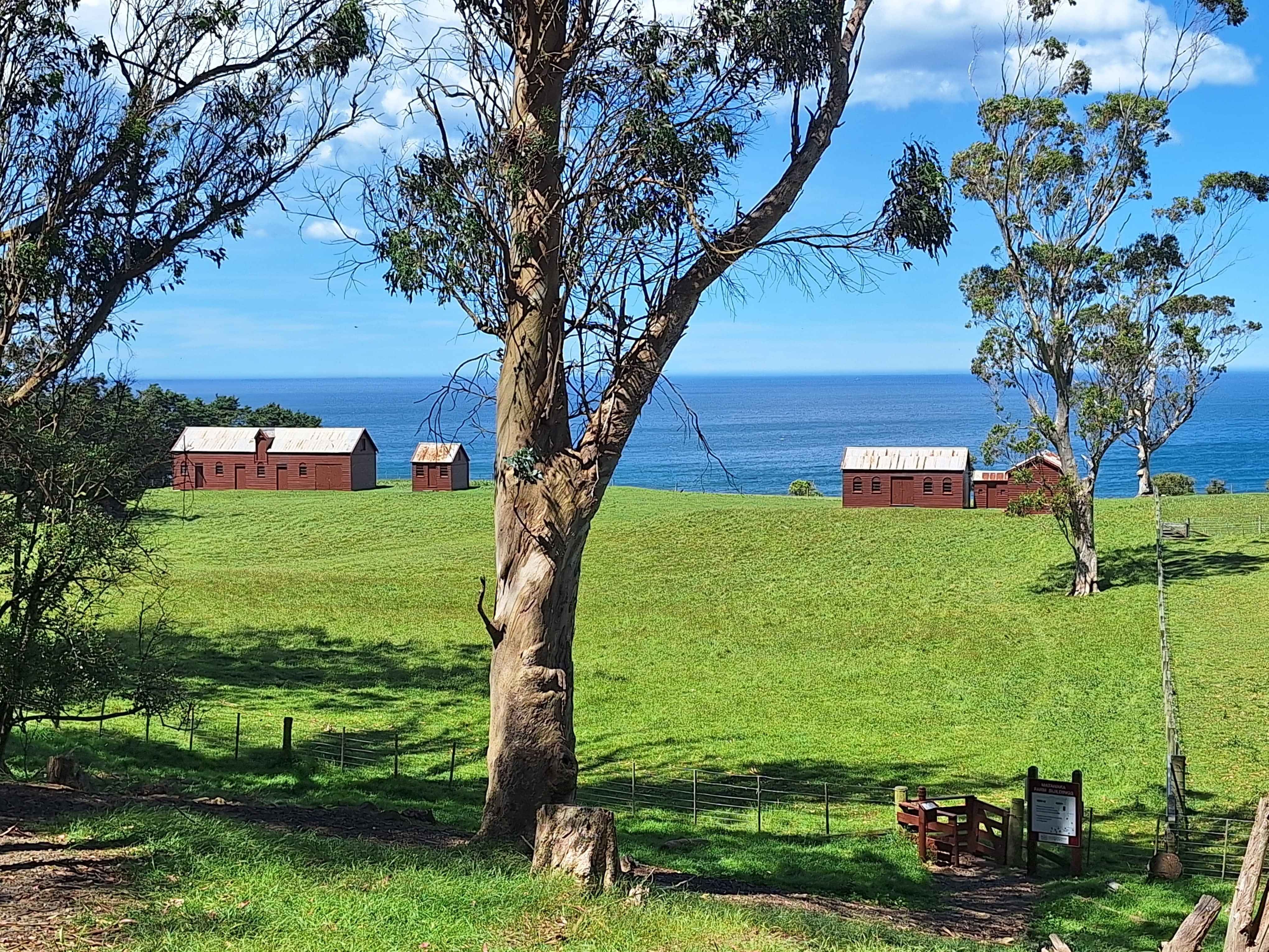
Matanaka, Nzs oldest Farm
I ventured to view NZs oldest farm house on the cliff looking over the ocean. The road up was closed, oddly, so I trekked the 1-2 kilometres uphill by foot. Not overly recommended. The sign said, yes we're open, but the gate said, road closed. I took the initial signage. Here's where it gets interesting. I walked the length of all the buildings. No one was here, absolutely no one. The wind was fiercely howling directly into the face of these buildings. Then oddly one of the farm shed doors opened admittedly maybe by the wind, but as I passed, immediately shut. These farm buildings have existed in current place and condition for over 180 years. As I walked back and forth admiring the design, the door creaked open again. As I walked past it then closed. The wind was only pushing in one direction. This happened continuously as I strolled. As I left the property, the door closed and didn't reopen as I walked away. Spooky, or what. Google suggests no ghosts, but really could there infact be old souls of this old farmyard.
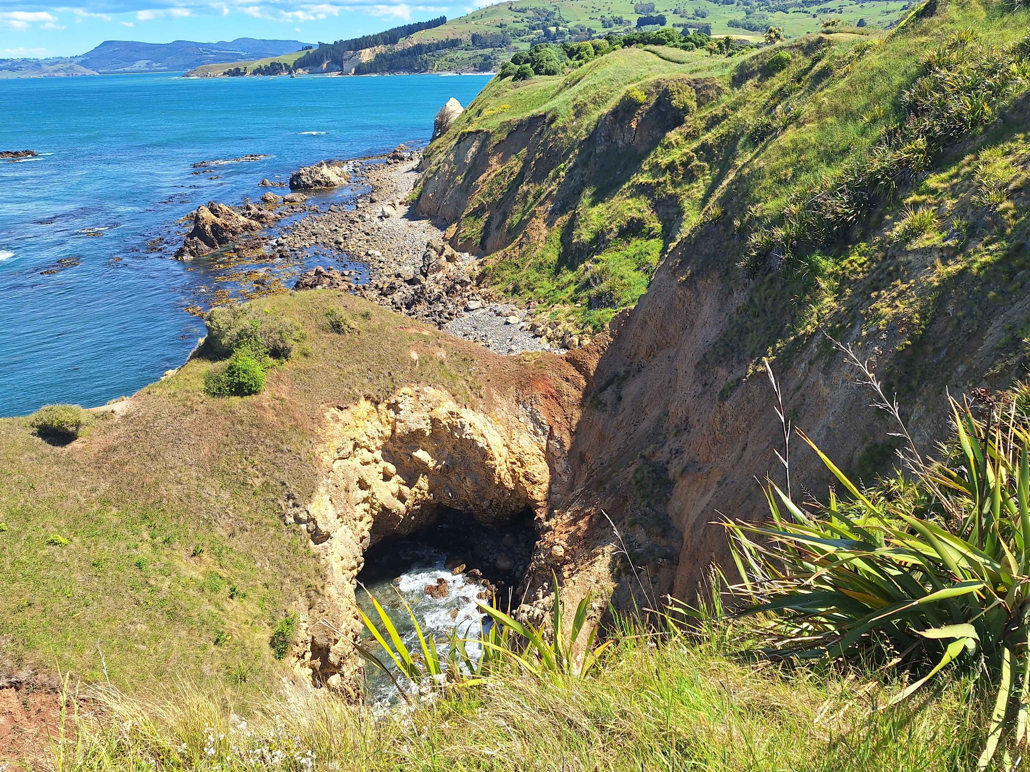
Nzs longest cave
The photo here is of a massively collapsed cave, where the water has dug in underneath, created a cave, then the weight of the hill, collapsing it. This was at the Pa on the Karitane Peninsula, directly opposite Waikouaiti where the World's Longest Cave exists today. This famous sea cave is 1.54kms long and sits underneath the farm of NZs Oldest Farm Building sits. I attempted to skirt around the rocks at high tide. However you come to a point where there's absolutely no access. Perhaps low tide offers better access. This 3km stretch of ocean battered shoreline houses many sea caves including the World's Longest.
Karitane
I had to document my first swim of the season at the white sanded Karitane Beach. Wow, being in the South, the water wasn't overly tepid. But ironically on this hot Otago day, much desired. I stay in for at least 10 minutes as didn't want to show my weakness for such waters to fellow beach goers. I'm certain they thought I was local after that.
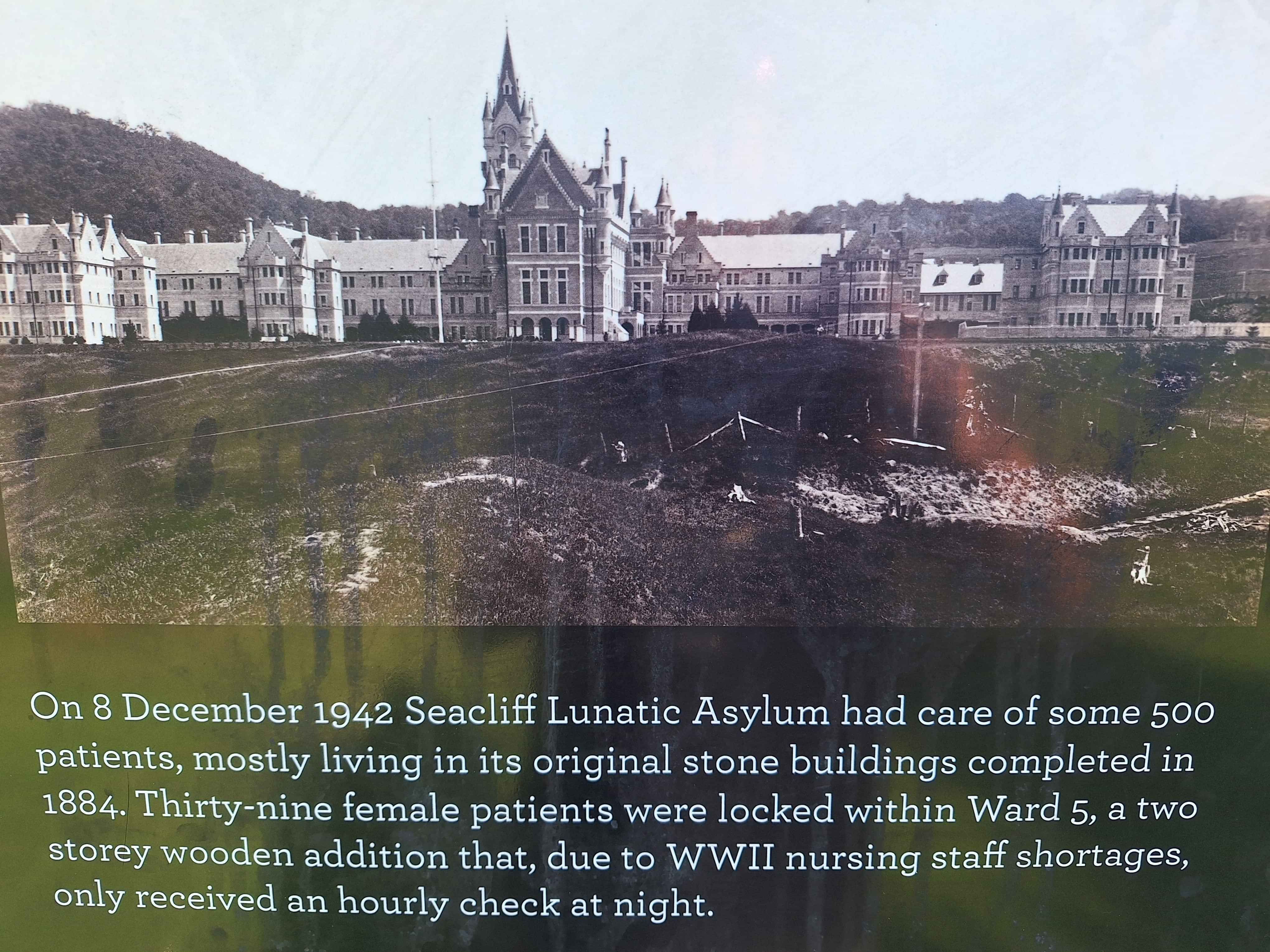
Seacliff
Whereever you discover an asylum or mental hospital, you find devastating background stories and always demolished properties that once we're nothing short of grand. Examples being Oakley and Kingseat in Auckland and Lake Alice near Marton. Here is another tragic asylum run apparently well by the founder of Karitane hospitals from 1889 to 1930. However new Supervisors of mental care weren't so giving after the 1930s. In 1942 a fire destroyed a wooden outbuilding at this property and 37 patients lost their lives as they were locked in their wards. After that, the Seacliff Asylum Hospital degraded, until the closure in the 70s and eventual full demolition of this site. The photo shows the grandeur. Today just a dormant playing field. Rumor has it, ghosts of 1942 still reside here. Not surprising really.
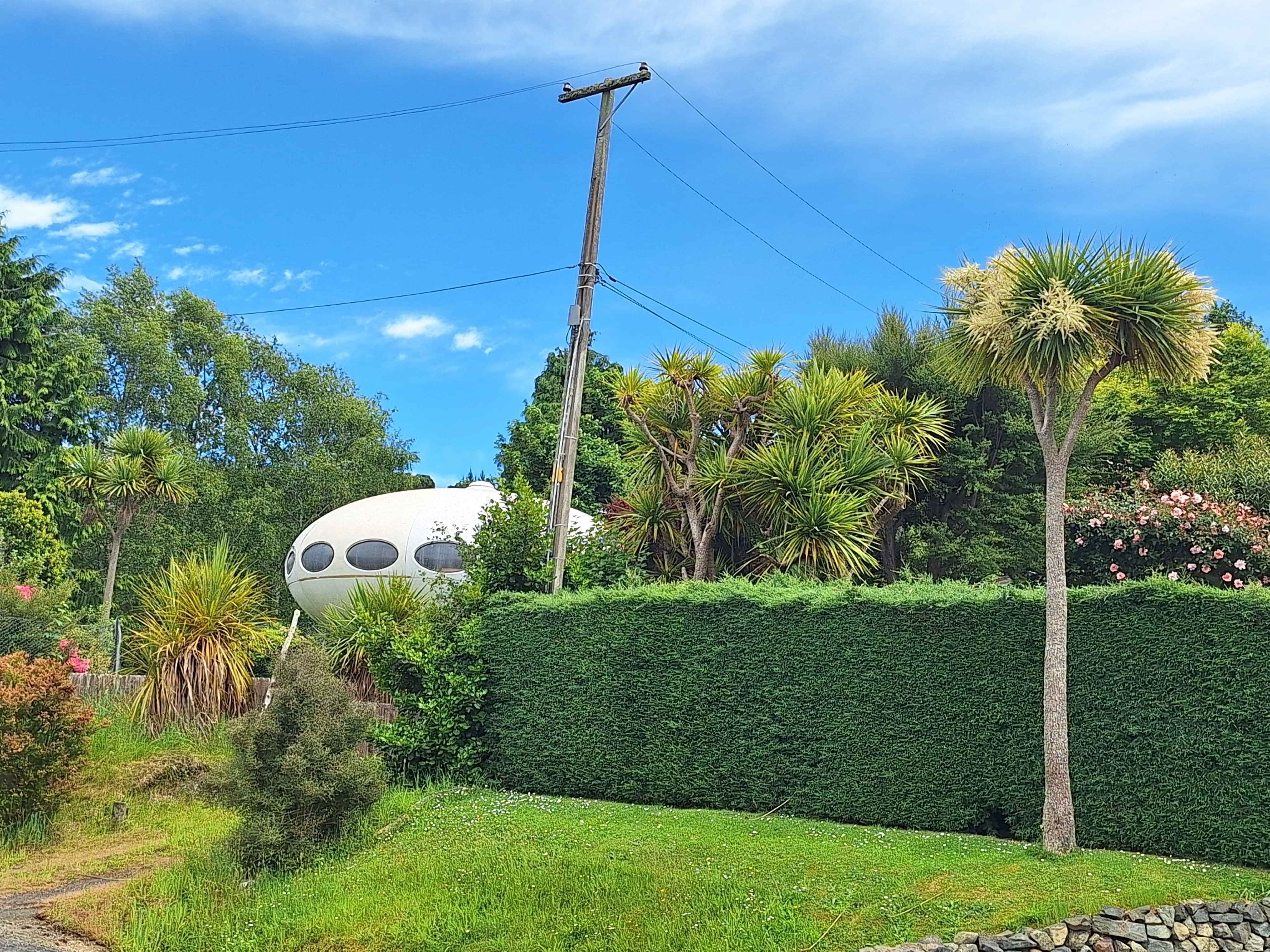
Warrington
Darling, was that a Spacecraft, we just drove past. Don't be silly, a Spacecraft, the driver scoffs.
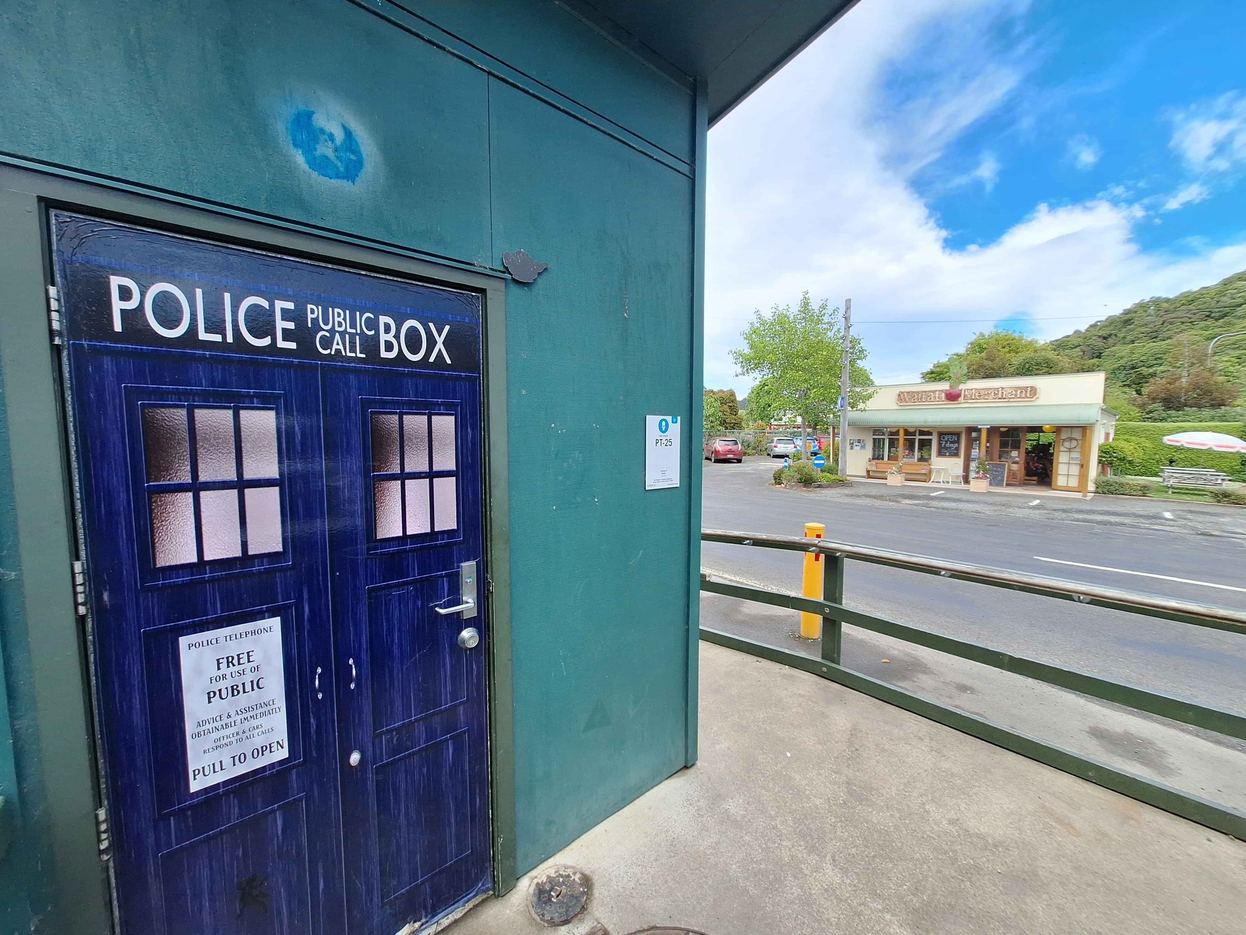
Doctors point, Dunedin
It struck me afterwards, a time machine at Doctorw Point is most apt when you consider the Tardis is infact Doctor Who's vehicle for travelling through time. I know, brilliant deduction, being Doctors Point. Funny.
Hare hills, Dunedin
Not a bad spot to camp. This farmer and fellow caravanner offers his property to members. Thankfully I'd paid my annual subscription. Thanks Wally. Goldplated campsite overlooking Dunedin Harbour and Port Chalmers.
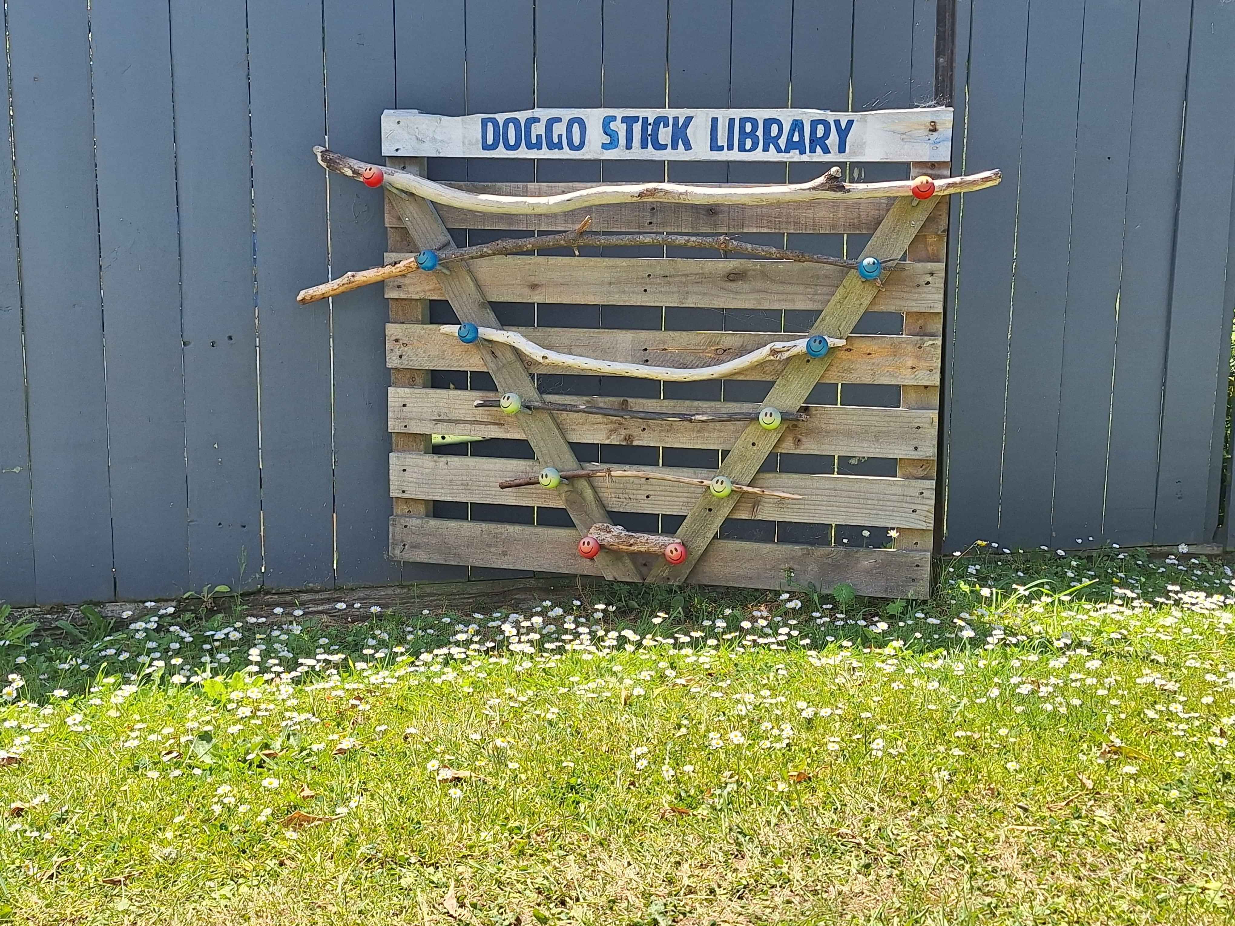
Doggo Stick library
Just when you think, have I seen it all. Yeah, Nah, along comes another gem at a beachfront property. Brilliantly lateral and so so desired. Woof.
Aramoana
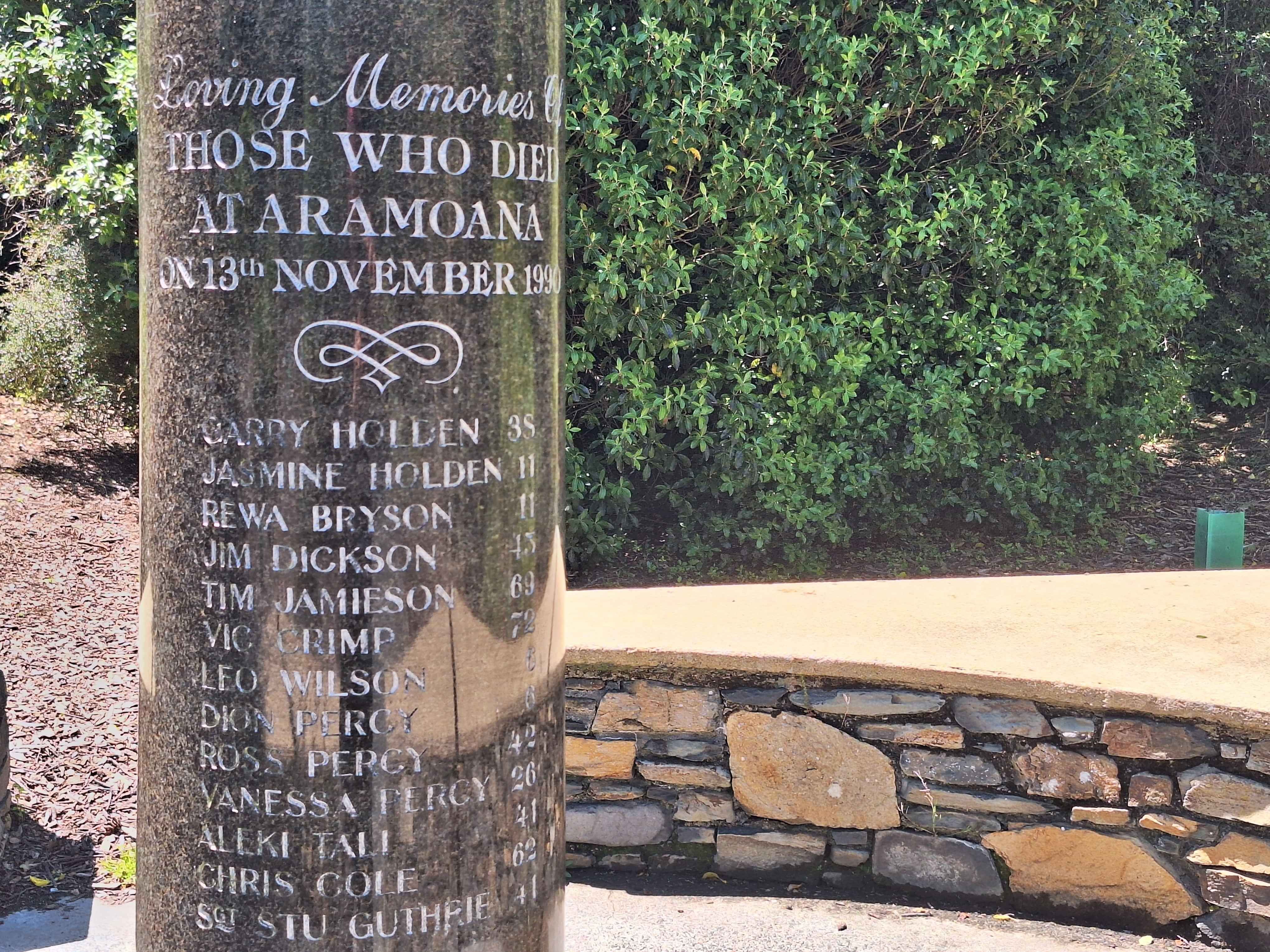
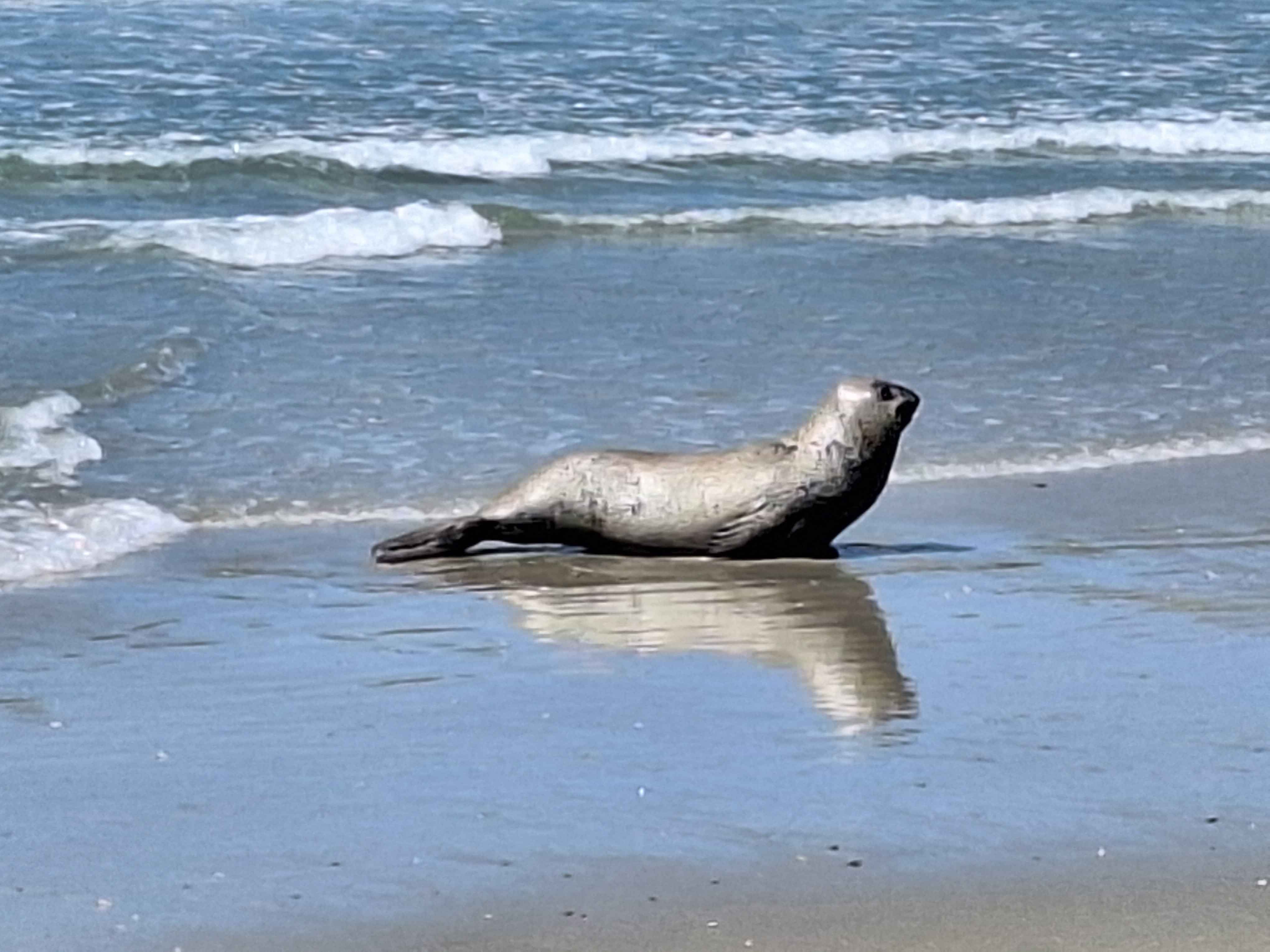
The oddly enjoyable, sometimes giddy drive around numerousBays along the northern Peninsula comprising 15-20kms of extremely narrow twisty turny road, with no outside edge for driving errors. Wrong steering wheel shift and you're in the briney. That aside, a wonderful wee beach township at the end by the name of Aramoana. Awful history here, with the deliberate death of 13 residents by a crazed local David Gray. The tribute brings back a flood of memories from 1990 when this was NZs biggest news event. Today it's reverted back to a sleepy beach vibe village, home too the joys of native Sea Lions and today even a leopard seal basking. Watch the wind here on the Mole or land outcrop. Sometimes vicious. It was nice to return to Aramoana again. Now 15kms of driving back with the outside wheel only 1 foot away from potential disaster. Thankfully no pressing vehicles behind me. Pure luck.
Wildlife Dunedin
Aramoana has the bathing seals, Sea Lions, penguins too I'm assured. Folk drive the 15-20km for this sight. On the southern Peninsula of Dunedin (the opposing Peninsula) is famous for the massive Seabirds that bred on the very outside tip of this Peninsula. It's quite the sight to watch them soar off the cliff face. Better too, when they're nurturing baby gulls in huge force winds which regularly batters the hills here. On the other side are various beaches housing more seals, sea lions etc. Both long Peninsulas offer continuous sealife viewing. But you need to get out of your car, which on my experience, many never do.
Legend in Dunedin
Possibly Dunedins most famous street where the Dunedin University students hold their massive flat parties, band gigs, even produce famous Rockstars in the band "Six60". I noted the police or council have installed a permanent spying camera at the end of this street. Not sure you get many student towns with surveillance like this. Concerning.
World's steepest
Baldwin Street remains the World's steepest street. The cheeky Welsh tried to grab this title, but stoic Kiwis simply uttered, Yeah Nah. The angle pitch at the top seems vastly steeper, or perhaps it's the exhaust action of getting to the top. A few obvious folk who hadn't had a good stroll recently, looked ghastly when they finally arrived with the ever growing masses. I wouldn't buy here as 12 hours a day, folk chatter away as they tick off this prize bucket list item. Equally surprised the Heart Foundation hasn't positioned a defibrillator box at the top. A few cars attempted the drive, even a campervan did the honours.
'Every Street',Andersons Bay
As I headed out towards Larnach Castle and the Royal Albatrosses, I glanced at a street sign, did a double take and recalled instantly, that is the Bain street. Who can forget it as we were as a nation fully involved with both the tradegy and eventual sentencing and pardon. David Bain, the young man on a morning paper run, came home to see his entire family of 5 had been slained. I read the papers, watched the TV news, read to books, even watched the film and follow up docos. It was inexplicable and intriguing. The house a massive double story villa, was eventually deliberately torched by the NZ Fireservice under instruction. The photograph here simply shows the street and view across to Dunedin business district. The street is incredibly steep, and the original land now houses a stately new home. The new owners have no association with the Bain family. Interesting to see the area and where infact the tragedy unfolded.
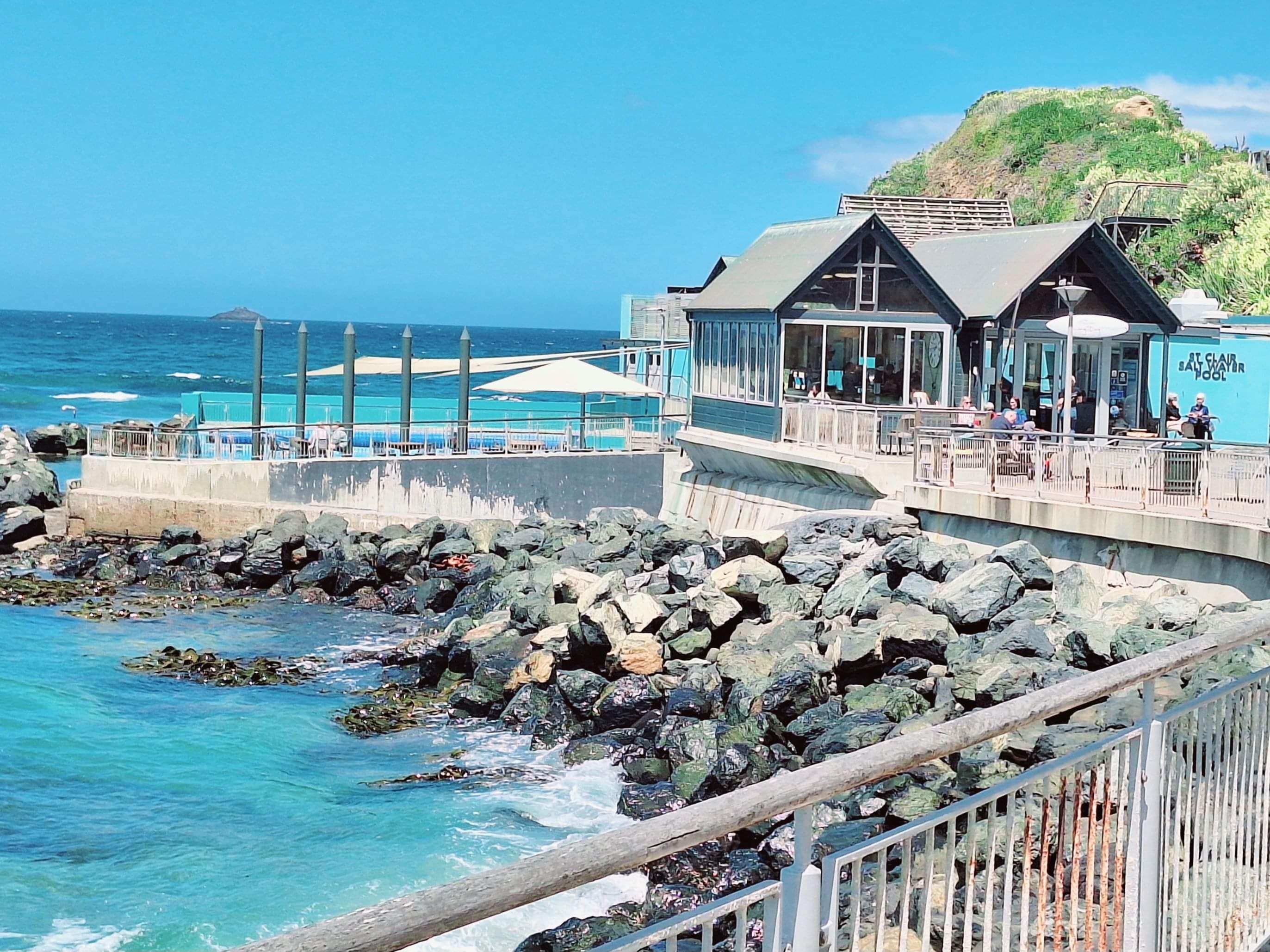
St Clair hot saltwater pools
Dunedin has an array of decent beaches. Admittedly chilly, but that doesn't stop these Dunedinites from plunging in the at times Arctic waters. At St Clairs, a hotwater swimming pool, drags in alot of the retirees, who seek warmer conditions. The entire beach front is noteworthy including a greenhouse styled cafe, the hotpools, a curved boardwalk and a notable old hotel, now a funky restaurant seaside. Top Tip...the only 2 saltwater pools nationally is here, and Parnell Pools in Auckland. The salt creates better flotation for swimming.
Tunnel Beach
I'll go our on a limb here, however the experience and discovery of Tunnel Beach was beyond superb. Infact 'stunning' is easily applied to both the hidden cove and hidden staircase, buy equally to the zig zag walk down that offered the most impressive seascape. Allow 1 hour return and and hour gazing around you. The cove itself would fit nicely into any desirable travel advertisement. It's quite jaw dropping. Do watch out for lounging sea creatures who frankly hide around the organized looking Boulders on the beachfront. You'll admire the handchiselled passage way, that a dad cut into the rock to allow access for his daughters to the beach below. Sadly one daughter drowned on his very special family Beach
Brighton Beach
This seaside bach or crib filled beach is exactly how beach suburbs used to be before the designer bach/crib became to new norm. You know the massive glass filled front room, double or triple storied with fancy motors in the driveway. Here it felt more old school. I preferred it. Beautiful white sand beach to complete the picture. Sea Lions, too.
Taieri Mouth
The 15km drive along the beach foreshore from Brighton Beach is a special gem. No houses to block the view, just miles of direct beachfront the entire length.
Benhar
Once renowned as a potters paradise where massive kilns burnt all day and night glazing anything pottery. Sadly this industry in small towns has disappeared. Look at the once famous New Lynn potters who used to make thousands of teacups for NZ Rail. Now gone, or at least reduced in capacity. Benhar kiln and factory is literally gone, and now being demolished by age. Pottery items used to be shipped out by rail, now long gone.
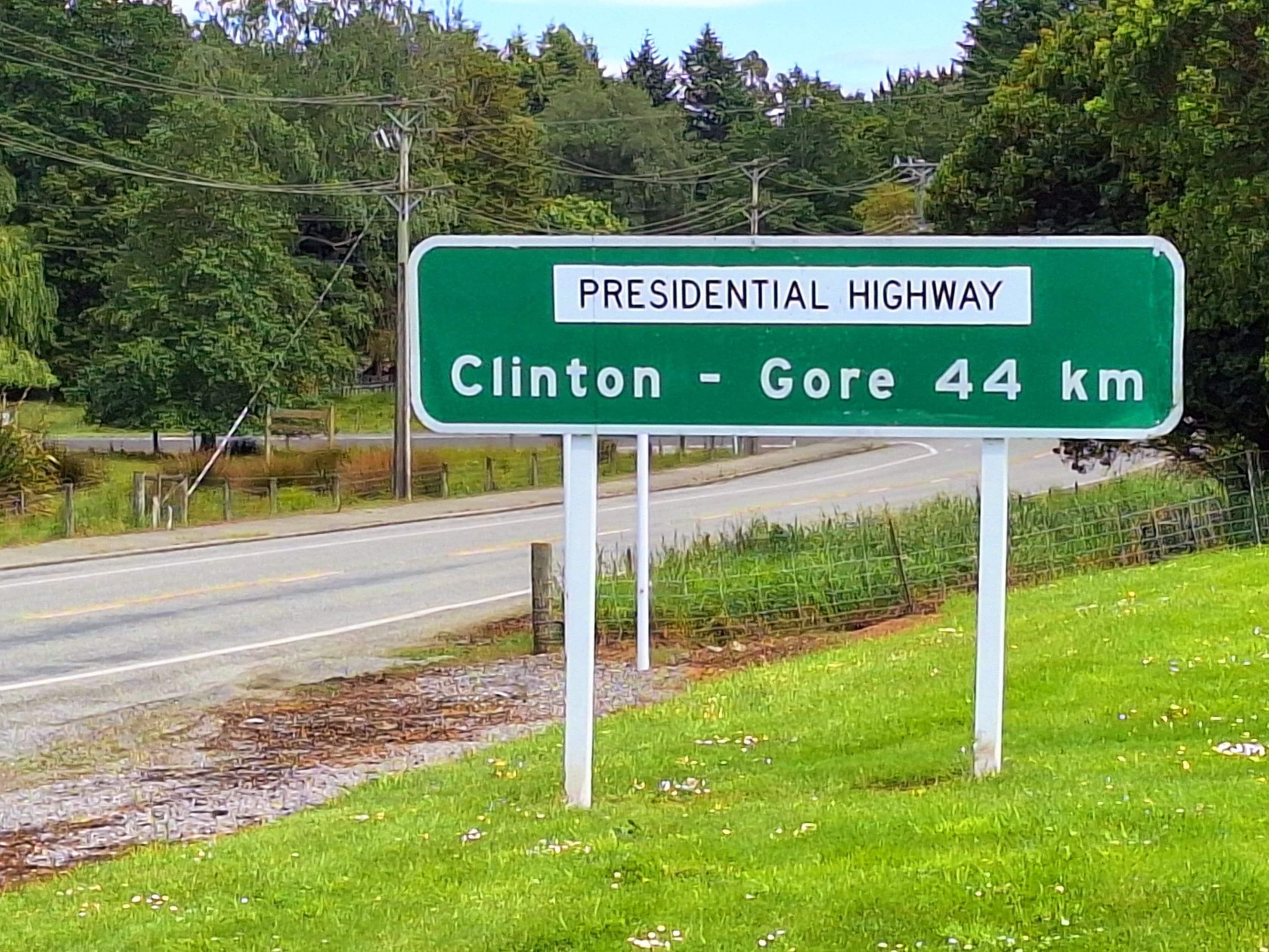
Clinton-Gore
Known as the "Presidential Highway" after famous American electoral running mates for US Elections of past years. Funny for 'Us', with salt and pepper in our hair. New generations might not get the parody.
Gore
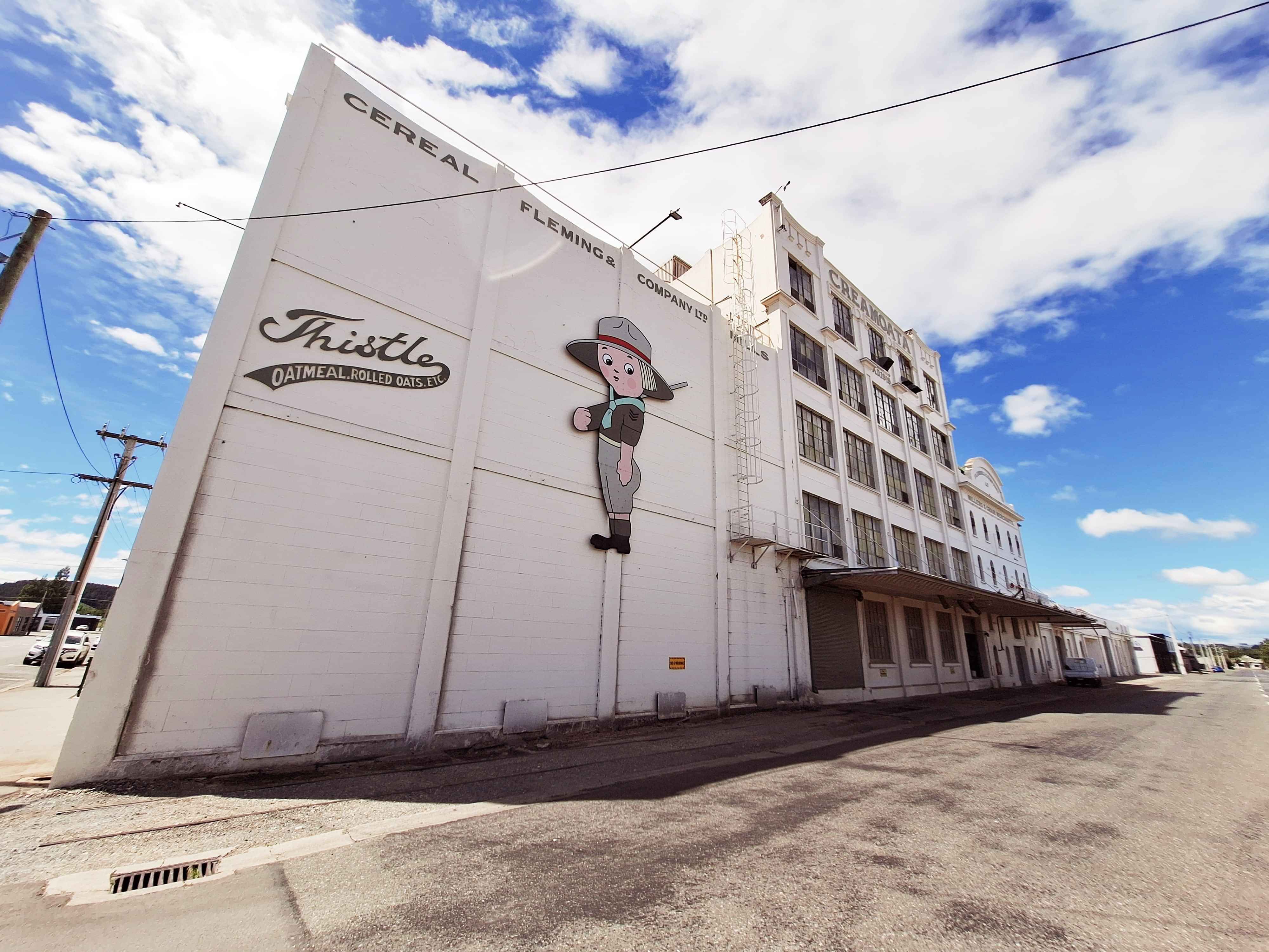
Home to NZs grandest Country music festival. Although Methven in Canterbury and Martoj offer similarly brilliant country music festivals too. Gore have gone one step ahead by encoding hand prints in concrete of world country musicians. Kenny Rodgers took my fancy. The other nig ticket items here is fishing for brown trout. Apparently Gore in a recent competitive notion challenged Turangi in the North Island to see who could land the most Brown, and apparently it was tied. However Gore suggests they don't need to spawn trout artificially speaking as do Turangi. It appears to natural fish spawning still works best here in Gore. Gore is also known for its once illicit sly grogginess and proudly host the Hokonui Moonshine Distillery in an I-site. Home also to that 70s oat cereal brand, Creamoata.
Invercargill
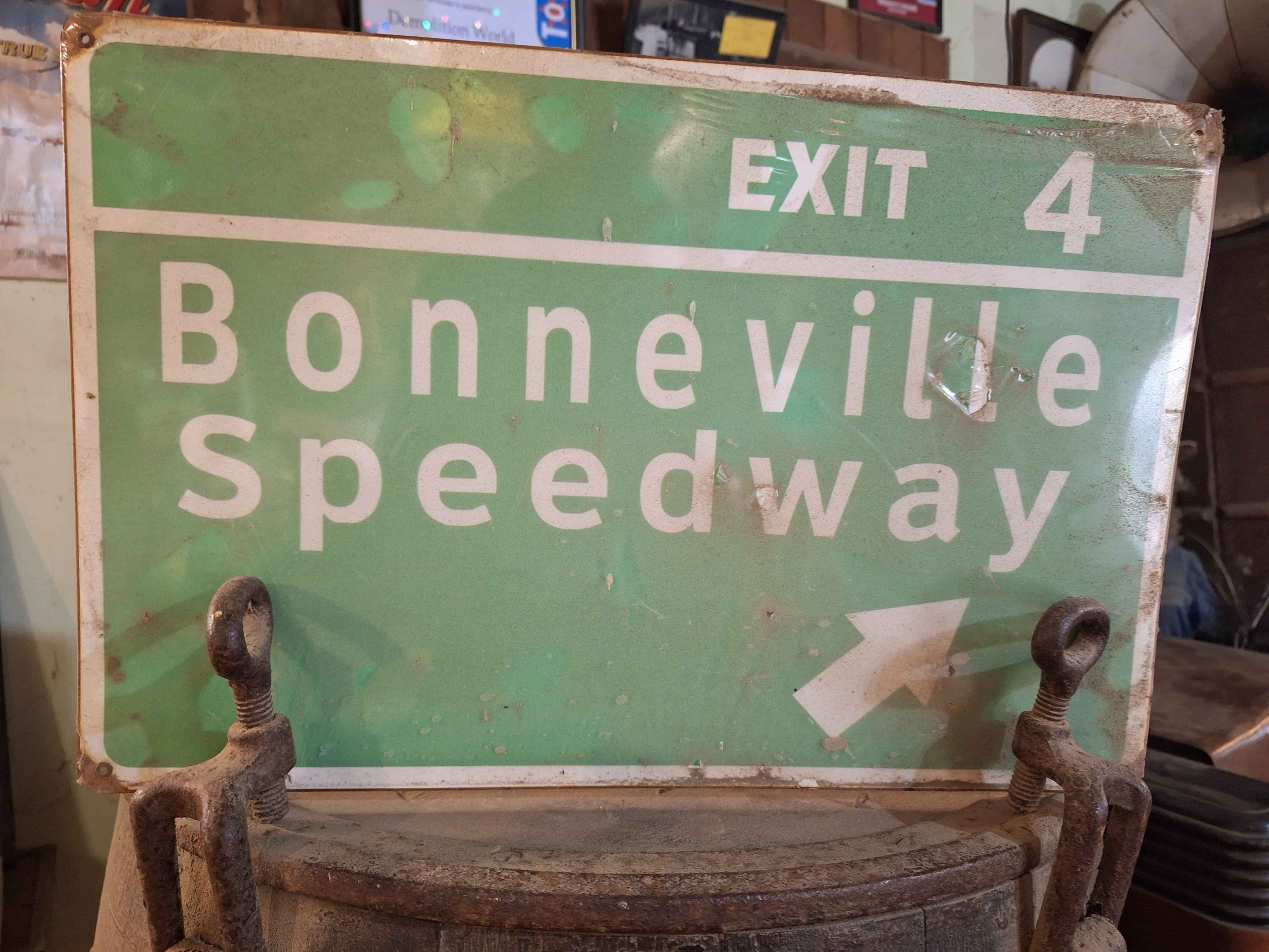
Most famous for The Munro Special, a local speed enthusiast, Burt Munro who rode tye worlds Fastest Indian motorcycle on the Bonneville Salt Flats and Speedway in Utah in the 1950s. His record hasn't been surpassed todate. His actual bike sits with pride at E Hayes and Sons in central Invercargill. A statue also sits at Queens Park. A tiny aspect of Burt also sits out at the fun and fabulous Demolition World. It's worth a peak in as you head down the highway to Bluff. For more Burt Munro, check out the annual beach racing on Oreti Beach 10kms to the South.
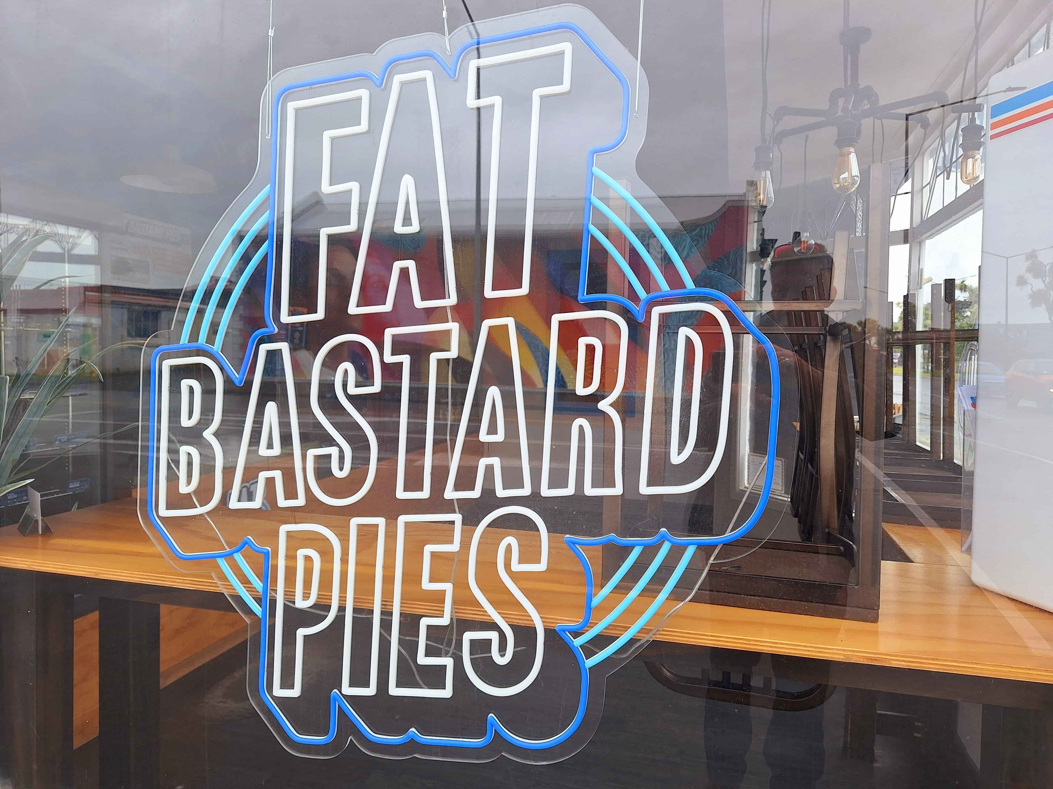
Invercargill fat Bastard pies
I'm surprised I havnt covered the Pie situation in NZ and it's taken me the very bottom of the South to even mention it. Albany in Auckland has the current supreme meat pie award. Fairview, South of Lake Tekapo demands attention. But so does Invercargill with the classically comical Fat Bastard Pies.
Demolition World
Heading to Bluff? You'll be daft not to visit this seriously fun establishment where the owners have created the quirkiest living town out of clients demolished buildings. I was hesitant to visit. But 2 hours later, I was in raptures over the laughs I got as I went from building to building. It's so bizarre and outrageous in its content, it's actually brilliant in its execution. Top Tip...Just visit. No set entrance fee. Simply a donation. Brilliantly fun.
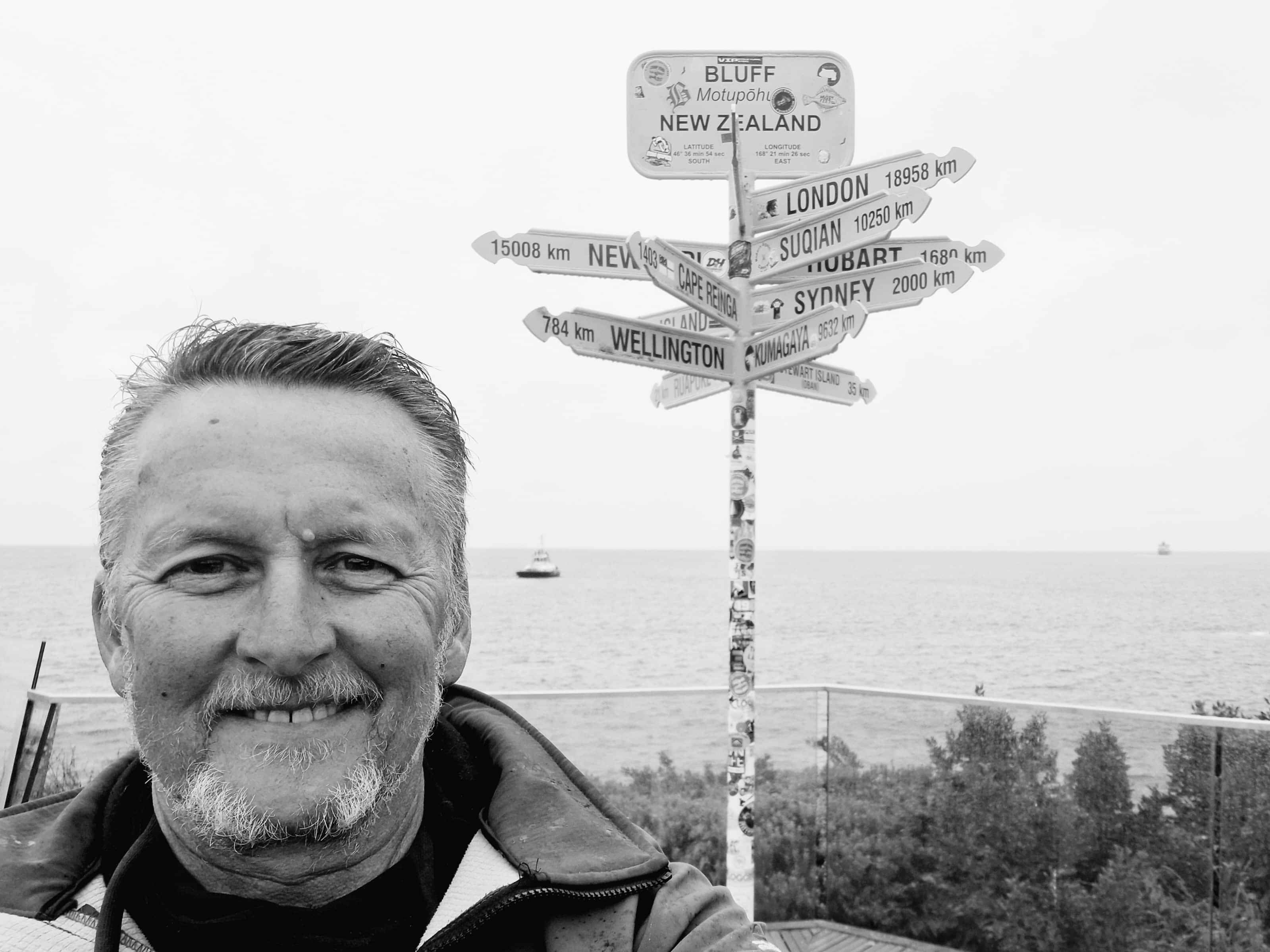
Bluff, end of SH1
Bluff has the dubious honour of experiencing NZs most rainfall and yes, it rained the moment I pulled up at the famous direction panel. I guess the grey tone of the photo summed up the atmospheric conditions. So I've made it once again to the end of State Highway One. Most think it's the most southerly. However Slope Point on the edge of the Catlins Coast had that honour.
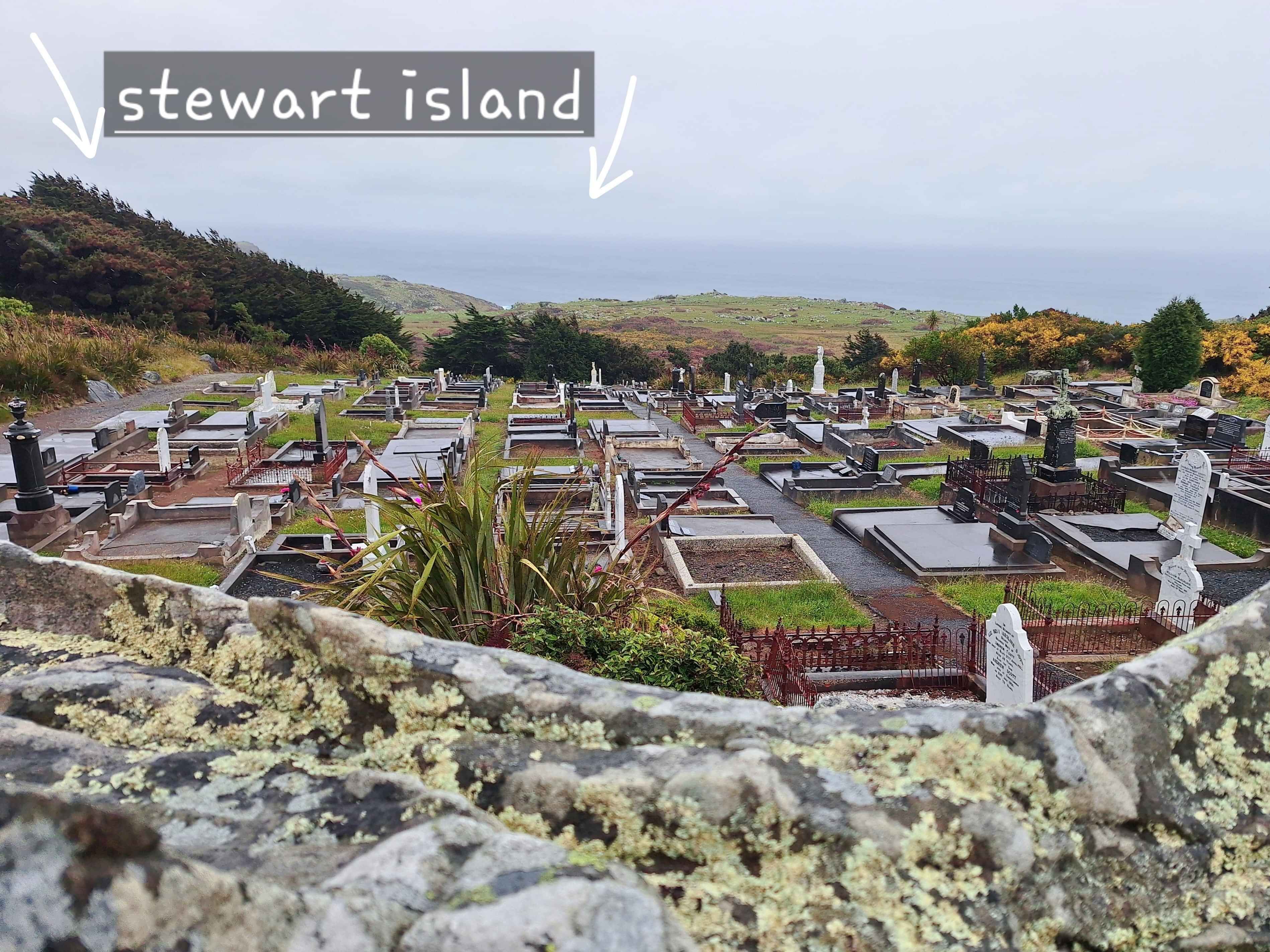
Bluff, best view on a good day
If you catch Bluff on a good sunny day, then head too the towns cemetary for delightful views across the 20 odd kilometres (towards the last of the 3 major islands that make up NZ), too Stewart Island. This cemetary of note, has the tombstone of James Spencer who founded Bluff in 1824.
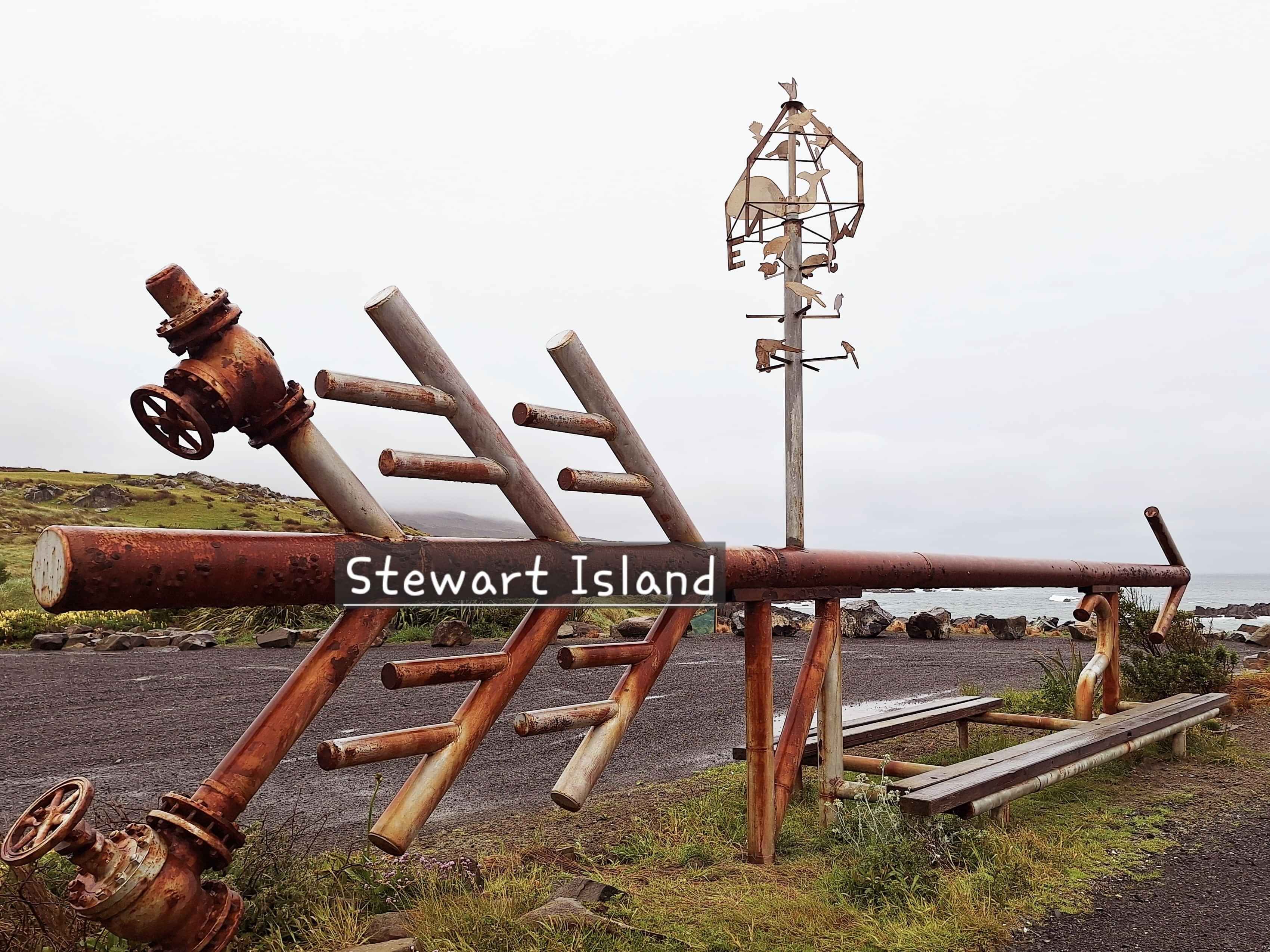
Stewart Island
Another sketchy day on the ocean between the Mainland and Oban of Stewart Island. It's a rough passage in Foveaux Straight quite regularly, so getting bounced around on the 39km wide journey is expected. Call me a soft sod, but dodgey water crossings aren't for me and I've done a few, so my hesitancy is valid in my books. Stewart Island is one of the only environments where the Kiwi Bird isn't overly scared of humans. I'm not sure they just venture into Oban the town, but I'm assured they do mill around in public.
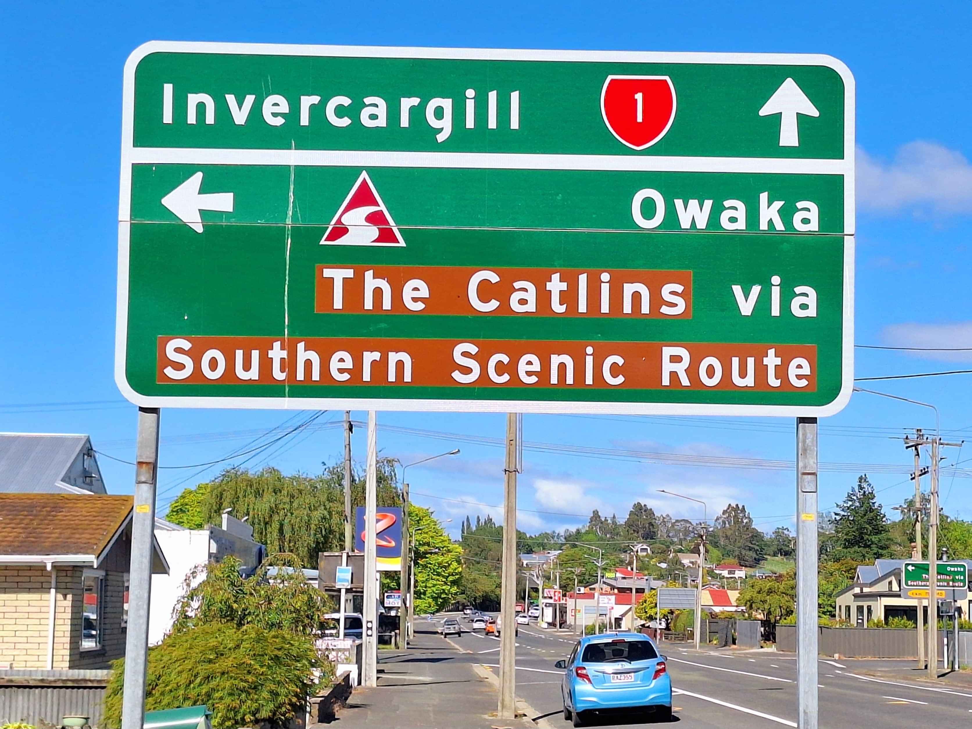
The Catlins
The 200km Southern Scenic Route from south of Balclutha through too Slope Point is a MUST Do. I've travelled this part of the Mainland on 3 occasions. Its essentially thebackroad too Invercargill and Bluff with highlights galore. Including the Teapot Collection in Owaka, the engaging Bus Museum by the name of the Lost Gypsy Gallery at Papatowai, the stunning nature masterpiece at Nugget Point, the Tautuku estuary boardwalk, venturing down a forest lair where enormous sea elephants rest in the forest, the notable Catherdral Caves, the massive waterfall that truly is named Niagra Falls, the adorable School Cafe, the Penguins at Purpoise Bay, the petrified forest at Curio Bay, NZs most Southerly aspect at Slope Point and the twisted trees at Waipapa Point Lighthouse including tragic ship cemetary nearby. It really is a roadtrip worth the effort. Top Tip...I reluctantly circumnavigated this route due to conflicting travel timetable. But I'd definitely return, next year perhaps.
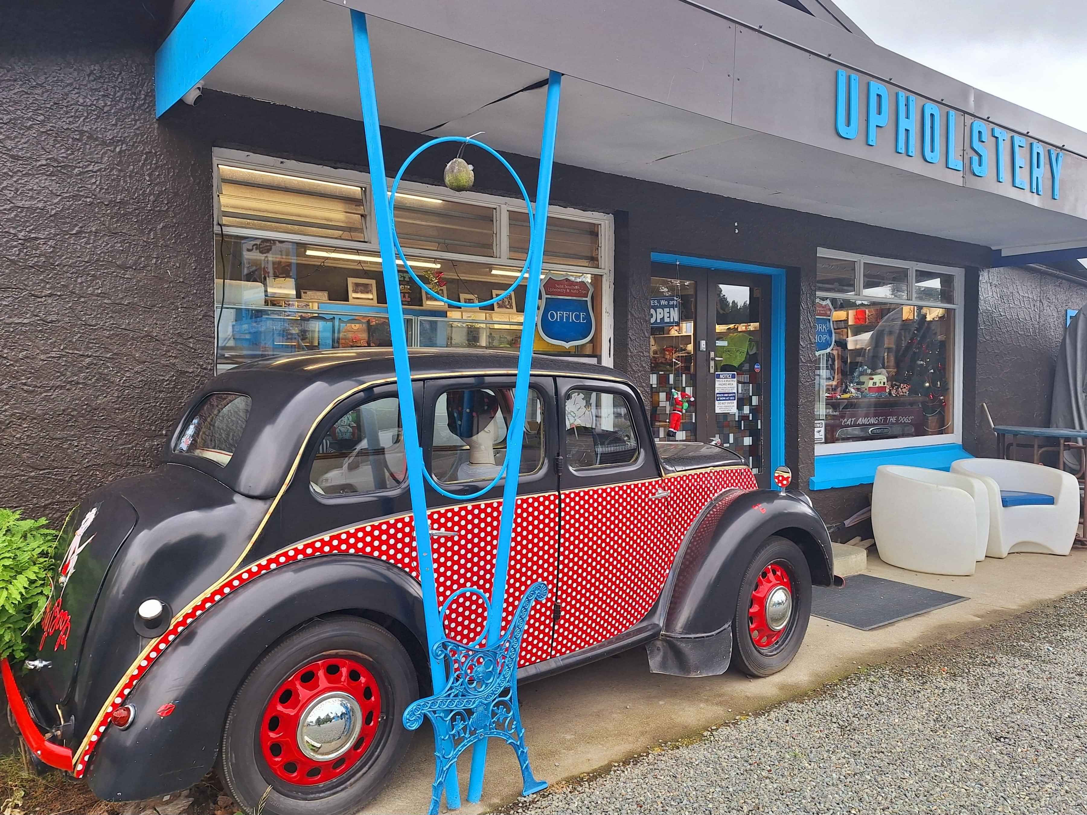
Dipton
There's a handful of small towns between Invercargill and Kingston on the southern arm of Whakatipu Lake of interest. Dipton has only 2 shops, but one of these in a rural farming area specializes in hotting up classic cars, even campers to their former glory through this Upholstery Business. I stopped mainly to see their revived Ford Popular car pf 1948 as it was the exact same model my parents owned in the 1950s. Agh, memories, aye.
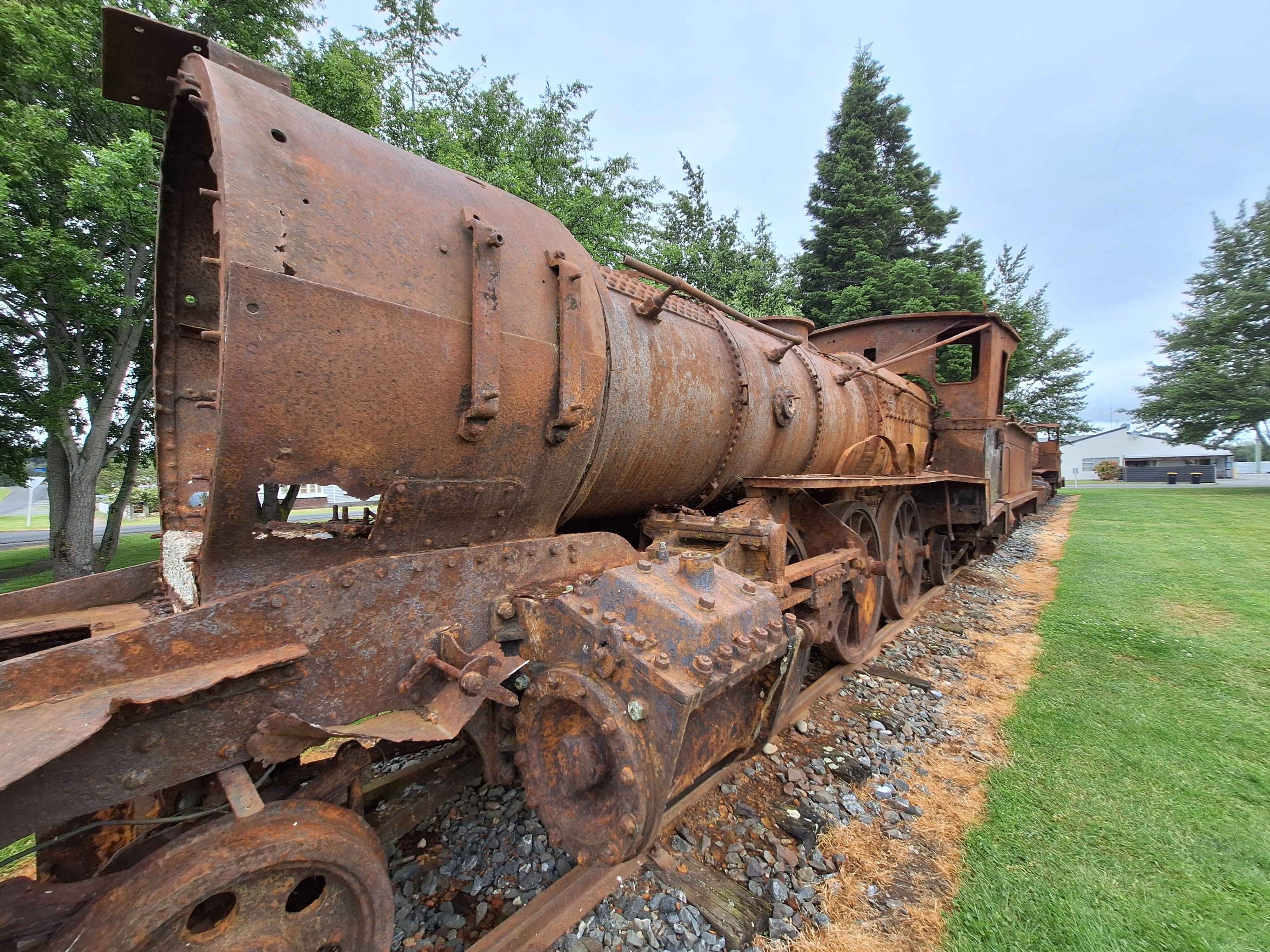
Lumsden
Route 66 is on my to do list in the USA, however Route 6 in Lumsden has their own nod to the illustrious highway here in Lumsden, Route 6 the cafe. Across the road is a collection of heavy metal, as in caulking train engines. Some rusting away and some perfectly rebuilt and under cover. Lumsden also connected to the Around the Mountain bike trail of 186kms that encircled the Eyre Mountains. Essentially a Route from Kingston, through Lumsden and out too Queenstowns Walter Peak. Epic.
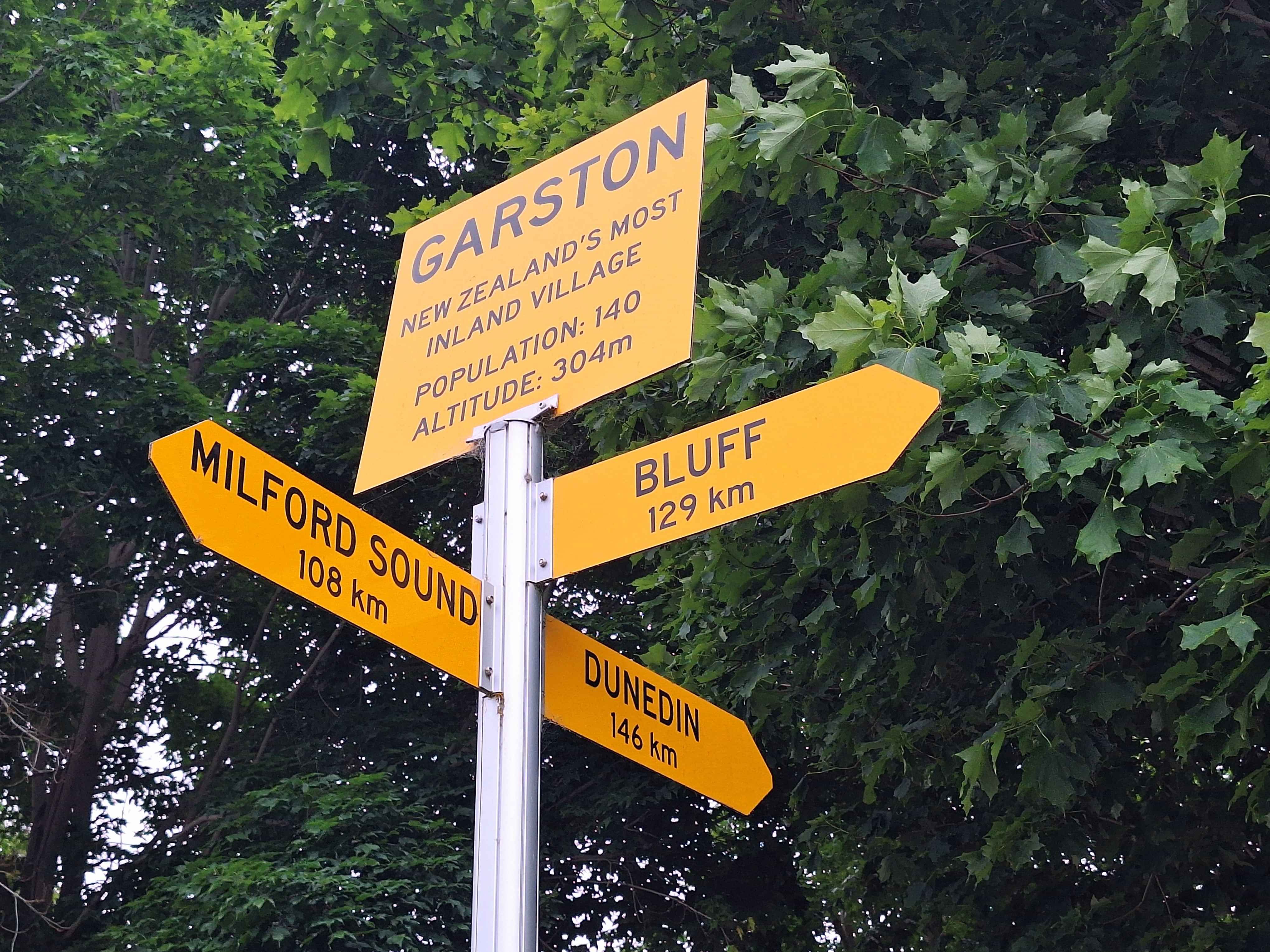
Garston
New Zealands Most Inland Village. Says it all.
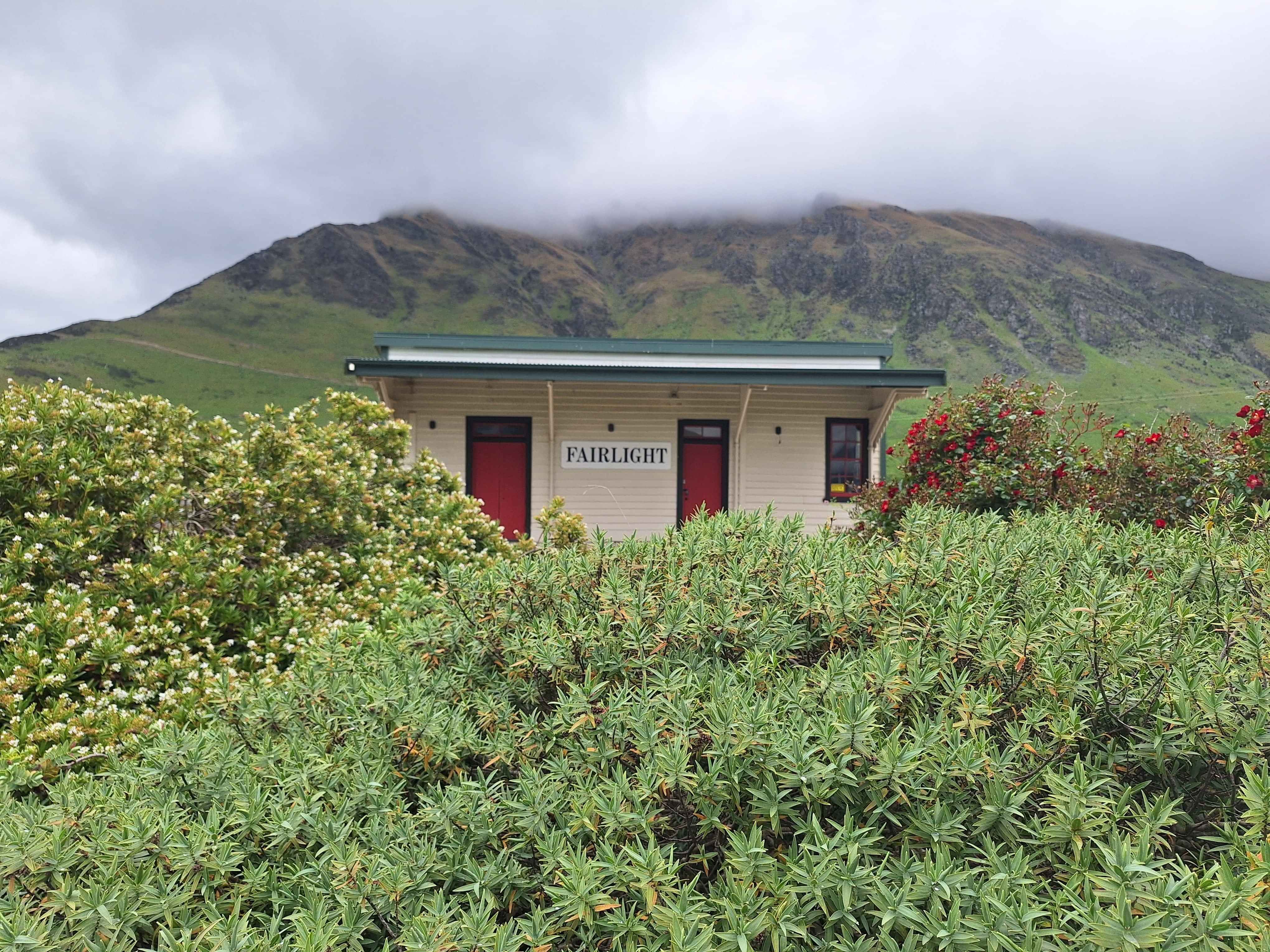
Fairlight
A one station town with no inhabitants. As seen on TV in the Lotto advertisement. Essentially it's a turnaround station for the touristy Kingston Flyer Steam Train from Kingston to Fairlight.
Kingston
The southern arm to Queenstowns massive Lake Whakatipu. Home to the 1920s Black Steam Train, the Kingston Flyer.
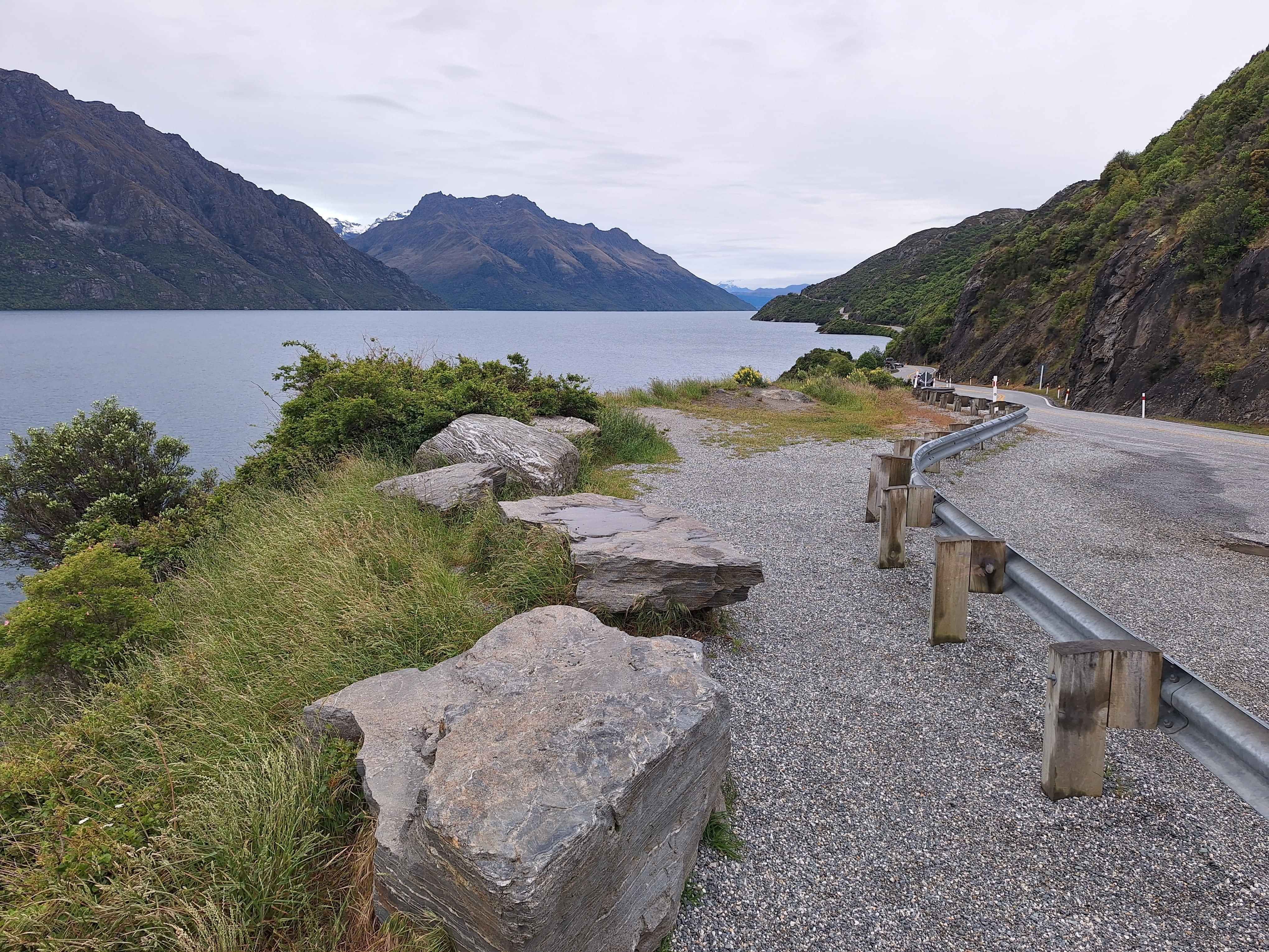
The devils staircase
The halfway point of interest on SH6 between Kingston and Queenstown. 46km sweeping direct lakeside roadtrip on a 100kmh highway, and locals oddly hit the 100 continuously. Watch for bends and a watery exit. The traffic moves at pace as it's the only roadway taking thousands a day towards Te Anau and Milford Sounds. Top Tip...drive at early morning and you'll enjoy 46kms at your pace, with limited following traffic. Way better.
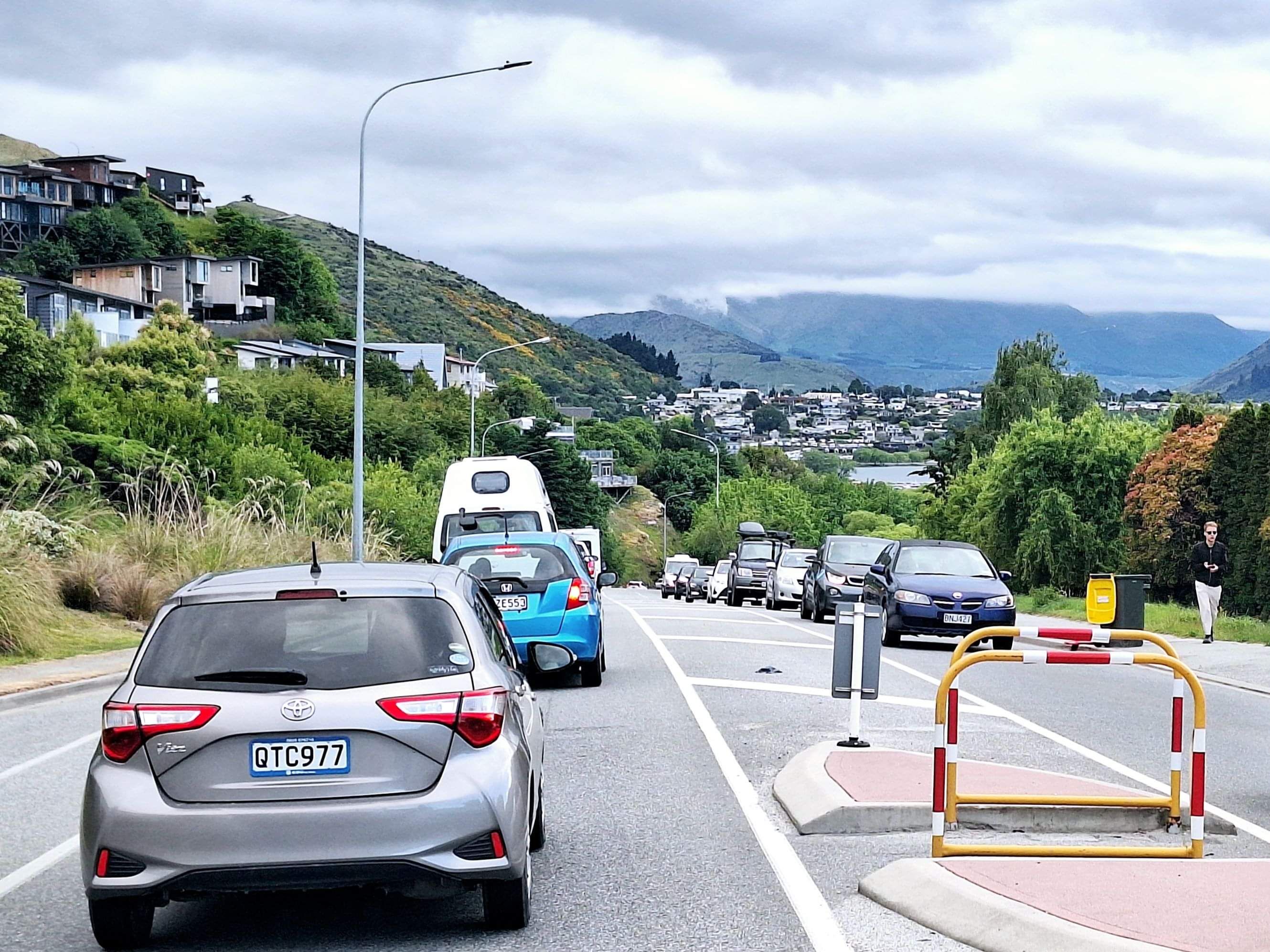
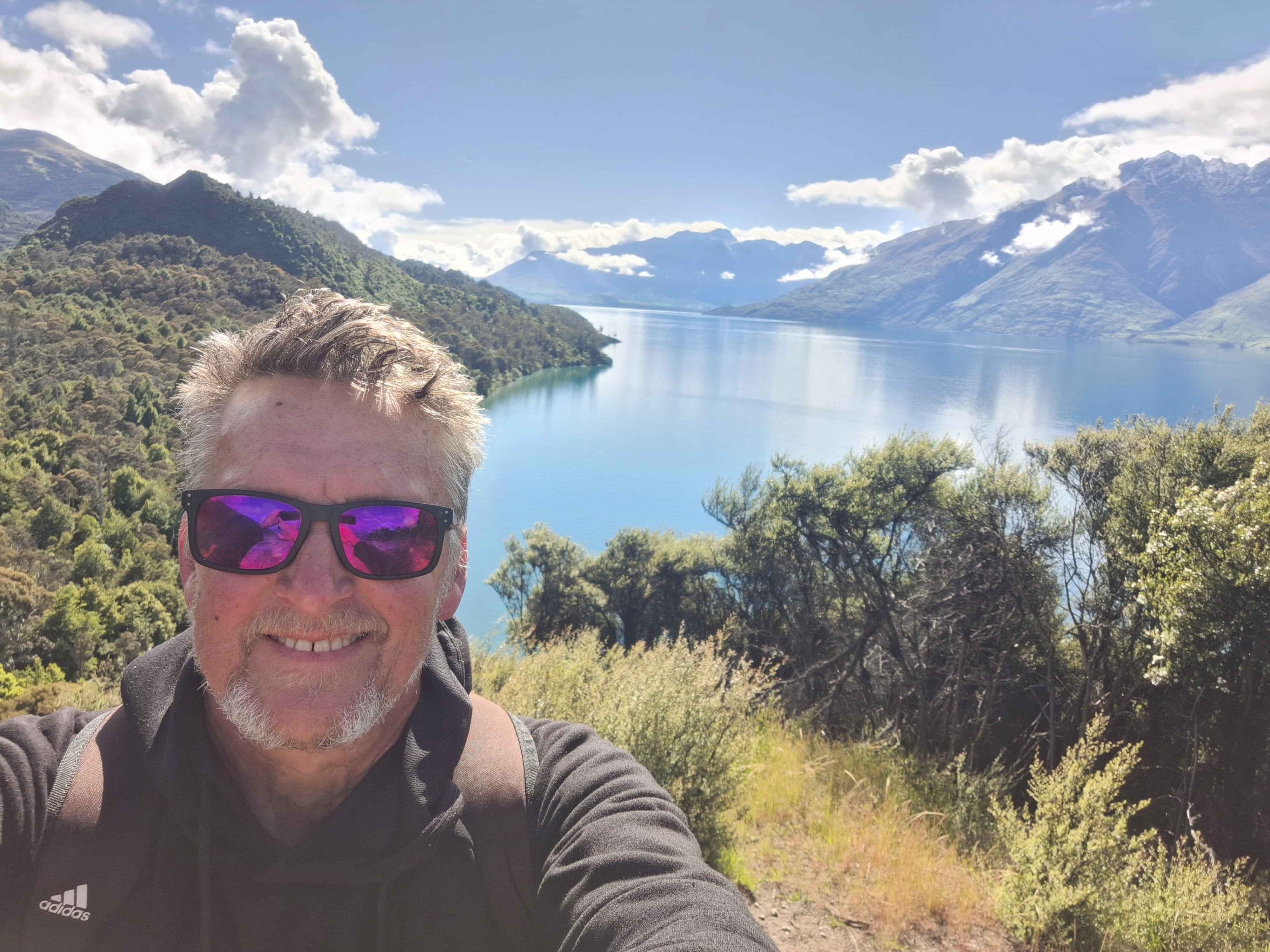
Queenstown
If you enjoy the traffic queues of Big Cities, here's Central Otagos version. I essentially keep on driving to either Glenorchy or too Cromwell. Top Tip..Its fantastic city if you fly in, fly out. Taking a vehicle is nightmarish for parking. One of NZs truly beautiful spots, if you can excuse the traffic. Not being bitchy, just 'been there, done that'. Top Tip...take the Queenstown hill walk or the steep drive up Mount Remarkable. For the city seekers, Fergburgers is key currently. Also take the steep ascent in this cities Gondola. Brilliant, but takes your breathe away. Great city, so do visit. I today fled the city for the 50km drive down the western arm too Bob's Cove and eventually Glenorchy and Paradise.
Bobs Cove
10 to 15kms out from Queenstown sits a hidden gem of Bob's Cove. Only a tiny green Conservation Department sign says look at me as you hurtle down the 50km highway to Glenorchy. Worth stopping and having am amble of say 40 minutes too the top of the small peak.
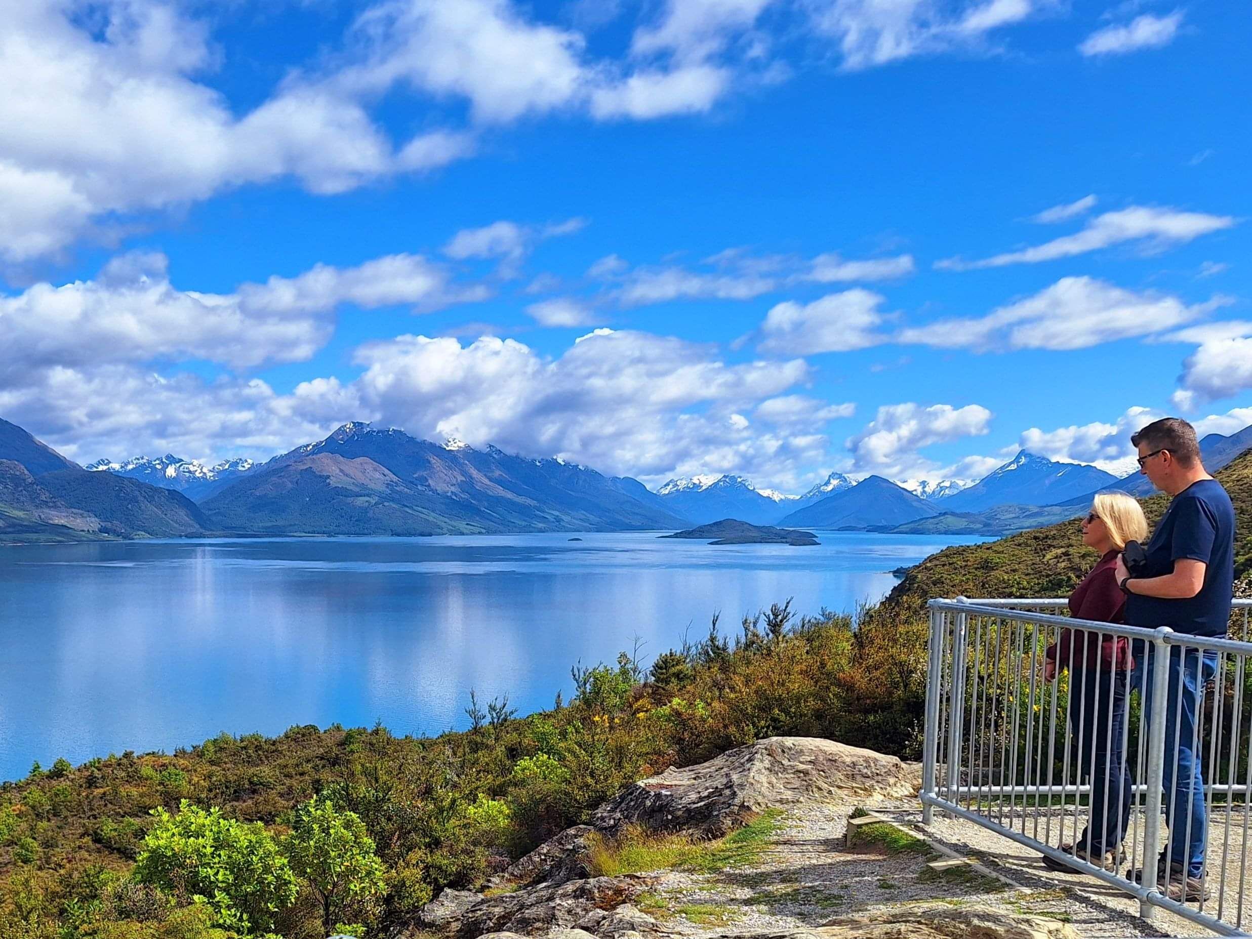
Road to Glenorchy
Possibly NZs best roadtrip road as you glide for 50kms between a lakefront and massive mountain ranges on either side. The Milford Sound Road gets an equal billing. Your preference.
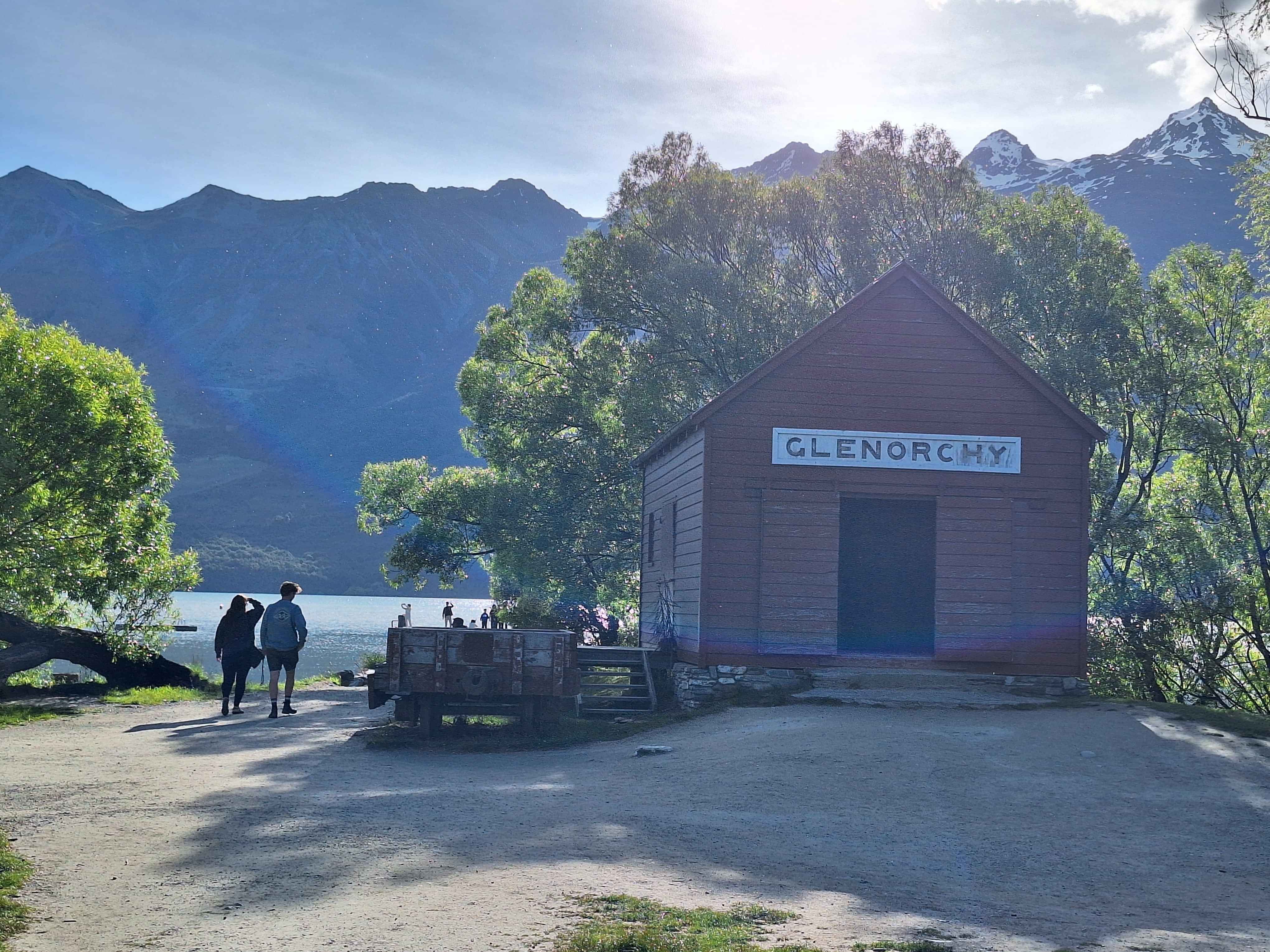
Glenorchy
Number One most photographed image in this tiny town. Queues form to get couples snaps infront of the Glenorchy Red Shed. For more freedom from the masses, the number one activity for me is the Dart River Safari whereby you'll be whisked up a meandering ice fed riverway too the forest. Then fed and watered and sent back down using the current in an inflatable kayak 5 out 5 tour. Pricey, but memories of this wil definitely remain. Mountain biking and riverside horse treks are also favoured here. I ended up with a gentle giant on my river amble.
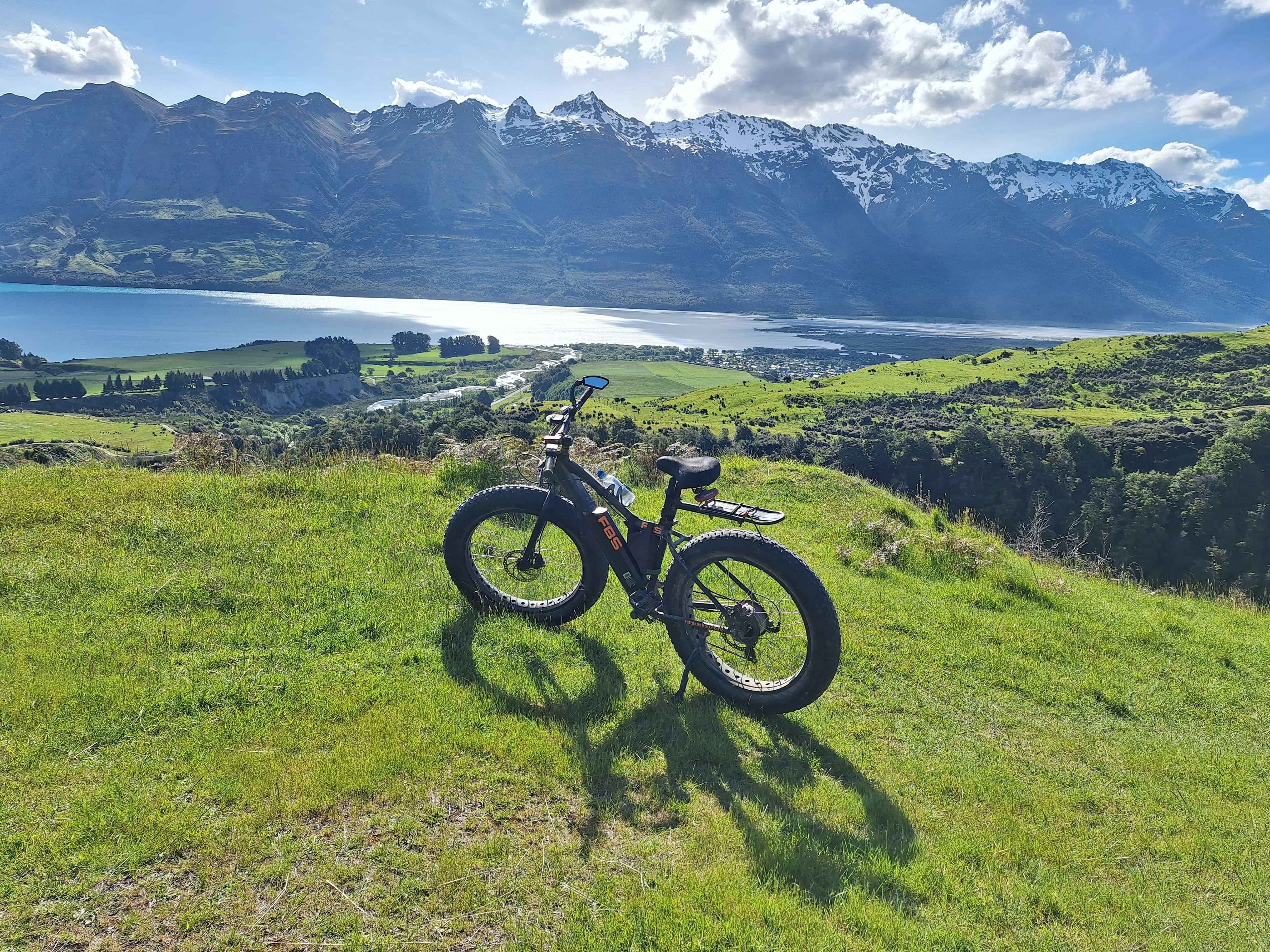
Hike or Bike Glenorchy
If you supply mountains, adventurous folk will form bike and hike trails. So, up I went.
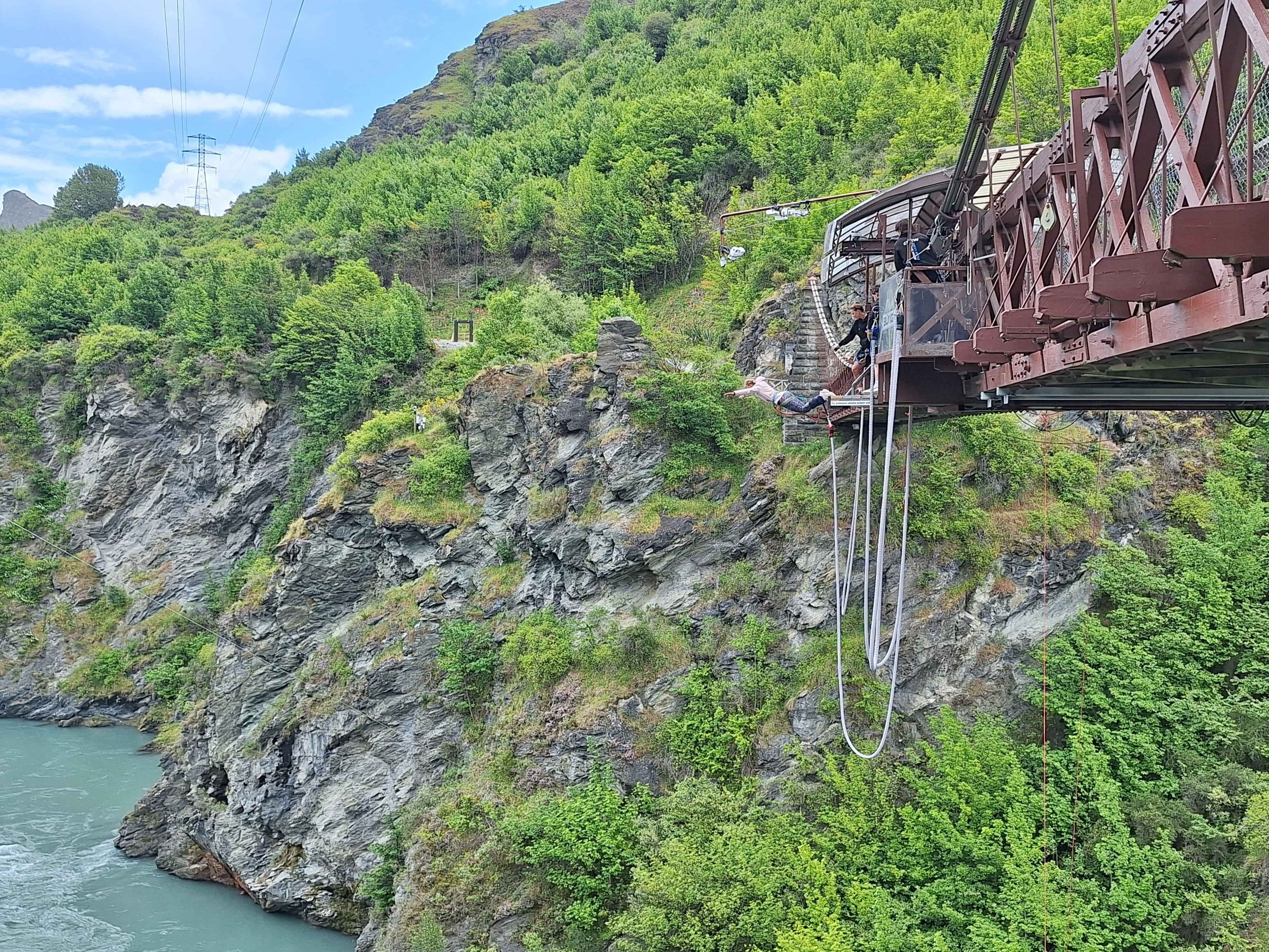
Gibbston Valley
The only stop I make as I crawl through Queenstown is at the river hosting mad Leemings jumping off a historic bridge, towards an icy river below, with only one rubbery rope tied to your ankles. What could go wrong. Thankfully nothing. But brilliant entertainment.
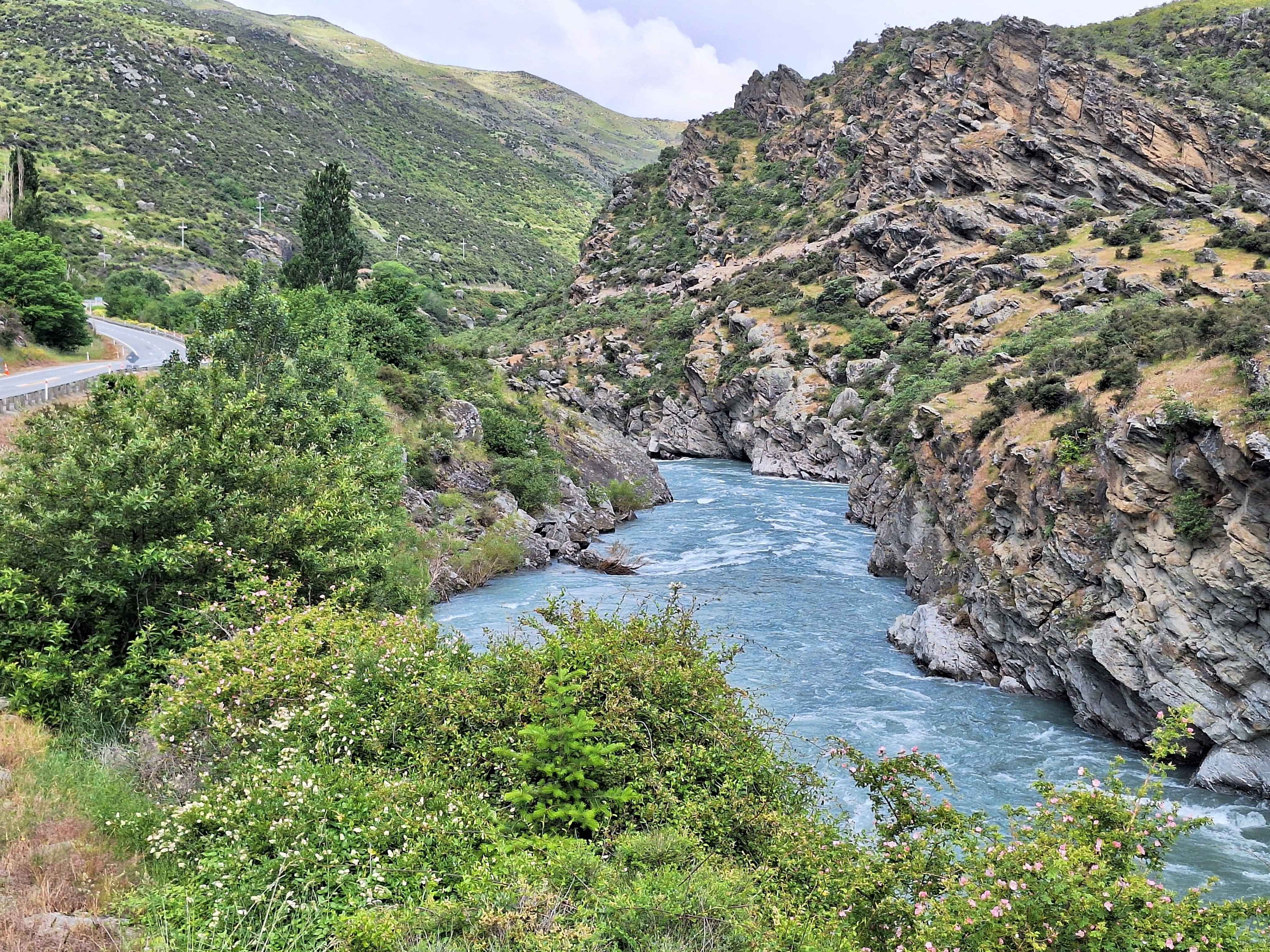
Roaring Meg
A famed drop of local Pinot Voir, or the squeeze point of the riverway between Queenstowns Gibbston Valley and Cromwell. The highway equally squeezes between two sets of mountain ranges for many kilometres. More twisty driving.
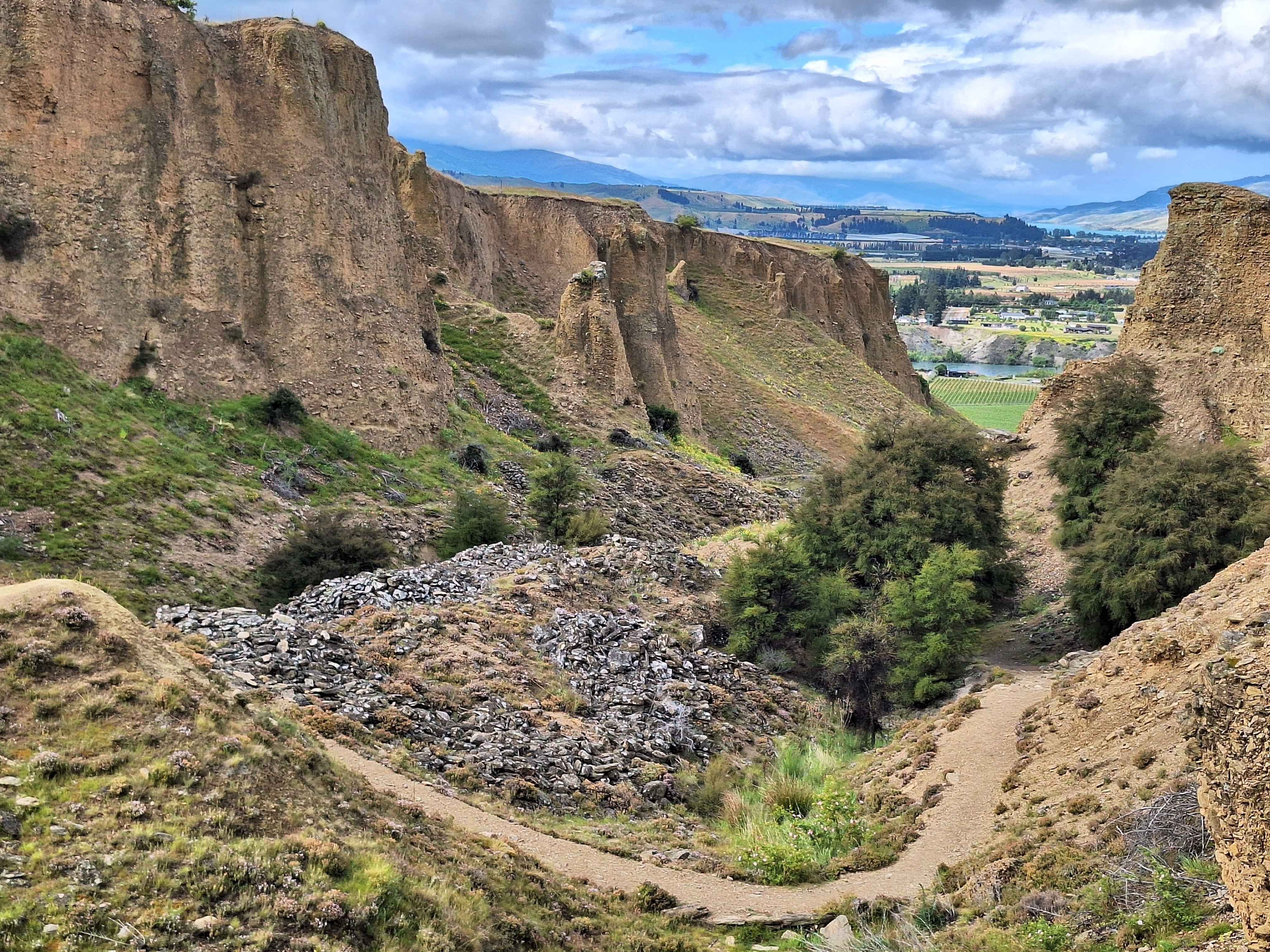
Bannockburn
Take a large fire hose and aim it directly at a hillside. Essentially that's what the Goldminers of 1900s did here and all over Central Otago. They made hillsides disappear in their search for gold. Today a fabulous historical walkway through these Tailings is a must do. Bannockburn also home to top end Pinor Noir grapes and brands you'll go, wow, that comes from here.
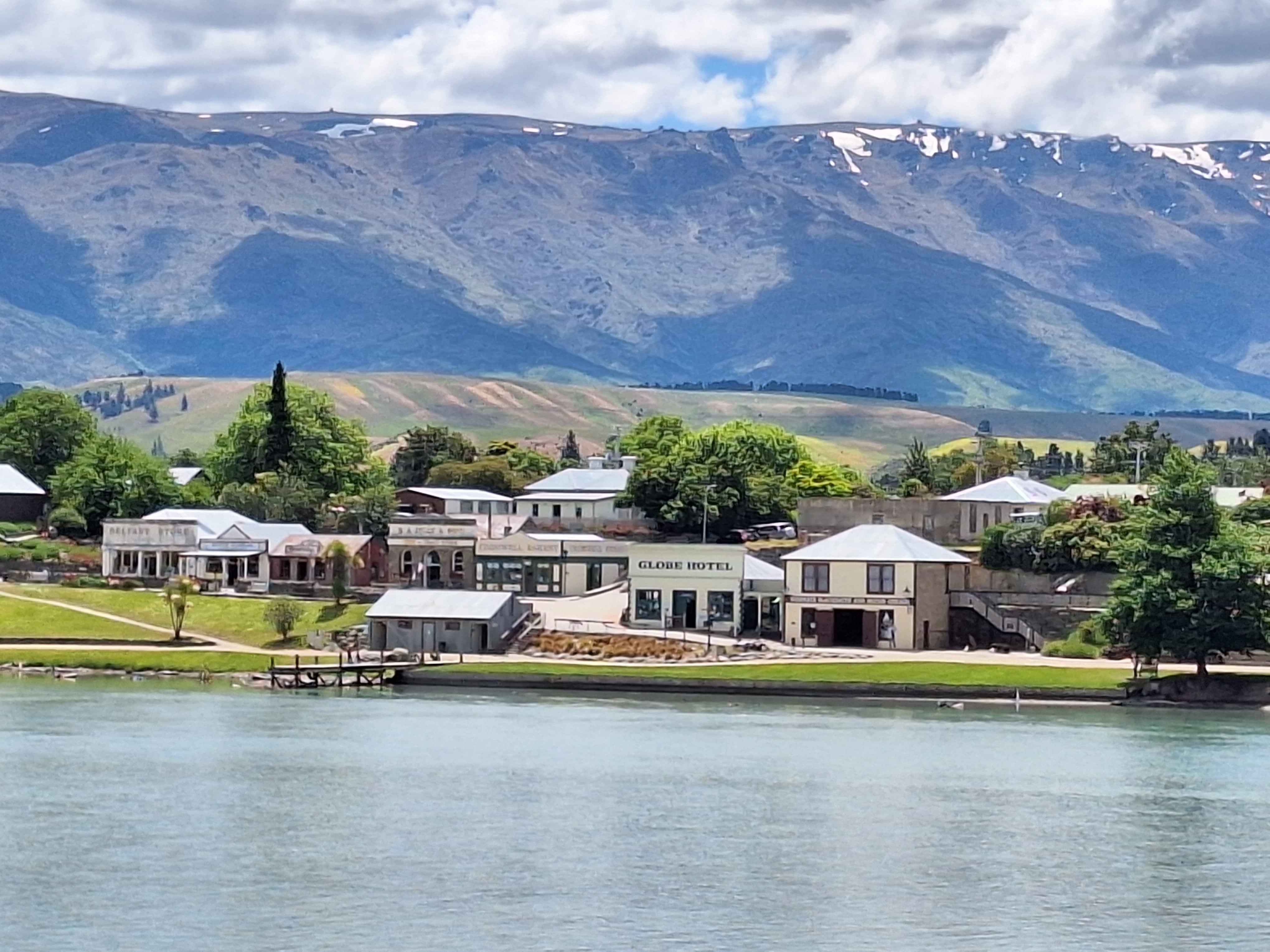
Old Cromwell Town
As one of NZs Think Big projects, the decision to flood Cromwell Town was instigated in the effort to produce water driven electricity via the downstream Clyde Dam. Most of the city now lies in this lake. This legacy is a reminder of what the town looked like. We'll maybe just 10% of this town. Hard to believe in recent times we deliberately flooded a town, but we did. Now a tourist mecca of Cromwell.
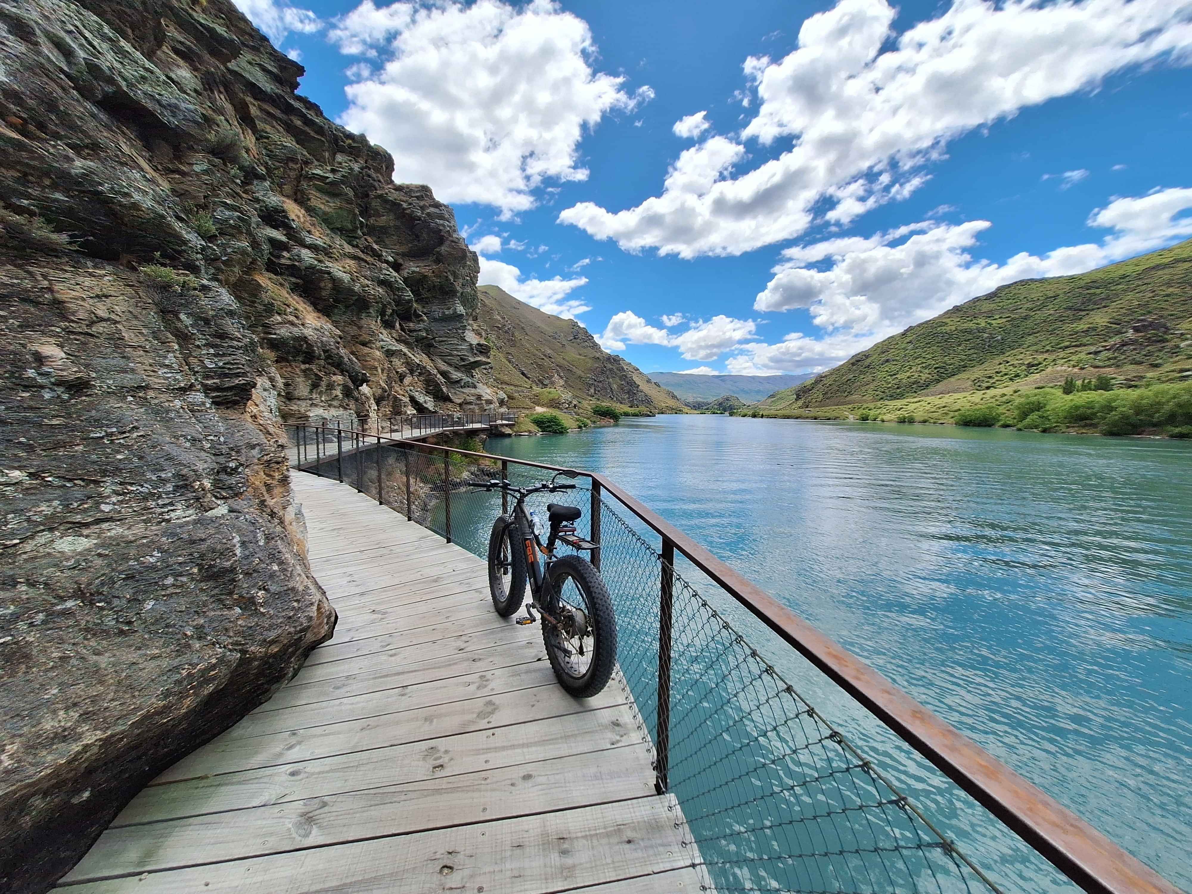
Lake Dunstan River Trail
One of the new gems of this region was the building of this river pathway from Cromwell too Clyde, some 50kms in length. It's popular and understandably so. The engineering of the rock hanging bridges will blow your mind. The trail takes you directly right alongside the river with plenty of bridges, occasional narrow paths and even a coffee house or coffee boat around 20-25km in from both start points. The experience is a must. Some folk even hike it. Most come by electric mountain bikes, and frankly why not.
Cromwell
If I was ever too shift too Central Otago and it's most tempting, I'd plumb for Cromwell. It's set between far apart mountain ranges so you don't feel hemmed in like possibly Queenstown and enjoys a river frontage. Plus the crowds have been kept away due mainly to massive parcels of farms on the major hillsides. It's got something about it. Don't become an overflow too Queenstown. I'm sure it no doubt will. Currently home to grapes and fruit.
Clyde
Known for it's rather delightful small goldfields township, the Clyde Dam, the beginning and or end stages of the Otago Rail and Dunstan Lake Bike trails.
Alexandra
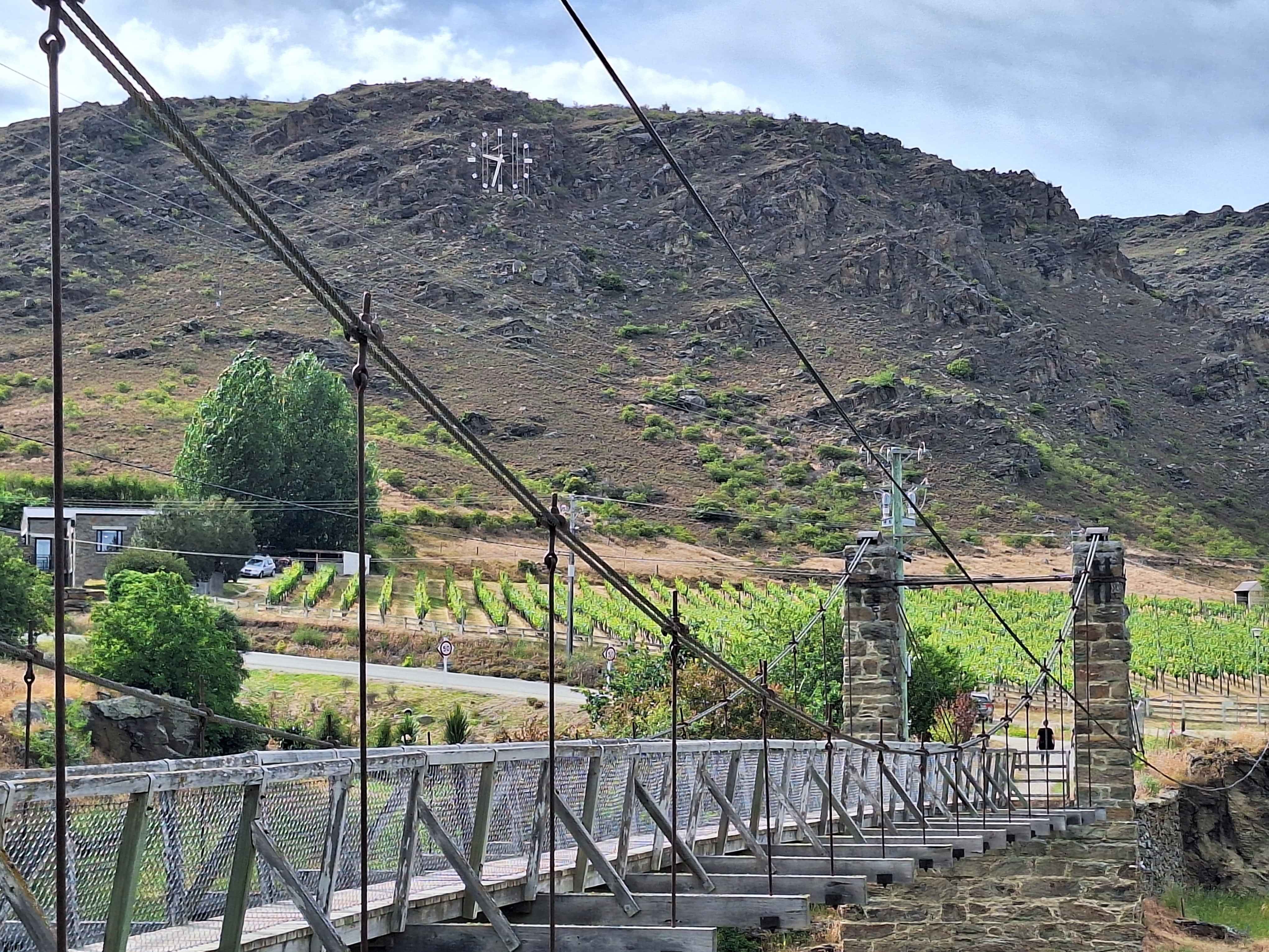
Not only my Mums middle name spelt correctly, but home to a Clock on a Rock. Apparently keeps immaculate time too. Add in a vineyard, rugged rock face and a swinging bridge and you'd think it's an artists playground. No easils today, however. Sadly the barn style coffee house across this bridge folded after Covid.
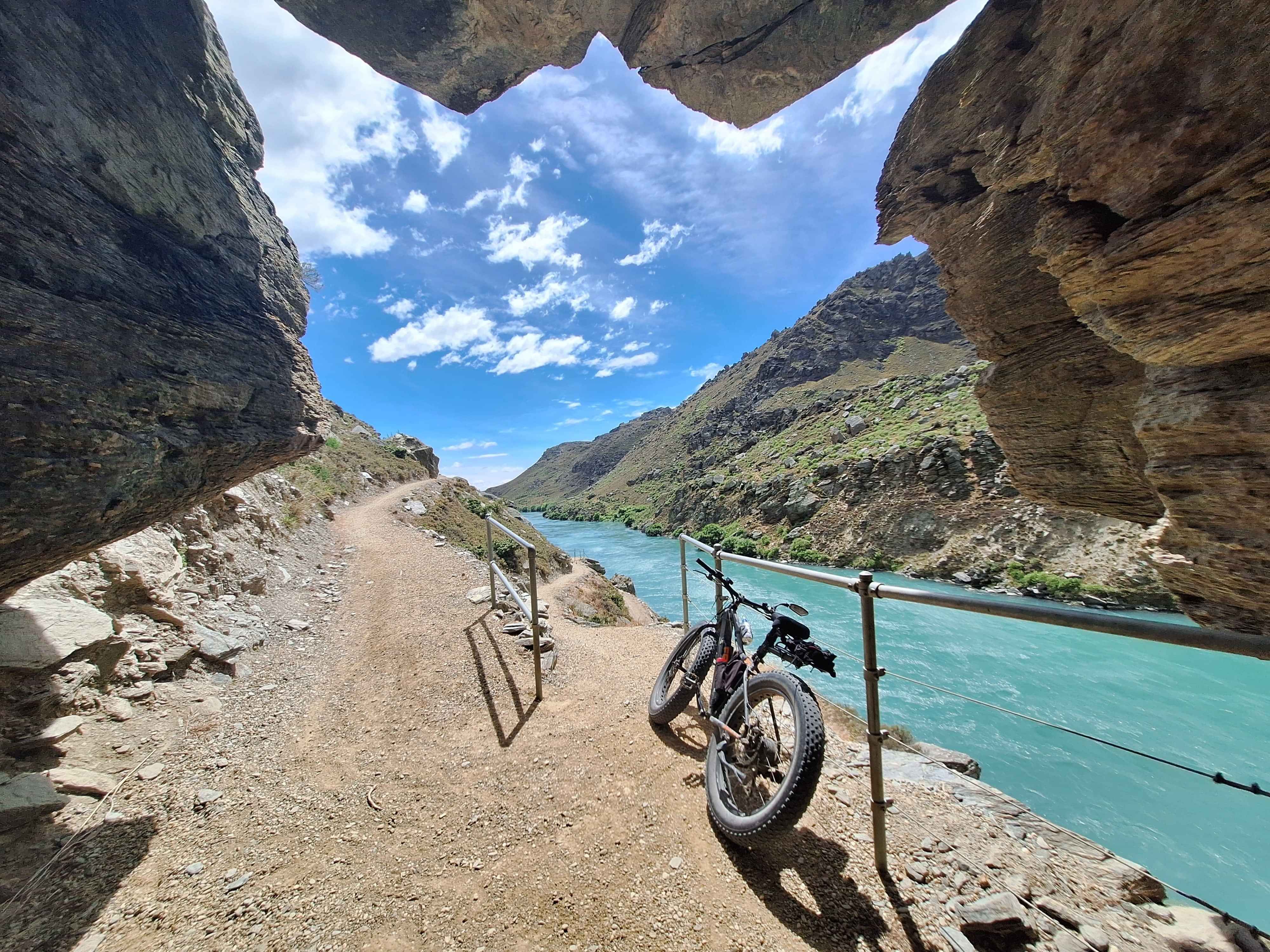
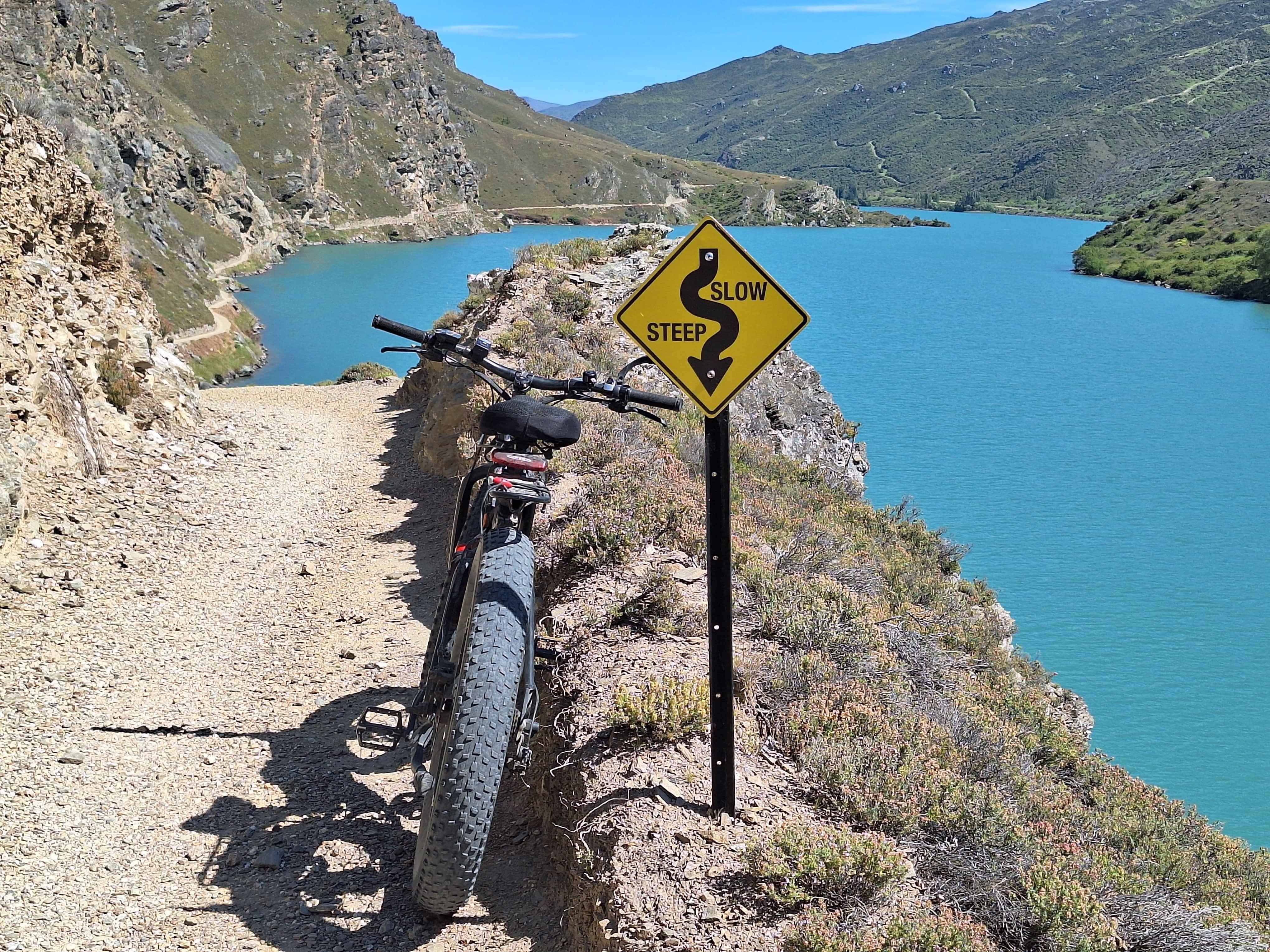
Roxburgh Gorge
The turquoise coloured River Clyde, Nzs longest, tears through this gorge at pace towards the Pacific ocean hundreds of kilometers away. The Gorge itself is massive in length and height. Naturally a bike trail has been built along it as the Clutha Gold Trail. At 10km south of Alexandra you need to join the boat that will take you 13kms through the sheer walled Gorge to recommence your bike or walk travels. Stunning.
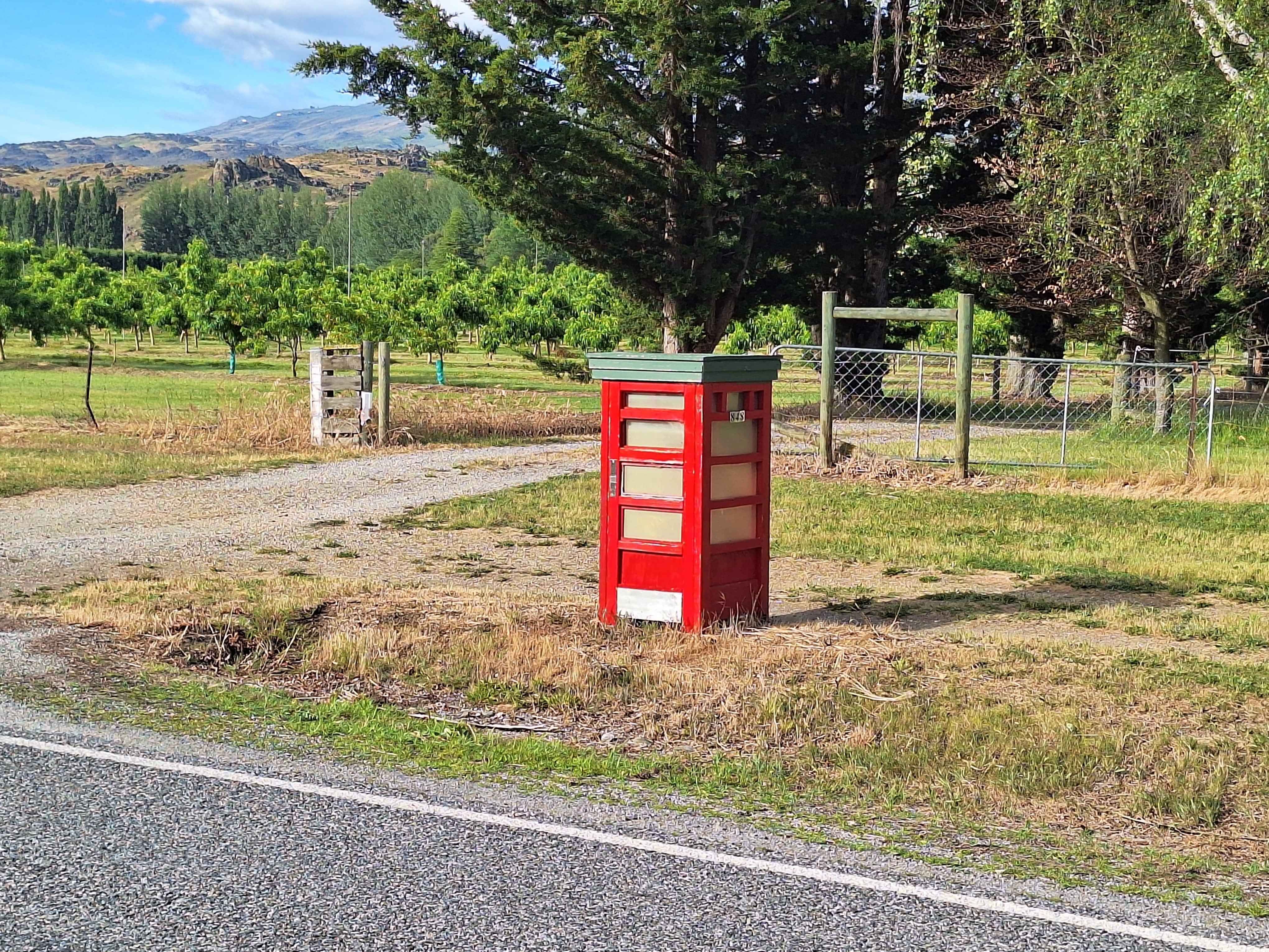
Earnscleugh
Sick of the many Tailings you'll see throughout Central Otago, so I decided to ignore the massive tailings on the riverside at Earnscleugh and look for something fun. Here it is, a UK Red Telephone Booth made at kid size and acting as this residents letterbox. Gold. (as we're in the Gold belt, afterall)
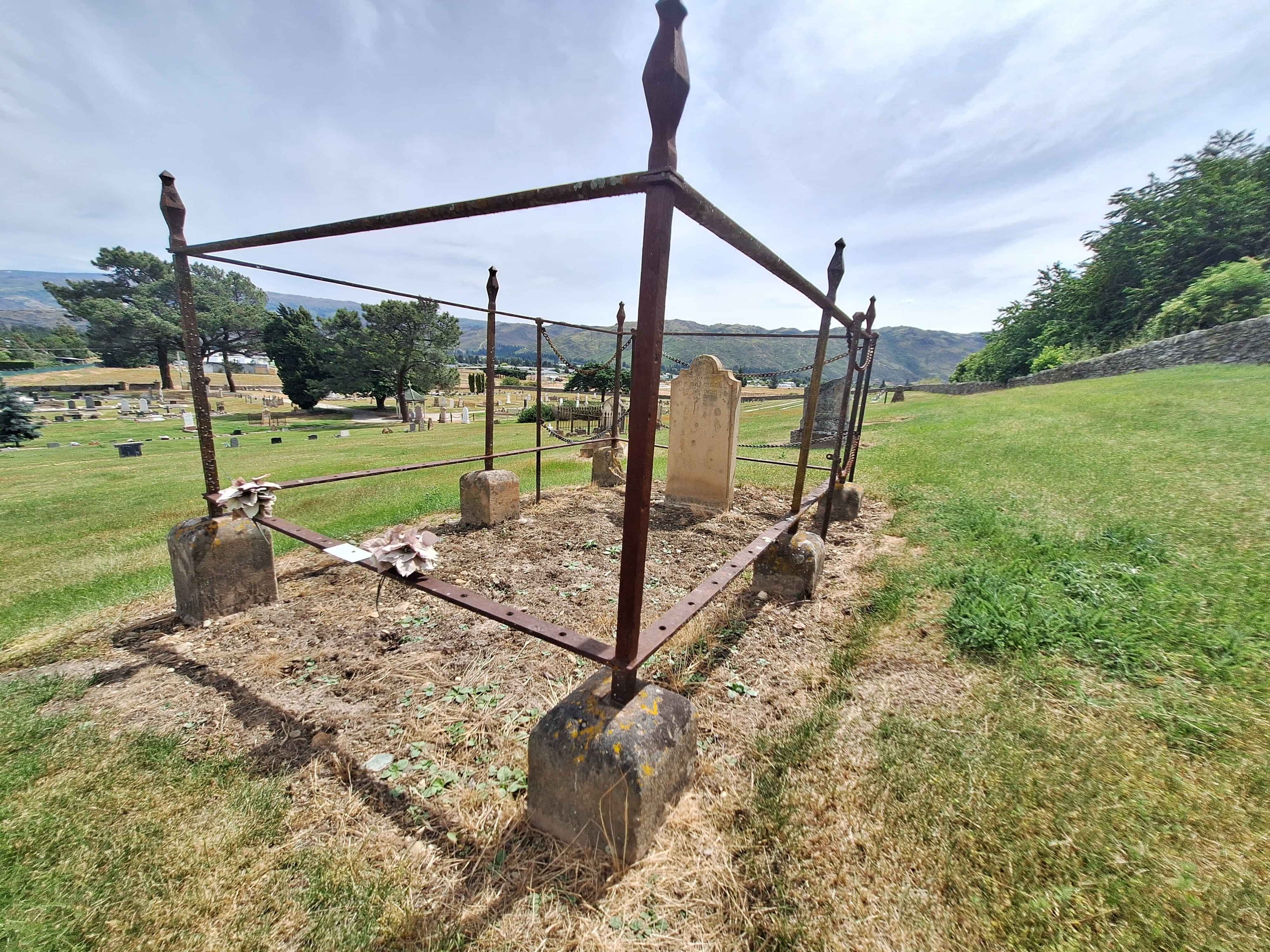
Historic Clyde Cemetary
A rather poignant cemetary. Only 35 of some 1800 gold miners plots are shown here as many were unnamed or buried without notification as in a tombstone, hence all the grass fields around this particular one plot. Many were Chinese miners who had no significance to the mainly European community. Incredibly sad in hindsight.


Contact
Phone: 022 601 4158
Email: dave_lewis@xtra.co.nz